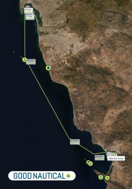
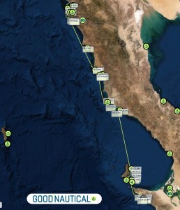
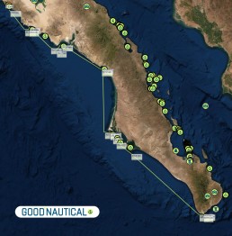
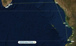
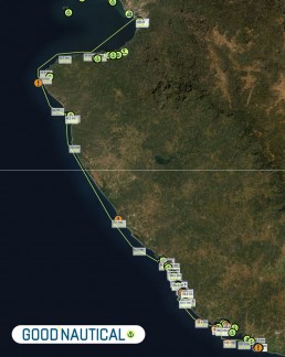
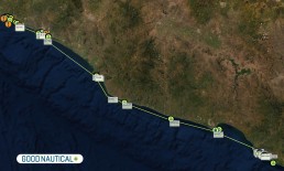
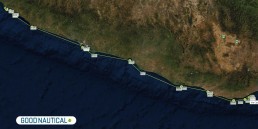
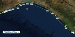
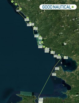
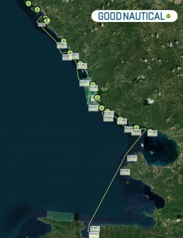
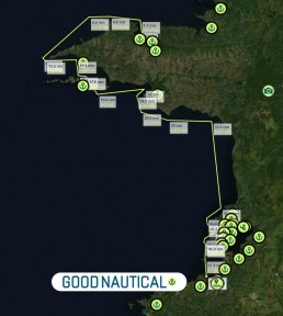
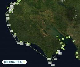
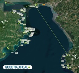
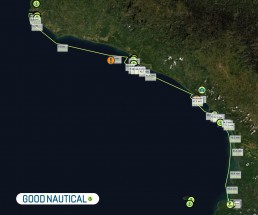
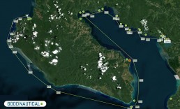
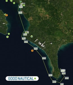
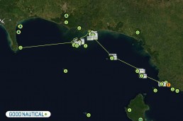
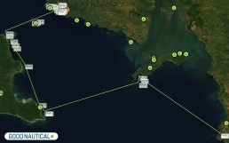
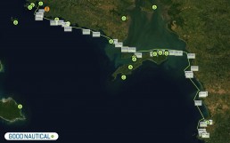
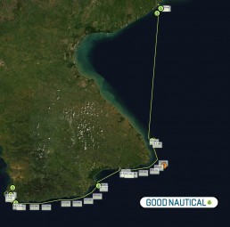
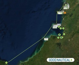
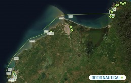
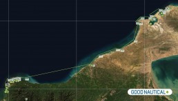
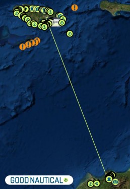
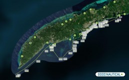
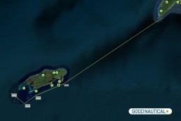
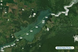
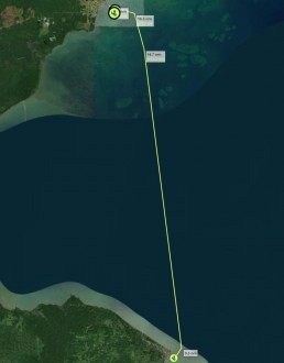
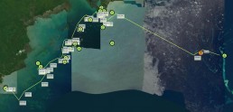
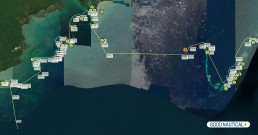
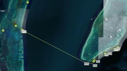
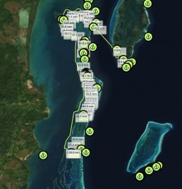
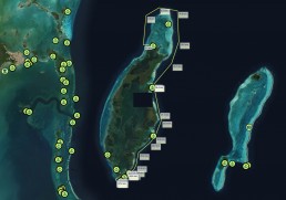
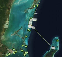
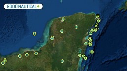
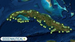
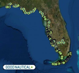
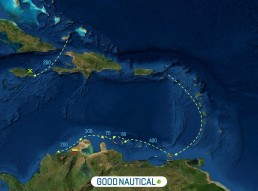
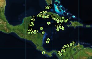
JOIN ANYWHERE ALONG THESE ROUTES
SIGN UP "IN"SEASON OR "PRE"SEASON FOR PERKS AND BENEFITS
YOU ARE NEVER LATE FOR ANYTHING - SET YOUR OWN SCHEDULE AND MEET THE FLEET ALONG THE WAY
PACIFIC ROUTES
SOUTH BOUND
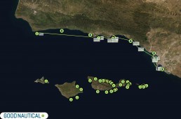
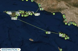
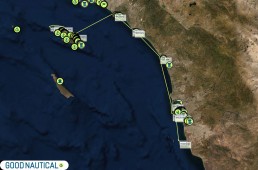
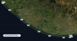
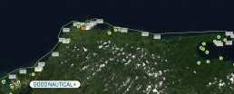
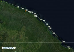
🇺🇸 SAN DIEGO - ENSENADA 🇲🇽 65 nm
READ FULL DETAILS ON THE BAJA RUN HERE >>
🇲🇽 ENSENADA - TURTLE BAY 300 nm
READ FULL DETAILS ON THE BAJA RUN HERE >>
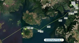
🇲🇽 TURTLE BAY - CABO SAN LUCAS 460 nm
READ FULL DETAILS ON THE BAJA RUN HERE >>
🇲🇽 CABO SAN LUCAS - Puerto Vallarta 370 nm
🇲🇽 PUERTO VALLARTA - BARRA DE NAVIDAD 160 nm
READ FULL DETAILS ON THE COSTALEGRE HERE >>
🇲🇽 BARRA DE NAVIDAD - ZIHUATANEJO 215 nm
READ FULL DETAILS ON THE COSTALEGRE HERE >>
🇲🇽 ZIHUATANEJO - ACAPULCO - HUATULCO 360 nm
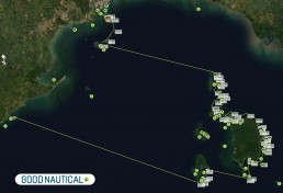
🇲🇽 HUATULCO - CHIAPAS 253 nm
🇲🇽 CHIAPAS - PUERTO QUETZAL 🇬🇹 115 NM
🇳🇮 SAN JUAN DEL SUR - BAHIA SANTA ELENA 🇨🇷
30 nm
🇨🇷 BAHIA SANTA ELENA - BAHIA COCOS
50 nm
🇨🇷 BAHIA COCOS - BAHIA BALLENA
110 nm
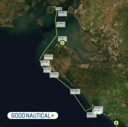
🇨🇷 BAHIA BALLENA - GOLFO DE NICOYA - BAHIA HERRADURA
90 nm
🇨🇷 BAHIA HERRADURA - BAHIA DRAKE
100 nm
🇨🇷 BAHIA DRAKE - GOLFO DULCE - GOLFITO
90 nm
🇨🇷 GOLFITO - CABO MATAPALO 🇵🇦
60 nm
🇵🇦 PUNTA BALSA / BURUCA
ISLAS SECAS - ISLA MEDIDORA
91 nm
🇵🇦 BAHIA HONDA - COIBA_ISLAND - ENSANDA NARANJO
90 nm
🇵🇦 ALTERNATIVE: BAHIA HONDA - ENSANDA NARANJO
60 nm
🇵🇦 ENSANDA NARANJO - VISTA MAR MARINA
130 nm
🇵🇦 VISTA MAR MARINA - ISLAS PERLAS - FUERTE AMADOR
160 nm
🇵🇦 FUERTE AMADOR - PANAMA CANAL - SHELTER BAY MARINA
48 nm
NORTH BOUND
🇵🇦 SHELTER BAY MARINA - PANAMA CANAL - FUERTE AMADOR
48 nm
🇵🇦 FUERTE AMADOR - ISLAS PERLAS - VISTA MAR MARINA -
160 nm
🇵🇦 VISTA MAR MARINA - ENSANDA NARANJO
130 nm
🇵🇦 ENSANDA NARANJO - BAHIA HONDA
60 nm
🇵🇦 ALTERNTIVE ROUTE: ENSANDA NARANJO - COIBA_ISLAND - BAHIA HONDA -
90 nm
🇵🇦 ISLA MEDIDORA - ISLAS SECAS
PUNTA BALSA / BURUCA
91 nm
🇵🇦 PUNTA BALSA / BURICA - GOLFITO 🇨🇷
60 nm
🇨🇷 GOLFITO - GOLFO DULCE - BAHIA DRAKE
90 nm
🇨🇷 BAHIA DRAKE - BAHIA HERRADURA
100 nm
🇨🇷 BAHIA HERRADURA - GOLFO DE NICOYA - BAHIA BALLENA -
90 nm
🇨🇷 BAHIA BALLENA - BAHIA COCOS
110 nm
🇨🇷 BAHIA COCOS - BAHIA SANTA ELENA
50 nm
🇨🇷 BAHIA SANTA ELENA - SAN JUAN DEL SUR 🇳🇮
30 nm
🇬🇹 PUERTO QUETZAL - CHIAPAS 🇲🇽
115 NM
🇲🇽 CHIAPAS - HUATULCO
253 nm
🇲🇽 HUATULCO - ACAPULCO - ZIHUATANEJO
360 nm
🇲🇽 ZIHUATANEJO - BARRA DE NAVIDAD
215 nm
🇲🇽 BARRA DE NAVIDAD - PUERTO VALLARTA
160 nm
🇲🇽 PUERTO VALLARTA - CABO SAN LUCAS
370 nm
🇲🇽 CABO SAN LUCAS - TURTLE BAY
460 nm
🇲🇽 TURTLE BAY - ENSENADA
300 nm
🇲🇽 ENSENADA MX - SAN DIEGO 🇺🇸
65 nm
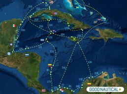
WESTERN CARIBBEAN ROUTES
NORTH BOUND
ROUTE via CARIBBEAN MAINLAND
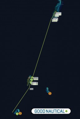
🇵🇦 PUERTO-OBALIDIA - SAPZURRO 🇨🇴
10 nm
🇨🇴 SAPZURRO - CARTAGENA
160 nm
🇨🇴 CARTAGENA - BARANQUILLA - SANTA MARTA
130 nm
🇨🇴 SANTA MARTA - BAHIA HONDITA
200 nm
OFFSHORE PASSAGE
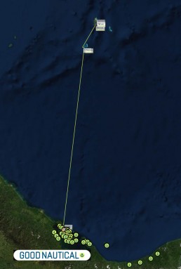
🇨🇴 SANTA MARTA COLOMBIA - KINGSTON JAMAICA 🇯🇲
430 nm
ROUTE via COLOMBIAN OFFSHORE ISLANDS
🇵🇦 BOCAS DEL TORO - ALBUQUERQUE CAY 🇨🇴
200 nm
ALBUQUERQUE CAY - SAN ANDRES - SANTA CATALINA 🇨🇴
80 nm
OFFSHORE PASSAGE
🇨🇴 SANTA MARTA COLOMBIA - KINGSTON JAMAICA 🇯🇲
430 nm
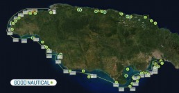
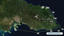
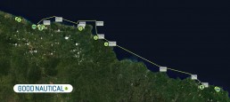
🇯🇲 KINGSTON HARBOUR - MONTEGO BAY
SOUTHERN ROUTE - 160 nm
🇯🇲 KINGSTON HARBOUR - PORT ANTONIO
NORTHERN ROUTE - 55 nm
🇯🇲 PORT ANTONIO - OCHO RIOS
NORTHERN ROUTE - 45 nm
🇯🇲 OCHO_RIOS - MONTEGO BAY
NORTHERN ROUTE 55 nm
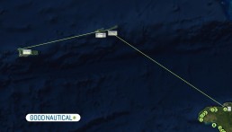
OFFSHORE PASSAGE
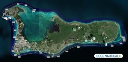
🇯🇲 MONTEGO BAY JAMAICA - GRAND CAYMAN ISLANDS 🇰🇾
220 nm
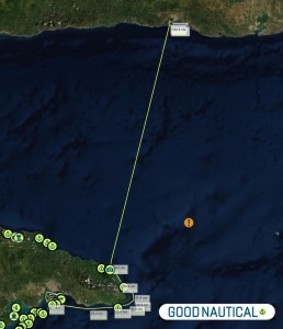
OFFSHORE PASSAGE
🇯🇲 KINGSTON JAMAICA - SANTIAGO DE CUBA 🇨🇺
180 nm
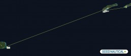
OFFSHORE PASSAGE
🇰🇾 GRAND CAYMAN ISLAND - SWAN ISLAND HONDURAS 🇭🇳
185 nm
OFFSHORE PASSAGE
🇭🇳 SWAN ISLAND - OFFSHORE
GUANAJA_ISLAND SAVANNAH BIGHT
120 nm
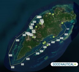
🇭🇳 GUANAJA SLAND HONDURAS
24 nm
🇭🇳 ROATAN_ EAST
24 nm
🇭🇳 ROATAN_ SOUTH WEST
20 nm
🇭🇳 ROATAN_ SW - UTILA
30 nm
OFFSHORE PASSAGE
🇭🇳 UTILA HONDURAS
GUANAJA_ISLAND SAVANNAH BIGHT- LIVINGSTON GUATEMALA 🇬🇹
106 nm
SOUTH BOUND
OFFSHORE PASSAGE
🇰🇾 GRAND CAYMAN ISLAND - SWAN ISLAND HONDURAS 🇭🇳
185 nm
OFFSHORE PASSAGE
🇭🇳 SWAN ISLAND - OFFSHORE
GUANAJA_ISLAND SAVANNAH BIGHT
120 nm
🇭🇳 GUANAJA SLAND HONDURAS
24 nm
🇭🇳 ROATAN_ EAST
24 nm
🇭🇳 ROATAN_ SOUTH WEST
20 nm
🇭🇳 ROATAN_ SW - UTILA
30 nm
OFFSHORE PASSAGE
🇭🇳 UTILA HONDURAS
GUANAJA_ISLAND SAVANNAH BIGHT- LIVINGSTON GUATEMALA 🇬🇹
106 nm
OFFSHORE PASSAGE
🇨🇴 SANTA MARTA COLOMBIA - KINGSTON JAMAICA 🇯🇲
430 nm
🇯🇲 KINGSTON HARBOUR - MONTEGO BAY
SOUTHERN ROUTE - 160 nm
🇯🇲 KINGSTON HARBOUR - PORT ANTONIO
NORTHERN ROUTE - 55 nm
🇯🇲 PORT ANTONIO - OCHO RIOS
NORTHERN ROUTE - 45 nm
🇯🇲 OCHO_RIOS - MONTEGO BAY
NORTHERN ROUTE 55 nm
OFFSHORE PASSAGE
🇯🇲 MONTEGO BAY JAMAICA - GRAND CAYMAN ISLANDS 🇰🇾
220 nm
OFFSHORE PASSAGE
🇯🇲 KINGSTON JAMAICA - SANTIAGO DE CUBA 🇨🇺
180 nm
ROUTE via CARIBBEAN MAINLAND
🇵🇦 PUERTO-OBALIDIA - SAPZURRO 🇨🇴
10 nm
🇨🇴 SAPZURRO - CARTAGENA
160 nm
🇨🇴 CARTAGENA - BARANQUILLA - SANTA MARTA
130 nm
🇨🇴 SANTA MARTA - BAHIA HONDITA
200 nm
OFFSHORE PASSAGE
🇨🇴 SANTA MARTA COLOMBIA - KINGSTON JAMAICA 🇯🇲
430 nm
ROUTE via COLOMBIAN OFFSHORE ISLANDS
🇵🇦 BOCAS DEL TORO - ALBUQUERQUE CAY 🇨🇴
200 nm
ALBUQUERQUE CAY - SAN ANDRES - SANTA CATALINA 🇨🇴
80 nm
🇵🇦 PUNTA BALSA / BURUCA
ISLAS SECAS - ISLA MEDIDORA
91 nm
🇵🇦 BAHIA HONDA - COIBA_ISLAND - ENSANDA NARANJO
90 nm
🇵🇦 ALTERNATIVE: BAHIA HONDA - ENSANDA NARANJO
60 nm
🇵🇦 ENSANDA NARANJO - VISTA MAR MARINA
130 nm
🇵🇦 VISTA MAR MARINA - ISLAS PERLAS - FUERTE AMADOR
160 nm
🇵🇦 FUERTE AMADOR - PANAMA CANAL - SHELTER BAY MARINA
48 nm
JOINING FROM OTHER AREAS
LESSER ANTILLES
WHITE DOG SAILS reports
Many of you ask how It went, so here is a quick recap.
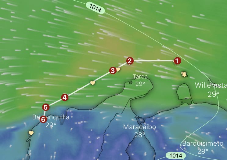
The leg Aruba to Colombia is pretty tricky to sail compared to the rest of the Caribbean and high on the “World dangerous sailing spots Top100” list. There are a few points of consideration if you are not familiar with those waters. You may use it or not, your choice. We did it only once. But we spent some time researching and talking to locals, and this is what we learned and experienced.
- Never leave Aruba if the winds are 25+kn ( check the gusts!)
- Stay away from the Venezuelan coast as far as you can, due to recent piracy attacks.
- Make sure you don’t rely on just wind forecast. It is necessary to take into account gusts, rain, and thunderstorms activity.
- Stay about 20miles off Gallinas (2) and Punta de la Vela (3). If Punta de la Vela is rough (waves or counter current) – make it 50nm – no joke, boats are lost there regularly.
- Gallinas is the most northern point of Colombia. Sea bottom there forms the narrow trench between the eastern and western Caribbean Sea. That means an increased speed of the current, which reaches 2kn+, speeds up the swell and shortens the period. Even with the easy winds, you feel that your boat is acting a bit weird.
- The coast between Gallinas and Punta de la Vela produces a big night breeze. (Day breeze as well, but it goes towards the land, and it is not felt that much offshore). It can reach the wind force up to 40kn, and it is visible on the weather charts only if you have a close look at the coastal points. The breeze starts between 10pm till about 1am. It is better to avoid that time.
- The coast between Punta de la Vela (3) and Santa Marta (4) is high mountains. The highest peak, Pico de Columbus 5775m, is located only 42km inland. This is the highest coastal mountain in the world. This mountain range – Sierra Nevada de Santa Marta – stops all small systems from the East and creates big cumulonimbus that seems to stick to the land. If there is a tropical wave on the way, thunderstorms will travel along across the Caribbean Sea.
- If you go further south to Puerto Velero (6) or Cartagena (past Barranquilla), make sure that you cross river Magdalena (5) during the day. There is 4-5s swell coming from the northeast (in no-wind conditions reaching over 2m), and there is a counter-current from the south. When the current intensifies, the swell period shortens. River spits a lot of debris (Magdalena is the biggest river in Colombia). Locals talk about dead cows and trees. We saw massive tree logs and floating islands of branches, grass, and leaves, we didn’t see any cows ;).
- Thunderstorms are not a joke here, activity lowers from December to March.
- Punta de la Vela has an infamous reputation for killing sailors and breaking boats, so take it seriously.
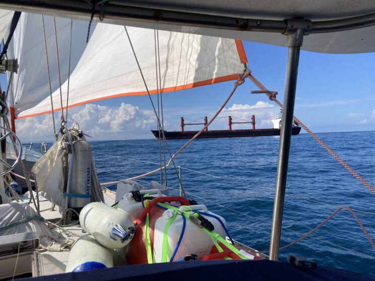
- By Barranquilla and Santa Marta, the traffic is bigger than everywhere in the Caribbean. Ships are mostly visible on the AIS and pretty responsive.
- Locals sail close to the coast, but still, they mind the timing at points 2,3, and 5.
We had an interesting passage: wind-wise super easy, thunderstorms- super stressful. Due to big currents and thunderstorms, we had to slow down, speed up, and zigzag to avoid the extensive lightning activity (even if the weather forecast returned a very low cape factor value, the thunderstorms were basically everywhere). As for forecasting, the ECMWF model was better for the wind and rain (and was better everywhere in the Caribbean), for thunderstorms – GFS.
Next time we will write about the cost of entrance and fee for the agency. We’ve heard so far that bay-hopping doesn’t really make much sense because you have to pay for the Zarape and agent every time you move outside the district. We are leaving White Dog in the marina and starting the backpacking trip soon.


PANAMA POSSE ROUTES
YOUR CENTRAL AMERICAN PACIFIC ROUTE WITHOUT A SET SCHEDULE
Our mission is to connect California with Florida and vice versa via the Panama Canal and have the latest and most detailed route information available to our participants – we also a want to offer discounts with Marinas and service providers wherever possible, As such every participants will scout, record and verify conditions, deals and discounts and are in 24/7 touch via our group app to communicate these findings to the fleet. It’s an awesome network of skippers captains and seafarers which work collectively to make it better.
Relevant seminars will be recorded and made available to all participants electronically
If you want a sense of timing click here for a sample schedule »
Please keep a close eye on weather – this route has distinct weather sections »
Southbound Pacific
or ANYWHERE BETWEEN CALIFORNIA AND PANAMA
– We will sail in a leisurely frog leaping fashion from the Costa Alegre on the Pacific Coast of Mexico- towards Panama.Alternatively the “Counter” Posse meets in Panama (Vista Mar Marina) and heads NW starting in October of
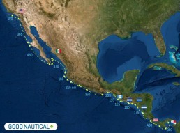
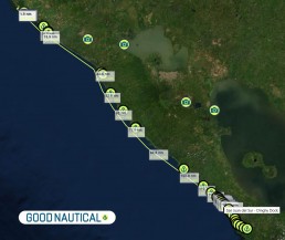
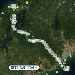
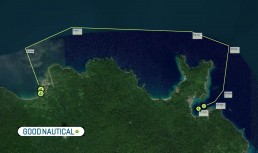
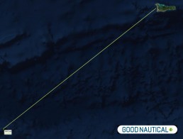
Click on the route image below for an interactive Goodnautical map.
You are free to sail ahead – follow us later – or stay behind at any time.The main choke points on this route are the Gulf of Tehuantepec and the Papagayo winds.This is good training ground for reefing and weather forecasting.
CARIBBEAN – HEADING NORTH FROM PANAMA OR COLOMBIA
CARIBBEAN – HEADING TOWARDS THE PANAMA CANAL
CHECK THE PACIFIC ROUTE
SAN DIEGO – PANAMA CANAL
There are over 350 verified anchorages and 13+ Marinas along the Pacific Coast.
Here are some of the mayor stops you will be able to day hop most of the way up or down the Pacific Coast
CHECK THE CARIBBEAN ROUTE
PANAMA CANAL – FLORIDA
There are over 400+ anchorages and 15+marinas along the Western Caribbean Basin Coast. And this season we will collect and verify the Caribbean route.
Northbound (counter) Posse
Northbound vessels have a different timing and get a chance to meet all the southbound vessels – there are specific weather related issues and of course prevailing winds and currents are challenging.
Leave Panama at the end of October and make your way up the coast – keep a close eye on swells abd the CAPE Index ( Lightning ) .
 Vista Mar Marina
 Ensenada Venao
 Ensenada Naranjo
 Bahia Honda
 Isla Seca
 Isla Parida
 Punta Rincon
 Banana Bay Marina , Golfito
 Drake Bay
 Punta Catedral – Manuel Antonio Park
 Marina Pez Vela
 Punta Leona
 Punta Naranjo
 Isla Cedros
 Bahia Ballena
 Bahia Samara
 Playa Coco
 Marina Papagayo
 COSTA RICA –
 San Juan del Sur
 Marina Puesta del Sol
 NICARAGUA –
 Isla el Tigre
 HONDURAS –
 Marina Hotel Bahia del Sol
 EL SALVADOR – New Year –
 GUATEMALA – The majority of the fleet will skip across here »
 Marina Chiapas
 Marina Chahue ( anchor nearby closed due to silting)
 Acapulco Vicente’s Moorings
 Zihuatanejo
 Isla Ixtapa
 Bahia Santiago
 Tenacatita
 Marina Puerto de la Navidad
SOMEWHERE ELSE IN THE CARIBBEAN AND CONSIDERING JOINING THE POSS
It all depends what your next destination is ?
The moment you plan to head West / South West towards Colombia / Panama or Jamaica from the Eastern Caribbean / Lesser Antilles – you will find benefits in joining the Panama Posse.
We do not sail on a schedule so there is no right time to join in – but the moment you are getting near our areas of influence
you will save money and time and meet new friendly vessels to buddy up with.
Registration provides you with the following benefits – ( panamaposse.com/benefits) including a dedicated and discounted Panama Canal Agent.
Here is a Map and list of Sponsoring marinas https://panamaposse.com/sponsors

