16) GOOD NAUTICAL:
COSTALEGRE: THE HAPPY COAST

Costalegre translates to the Happy Coast. The 135 nm stretch of coast in Mexico known by this name runs from Cabo Corrientes (the southern limit of Banderas Bay) to Manzanillo. There are 20+ wonderful anchorages along this stretch of coast that make it a fabulous place to cruise. As always, choose your own adventure and take your time to enjoy the most Happiness you can along the Happy Coast. Of course the Panama Posse started in Barra de Navidad and we hope to see you at the kick off event staring Dec 7 – and don’t forget to bring your expired flares…
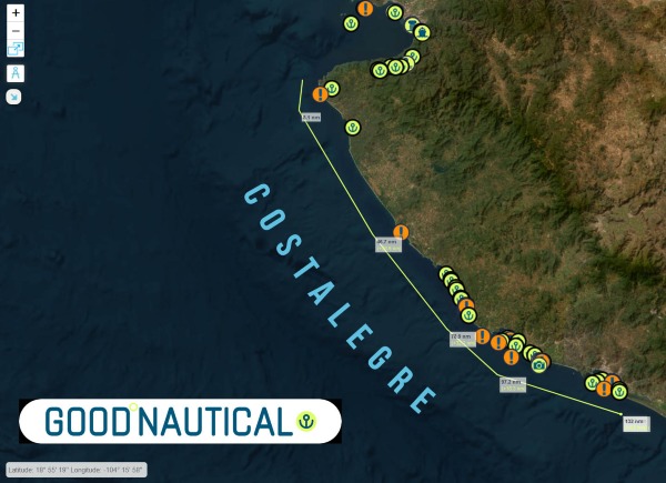 |
With over 30 anchorages the Costalegre is the Panama Posse playground. The water is usually warm and pleasant with gentle dinghy beach landings, Some of these remote anchorages are solitary with the exception of Tenecatitia which at the height of the cruising season will have up to 50 yachts at anchor.
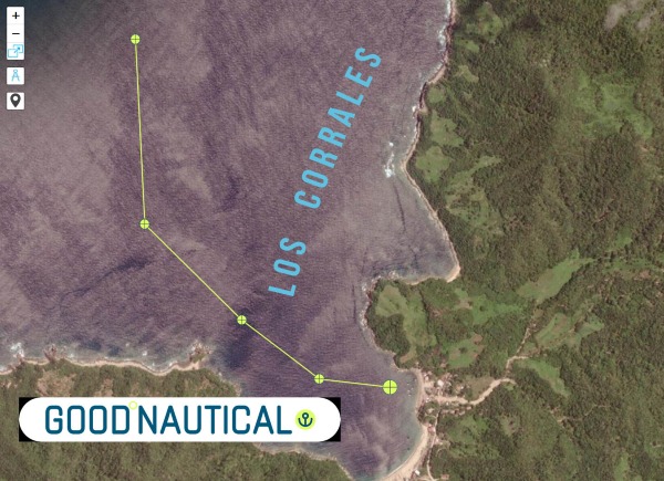 |
⚓ Los Corrales @ 20 246 N 105° 40 W –
(exposed to N – NW & W Swell )
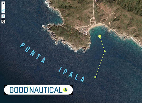 |
⚓ Punta Ipala @ 20° 14.2132′ N 105° 34.4000′ W
(exposed to W – SW – S Swell )
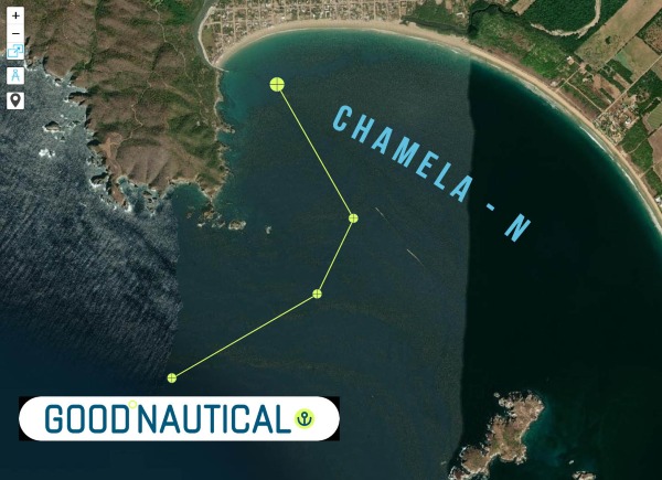 |
⚓ Chamela – N @ 19° 35.0317′ N 105° 07.8500′ W
(exposed to SW Swell )
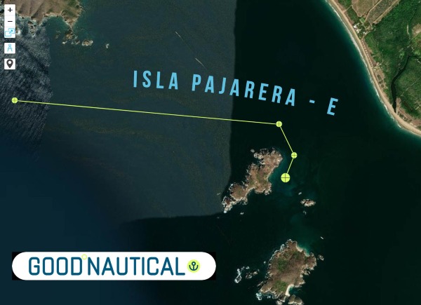 |
Isla Pajarera – E @ 19° 33.5505′ N 105° 06.6070′ W
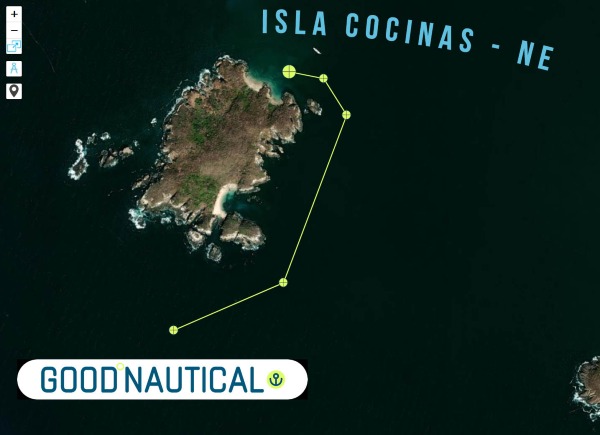 |
Isla Cocinas – NE @ 19° 33.1496′ N 105° 06.3817′ W
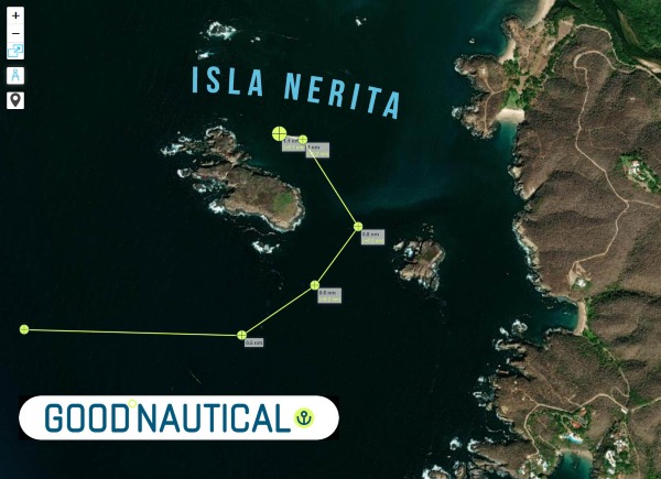 |
Isla Nerita @ 19° 31.4755′ N 105° 05.0901′ W
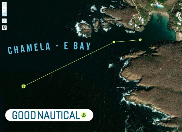 |
Chamela – E Bay @ 19° 30.8433′ N 105° 04.8342′ W
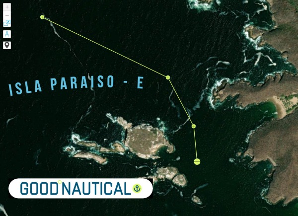 |
Isla Paraiso – E @ 19° 28.6147′ N 105° 03.7655′ W
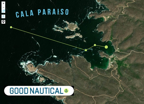 |
Cala Paraiso @ 19° 28.4782′ N 105° 03.5512′ W
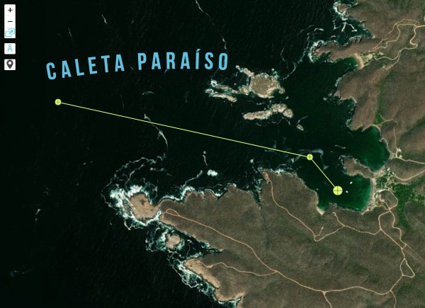 |
Caleta Paraíso @ 19° 28.3383′ N 105° 03.6213′ W
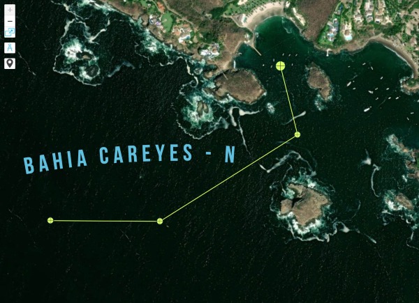 |
Bahia Careyes – N @ 19° 26.6418′ N 105° 02.1684′ W
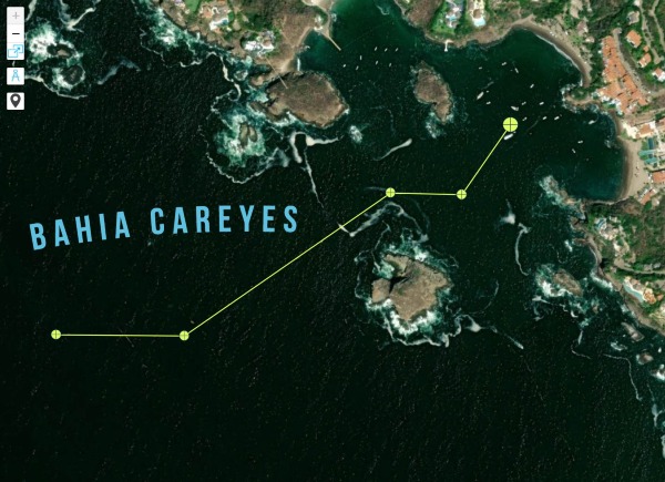 |
Bahia Careyes @ 19° 26.5847′ N 105° 02.0021′ W
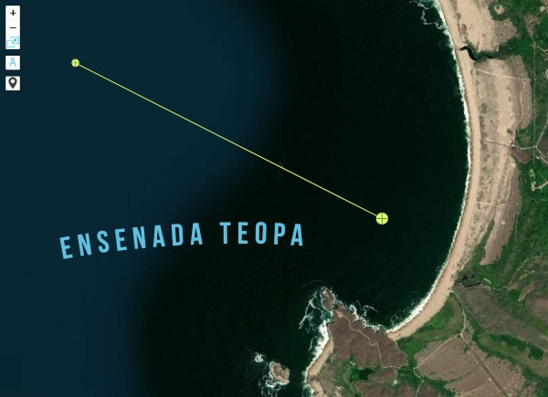 |
Ensenada Teopa @ 19° 23.9448′ N 105° 01.4672′ W
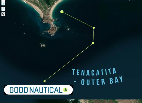 |
Tenacatita – Outer bay @ 19° 17.1346′ N 104° 52.0404′ W
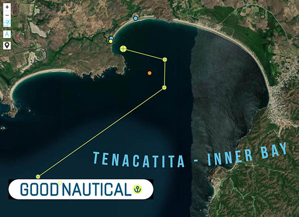 |
Tenacatita – Inner Bay @ 19° 17.8725′ N 104° 50.1806′ W
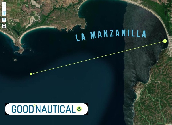 |
La Manzanilla @ 19° 16.8747′ N 104° 47.4327′ W
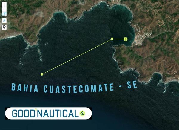 |
Bahia Cuastecomate – SE @ 19° 13.8132′ N 104° 43.8949′ W
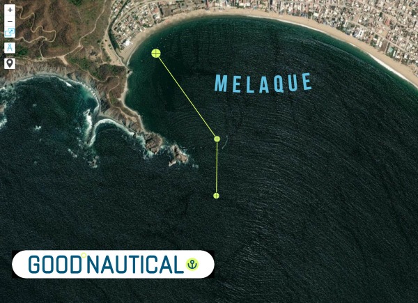 |
Melaque @ 19° 13.1810′ N 104° 42.5871′ W
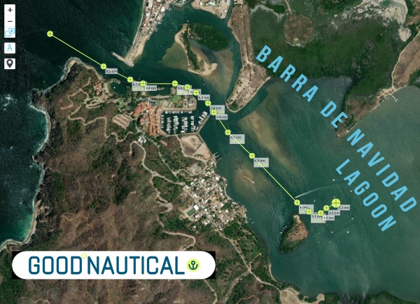 |
Barra de Navidad – Lagoon @ 19° 11.5084′ N 104° 40.3672′ W
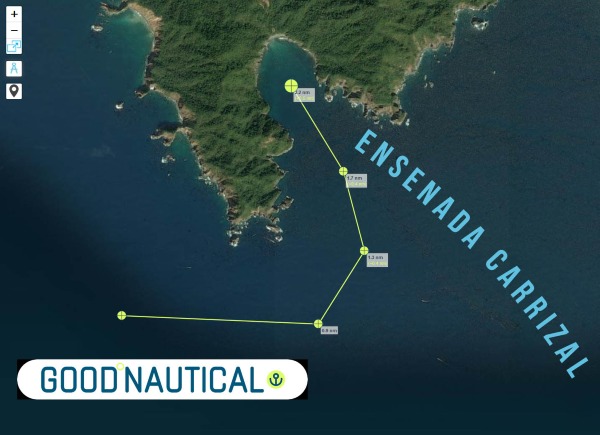 |
Ensenada Carrizal @ 19° 05.7860′ N 104° 26.2464′ W
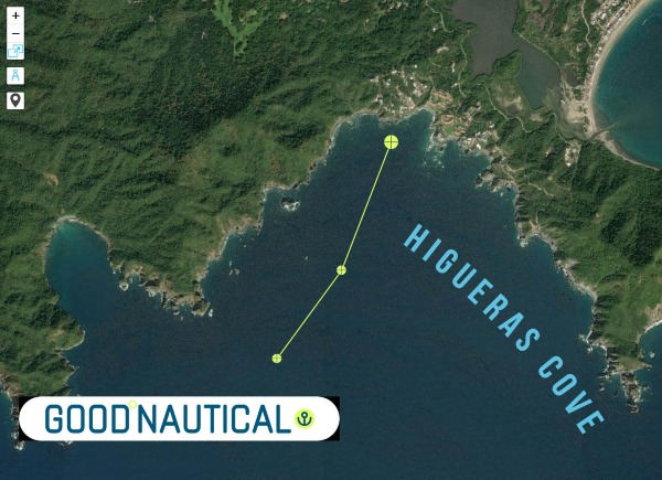 |
Higueras Cove @ 19° 06.2471′ N 104° 24.7503′ W
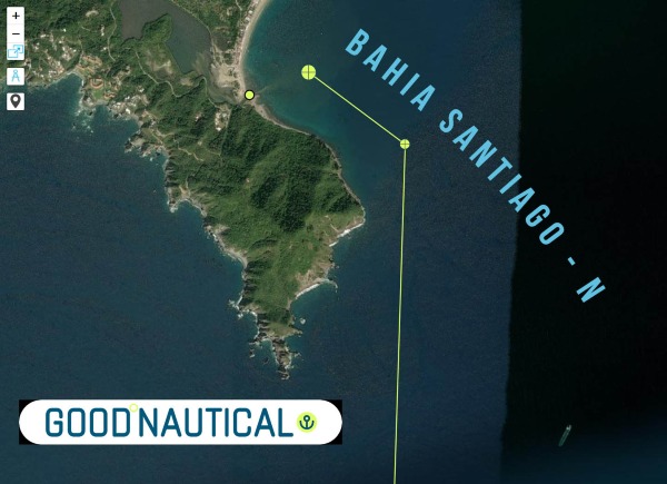 |
Bahia Santiago – N @ 19° 06.6530′ N 104° 23.4890′ W
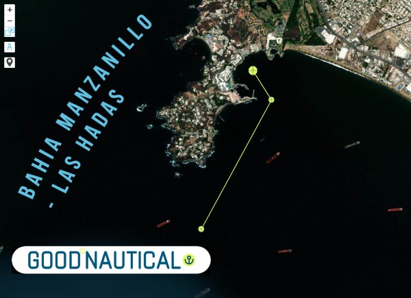 |
Bahia Manzanillo – Las Hadas @ 19° 06.0977′ N 104° 20.6284′ W
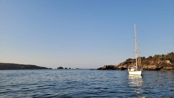 |
SY Seaglub anchored @ Costalegre
| SIGN UP FOR THE PANAMA POSSE |