FLEET UPDATE 2021-03-27
|


|
|
|


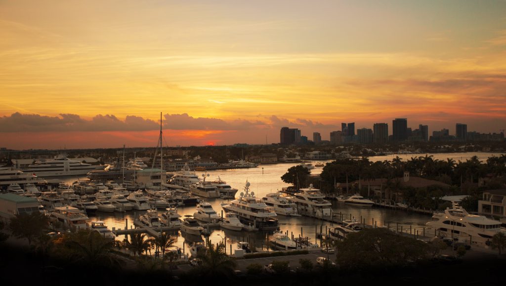
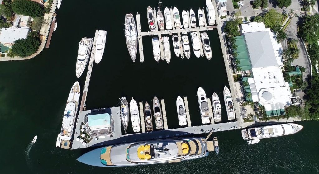
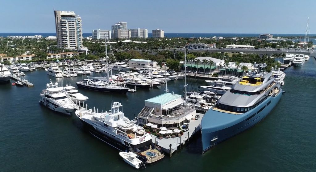
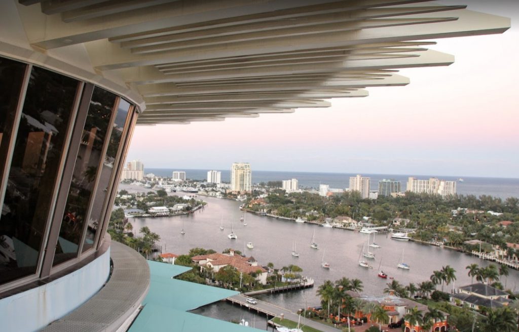
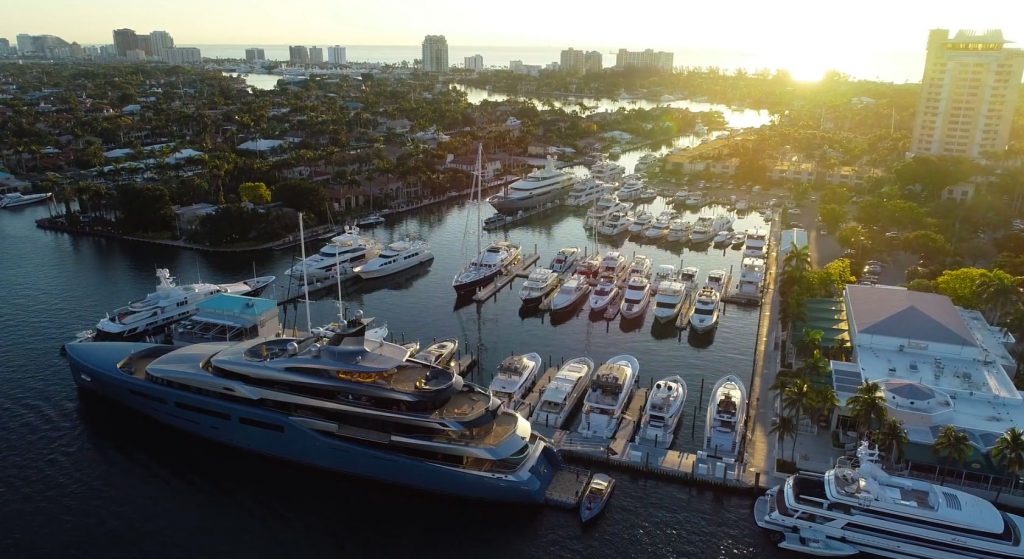
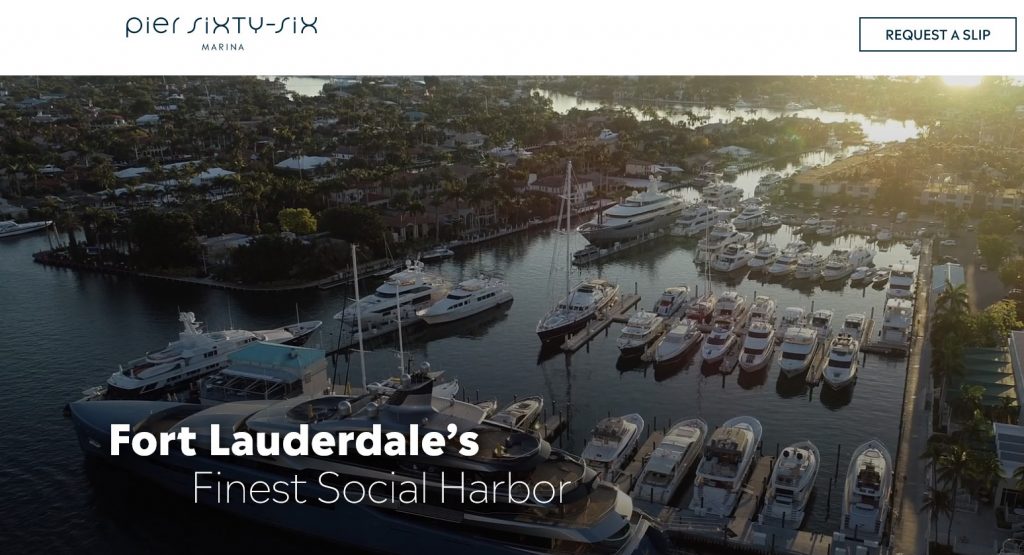
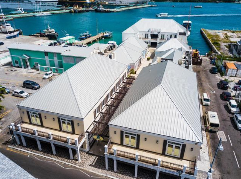
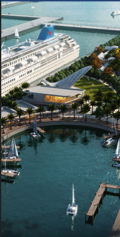
PIER SIXTY-SIX MARINA - FT LAUDERDALE 🇺🇸 SPONSORS THE PANAMA POSSE
PIER SIXTY-SIX MARINA 🇺🇸 Ft. Lauderdale, Florida USA
26°06.1666' N 080°07.0033' W
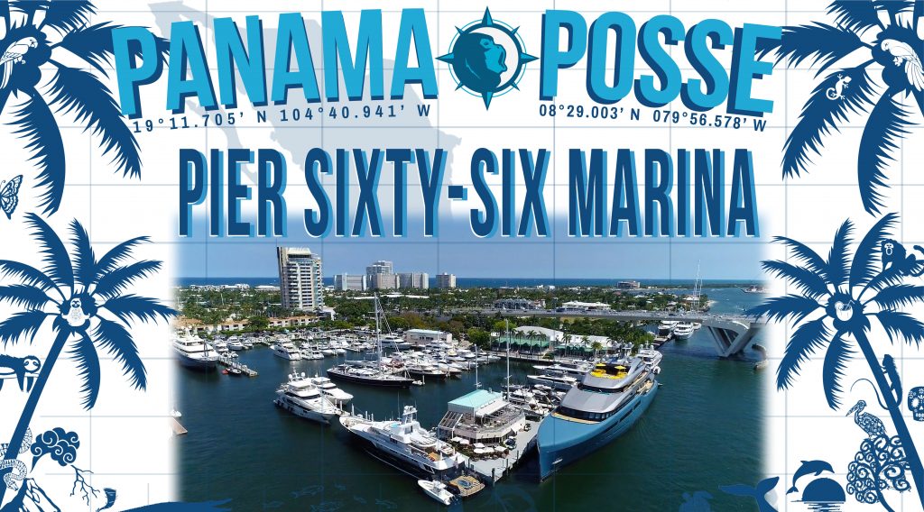
We are excited to welcome the Panama Posse and look forward to your arrival !
Pier Sixty-Six Marina is the closest marina to the Port Everglades inlet and in the center of the marine world of Fort Lauderdale.
As a special recognition we will offer a discounted fuel rate reserved for annual dock holders
of $ 2.85 vs $ 3.57 x gallon ( 07/01/2021) and an exclusive welcome gift.
We alos offer the lowest slip rates in the area.
We look forward to meeting all the participants of the Panama Posse
MEGAN LAGASSE

Marine Director
Pier Sixty-Six Marina
2301 SE 17th Street
Fort Lauderdale, FL 33316
INFO@66MARINA.COM
p +1 954.728.3578
c +1 978.270.8508
w 66marina.com
AMENITIES
- FUEL Marine Diesel and Rec90
- WATER Potable Broward County Water meets exceeded all federal Safe Drinking Water Act standards
- SHORE POWER ( 125V 30/50 125/220V 50 no 230v
- WIFI Newly updated 1 gig up and down
- PET FRIENDLY
- RUBBISH / RECYCLING Rubbish / Recyling from 4Ocean
- LOCAL PARKING
- TOILETS ( no showers during construction phase )
- LAUNDRY Dryclean USA pick up and drop off
- RESTAURANTS which are a 2 min dinghy ride away and have patrons docks
15 Street Disheries
Southport Rawbar
Boatyard Restaurant - PROVISIONING
- PHARMACY
Walgreens
RATES
| In-Season October 1st - May 30th | ||
| Daily | Monthly | |
| 40-49 | $3.10 | $2.75 |
| 50-69 | $3.50 | $3.00 |
| 70-89 | $4.00 | $3.75 |
| Off-Season June 1st - September 30th | ||
| 40-49 | $1.75 | $1.50 |
| 50-69 | $2.00 | $1.75 |
| 70-89 | $2.25 | $1.85 |
| 30 amp | $15.00 | per cord per day |
| 50 amp | $20.00 | per cord per day |
| 100 amp | $50-$95 | per cord per day |
FUEL
The marina offers contracted fuel prices and discounts for customers who sign annual contracts
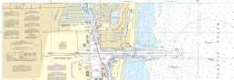
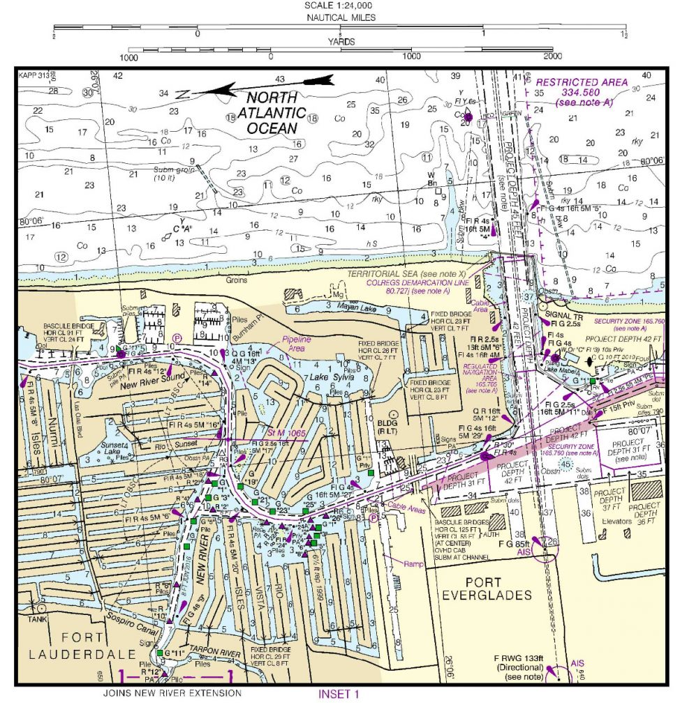
MARINA Pier 66 Hotel Marina SAFE APPROACH
Statute Mile 1065.9. 954-527-5959. The draw shall open on the hour and half-hour only if requested.
OFFICIAL WEBSITE >>
MAP
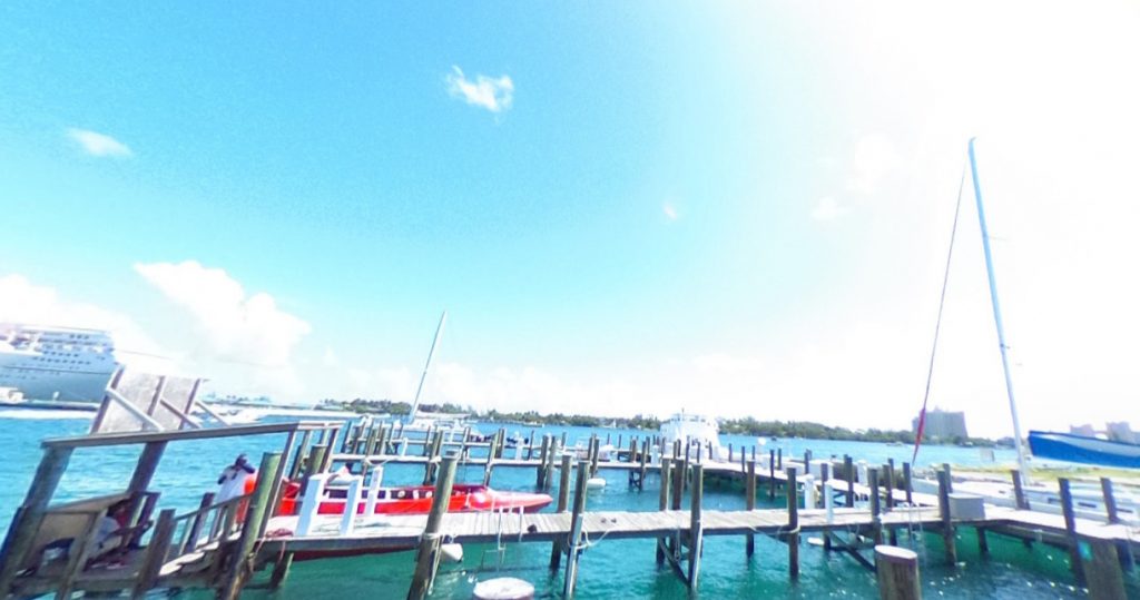
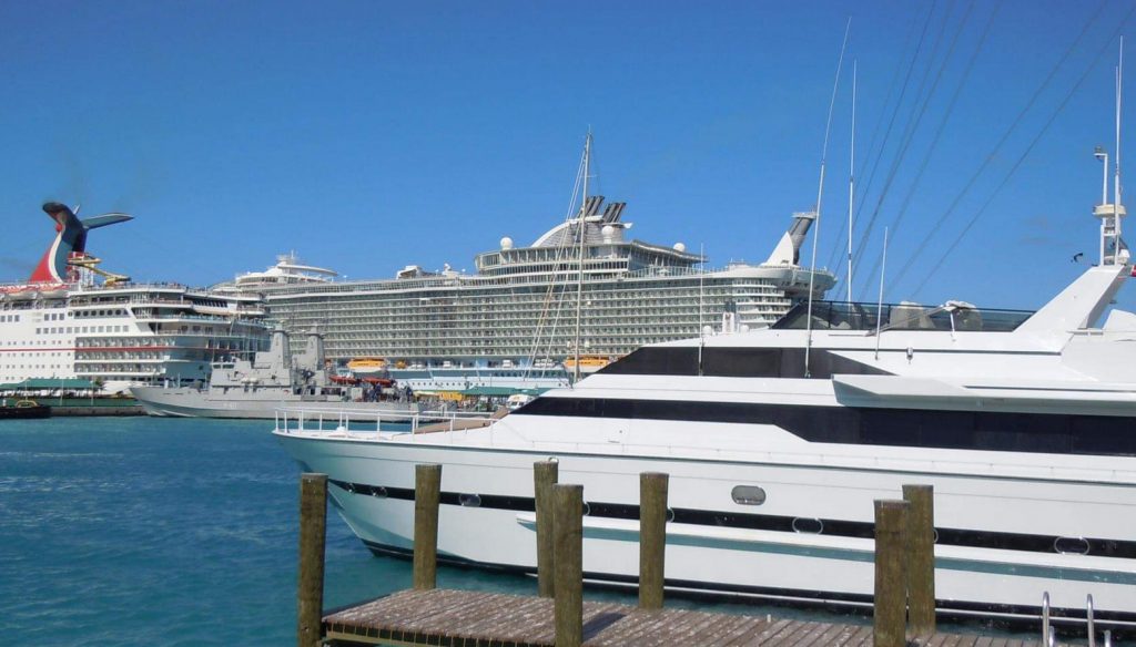
GATEWAY TO THE ICW
Deep Sea Port
Vessels of all shapes and sizes
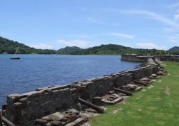
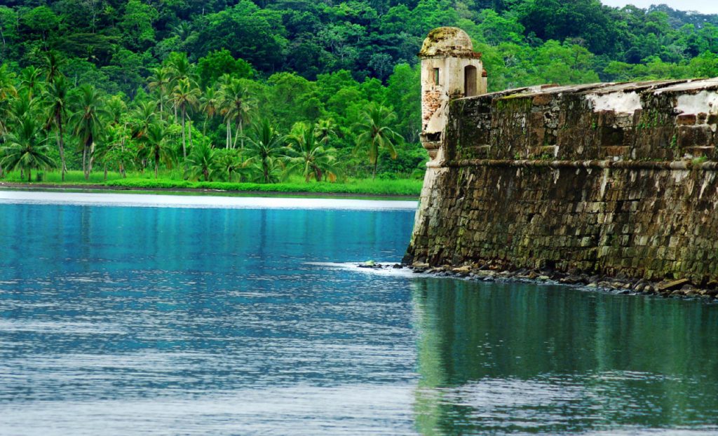
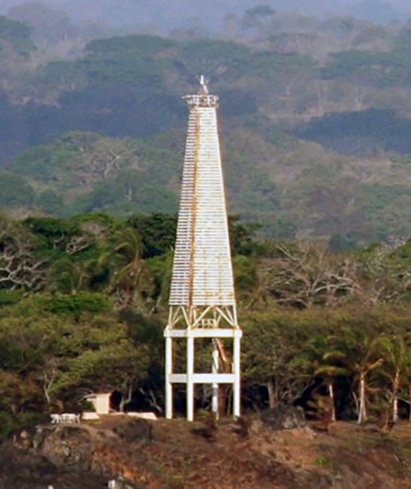
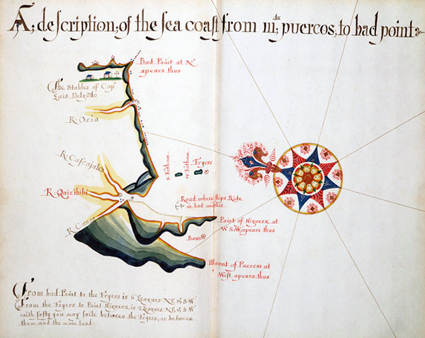
PORTOBELO - FORT SAN LORENZO PANAMA
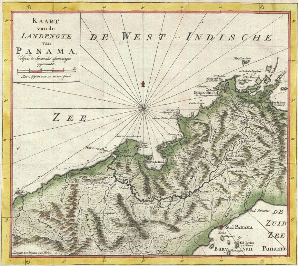
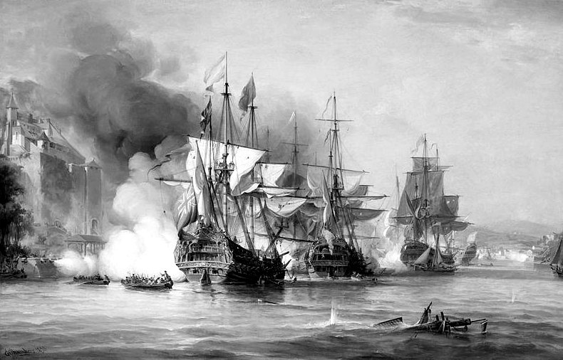
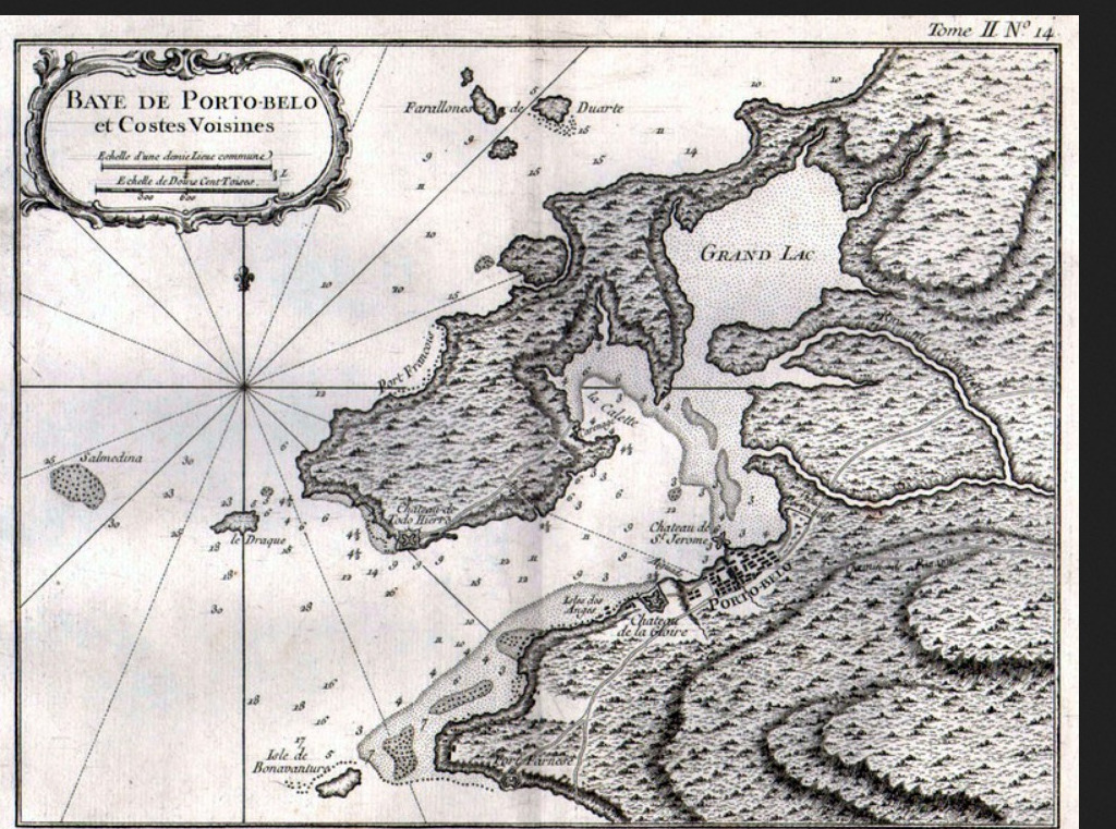
Portobelo is a historic port in the Portobelo District, Colón Panama. It lies 20 nm from the Caribbean entrance to the Panama Canal. Established in 1597 by the Spanish empire due to its deep natural harbor, it served as one of the two ports alongside Veracruz through which Spanish treasure was shipped from the mines of Peru back to Spain. The city was repeatedly captured by British privateers and pirates, culminating in a successful siege by the Royal Navy in 1739.
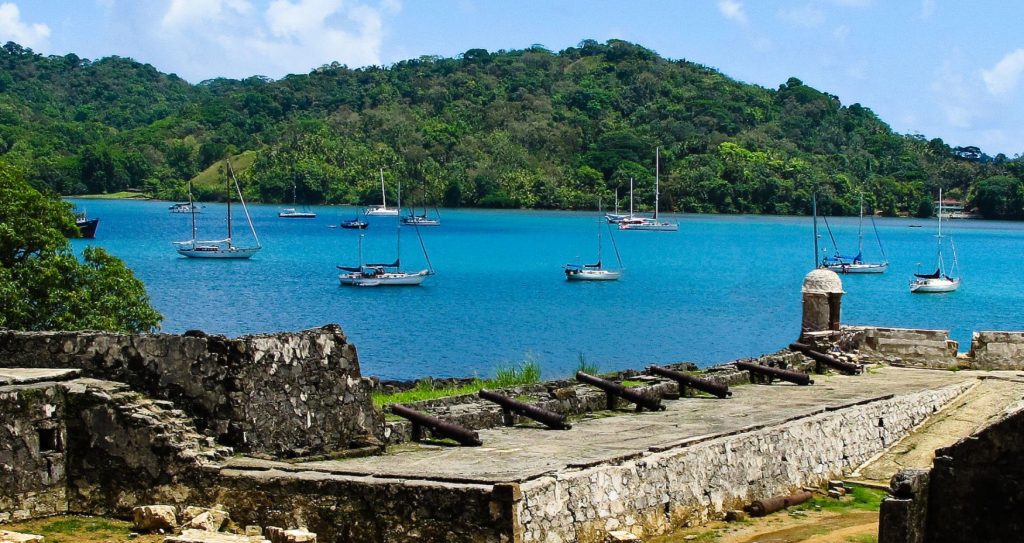
UNESCO designated the ruins of the Spanish colonial fortifications, along with nearby Fort San Lorenzo, as a World Heritage Site named "Fortifications on the Caribbean Side of Panama: Portobelo-San Lorenzo".
HISTORY
Portobelo was founded in 1597 by Spanish explorer Francisco Velarde y Mercado and quickly replaced Nombre de Dios as a Caribbean port for the transfer of Peruvian silver.
Sir Francis Drake died of dysentery in 1596 was buried in a lead coffin near Portobelo Bay, memorialised by the present Isla Drake at the entrance of the harbour.
The Spanish built an extensive network along the route of defensive fortifications.
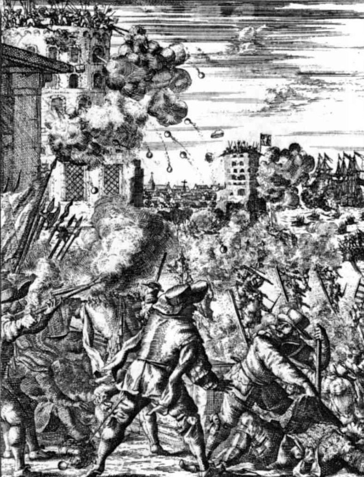
In 1601 by the English privateer William Parker captured Portobello from the Spanish. Henry Morgan captured it in 1668 with a posse of 450 privateers to overcome its strong fortifications.
It was captured again in 1680 by pirate John Coxon.
In 1726 the British suffered a disaster in their Blockade of Porto Bello under Admiral Francis Hosier, an attempt to prevent the Spanish treasure fleet returning to Spain, when due to their lengthy wait and inactivity moored at Bastimentos to the northeast a significant portion of sailors died from tropical diseases. 13 years later during the War of Jenkins' Ear the port was captured on November 21, 1739, by a British fleet of six ships commanded by Admiral Edward Vernon. Across the British Isles the name of "Portobello" was given to places and streets in honor of the victory, most notably Portobello Road in London.
The Spanish soon recovered Portobelo when in 1741 they defeated the British in the Battle of Cartagena de Indias and forced Vernon to return to England with a decimated fleet, having suffered more than 18,000 casualties. British efforts to gain a foothold on the Spanish Main and disrupt the galleon trade were ultimately fruitless. A change in tactics by the Spanish as they switched from using large fleets calling to small fleets trading at a wide variety of ports allowing them to develop flexibility that made them less subject to attack. Their vessels also began to travel around Cape Horn to trade directly at ports on the western coast.
Portobello was integrated via these Spanish trading Routes
CULTURE
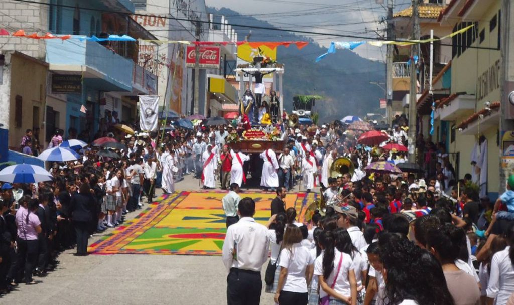
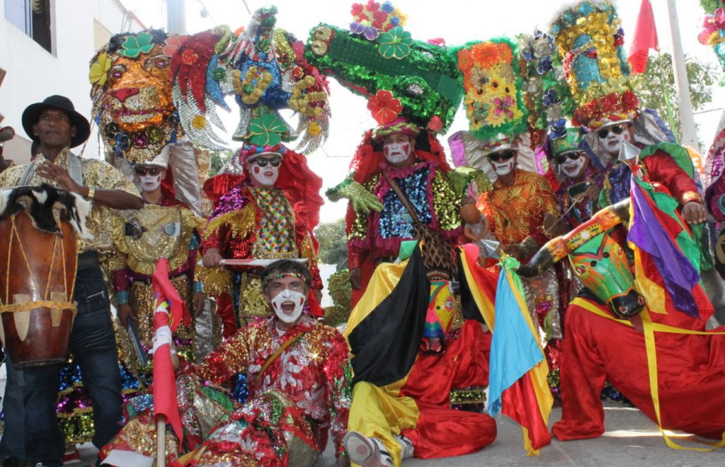
Festival del Cristo Negro
Panama for its celebration of the Festival del Cristo Negro which takes place on October 21. During this festival, thousands of Panamanians travel to Portobelo and head to the Church of San Felipe, which houses the life-size wooden sculpture of the Black Christ. 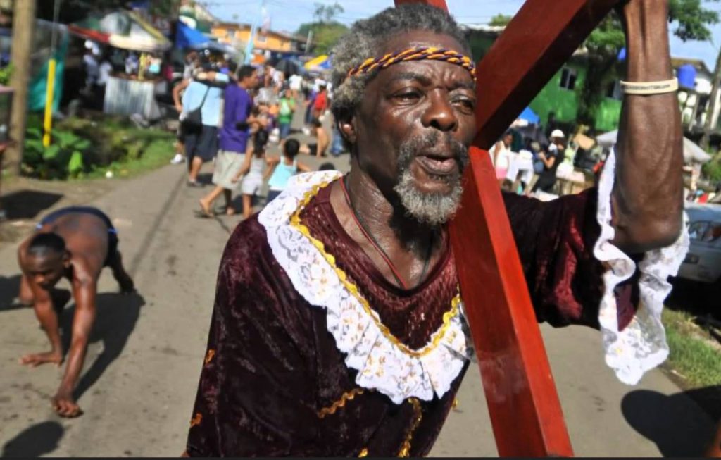
Portobelo is renowned throughout The Black Christ is bathed in legend, some of which describe it being marooned in Portobelo by sailors while en route to Colombia. Another legend says that on October 21, 1821 the residents of Portobelo prayed to the Black Christ to be spared from a cholera epidemic that was sweeping Panama—and they were
.
Festival de Diablos y Congos
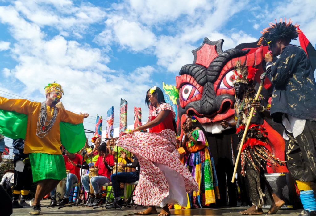
It's a festival of celebration and rebellion: Every year in February, the port city of Portobelo, Panama holds the “Festival de Diablos y Congos." It's a unique local take on the widespread Carnival tradition, a five-day party with no shortage of loudspeakers, dancing — and devils wielding whips.
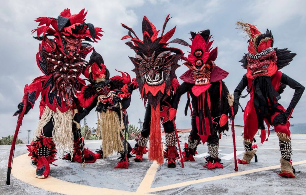
The Casa de la Cultura Congo is an open public space that hosts workshops and the creation of arts and crafts. Focusing on Congo art, the mission of the Casa de la Cultura Congo is to exalt and express the importance of the colonial Latin and African legacy in Portobelo, by bringing those traditions to life through different creative expressions.
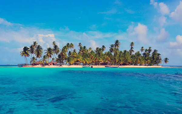
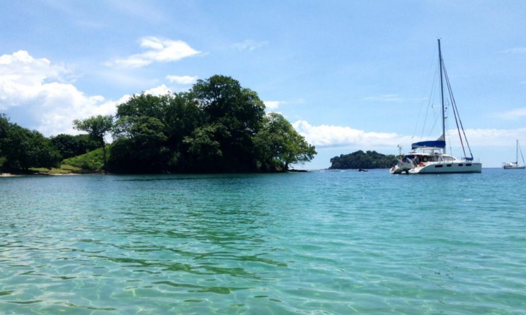
PLAYA BLANCA
Outside of the town, there is a small, scenic beach known as Playa Blanca. It’s at the tip of a peninsula and only accessible by boat. Those that make the trip here will often have the whole beach to themselves.
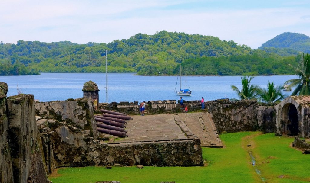
PORTOBELO - FORT SAN LORENZO PANAMA VISITING YACHTS MAP
|
|
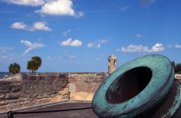
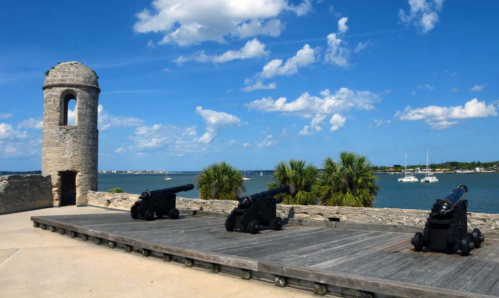
🇺🇸 CASTILLO SAN MARCOS
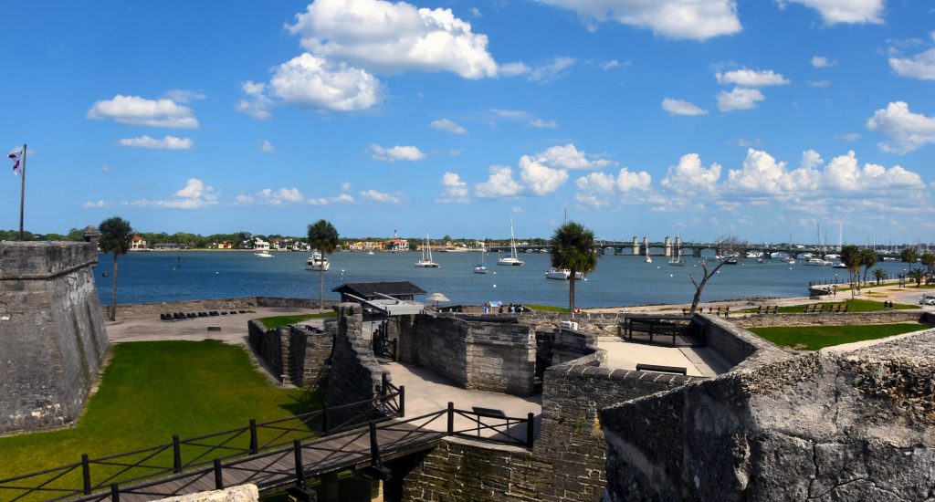
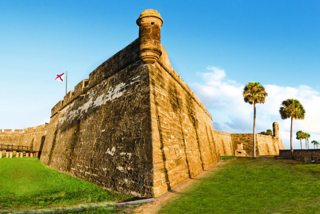
🇺🇸 CASTILLO SAN MARCOS, St Augustine Florida
The Castillo de San Marcos is the oldest masonry fort in the continental United Statesand is located on the western shore of Matanzas Bay in the city of St. Augustine, Florida. The Castillo was designed by the Spanish engineer Ignacio Daza and construction begn in 1672, 107 years after the city's founding by Spanish Admiral and conquistador Pedro Menéndez de Avilés, when Florida was part of the Spanish Empire.
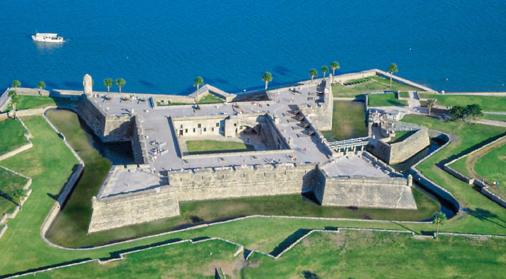
Castillo de San Marcos was for many years the northernmost outpost of Spain's vast New World empire. It is the oldest masonry fort and the best-preserved ex-ample of a Spanish colonial fortification in the continental United States. It anchored East Florida's defenses, which extended northward to the St. Marys River, westward to the St. Johns, and southward to Fort Matanzas. It protected St. Augustine from pirate raids and from Spain's major rival, Great Britain, during a time when the Florida-Georgia-Carolina coastline was an explosive international battleground.
![When Britain gained control of Florida in 1763 pursuant to the Treaty of Paris, St. Augustine became the capital of British East Florida, and the fort was renamed Fort St. Mark[8] until the Peace of Paris (1783) when Florida was transferred back to Spain and the fort's original name restored. In 1819, Spain signed the Adams–Onís Treaty which ceded Florida to the United States in 1821; consequently, the fort was designated a United States Army base and renamed Fort Marion, in honor of American Revolutionary War hero Francis Marion. The fort was declared a National Monument in 1924, and after 251 years of continuous military possession, was deactivated in 1933. The 20.48-acre (8.29 ha) site was subsequently turned over to the United States National Park Service. In 1942 the original name, Castillo de San Marcos, was restored by an Act of Congress.](https://panamaposse.com/wp-content/uploads/2021/05/castillossanmarcos-1024x637.jpg)
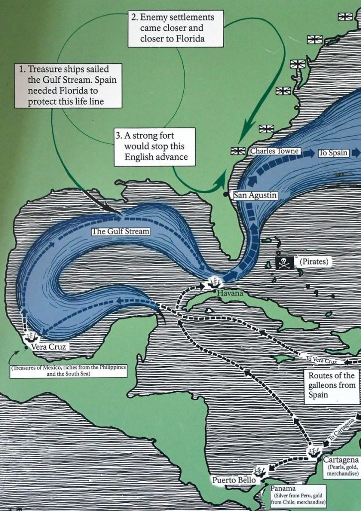
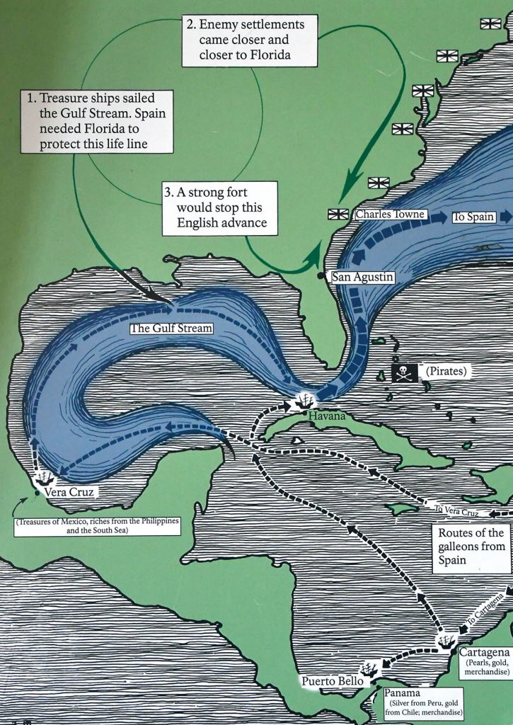
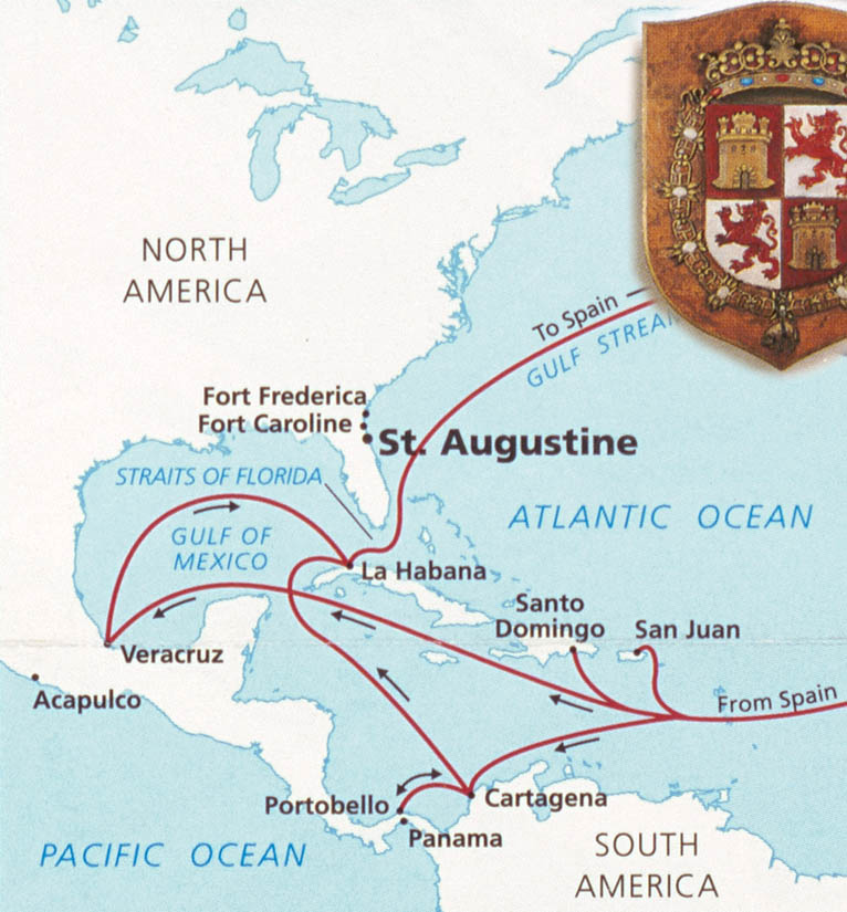
The roots of the Castillo's history reach back to the years just after Christopher Columbus's final transatlantic voyage, when conquistadors carved out a vast and wealthy overseas empire for Spain, first in the Caribbean and then on the mainlands of Mexico, Central America, Colombia, Venezuela, and Peru. Products of these tropical and mountainous territories brought high prices on the Continent, and Spanish galleons sailed home laden with exotic dyes, sugar, tobacco, chocolate, pearls, hardwoods, and silver and gold. These so-called "treasure fleets" made Spain the most powerful and envied nation in Renaissance Europe.
Thanks to the travels of Ponce de Leon in 1513, Spanish navigators knew that the best return route from Spain's rich Caribbean possessions was along the Gulf Stream, through the Bahama Channel, and past the shores of Florida. The Spanish knew they must defend this peninsula to prevent enemies from using its harbors as havens from which to raid the passing treasure fleets.
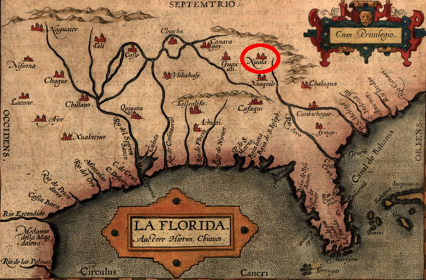
In 1513 Spain claimed Florida through the expedition of Ponce de Leon, but France gained the first foothold there by establishing Fort Caroline on the St. Johns River in 1564. Seeing this as both a challenge to Spain's claims and a menace to the treasure fleets, King Philip II sent an expedition under Don Pedro Menendez de Aviles to eliminate the French threat and establish settlements in Florida. It arrived at the mouth of the St. Johns River in September 1565.
After attempting unsuccessfully to board the French ships anchored there, Menendez sailed to a harbor farther south and established St. Augustine as a base for further operations. Almost immediately a French fleet sailed south to attack. But the ships were driven southward and wrecked by a violent storm and the mission failed. Realizing that Fort Caroline would be lightly guarded, the Spaniards marched north, captured the fort, and executed most of the inhabitants.
The same fate befell survivors from the French fleet, whom the Spaniards captured and killed at an inlet 14 miles south of St. Augustine. The episode gave a name to the area: Matanzas, Spanish for "slaughters."
England became Spain's next contender for Florida. The Spanish had watched the English warily ever since Sir Francis Drake attacked and burned St. Augustine in 1586. They became even more watchful after English-men settled Jamestown in 1607. British pirates sacked St. Augustine again in 1668, and this hit-and-run attack, followed by the English settlement of Charleston in 1670, caused Spain to build the Castillo de San Marcos.
Begun in 1672 and completed by 1695, the Castillo replaced nine successive wooden fortifications that had protected St. Augustine since its founding. The fort's commanding location on the west bank of Matanzas Bay allowed its guns to protect not only the harbor entrance but the ground to the north against a land attack.
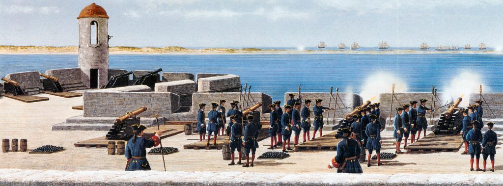
The Castillo's baptism of fire came in 1702 during the War of the Spanish Succession, when the English occupied St. Augustine and unsuccessfully besieged the fort for 50 days. The English burned the town before they left, but the Castillo emerged unscathed, thereby making it a symbolic link between the old St. Augustine of 1565 and the new city that rose from the ashes.
When Britain gained control of Florida in 1763 pursuant to the Treaty of Paris, St. Augustine became the capital of British East Florida, and the fort was renamed Fort St. Mark[8] until the Peace of Paris (1783) when Florida was transferred back to Spain and the fort's original name restored. In 1819, Spain signed the Adams–Onís Treaty which ceded Florida to the United States in 1821; consequently, the fort was designated a United States Army base and renamed Fort Marion, in honor of American Revolutionary War hero Francis Marion. The fort was declared a National Monument in 1924, and after 251 years of continuous military possession, was deactivated in 1933. The 20.48-acre (8.29 ha) site was subsequently turned over to the United States National Park Service. In 1942 the original name, Castillo de San Marcos, was restored by an Act of Congress.
Castillo SAN MARCOS Timeline
- 1513 Sailing from Puerto Rico, Spanish claim Florida.
- 1565 Spanish found St. Augustine and destroy French at Fort Caroline and Matanzas Inlet.
- 1672 Ground is broken on October 2 for Castillo de San Marcos.
- 1695 Castillo de San Marcos (curtain walls, bastions, living quarters, moat, ravelin, and sea-wall) is finished in August.
- 1702 War of the Spanish Succession pits Spain and France against Austria, Great Britain, and others. Coastal Georgia missions are destroyed by Carolinians en route to St. Augustine. Carolinians occupy and burn St. Augustine but the Castillo successfully resists their siege.
- 1738 Spanish governor at St. Augustine grants freedom to runaway British slaves. Black families settle at new town called Fort Mose.
- 1740 St. Augustine successfully endures siege by British, Georgian, and South Carolinian forces. Spanish attack and de-feat British Highland troops camped at Fort Mose.
- 1740-42 Fort Matanzas is built to block southern approach to St. Augustine.
- 1756-62 Fort Mose re-built in masonry. Earth-works at Mose extended to complete northern-most defense.
- 1763 Peace of Paris gives Florida to Great Britain in exchange for La Habana. Castillo becomes known as Fort St. Mark.
- 1783 Peace of Paris recognizes independence of the United States and returns Florida to Spain.
- 1821 Spain cedes Florida to the United States.
- 1825 Castillo de San Marcos renamed Fort Marion.
- 1924 Fort Marion and Fort Matanzas are proclaimed national monuments
- 1933 Transferred to the National Parks Service
- 1942 Original name Castillo San Marcos is restored
GET THERE BY YACHT
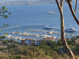
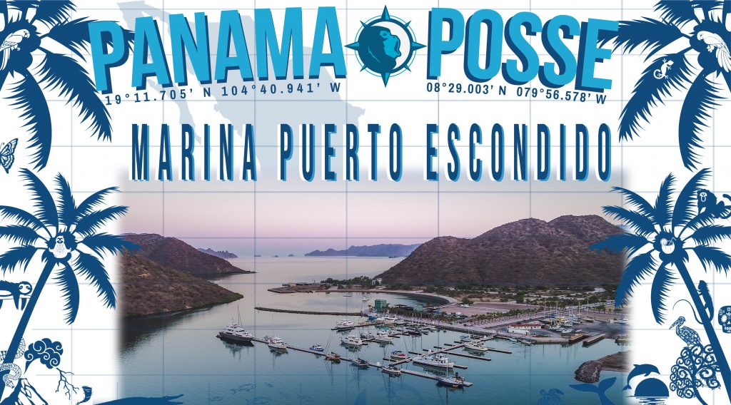
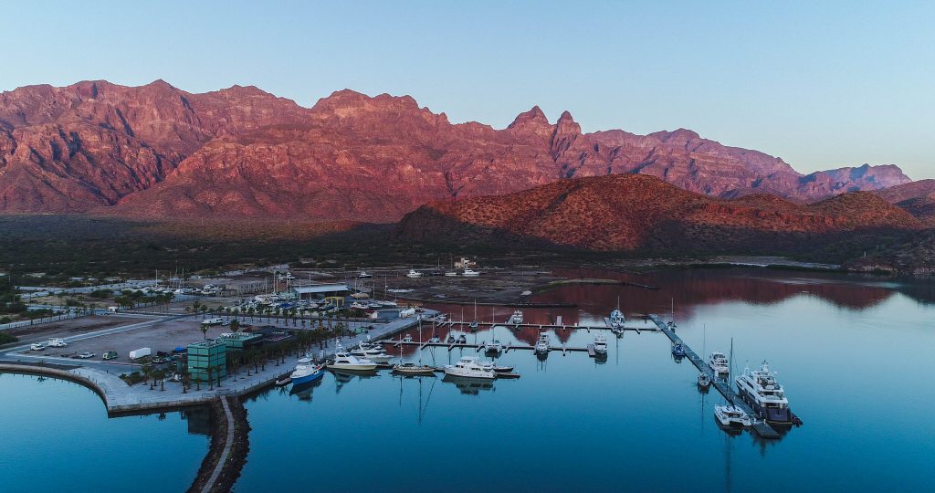
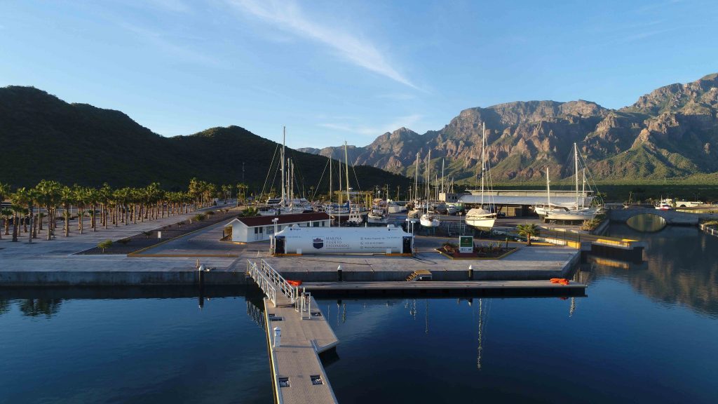
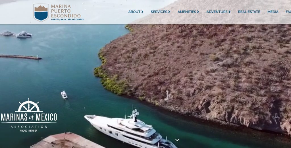
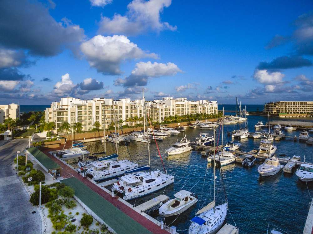
MARINA PUERTO ESCONDIDO 🇲🇽 SPONSORS THE PANAMA POSSE
 MARINA PUERTO ESCONDIDO, MX SPONSORS THE PANAMA POSSE
Hello Panama Posse - Good Afternoon
With Pleasure we would like to offer a discount of 10% of our published daily rates to the participants of the Panama Posse
Contact us below to check for availability and please let us know your vessels dimensions to confirm your reservation

Harbor Master Javier
RESERVATION FORM
https://www.marinapuertoescondido.com/slip-reservation.php
CONTACT MARINA PUERTO ESCONDIDO
Tel +52 6131318097
Email: harbormaster@marinapuertoescondido.com
concierge@marinapuertoescondido.com
AMENITIES
- Launching Ramp & Travel Lift
- Car & Trailer Parking
- The Market
- La Brisa Pizza + Bar
- Wifi & Conference Room
- Showers & Laundry
- Fish Scale & Fillet Station
- Rooftop Pool
- Captain's Lounge
- Fuel
- Propane
- Repair Services
- Car Rental & Transportation
RATES
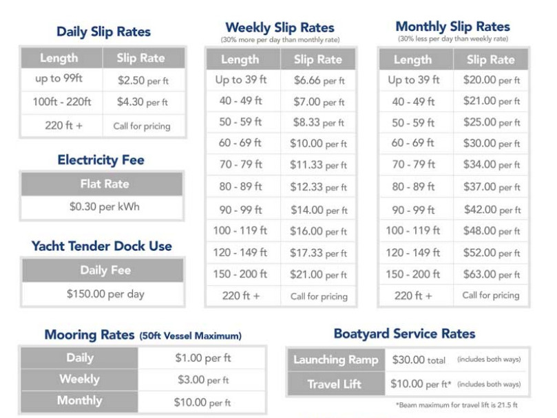
FUEL DOCK
SAFE APPROACH
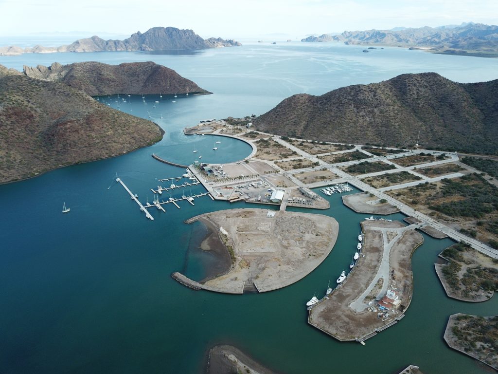
MAP LOCATION
MARINA PUERTO ESCONDIDO OFFICIAL WEBSITE >>
FLEET UPDATE 2021-03-20
|


|


|
|

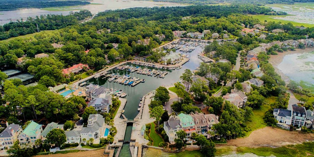
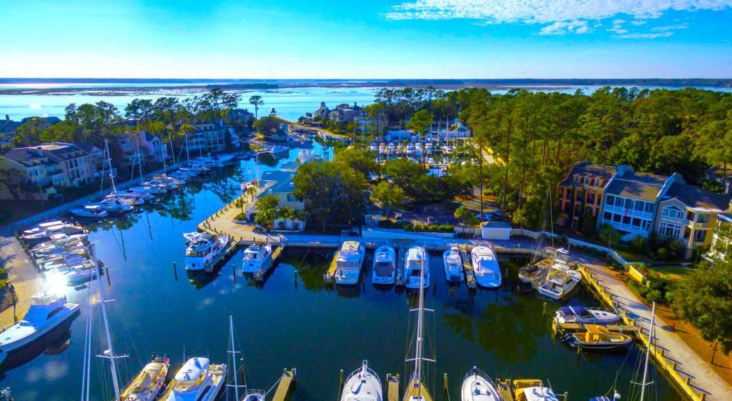
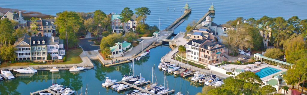
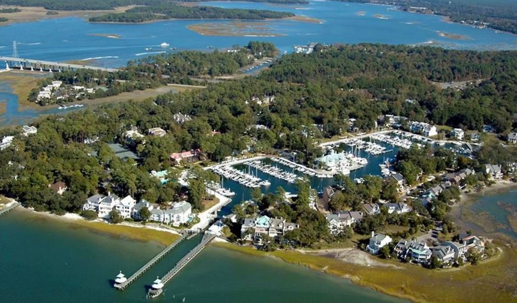
Windmill Harbour Marina 🇺🇸 Hilton Head USA Sponsors the Panama Posse
Windmill Harbour Marina 🇺🇸 Hilton Head USA Sponsors the Panama Posse
32° 12.9616'N 080°46.8716' W
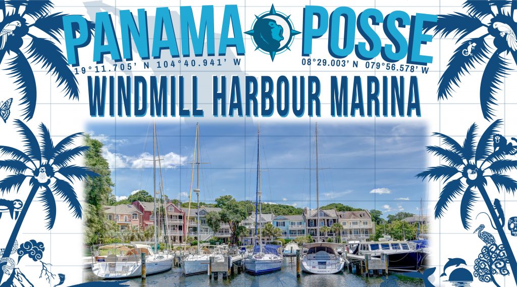
Welcome to Windmill Harbour Marina, situated on the northwest coast of Hilton Head Island, South Carolina.
We are please to sponsor the Panama Posse rally with a 20 cent x foot discount over published rates !

Harbourmaster
JAKE MCMILLAN
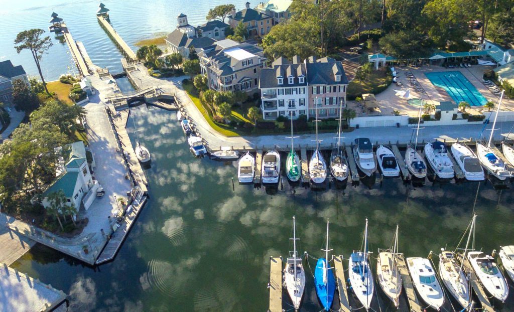
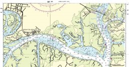
We are located on the Intracoastal Waterway, just ½ mile south of the Pinckney Island Bridge at mile marker 558, 500 yards south of channel marker 27, and ½ mile north of channel marker 29 in the Calibogue Sound. The marina’s 15.5 acre harbour boasts 258 Hilton Head boat slips, offering many for rent or sale. Transient dockage is available. Our remarkable harbour offers a safe, tide free haven protected by a lock system directly off the Intracoastal Waterway. The Windmill Harbour Marina lock is 75′ long by 19′ wide. Hours of operation are 0800 to 1900 by harbour master or 24 hours by yachtsmen with a keycard. We monitor channel 14 VHF. Our phone number is 843-681-9235 and our email is windmillharbourmaster@gmail.com.
CONTACT
Windmill Harbour Marina
161 Harbour Passage
Hilton Head Island, SC 29926
Phone (843) 681-9235
Fax (843) 681-9394
Email: windmillharbour@gmail.com
AMENITIES
• High Speed Fueling
• Ships’ store
• Pump out facility
• Easy access to Hilton Head and Savannah Airports
• Harbor side restrooms and showers
• Current and tide free docking
• Constant 8′ depth
• 258 slips from 25′ to 70′
• 19′ wide access
• 15.5 acre harbour
• Direct access to Intracoastal Waterway and Calibogue Sound
• 24 hr security
• Yacht sales and brokerage
• Transients welcome
• Pet Friendly neighborhood with dog park
• Boat slip sales and rentals
• Reasonable rates
• On-call maintenance includes boat cleaning, engine repair, electronics, and canvas
• Home of the elegant South Carolina Yacht Club with fine dining, swimming, tennis, sauna, hot tub, showers and locker room
• Close to supermarkets, restaurants, shopping, lodging, and golf
NEARBY
• Over 12 miles of public beaches
• 24 world famous golf courses designed by some of the preeminent architects such as Jack Nicklaus, Pete Dye, Robert Trent Jones, Arnold Palmer and many more
• Over 350 tennis courts in all three Grand Slam surfaces
• More than 250 restaurants
• A multitude of outdoor adventure options
• A superb selection of over 200 shopping opportunities
• Close proximity to Beaufort and Charleston, SC as well as Savannah, GA
• Hilton Head Regional Hospital
Marina SAFE APPROACH
RATES
TRANSIENT BOAT SLIP RATES
| BOAT LENGTH | NIGHTLY RATE |
|---|---|
| Under 50′ | $2.20 p/ft |
| 50′ and Over | $2.40 p/ft |
ELECTRIC POWER
| ELECTRIC POWER | DAILY | MONTHLY |
|---|---|---|
| 30 amp | $6.00 | $50.00 |
| 50 amp | $9.00 | $90.00 |
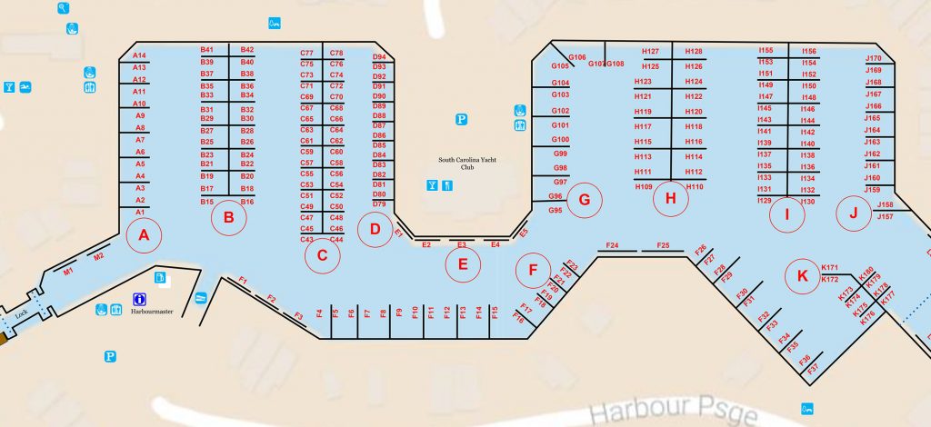
DOCK MAP
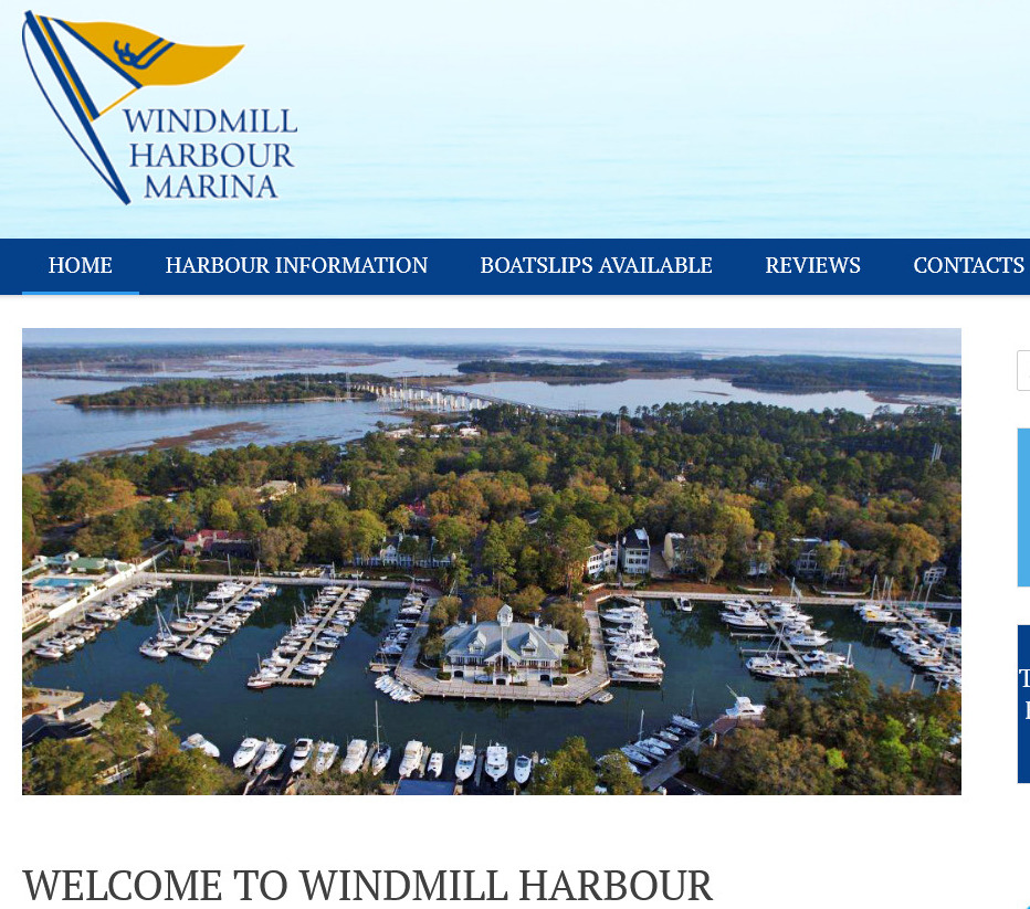
OFFICIAL WEBSITE >>
ELIZABETH ON THE BAY MARINA MARKET 🇧🇸 SPONSORS THE PANAMA POSSE
ELIZABETH ON THE BAY MARINA & MARKET 🇧🇸
We are please to sponsor the Panama Posse with a discount over our lowest berthing rates.
CONTACT
Sophi Parras
+1 242 424-0557
+1 (242) 424-7374
Email:
sophia@grahamrealestate.com
assistant@grahamrealestate.com
Web:
https://www.facebook.com/Elizabeth-On-Bay-Marketplace-and-Marina-114961361699/
RATES
AMENITIES
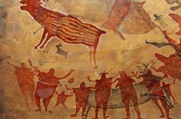
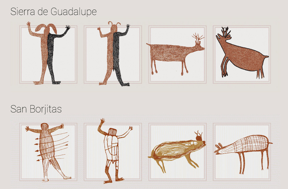
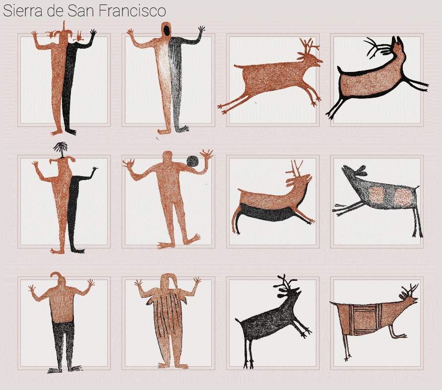
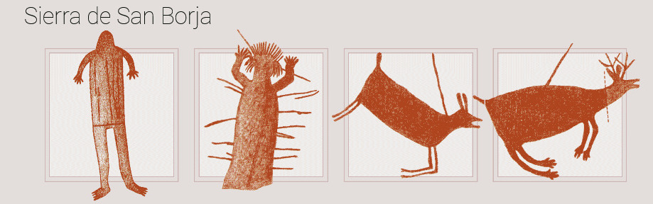
Sierra de San Francisco Murals 🇲🇽 Mexico
Rock Paintings of the Sierra de San Francisco 🇲🇽 BAJA CALIFORNIA Mexico
From c. 100 B.C. to A.D. 1300, the Sierra de San Francisco (in the El Vizcaino reserve, in Baja California) was home to a people who have now disappeared but who left one of the most outstanding collections of rock paintings in the world. They are remarkably well-preserved because of the dry climate and the inaccessibility of the site.
The central part of Baja California peninsula is a region of Mexico that concentrates one of the most extraordinary repertoires of rock art in the country, the Rock Paintings of the Sierra de San Francisco. The region is insular-like and kept the native peoples relatively isolated from continental influences, allowing the development of local cultural complex. One of the most significant features of the peninsular prehistory is the mass production of rock art since ancient times and the development of rock art tradition of the Great Murals.
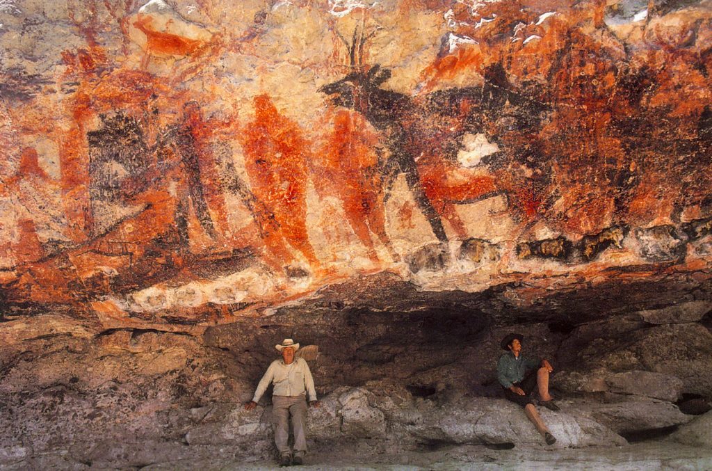
The Sierra de San Francisco is the mountain range which concentrates the most spectacular and best preserved Great Mural sites, scale wise one of the largest prehistoric rock art sites in the world. Hundreds of rock shelters, and sometimes huge panels with hundreds and even thousands of brightly painted figures, are found in a good state of conservation. The style is essentially realistic and is dominated by depictions of human figures and marine and terrestrial fauna, designed in red, black, white and yellow, which illustrate the relationship between humans and their environment, and reveal a highly sophisticated culture. The paintings are found on both the walls and roofs of rock shelters in the sides of ravines that are difficult of access. Those in the San Francisco area are divided into four main groups - Guadalupe, Santa Teresa, San Gregorio and Cerritos. The most important sites are Cueva del Batequì, Cueva de la Navidad, Cerro de Santa Marta, Cueva de la Soledad, Cueva de las Flechas and Grutas del Brinco.
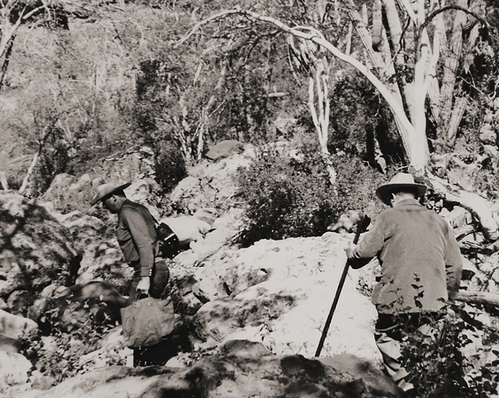
The landscape of the area is another significant attribute, understood as the extensive physical space in which, through rock art, the thoughts of their early dwellers, hunter-gatherers people who living here from the terminal Pleistocene (10,000 BP) until the arrival of Jesuit missionaries in the late seventeenth century, are expressed.
North of San Ignacio lies a mountain wilderness, the deeply eroded remains of layer upon layer of volcanic outpourings. This rugged mass rises from the surrounding desert to heights of more than 5,000 feet and covers an area 35 miles from north to south and half of that from east to west. From its uplands, there are views west to Scammon's Lagoon and the Vizcaíno Desert, northwest to the even taller Sierra de San Borja, and east to the abrupt eminences of Las Tres Vírgenes, taller and more recent volcanos that tower in front of the Gulf. The sierra embraces a world that would never be suspected from the low, barren lands outside. Groves of palms and pools of water are set between walls of vertical grandeur water-carved from rich-colored rock. A few ranches, built by rustic and hospitable people, nestle near the few water sources. Here also are the grandest reminders of the Painters, corridors decorated by their hands and haunted by their spirits.
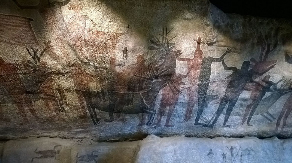
Showing human figures and many animal species and illustrating the relationship between humans and their environment, the paintings reveal a highly sophisticated culture. Their composition and size, as well as the precision of the outlines and the variety of colors, but especially the number of sites, make this an impressive testimony to a unique artistic tradition.
Cultural traditions, with roots back to the XVIII century, persist and the Sierra has a strong social value in the role that culture plays in the preservation of the traditional links between mountain communities and the South Californians and Mexicans in general.
Integrity
The Rock Paintings of the Sierra de San Francisco encompass an area of 183, 956 ha, where more than 400 sites have been recorded, the most important of them within the reserve, near San Francisco and Mulege, over 250 in all. The inscribed property contains an exceptional repertoire of rock art that convey its Outstanding Universal Value. The sites have remained virtually intact and still have a good state of conservation. The integrity of rock painting sites and their surroundings has been maintained largely due to the situation of isolation and the low population density that prevails in the region.
Protection and management requirements
The Rock Paintings of the Sierra de San Francisco are protected by the 1972 Federal Law on Historic, Archaeological and Artistic Monuments and Zones and fall under the protective and research jurisdiction of National Institute of Anthropology and History (INAH). In addition, the property is entirely within the Vizcaino Biosphere Reserve; which grants it with additional protection. The Management Plan has been in operation since 1994 and has proved a successful strategy in the administration of cultural resources of the property. This model emphasizes the importance of defining the meaning of this heritage site, so that all management strategies are consistently directed toward the preservation of the values that make it important. Another key feature is the total involvement of all those groups that have an interest in the area under discussion. The Management Plan focuses on issues such as mitigation of the impact of visitors on sites and control and monitor of access. Some measures included the installation of reversible infrastructure in seven of the most visited rock painting sites and the definition of authorized access paths, the areas open to the public or restricted, and four levels of access for tourists. This system allows visitors to experience a wide range of sites and at the same time protects the majority of those who are very well preserved. In this sense the most popular sites have remained open under this Management Plan. Threats remain that have to be addressed, including those derived from the proposals to construct roads within the protected area which would jeopardize the existing integrity between the landscape and the rock art sites.
The medium and long term management expectations include obtaining additional legal protection through the presidential declaration of the area; allocating permanent custodian positions to improve monitoring, enhance the administrative and technological infrastructure of Sierra de San Francisco Information Unit located in San Ignacio town, capacity building for the custodians and guides and improvement of low-impact infrastructure for services.
more at https://www.bradshawfoundation.com/baja/great_mural_styles/index.php
JOIN THE PANAMA POSSE TO CRUISE AND SAIL 🇲🇽 THE SEA OF CORTES
FLEET UPDATE 2021-03-13
![]()
"Times of great calamity and confusion have been productive for the greatest minds. The purest ore is produced from the hottest furnace. The brightest thunder-bolt is elicited from the darkest storm."
- Charles Caleb Colton
English cleric, writer and collector, well known for his eccentricities.
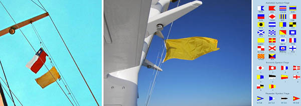
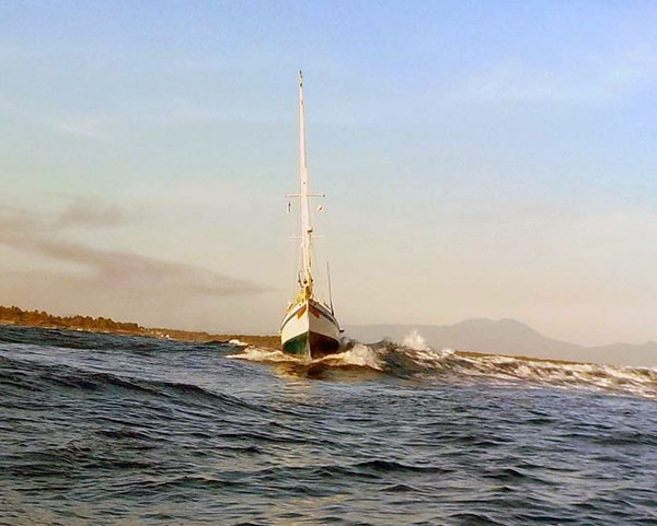
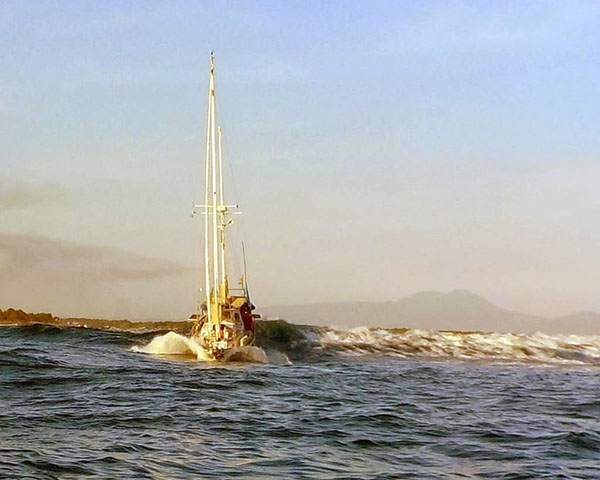
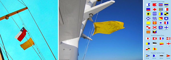
VESSELS EXITING THE BAR IN EL SALVADOR
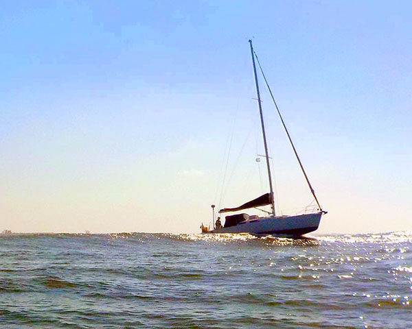
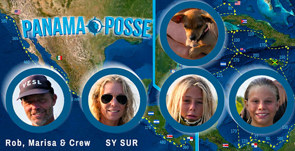
SY SUR heading out
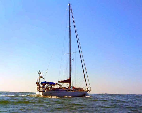
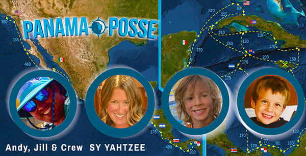
SY YAHTZEE in hot pursuit
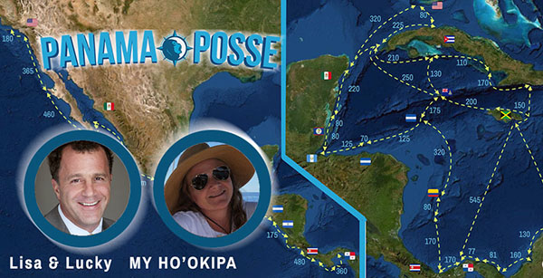
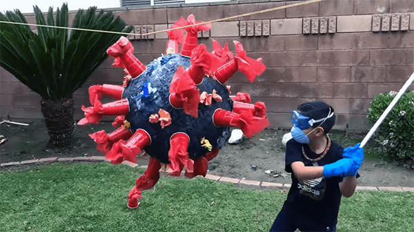
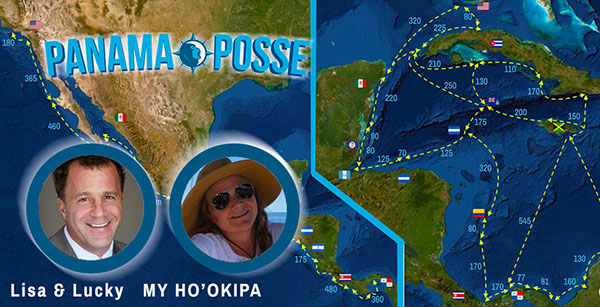
MY HO’OKIPA entering this week’s CAPTAIN RON AWARD
Incident report:
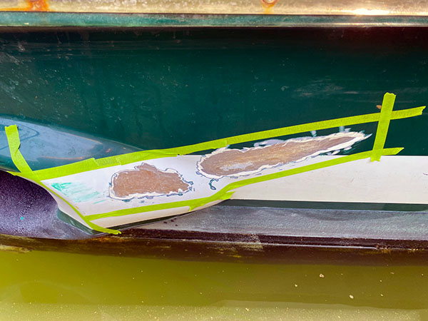
March 5, 2021 @ 1700 hrs - Puesta Del Sol, Nicaragua – went offshore 5 miles to empty holding tanks and make water. On the way back into the marine, the tidal flow unexpectedly pushed Ho’okipa’s stern to starboard and she clipped a channel buoy leaving a 1/4” gash in her hull starboard aft – above the water line.
After 12 hours of beating myself up, I spoke with my team (guru, mechanic and cosmetician). We all decided it wasn’t an emergency, and not to panic. Since the fiberglass hull was exposed, we were concerned that water would permeate into the hull and create a much bigger more costly problem. Our plan was to patch the gash until we get to Panama and pull it out of the water to do a proper repair.
On board, I have West System Epoxy Resin, including Hardener, Filler and Glass Mat sheets. Also, I have 1 gallon of Splash Zone.
I opted for the Splash Zone for 2 reasons: a) it was a vertical patch and I felt more comfortable working with the putty of Splash Zone versus the West System which I wasn’t certain I could set up correctly on a vertical surface right above the waterline, b) I would need 3 coats of the West System epoxy and 1 coat of Glass Mat and I wasn’t sure I had epoxy material for that.
Next step was to prep the surface for the patch: grind, sand, clean and tape. Then the Splash Zone 2-part epoxy was mixed by hand with wet gloves, applied, shaped and set.
Lessons I learned:
1. I will now pay closer attention to Captain Rob Murray and heed his advice to pay close attention and respect the tidal flows. Here in Puesta Del Sol, there is an 8-10’ tidal flow with a 10-20 knot current. Plus, reefs, rocks, sandbars and whatnot. The channel is winding and takes a hard portside 90 degree turn right after the bottleneck, and right before the channel buoy so I should have been more on guard to take that punch!!!
2. Don’t friggen panic. It’s only a scratch. And forgive myself, as it’s only an accident.
3. Have lots of supplies and tools on the boat to do an above/below waterline repair.
Nuff said.
~Lucky Chucky mv Ho’okipa out

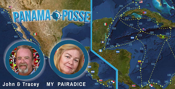
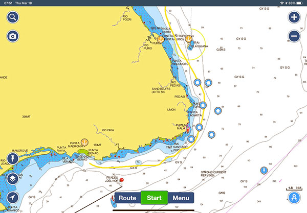
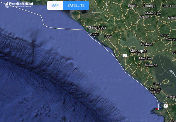
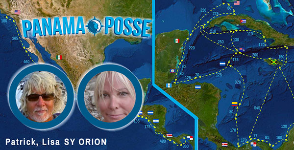
ORION ON PASSAGE
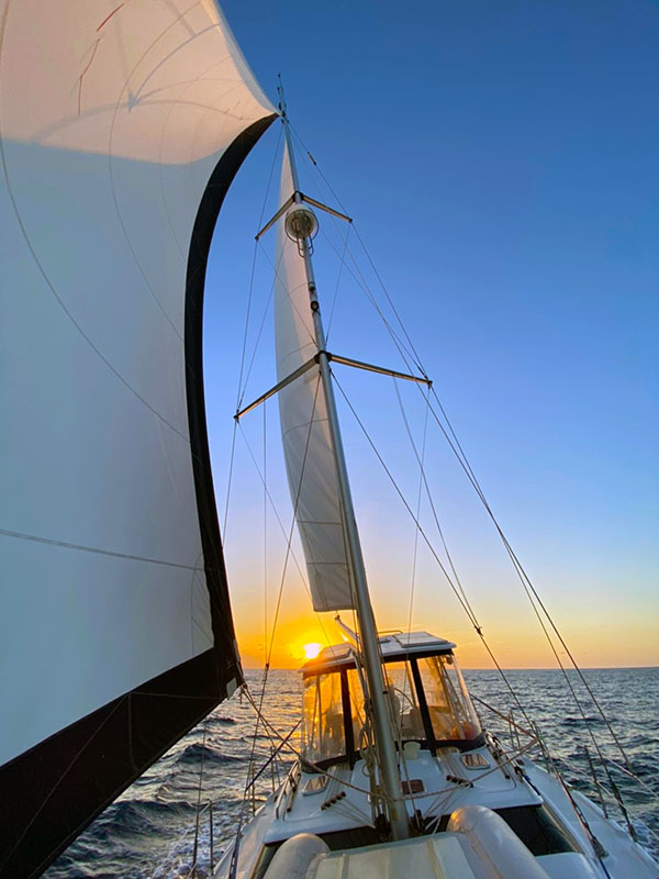
heading east = sunset aft !
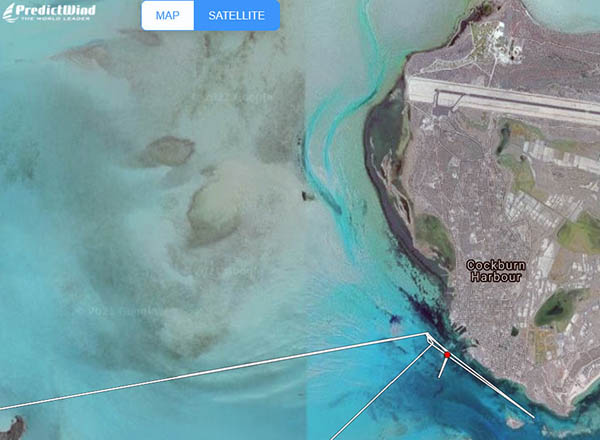
Picture from agent Julian Julian Javier Watson Maturel a great local resource and agent to help in San Andres Colombia
Contact Julian on WhatsApp +57 310 234 0781 or via email julian.jwm@gmail.com
PREDICT WIND SPONSORS THE PANAMA POSSE
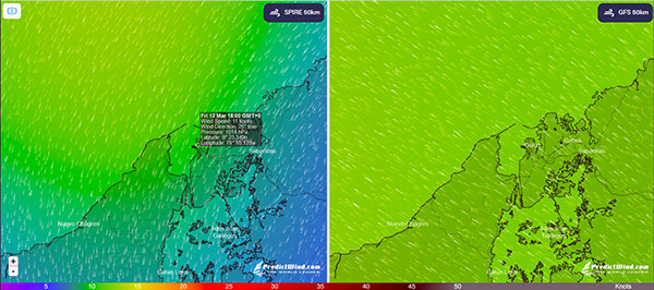
PANAMA POSSE 20-21 & PREDICT WIND WEATHER WEBINAR with NICK OLSEN
- California to Jamaica mayor weather areas
- Cabo Falso
- Cabo Corrientes
- Tehuantepec
- Papagayo Winds|
- Cabo Malo
- Santa Marta
Follow the link below to watch this free video
https://www.youtube.com/watch?v=7LkNUpZ68Ds
REPORT FROM MAZATLAN, MEXICO
the colors, the sky, the whole shebang
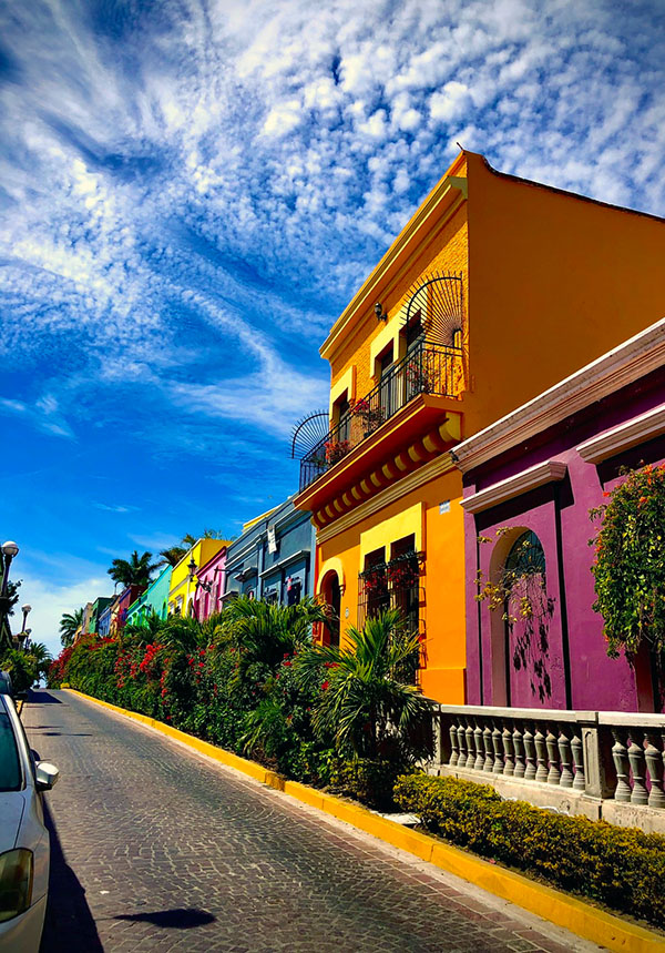
Colorful streets Mazatlán is well known as the Only Colonial City on the Beach in México
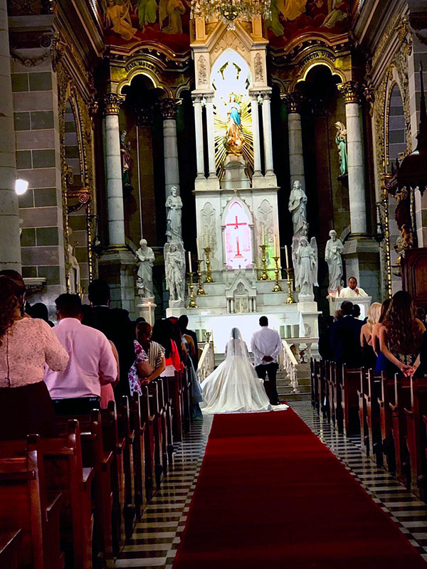
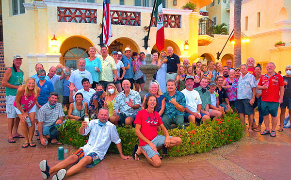
Panama Posse Participating in Mexican wedding crashing ...
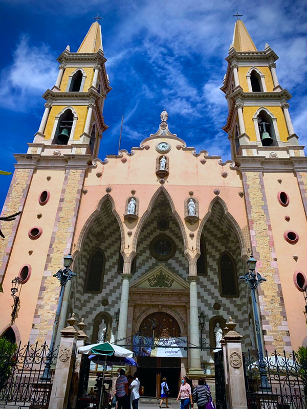
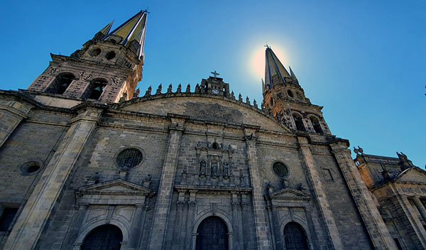
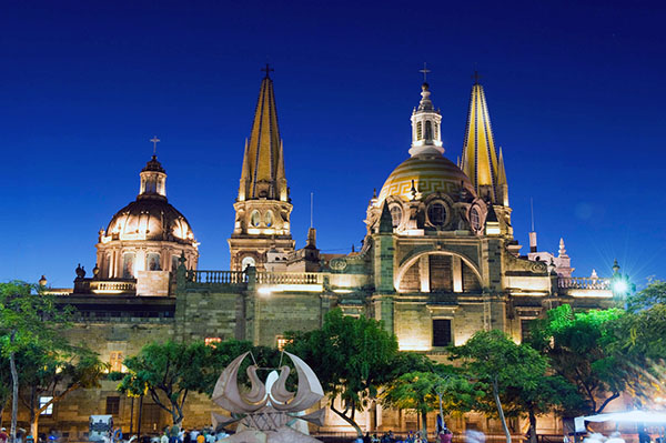
The Cathedral Basilica of the Immaculate Conception- Mazatlán Cathedral Is the main religious building in the city of Mazatlan, in Baroque-Revival style of Sinaloa, Mexico and home of the Catholic Diocese of Mazatlan. It is located in the historical center.
The works of the temple began in the year of 1856, by order of the then bishop Pedro Loza and Pardavé. Later, the parish priest Miguel Lacarra takes over the works and it is for this that they are concluded in the year of 1899.
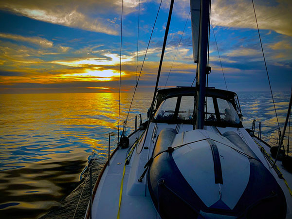
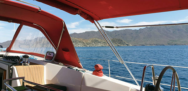
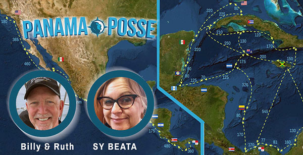
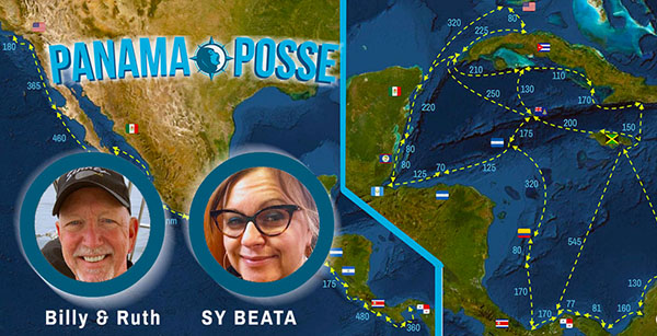
SY Beata on passage to Mexican Mainland Mazatlan
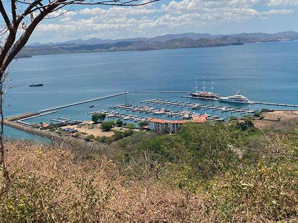
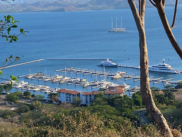
Sunset at Marina Papagayo Costa Rica
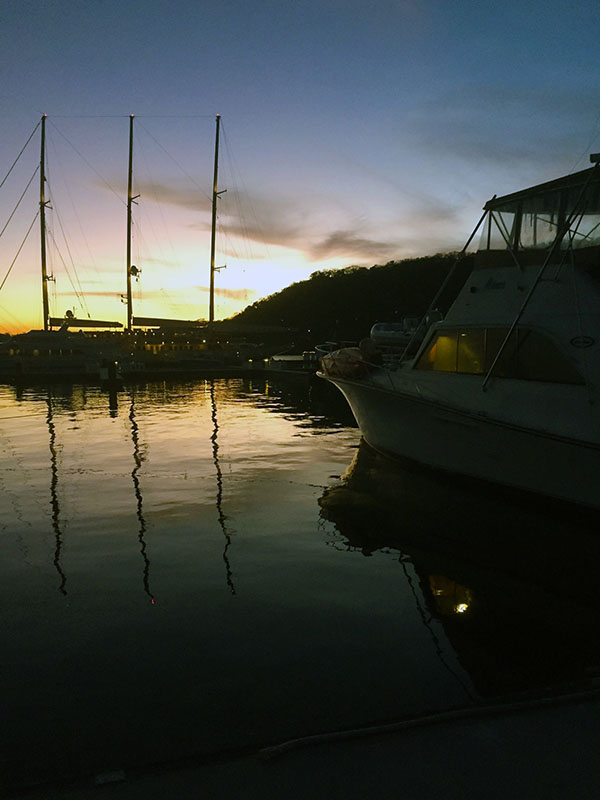
A sunset picture from Marina Papagayo
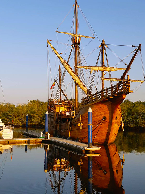
The Iconic NAO Santa Maria captured by Evie
REPORT FROM A PUEBLO MAGICO
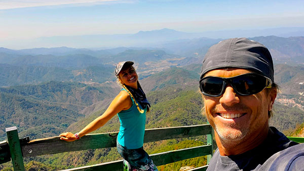
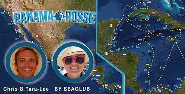
Seaglub in "Gobble up all of Mexico mode" before heading to the south pacific
San Sebastián del Oeste
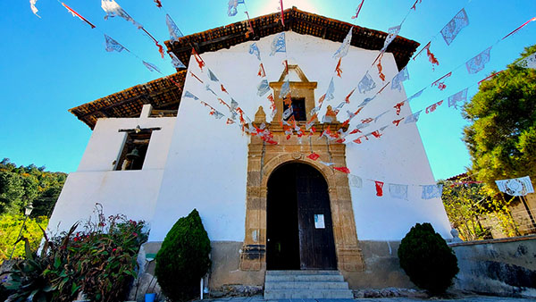
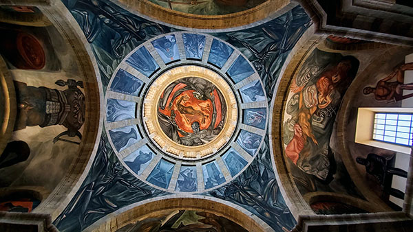
The Church of Saint Sebastian, whose original construction was in 1608, was designed in the Colonial Spanish Baroque style. It has notable architectural details, including Corinthian columns and ceiling vault frescos.
San Sebastián was founded as a mining town in 1605, during the early Spanish colonial Viceroyalty of New Spain period. Gold, silver and lead were mined in the area. More than 25 mines and a number of foundries were established by 1785.
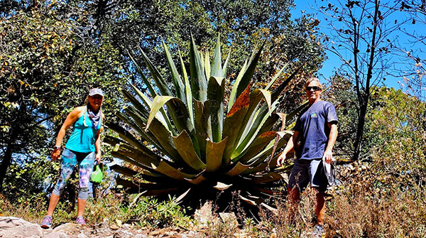
The succulent leaves of most Agave species have sharp marginal teeth, an extremely sharp terminal spine, and are very fibrous inside. The stout stem is usually extremely short, which may make the plant appear as though it is stemless.
Agave rosettes are mostly monocarpic. During flowering, a tall stem or "mast" "quiote" develops which can grow 12 meters (40 feet) high
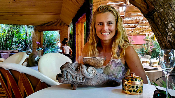
Tara-Lee with a - what is that ?
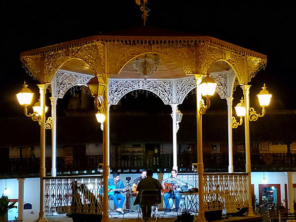
Music on the Plaza at night

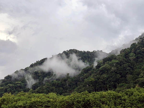
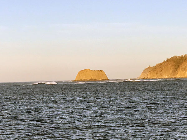
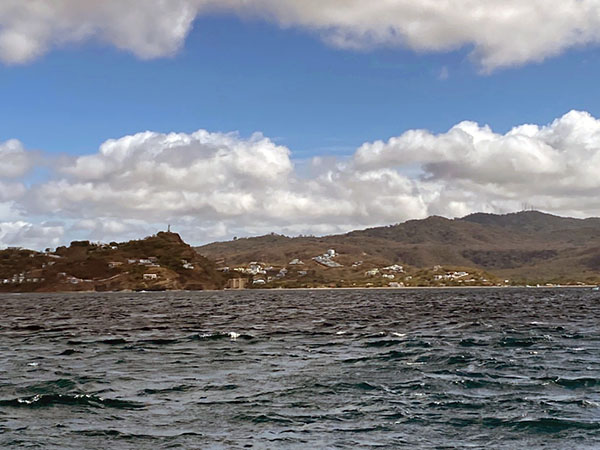
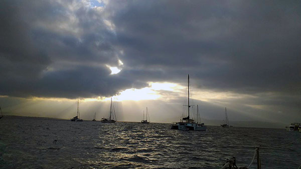
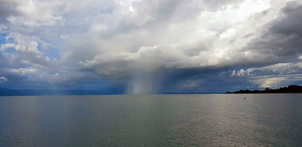
MONSOON: ANCHORAGE AND CLOUDS
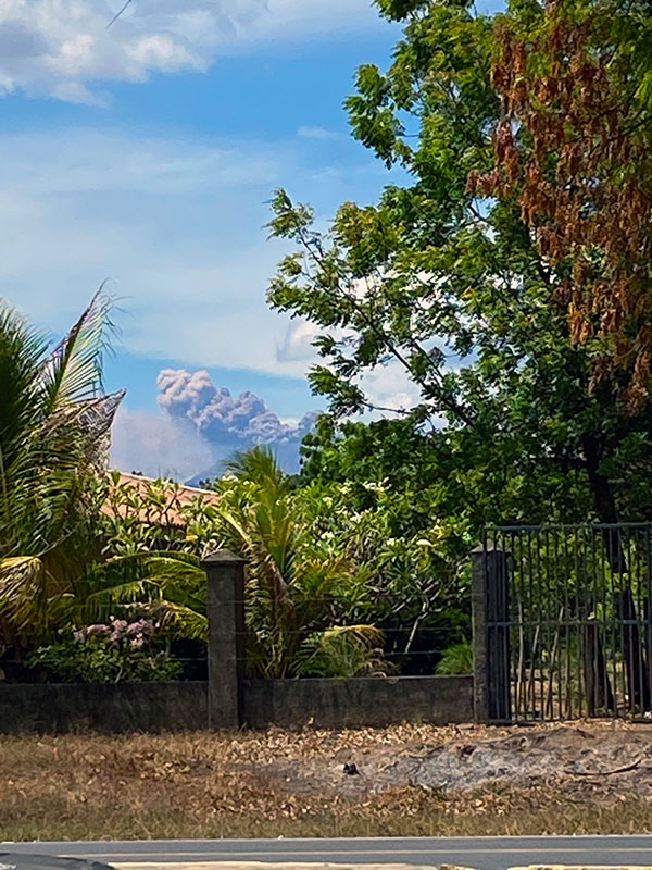
VOLCANIC ERUPTION IN NICARAGUA
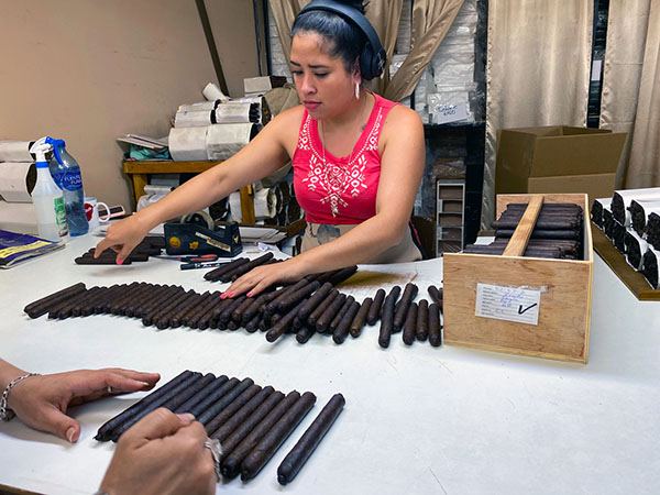
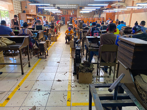
90 minute tour at Tabacalera Carreras cigar factory - Esteli, Nicaragua

AKA: LUCKY CHUCKY AND THE CIGAR FACTORY
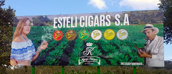
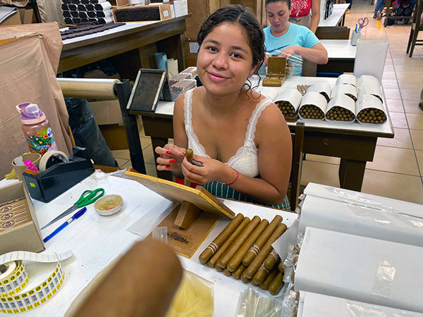
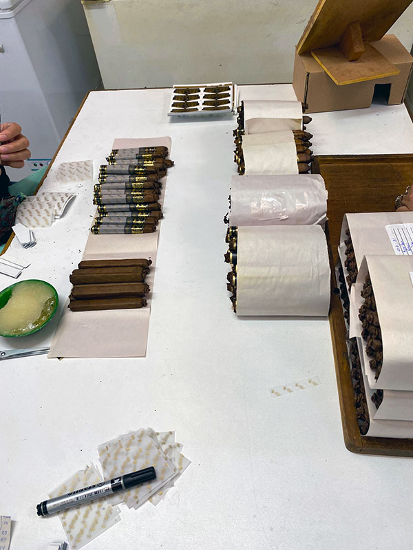
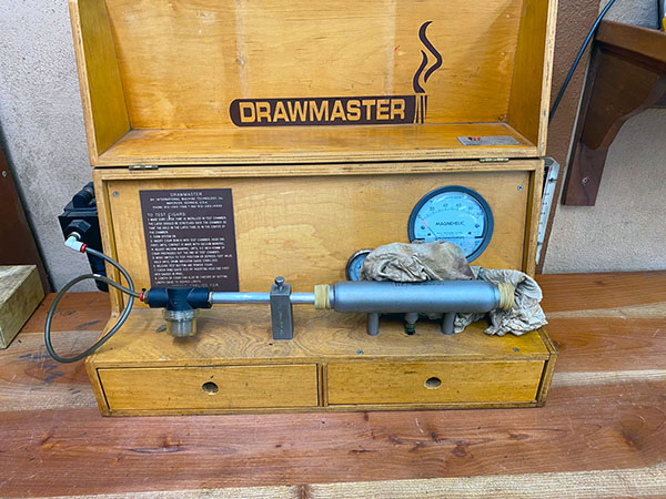
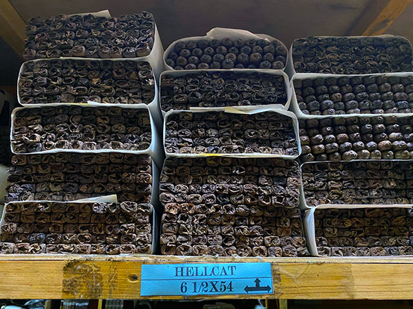
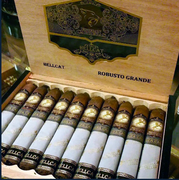
time to stock up ! Esteban Carreras Chupacabra Hellcat in the US 20 x $ 173.50
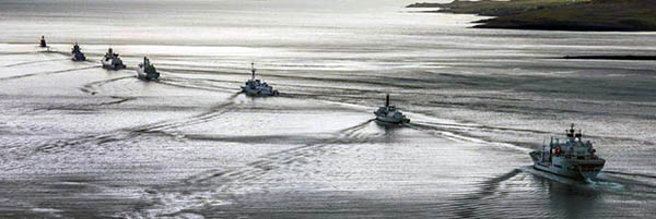
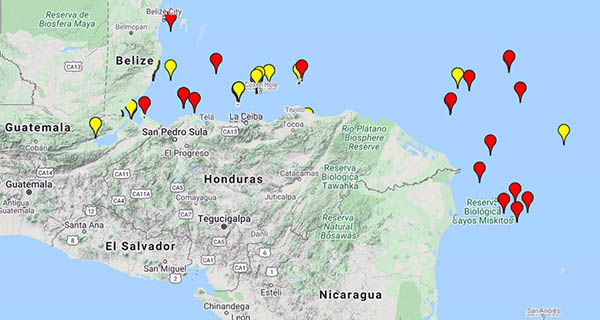
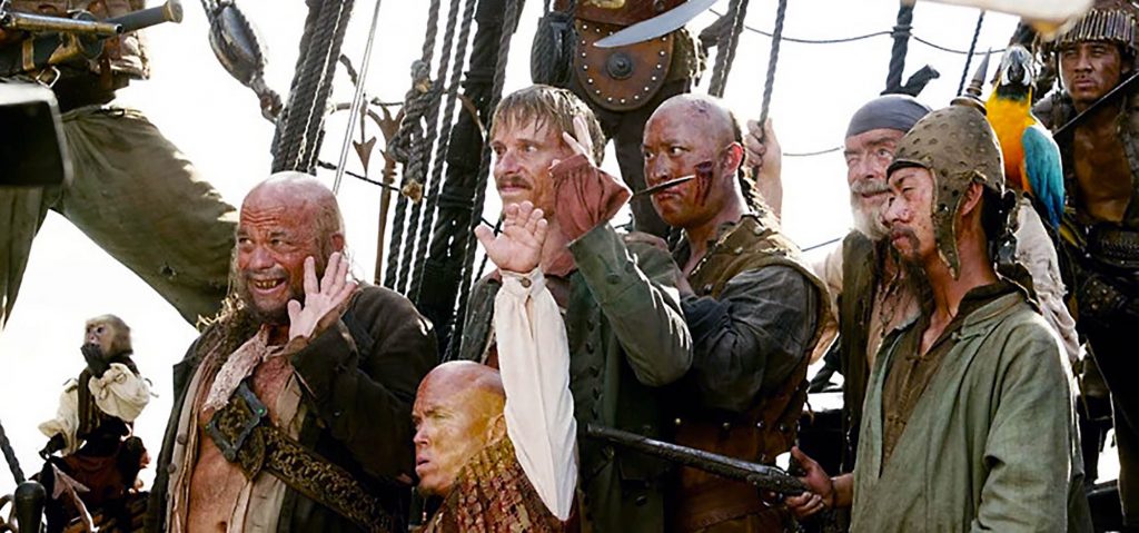
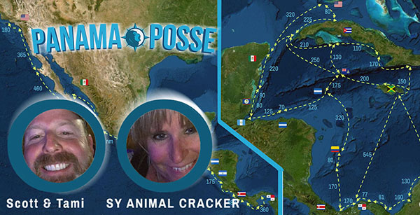
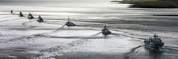
PANAMA POSSE CONVOYS forming through pirate waters
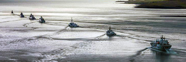
DEFINITION: a group convoyed or organized for convenience or protection in moving
This season we are supporting the creation of convoys for vessels planning on traveling along the north coast of Venezuela or transiting along the Nicaraguan / Honduran Caribbean coast. We have a working safety protocol which will group vessels into a convoy. Please inform us if you would like to participate -> email security@panamaposse.com with your vessel name.
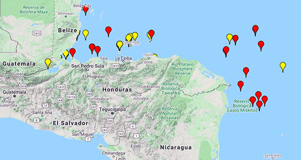
The area of mayor incidents as compiled from CSSN - Caribbean Safety and Security Net
COVID VACCINE ROLLOUT: RACE TO NORMALCY
Most Embassies are not offering vaccinations for citizens abroad apart from their own staff, meaning private-sector personnel abroad need to arrange their own vaccinations, either by accessing locally available vaccines or by returning to their countries. This report provides a country-by-country overview of the state of the vaccine rollout as of the end of February 2021 as per "our world in data"
The statistics were accessed on March 13, 2021 and reflect reported Cumulative COVID-19 vaccinations per 100 people (%) from countries who report this
Belize 1.87
Canada 7.50
Cayman Islands 40.44
Colombia 1.16
Costa Rica 4.75
El Salvador 0.25
Guatemala 0.01
Honduras 0.03
Mexico 3.11
Panama 5.68
Turks & Caicos Islands 16.62
United States 30.55
source March 13,2021 https://ourworldindata.org/covid-vaccinations
UPDATES ON QUARANTINE BY COUNTRY >>
QUARANTINE UPDATES Keep checking this section for most recent updates ...more >>>
IMAGE OF A SQUALL
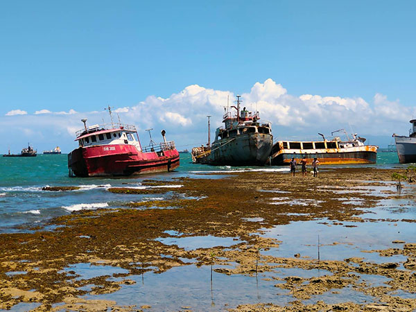
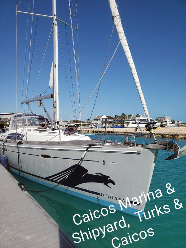
Vessels on the hard !
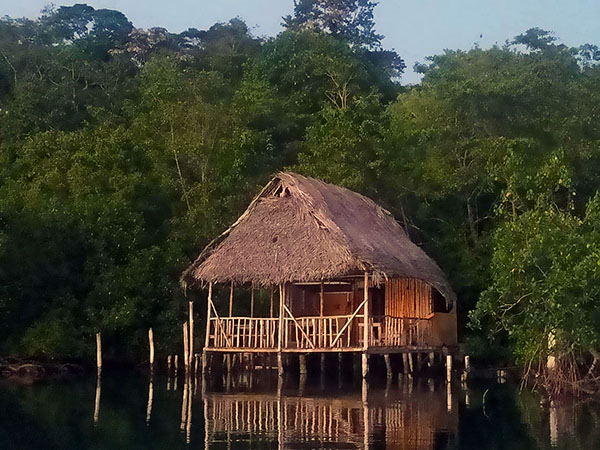
Image y MY LADY K
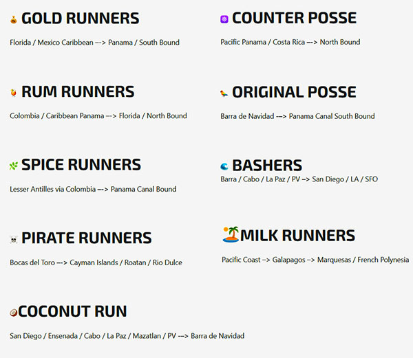
PANAMA POSSE pods based on your cruising plans
💰 🍹🌿 ☠️ 🥥☸️ 🦜🌊 🏝️
Based on seasonal gathering spots here are the "sub pods" with line calls after the main calls starting Mondays in November to save everyone's time (great suggestion Eric Sprezzatura)
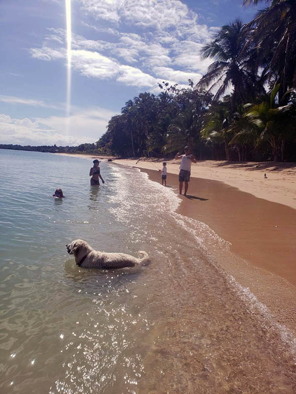
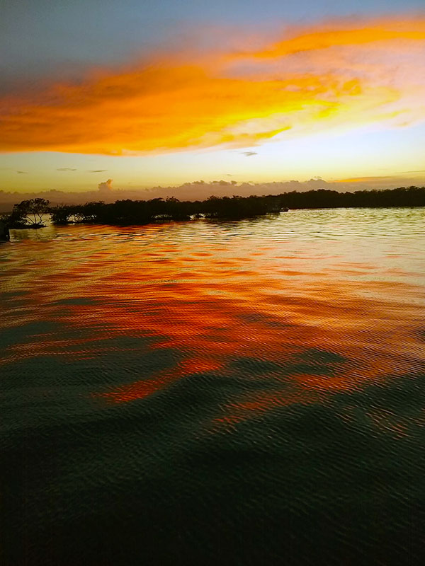
SUNSET IN BOCAS DEL TORO, PANAMA
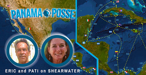
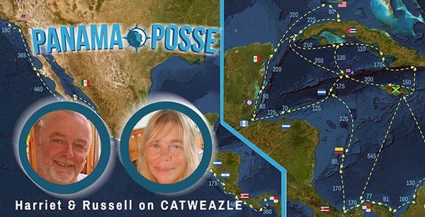
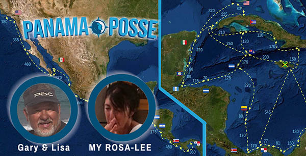
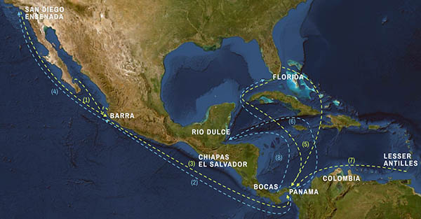
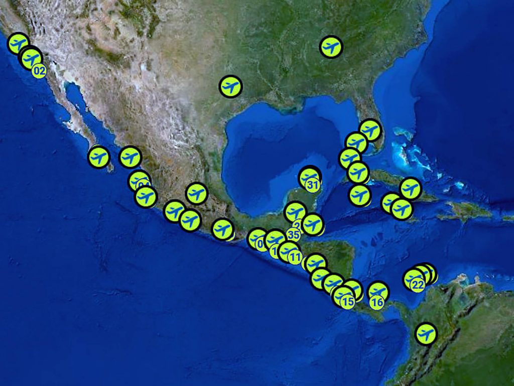
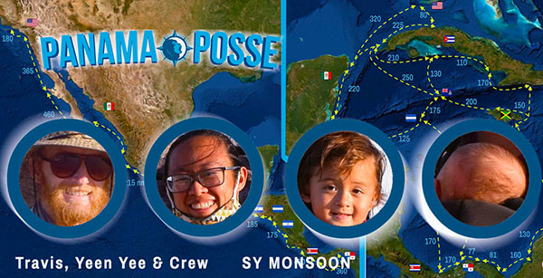
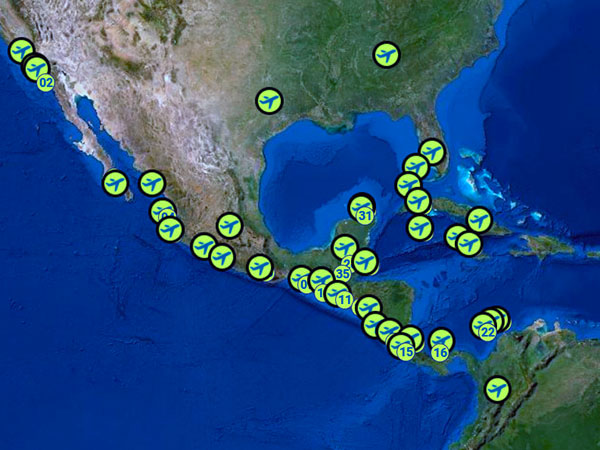
PANAMA POSSE <-> CREW
YOUR CREW LOGISTICS MAP WITH AIRPORTS – CODES AND MARINAS ALONG THE PANAMA POSSE ROUTE TO MAKE CREW LOGISTICS EASIER >>
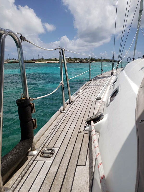
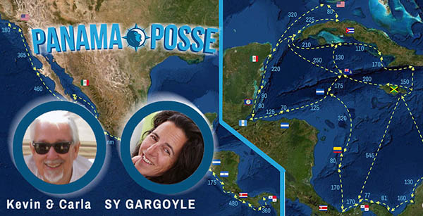
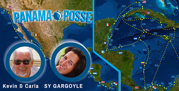
PICTURE OF THE WEEK
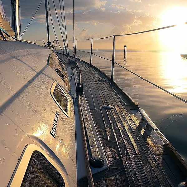
SV Gargoyle exiting Grand Cayman
REMINDER WEEKLY PANAMA POSSE LINE CALLS
MONDAYS 15:30 UTC for CARIBBEAN 16:00 UTC for PACIFIC
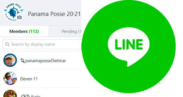
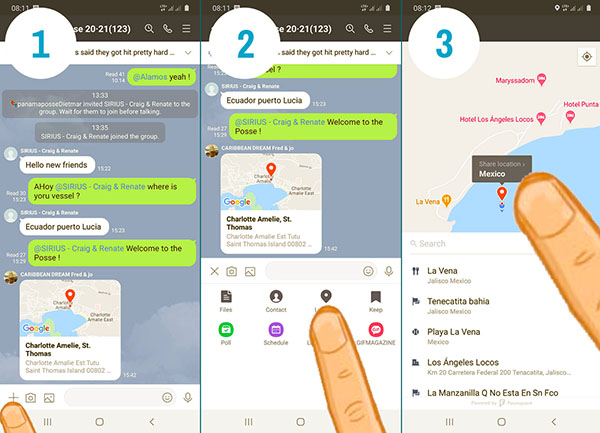
LINE TIP:
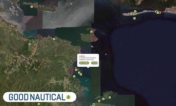
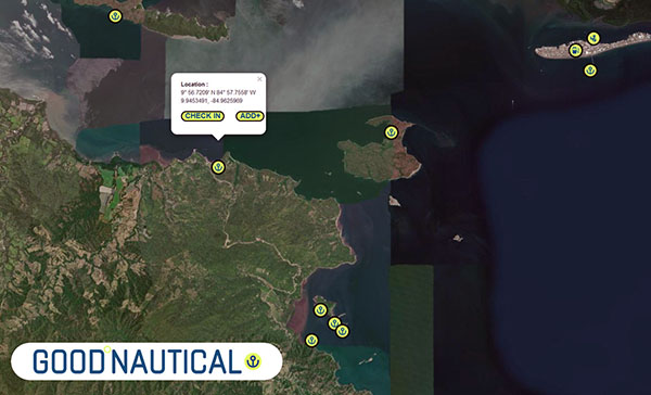
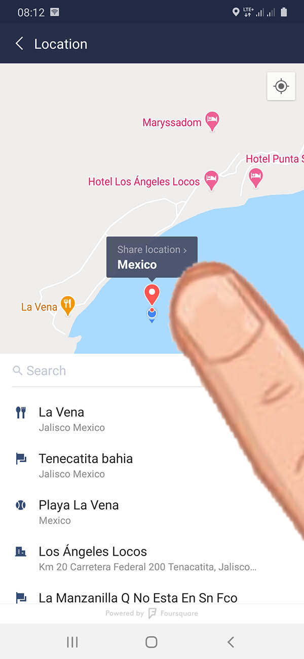
Please drop your location pins and take pictures of the anchorages and places you visit
NOT PART OF THE 20·21 POSSE ? SIGN UP NOW
193 VESSELS HAVE SIGNED UP ALREADY >>
See the faces of the 20·20 Panama Posse, SEE WHO IS ON THE ROSTER >>>

PANAMA POSSE RUM COCKTAIL RECIPE
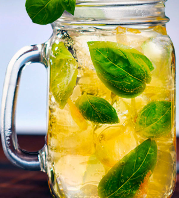
½ parts of good rum
½ part of fresh lemon juice
¼ part passion fruit juice
2 tablespoons of sugar
1 sprig of fresh basil
2 parts sparkling water
8 ice cubes
Preparation:
Straight into the glass, start with basil, sugar, lemon and passion fruit, gently mash with a mortar, then add the ice followed by good rum fill with sparkling water
¡pa' arriba, pa' abajo, pal centro y pa' dentro!
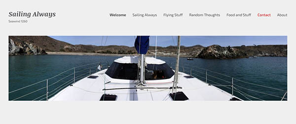
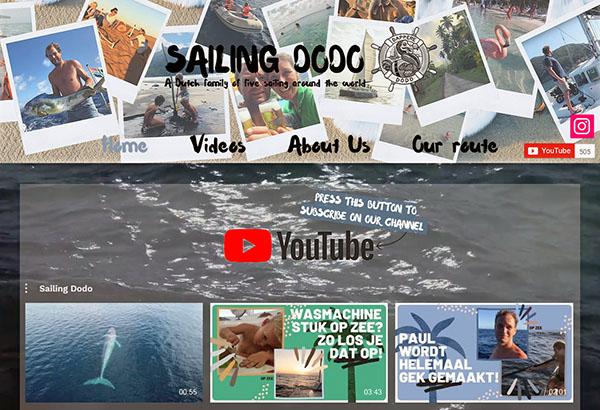
PANAMA POSSE PARTICIPANT WEBSITES
Here is the link to Past and Present Participant Websites and Blogs. Great experience here ...more >>>
IT WOULD NOT BE A RALLY WITHOUT A CONTEST
by the end of May 2021 we will announce the winners in these highly competitive fields
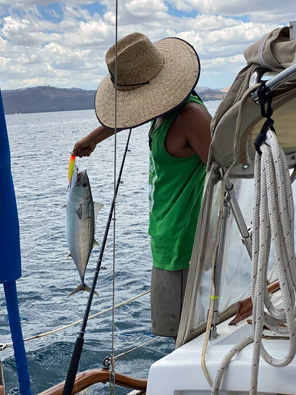
BIGGEST FISH CAUGHT
HIGHEST WIND RECORDED
BIGGEST MISHAP aka THE CAPTAIN RON AWARD
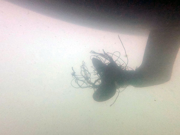
MOST UNWELCOME VISITOR ONBOARD
SPEEDY GONZALEZ AWARD
PANAMA POSSE YODA OF THE YEAR
PICTURE OF THE YEAR
GOOD SAMARITAN OF THE YEAR
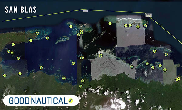
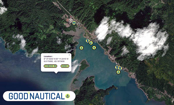
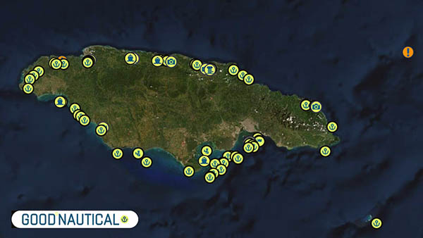
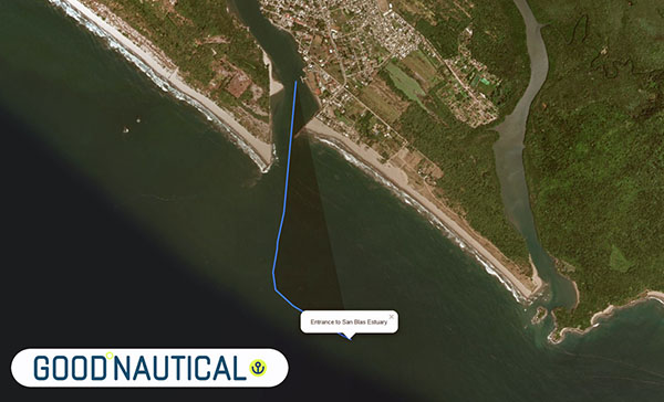
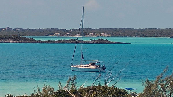
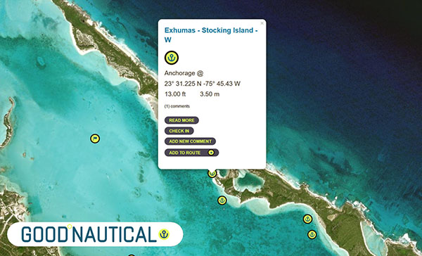
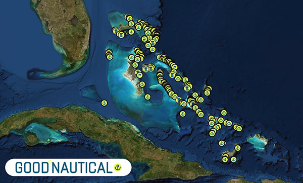
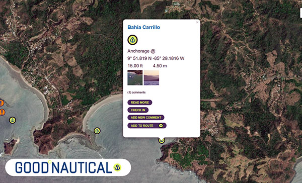
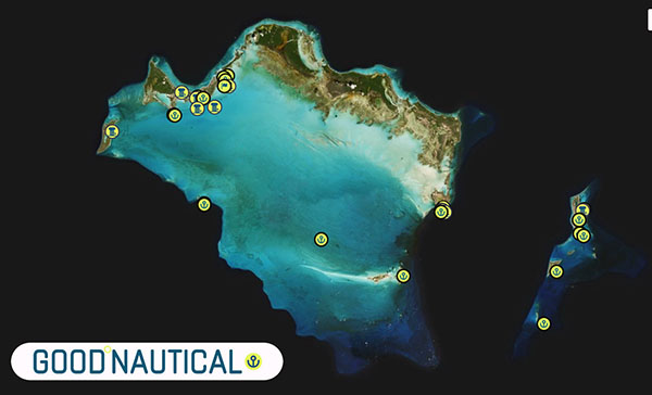
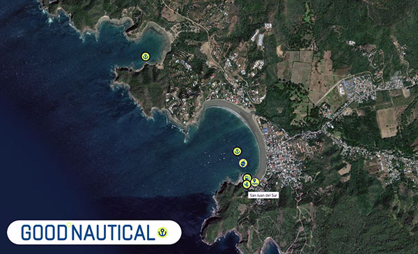
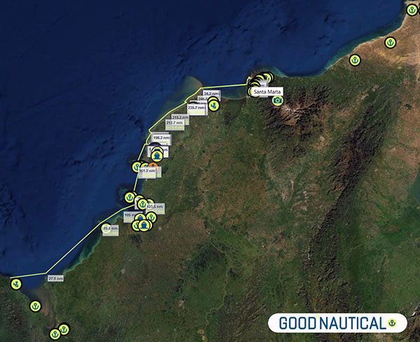
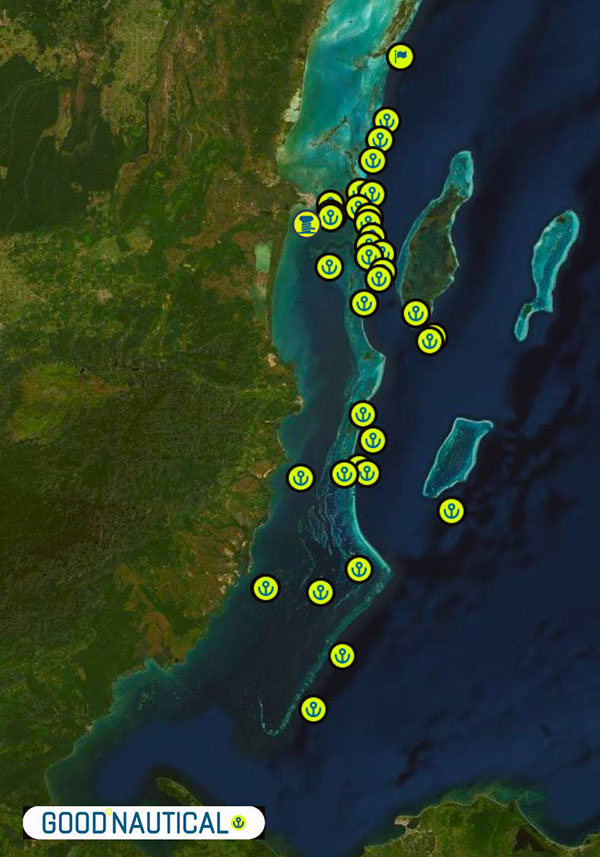
🇧🇿 Belize is in Good Nautical
PANAMA POSSE SPONSORS
🇺🇸 California Yacht Marina, San Diego, Chula Vista - USA
🇲🇽 Marina Coral, Ensenada – Mexico
🇲🇽 IGY Marina Cabo San Lucas – Mexico
🇲🇽 Marina de la Paz – Mexico
🇲🇽 Marina y Club de Yates Isla Cortes – Mexico
🇲🇽 Marina el Cid – Mazatlan – Mexico
🇲🇽 Marina Vallarta, Puerto Vallarta – Mexico Marina
🇲🇽 PANAMA POSSE HQ – Marina Puerto de La Navidad – Barra de Navidad – Mexico
🇲🇽 Marina Ixtapa, Ixtapa – Mexico
🇲🇽 La Marina Acapulco, Acapulco – Mexico
🇲🇽 Marina Chiapas – Mexico
🇬🇹 Marina Pez Vela – Guatemala
🇸🇻 Marina Bahia del Sol – El Salvador
🇸🇻 La Palma Moorings – Bahia del Sol, El Salvador
🇳🇮 Marina Puesta del Sol – Nicaragua
🇨🇷 Marina Papagayo – Costa Rica
🇨🇷 Marina Pez Vela – Costa Rica
🇨🇷 Marina Bahia Golfito – Costa Rica
🇨🇷 Banana Bay Marina – Costa Rica
🇵🇦 PANAMA POSSE PACIFIC HQ Vista Mar Marina – Panama
🇵🇦 Shelter Bay Marina – Panama
🇵🇦 IGY Red Frog Marina – Panama
🇵🇦 Bocas Marina – Panama
🇵🇦 Linton Bay Marina – Panama
🇨🇴 ClubNautico Cartagena – Colombia
🇨🇴 Club de Pesca Marina Cartagena – Colombia
🇨🇴 Marina Puerto Velero – Colombia
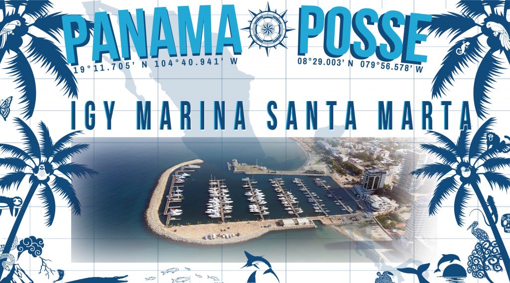
🇨🇴 IGY Marina Santa Marta – Colombia
🇯🇲 Royal Jamaica Yacht Club – Jamaica
🇯🇲 Errol Flynn Marina – Jamaica
🇯🇲 Montego Bay Yacht Club –Jamaica
🇰🇾 The Barcadere Marina –Cayman Islands
🇭🇳 Barefoot Cay Marina – Roatan – Honduras
🇭🇳 Fantasy Island Marina – Roatan – Honduras
🇭🇳 Jonesville Point Marina -Roatan – Honduras
🇬🇹 Marina Nana Juana Resort & Boatyard – Guatemala
🇧🇿 Thunderbirds Marine – Placencia – Belize
🇲🇽 Marina Makax – Isla Mujeres – Mexico
🇲🇽 Marina V&V – Quintana Roo – Mexico
🇲🇽 Marina El Cid – Cancún – Riviera Maya – Mexico
🇨🇺 Marina Marlin Nautica Cayo Largo – Cuba
🇺🇸 Marathon Marina, Florida, USA
SERVICE PROVIDERS
- ULLMAN SAILS SAN DIEGO
- PREDICT WIND
- SEVENSTAR YACHT TRANSPORT
- CABRALES BOATYARD
- ONESAILS MEXICO
- NAUTICED.ORG
- HOME DEPOT PRO MEXICO
- HERTZ RENTAL CARS MEXICO
- YACHT AGENTS GALAPAGOS OFFICIAL PANAMA CANAL AGENT
STRATEGIC PARTNERS
SEVEN SEAS CRUISING ASSOCIATION
Vicente’s Moorings – Acapulco – Mexico
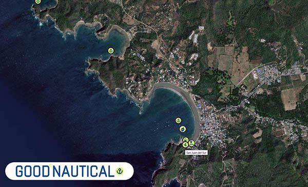
Park Avenue Villas – San Juan del Sur – Nicaragua
Coconutz – Playa Cocos – Costa Rica
Abernathy – Chandlery – Panama
Advertising Partners – Las Vegas
PLEASE SEND US YOUR UPDATES AND WE'LL INCLUDE YOUR STORIES IN NEXT WEEKS FLEET UPDATE via email to news@panamaposse.com
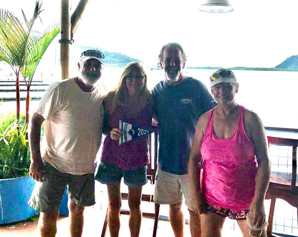
Crew of ARROW picking up their burgee in December !
WE OPERATE UNDER INTERNATIONAL MARITIME LAW
YOUR VESSEL YOUR CREW YOUR RESPONSIBILITY
![]()
panama posse communications on land @ 9811 w charleston blvd 2262 89117 Las Vegas USA
© 2021 Panama Posse / Good Nautical Inc