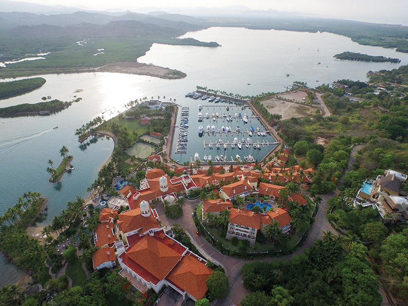
🇲🇽 Marina y Club de Yates Isla Cortés
 Marina y Club de Yates Isla Cortés
Nice to greet you, and thank you for contacting us.
We will gladly assist the Panama Posse at the Marina & Club de Yates Isla Cortés.
Responding to your email we can give you a 10% discount on our rate,
CONTACT
Marina y Club de Yates Isla Cortés
Altata Navolato, Sinaloa
+52 667 324 0446
comercialmcortes@gmail.com
Restaurant phone:+52 (672) 122 9908
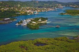
North from Mazatlan and only 45 minutes from Culiacán, Sinaloa´s Capital, you can find a heavenly landscape with dunes and beautiful beaches bathed by Mar de Cortés called Bahía de Altata.
AMENITIES
- 40 spaces to house boats up to 150 feet
- Draft of 2.3 meters
- Electricity of 50 and 30 amps
- Water
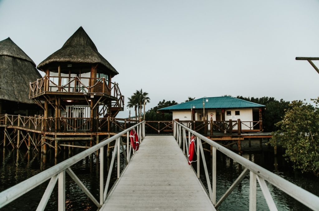
- Restaurant
- Bar
- Bathrooms
- Showers
- Wi fi.
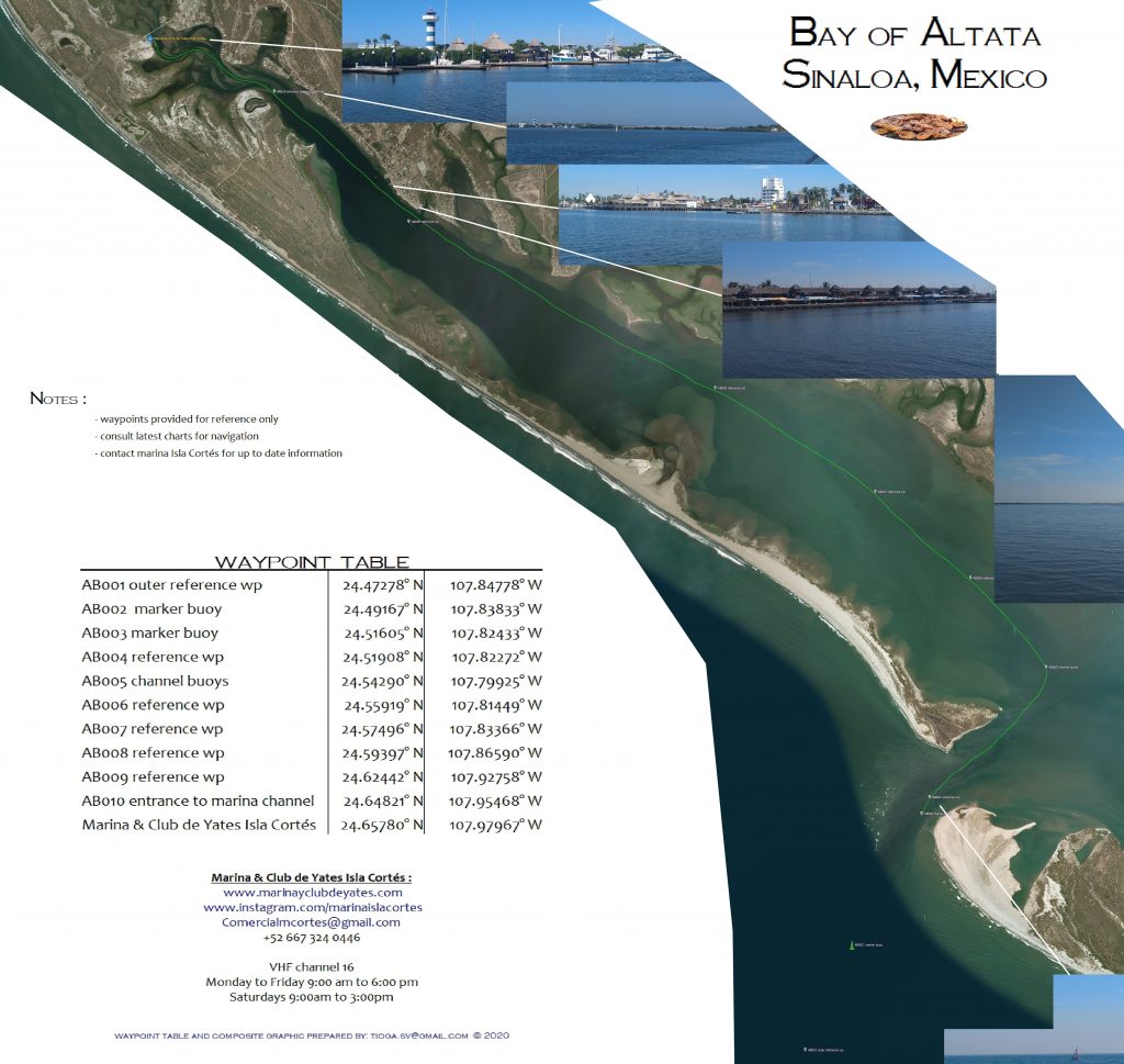
Marina y Club de Yates Isla Cortés SAFE APPROACH
RATES
We will be charging you in Mexican pesos not USD
| 31-35 Feet MXD | 36-40 Feet MXD | 41-50 feet MXD | ||
| Daily | 500 | |||
| Weekly | 2,550 | |||
| Bi-Weekly | 4,800 | |||
| Monthly | 6,250 | 7,500 | 9,000 |
LOCATION
24°39.466' N 107°58.736 O
S&H CRUISING GUIDE UPDATE AND LINK
- https://www.bluelatitudepress.com/Blue%20Latitude%20Press_SOC_Altata_update_2014.pdf
OFFICIAL WEBSITE
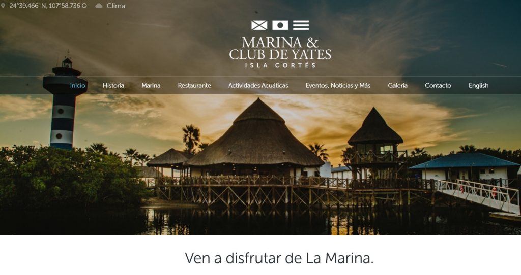
https://marinayclubdeyates.com/es/?lang=en
🇲🇽 TULUM
🇲🇽 Tulum
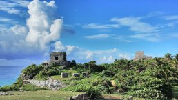
Tulum is the site of a Mayan walled city which served as a major port for Coba, in the Mexican state of Quintana Roo. These magificent ruins are situated on 40foot tall cliffs along the east coast of the Yucatán Peninsula. The site might have been called Zama, meaning City of Dawn, because it faces the sunrise.
Tulum was one of the last cities built and inhabited by the Maya at its height between the 13th and 15th centuries and managed to survive about 70 years after the Spanish began occupying what is now Mexico .
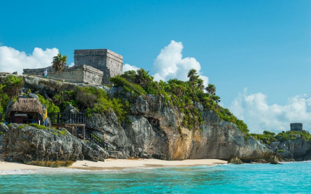
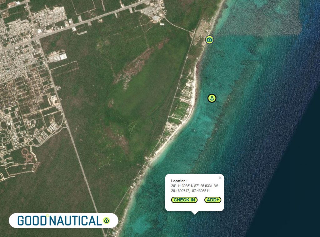
It is one of the best-preserved coastal Maya sites, Tulum and you can see it from your own vessel and anchor just south or to the north of it if you are brave enough to enter the path though the reef with good light ( noon non cloudy not too windy )
and draw less than 6 foot on a calm day - give yourself the flexibility to visit during the off-peak hours of the early morning or late afternoon and save your track. The Sand is compacted so only recommended as a day anchorage.
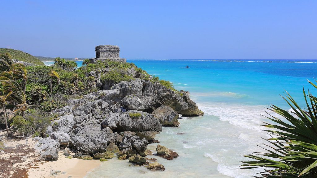
Tulum's massive wall was thick and 1,300 ft long parallel to the sea and would have taken an enormous amount of energy and time, which shows how important defense was. On the southwest and northwest corners there are watch towers demonstrating a well defended city.
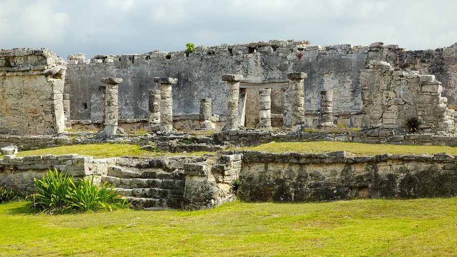
Tulum is considered by archeological experts one of the most well-known fortified sites of the Mayan Civilization
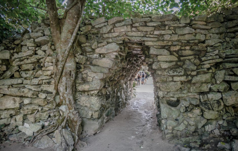
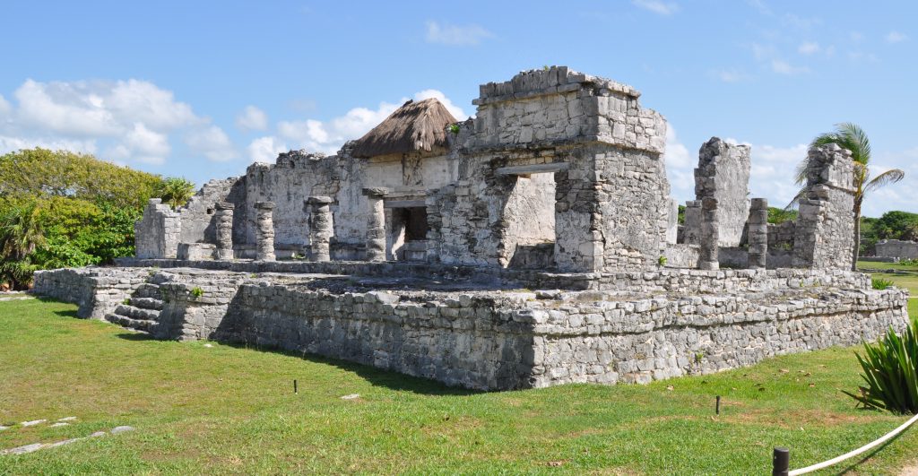
Three major structures of interest
El Castillo
Temple of the Frescoes
Temple of the Descending God
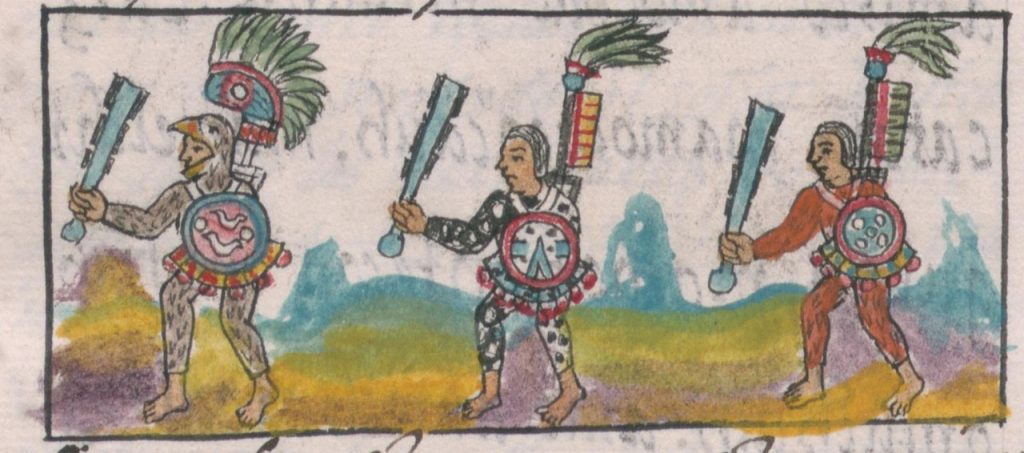
Since tulum had access to both land and sea trade routes it was an important trade hub, especially for volcanic glass called ovisidian used for tools, decorative objects and made into a type of sword with obsidian blades mounted in a wooden body. Called a macuahuitl .This weapon could inflict terrible injuries, combining the sharp cutting edge of an obsidian blade with the ragged cut of a serrated weapon.

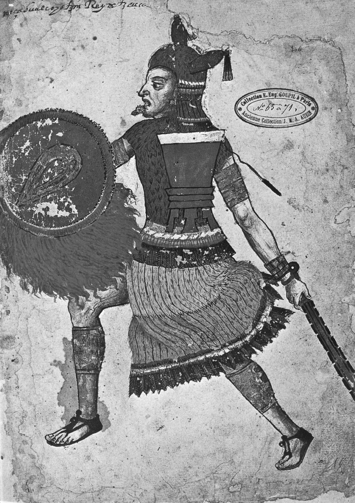
From numerous depictions in murals and other works around the site, Tulum appears to have been an important site for the worship of the Diving or Descending god
Tulum was first mentioned by Jua Diaz a member of Grijalva's Spanish expedition in 1518, the first Europeans to spot Tulum.
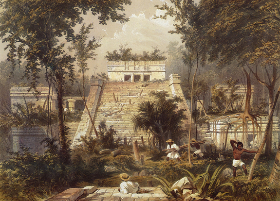
In 2020, an underwater archaeological expedition led by Jerónimo Avilés again excavated the cave and revealed the skeleton of a female about 30 years of age that lived at least 9,900 years ago.
The Site is close to 2 marinas https://panamaposse.com/marina-vv-cancun and https://panamaposse.com/marina-el-cid
VIDEO OF THE AREA
🇬🇹 Castillo de San Felipe
🇬🇹 The Castle of San Felipe de Lara
(Castillo de San Felipe de Lara)
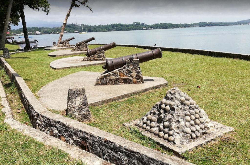
is a Spanish colonial fort at the entrance to Lake Izabal in eastern Guatemala.
Lake Izabal is connected with the Caribbean Sea via the Dulce River and El Golfete lake. The fort was strategically situated at the narrowest point on the river. The Castillo de San Felipe was used by the Spanish for several centuries, during which time it was destroyed and looted several times by pirates
The fort is listed on the UNESCO World Heritage Tentative List and is a popular regional tourist destination.
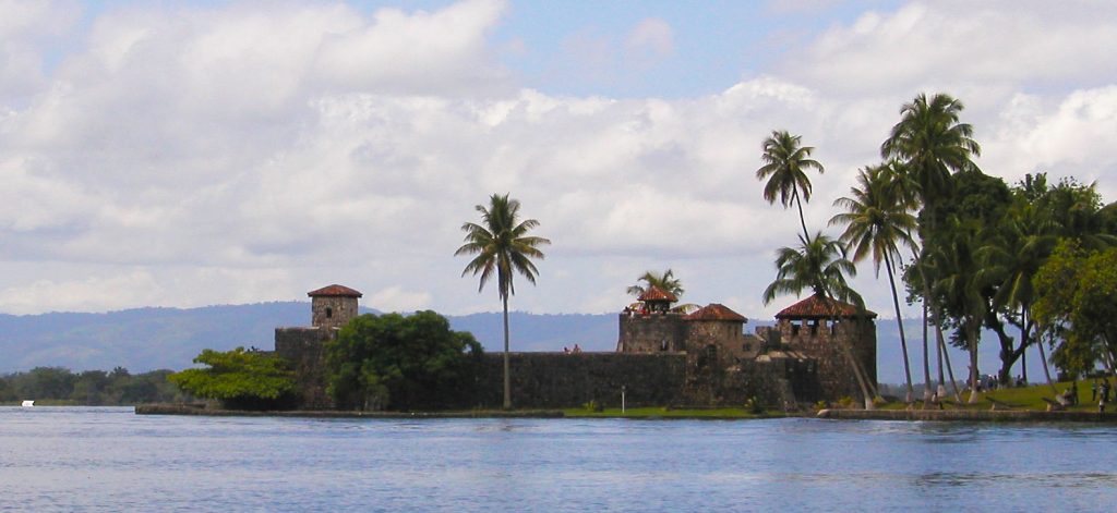
The Castillo de San Felipe was built to protect the port of San Antonio de las Bodegas on the south shore of Lake Izabal from frequent pirate attacks, mostly by English pirates.
After nightfall, passage along the river into the lake was blocked by a large chain that crossed from the fort to the far bank. San Antonio was the main port for receiving Spanish shipping carrying goods for the Captaincy General of Guatemala and was responsible for supplying and garrisoning the fort. Guatemalan records contain details of captains being appointed to the fort well into the 18th century.
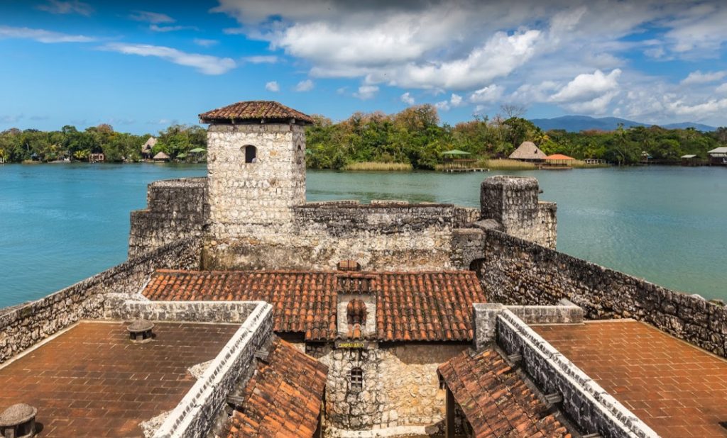
The position was a joint post, also including the position of mayor of San Pedro de Amatique and San Antonio de las Bodegas. The latter post was in name only, since the towns were soon abandoned due to constant slave raids by the Mosquito Zambo that left the Motagua delta and shores of Lake Izabal largely deserted, with those inhabitants that did not flee being sold into slavery in the British colony of Jamaica.
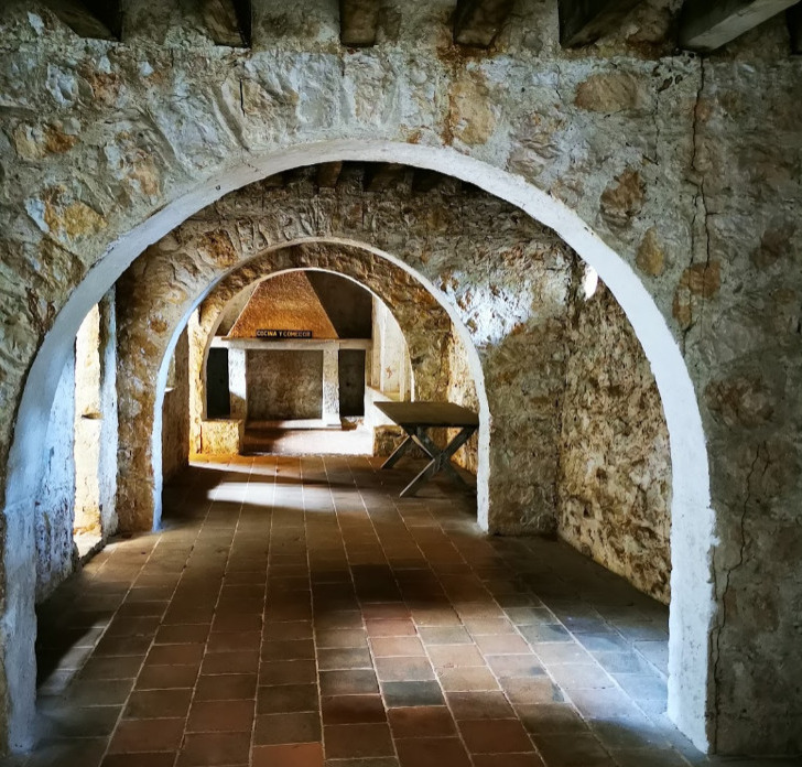
A tower already existed on the site by 1604, when it is recorded as having been destroyed. The fort was built in 1644 under the orders of Diego de Avendaño, then governor of the Kingdom of Guatemala. At the time it was known as Fuerte Bustamente ("Bustamente Fort") and the Torreón de Defensa ("Defence Tower").
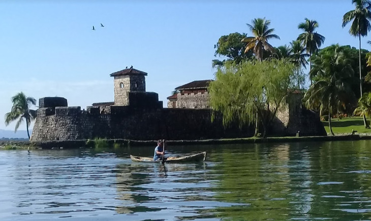
The fort was redesigned in 1687 by Diego Gómez de Ocampo in the style of the French military architect Sébastien Le Prestre de Vauban. The modified design was implemented in 1689. Three bastions were functioning by 1697.
LOCATION YACHTING MAP
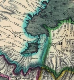
OLD MAP

SIGN UPFIND OUT MORE SUBSCRIBE
Near Marina Nanajuana >>
FLEET UPDATE 2020-10-25
|
|
|
|
|
|
FLEET UPDATE 2020-10-17
|
🇲🇽 San Cristóbal de las Casas
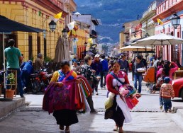
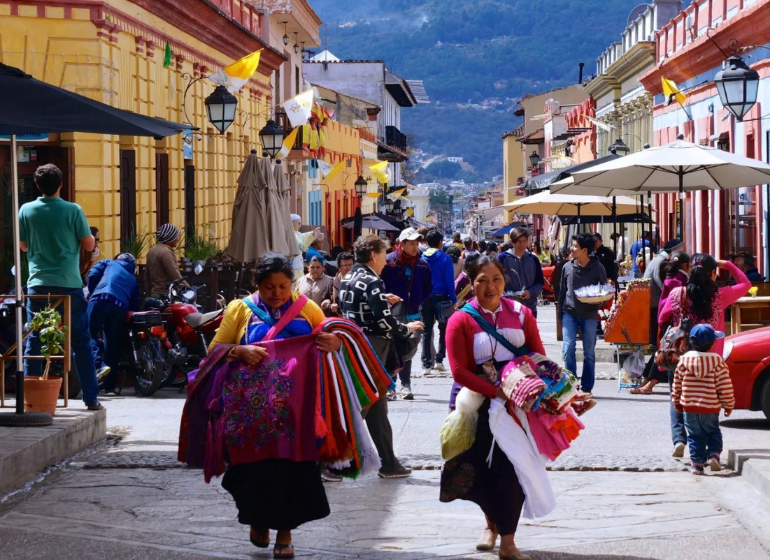
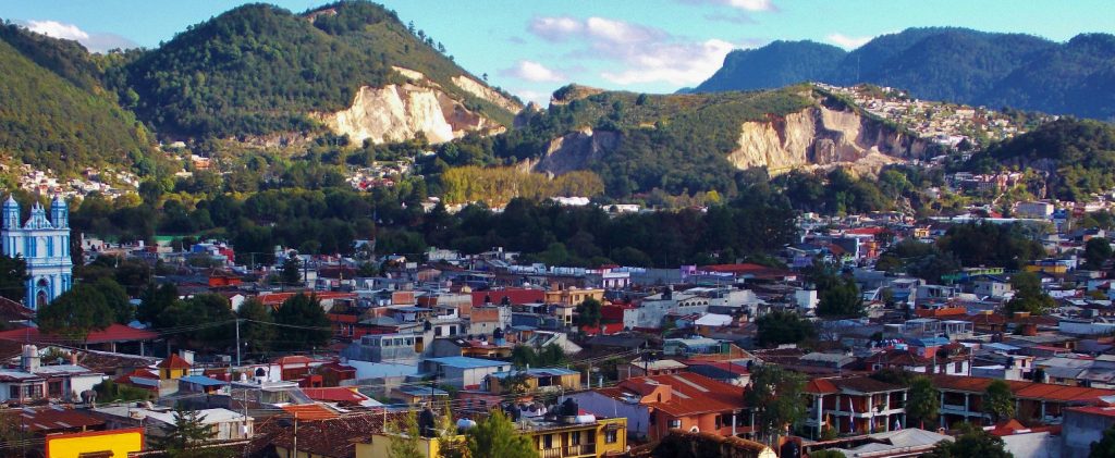
🇲🇽 San Cristóbal de las Casas is a city and municipality located in the Central Highlands region of Chiapas.
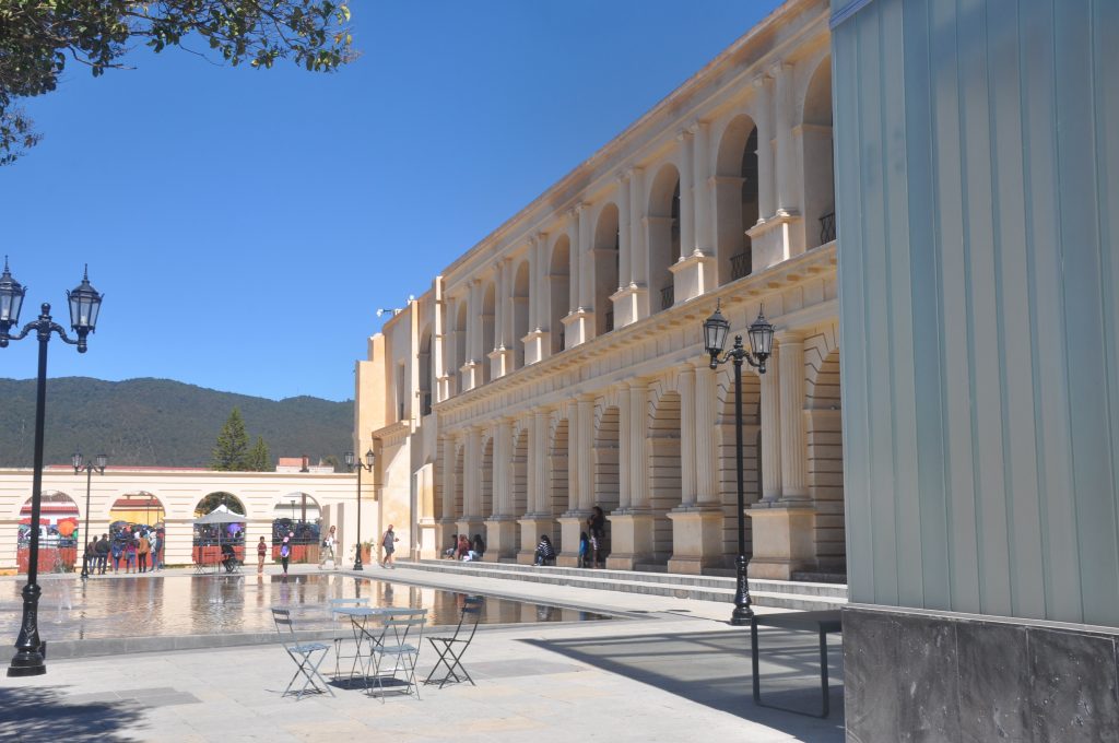
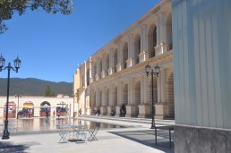
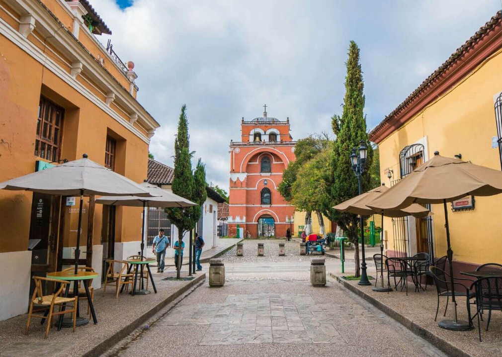
The historic center, has maintained its Spanish colonial layout, with narrow cobblestone streets, roofs covered in red clay tile and wrought iron balconies with flowers. The facades of the buildings vary from Baroque to Neoclassical and Moorish, painted in various colors.
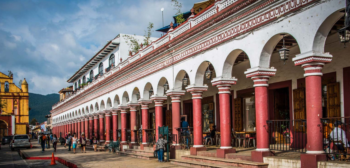
Diego de Mazariegos founded San Cristóbal in 1528 as the Spanish regional base.
Its Spanish citizens made fortunes from wheat, while the indigenous people lost their lands and suffered diseases, taxes and forced labor.
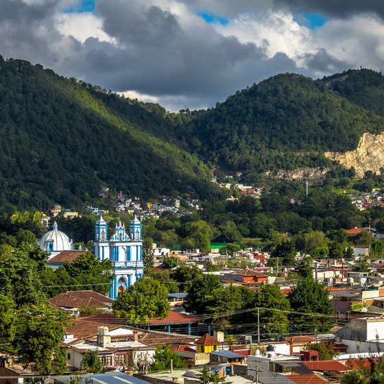
San Cristóbal is considered to be the “cultural capital” of the state and a designated in 2003 a "Pueblo Mágico" (Magical Village) in 2003, Mexcian President Felipe Calderón recognized it as “The most magical of the Pueblos Mágicos” and is located in a small valley surrounded by hills in the mountains with a 2,200-meter elevation 7,218 feet gives the city a crisp and cool climate.
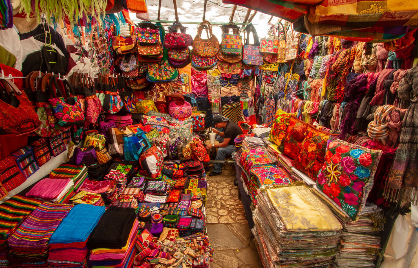
Much of it's large indigenous population made up of Tzotzils and Tzeltals continue to provide and continue to foster traditional culture.
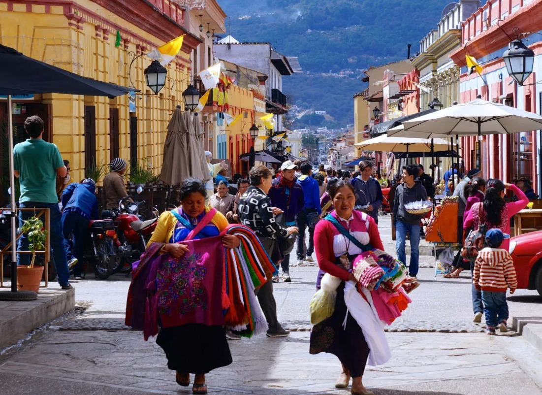
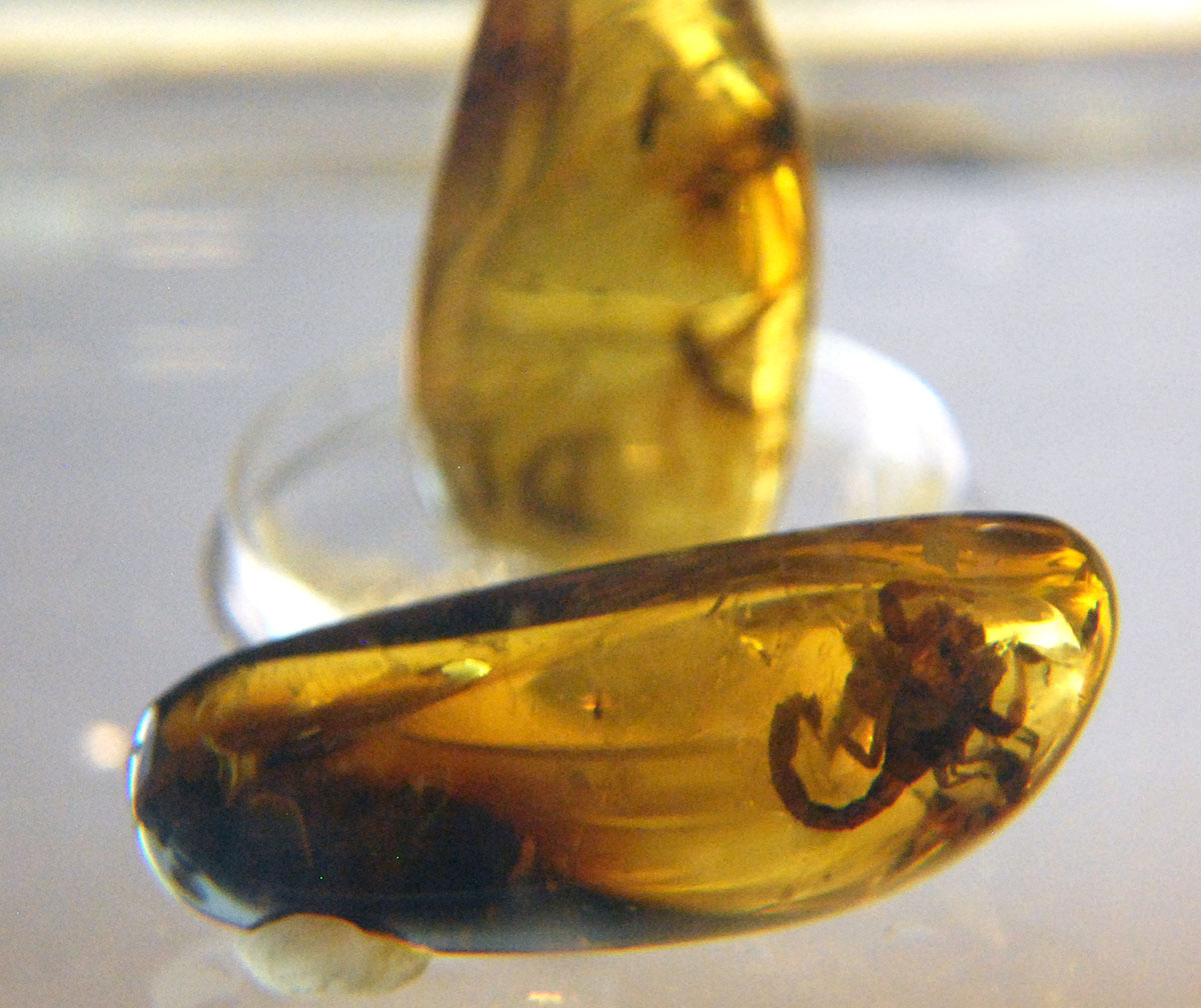
The making of textiles, especially weaving, with amber another important product. Ceramics, wrought iron and filigree jewelry can be found as well. The area is for crafts is the tianguis at Santo Domingo. The city hosts an annual Amber Expo at the Centro de Convenciones Casa de Mazariegos.
A more traditional Mexican market is located just north of the Santo Tomas Church. It is open each day except Sunday, when its vendors go to the surrounding communities in the municipality to sell at their markets which serve traditional dishes such as saffron tamales, sopa de pan, asado coleto, atole de granillo, a drink called posh made from sugar cane and the delightful Chiapanecan Coffee.

The city’s attraction for tourists has also led to a number making San Cristobal their permanent home. Foreign influence is the city’s noted cured meat tradition, which can be traced back to both the Spanish and the Germans These are featured in a number of dishes including chalupas. The pedestrian-friendly cobble-stoned streets and pastel dwellings are hugging the hillsides and add to San Cristobal’s charm.
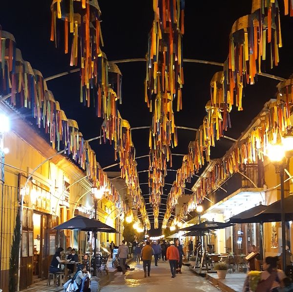
It’s a convenient hub for travelers to base themselves for further explorations and things to do all throughout the state of Chiapas.It's nightlife music scene offers reggae, salsa, techno and more.
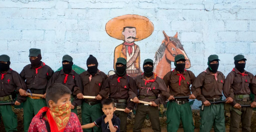
In the early 90's a guerrilla group, known as the Zapatista National Liberation Army named after Emiliano Zapata, a popular hero of the 1910-1917 Mexican Revolution who defended poor peasants’ rights to free land seized from wealthy landowners, has caused skirmishes with the Federal Mexican Government in the area and back in 1994 even occupied the main plaza - all of which adds to the bohemian flair, sporting mannequins in balaclavas, playing revolutionary music and selling T-shirts. Images of Che Guevara mix with those of Subcomandante Marcos, the poetic, pipe-smoking political philosopher who declared that the “fourth world war against neoliberalism and oblivion”. ...
JOIN THE PANAMA POSSE >>>
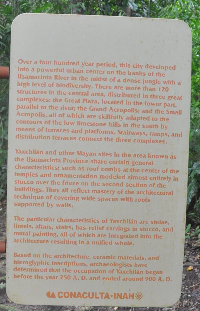
🇲🇽 YAXCHILAN
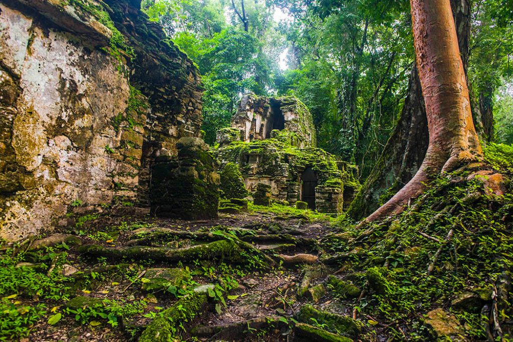
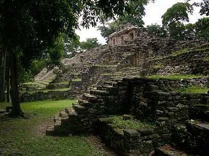
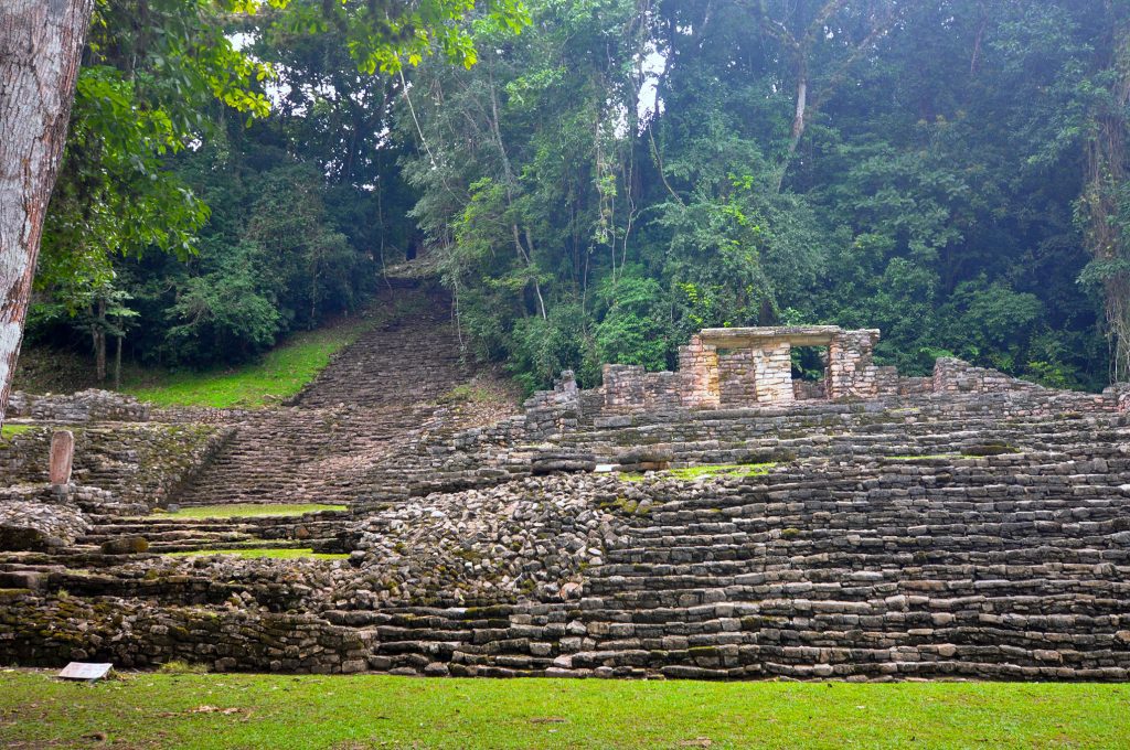
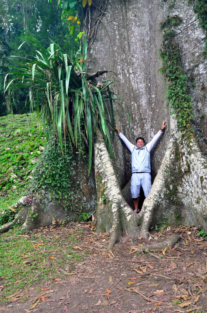
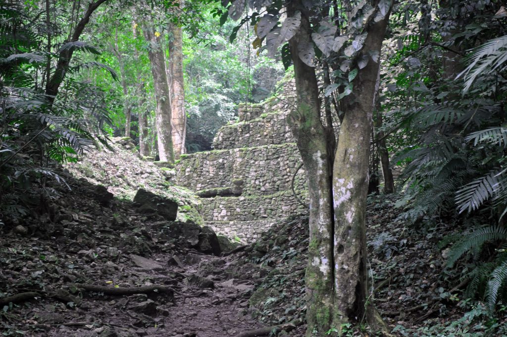
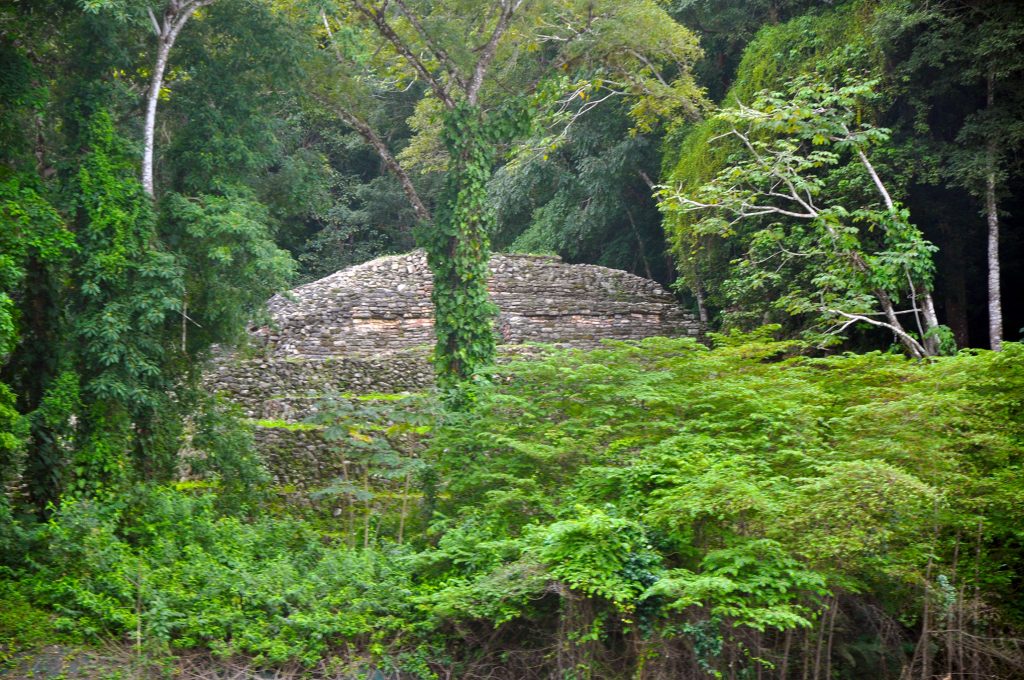
Yaxchilan is an ancient Maya city located on the bank of the Usumacinta River in the state of Chiapas, Mexico. During the height of its power the kings of Yaxchilan built gleaming temples, pyramids, and luxurious palaces clustered along the grand plaza and was one of the most powerful Maya states along the course of the Usumacinta River, with Piedras Negras as its major rival. Architectural styles demonstrate clear differences that mark a clear boundary between the two kingdoms.
In 1882 archeologist Desire Charnay named it City Lorilla but Yaxchilan was a large center, important throughout the Classic era, and the dominant power over such smaller sites as Bonampak and was a rival of Palenque, with which Yaxchilan warred in 654.
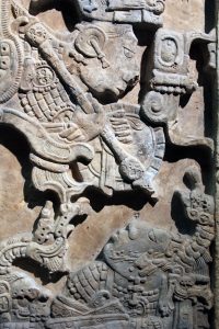
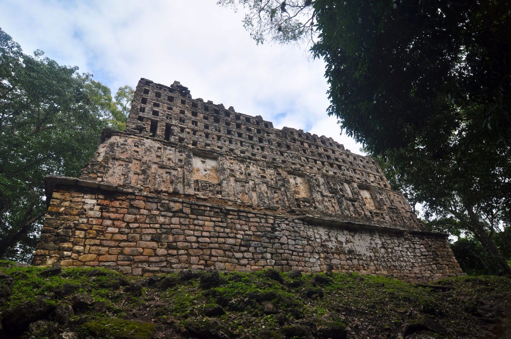
The site is particularly known for its well-preserved sculptured stone lintels set above the doorways of the main structures which contain hieroglyphic texts describing the dynastic history of the city.
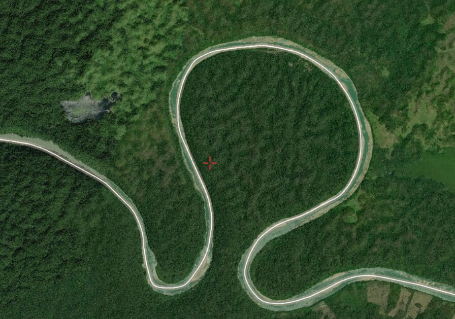
Yaxchilan is located on the south bank of the Usumacinta River at the apex of a horseshoe-shaped river bend.
This loop defends the site on all sides except for a narrow land approach from the south. This natural barrier protected the city from invasion from outside forces. However, the river was in a high flood stage during the six month rainy season, during this time Yaxchilan became an island due to the swiftly flowing waters of the engorged river which encompassed the city. An all-weather passage across the treacherous river was a necessity in order to gain access to the farmlands to the north of the city.
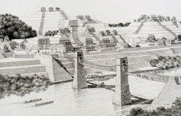
Yaxchilan had long been known to include an unusual raised terrace beside the river and pier in the river; these structures were long theorized to be the remains of a bridge thought to have been a suspension bridge built by the Maya across the River. If so, it would have been the longest bridge discovered in the ancient world. Yaxchilan required a dependable passageway to provide an uninterrupted flow of traffic across the river on a year-round basis.
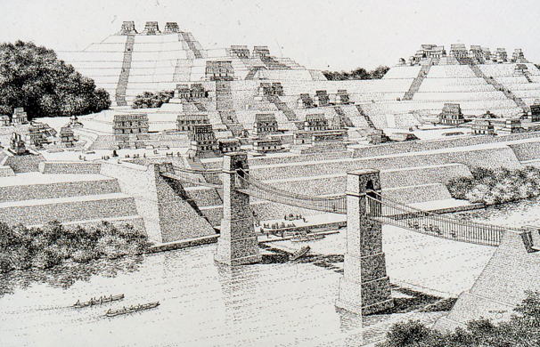
The prevailing theory is by constructing a 100-meter long suspension bridge featuring three spans extended from a platform on the grand plaza of Yaxchilan crossing the river to the northern shore. This span would be the longest in the world until the construction of the Italian Trezzo sull'Adda Bridge in 1377 and this unique feat of engineering has been virtually reconstructed by computer by archaeoengineering techniques by Engineer James A O'Kon PE. Results of this hypothesis were presented to the archaeological and engineering world in the pages of National Geographic magazine in 1995.
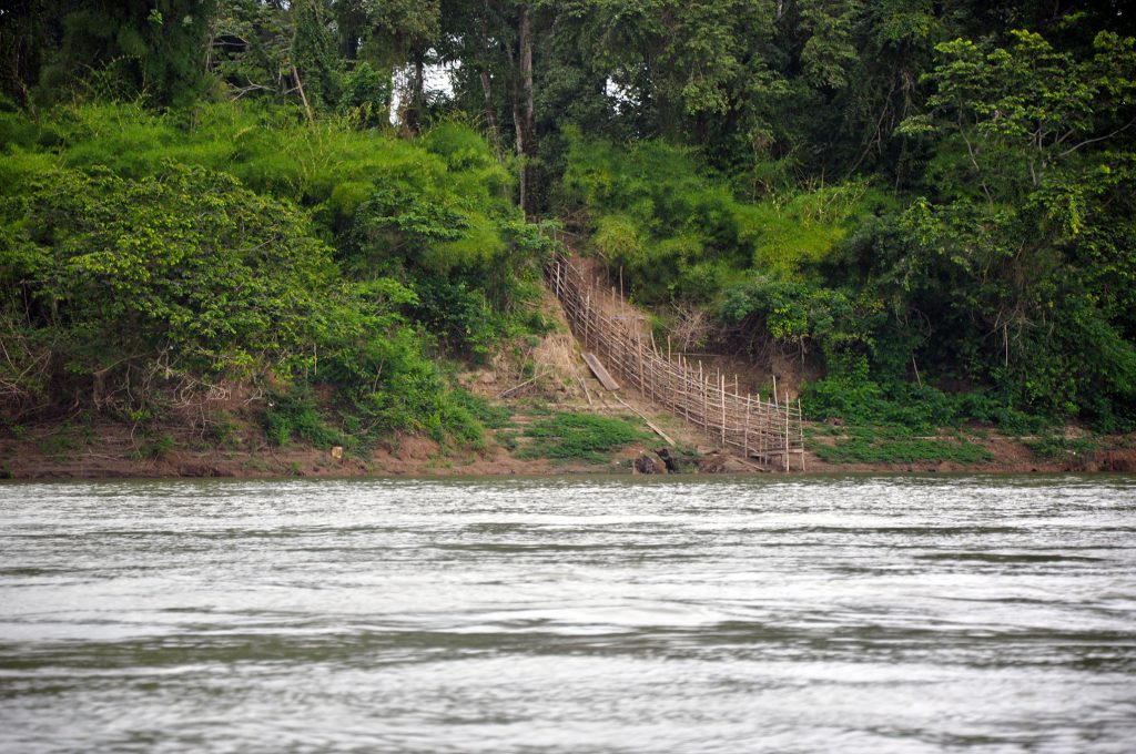
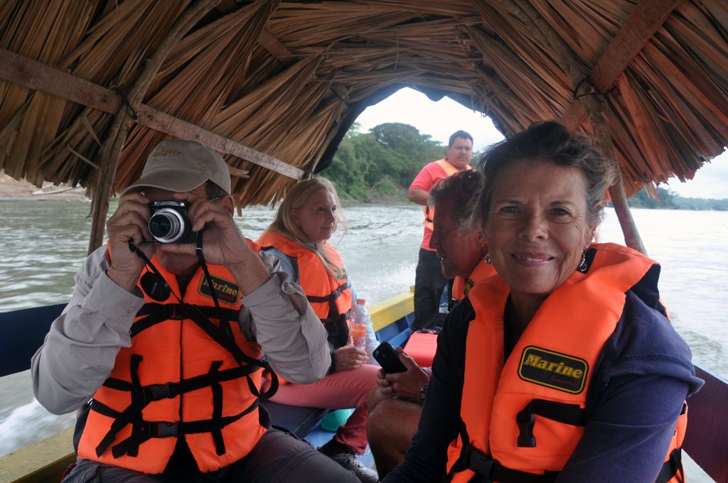
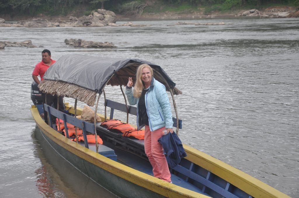
The First Panama Posse gang to visit Yaxchilan was SV RESPITE / MY CROSSROADS AND SV CARINTHIA utilizing local knowledge by LUIS a Chiapas based bilingual tour-guide which still operates in the area. The Area and adjacent world heritage sites are bets accessed via a multi-day excursion from Marina Chiapas a sponsor of the Panama Posse.
MY CROSSROADS
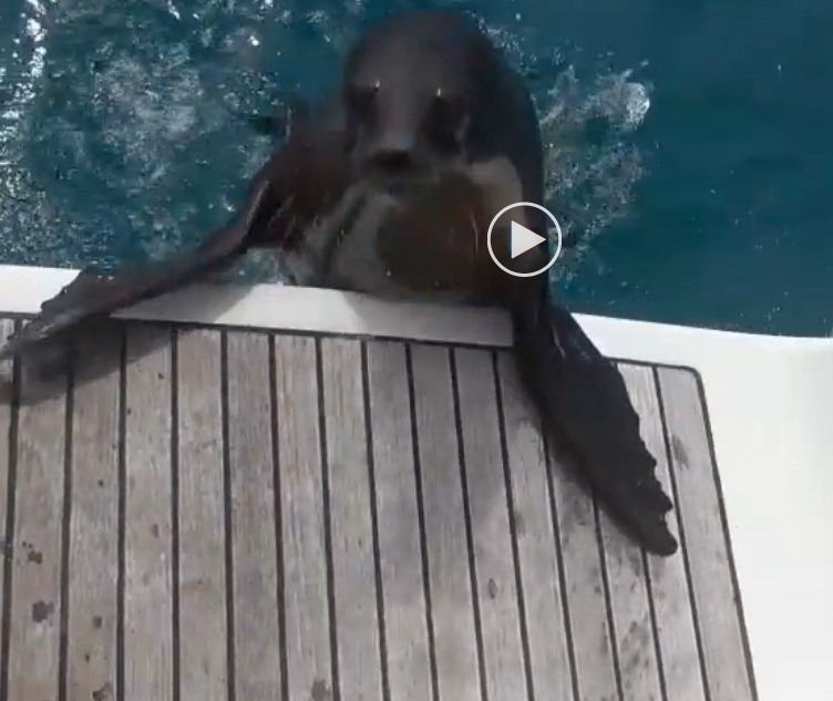
🇪🇨 UNINVITED VISITORS - SY GARGOLYE - OCT 2020- GALAPAGOS - ECUADOR
🇪🇨 UNINVITED VISITORS - SY GARGOLYE - OCT 2020- GALAPAGOS - ECUADOR
🇩🇪 MEDIA - GERMANY
🇩🇪 Panamericana zur See,
oder: Mancher Umweg ist gar keiner!
Von Panama City zu den Marquesas Inseln (französisch Polynesien) segelt man in der Regel den direkten Weg und der ist auch noch ganzjährig befahrbar.
Allerdings waren wir ständig dem Einfluss amerikanischer Segler ausgesetzt, die von Kalifornien kommend, alle unisono das Mexiko Lied sangen. Es muss phantastisch dort sein (... und das war es auch). Also sollten wir da nicht auch mal die Pazifikküste von Panama über Costa Rica, Nicaragua, El Salvador, Guatemala nach Mexiko hochsegeln? Alles Länder, vor denen das "Auswärtige Amt" Reisende ständig warnt? Nun, wir hatten schon zuvor erfahren, dass unser lichtgraues Boot nahezu unsichtbar ist: Weder wir finden es wieder, noch mag der Zollhund an Bord kommen. Selbst die schwimmenden Händler auf Dominika gingen lieber zu den großen Yachten. Also was soll uns schon passieren? ... und dann gibt es noch die schützende Hand des "Panama Posse", einer virtuellen, aber sehr effektiven Segelrally, die von Kalifornien, USA nach Florida verläuft.
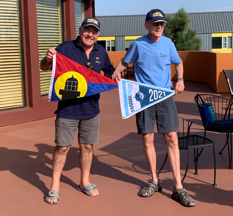
Der Name "Panama Posse" bedeutet soviel wie "Panama-Bande". Hier bekommt man einen prächtigen Stander, Rat und Tat via Internet und natürlich Rabatt auf die Marinagebühren unterwegs. Nicht zu vergessen die Funkrunden, für die man aber einen speziellen UKW Kanal benötigt (also Kanal 22b, eine Art ADAC Ruf für Segler). Und obendrauf gibt es noch nette Bordparties und in El Salvator einen leibhaftigen Stützpunktleiter, der den Namen mehr als verdient hat. Zudem bemerkten wir, dass die Erde eine Kugel sein muss, denn von Mexiko zu den Marquesas ist die Strecke 1300 sm kürzer als von Panama aus.
Also neben all den "World ARCs", die ständig unterwegs sind und einer gewissen Komik nicht entbehren, wenn noch während des Anlegemanövers gefragt wird, an welchem von 3 Ausflügen man morgen früh teilnehmen möchte ... ist der Panama Posse eine preiswerte und nützliche Veranstaltung. Eigentlich mal konzipiert, um den netten US-amerikanischen Seglern zu helfen, ihr Boot vom Atlantik in den Nord Pazifik zu bringen.
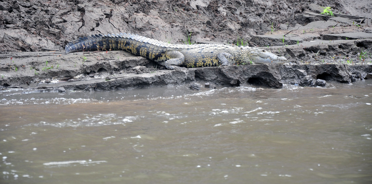
Die Strecke führte uns von Panama City in den schönen Norden des Landes mit großartiger Tierwelt im Wasser, weiter in den fjordähnlichen Süden von Costa Rica. Springende Rochen, Wale, Seeschlangen, große Salzwasserkrokodile, Schildkröten, die gegen den Rumpf klopfen und Aras (farbenprächtige Papageien), die um den Mast flogen. Dann segelten wir vorbei am ersten von zwei Passatwinddurchstößen an der Grenze zu Nicaragua, wo auch mal etwas frischer Wind wehen kann, Papagayo-Windjet genannt. Von dort war es dann aber nicht mehr weit bis El Salvador.
Der zweite Passatwinddurchstoß ist der Isthmus von Tehuantepec. Es ist eine Landenge in Mexiko. Mit einer Breite von 216 km ist er die kürzeste Landverbindung zwischen dem Golf von Mexiko und dem Pazifik. Da stürmt es sehr häufig und man sollte die Überquerung gut planen.
Weiter ging es mit 3 Übernachtungen vor Anker an Nicaragua vorbei. Ankern kurz vor der Brandungszone im offenen Ozean erfordert Überwindung und Vertrauen in das Ankergeschirr und die Alarme.
Von Nicaragua ging es dann nachts weiter nach El Salvador. Wir sahen einen aktiven Vulkan, der seine rot glühende Lava den Hang herunter gleiten ließ.
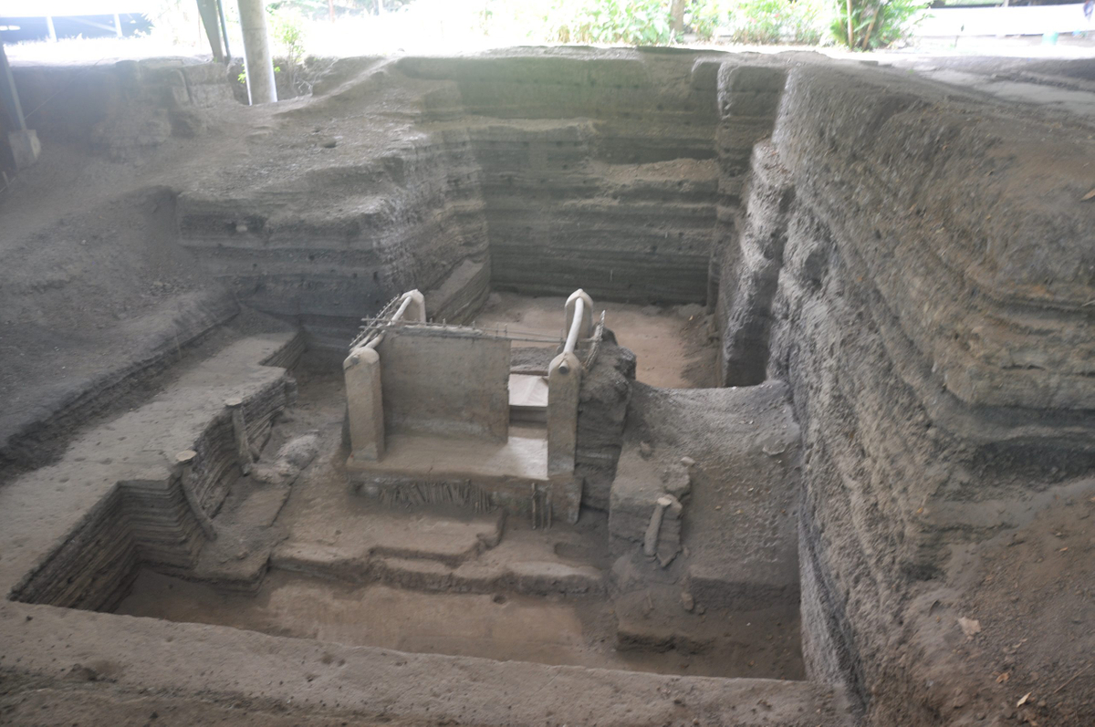
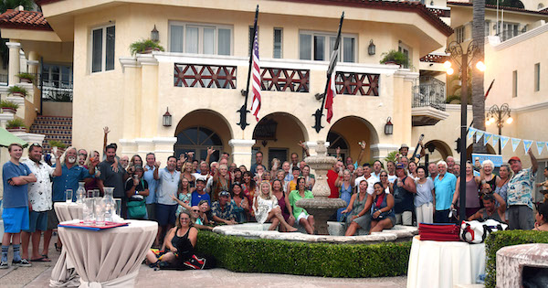
Endlich kamen wir an der Flusslagune von Bahia del Sol an. Ein Lotsenboot ermuntert uns ihm zu folgen und über die Barre in den Fluss zu fahren. Für uns schien es, als steuerten wir durch die Brandung direkt auf den Strand zu. "Bahia del Sol" klingt etwas kitschig, es ist sozusagen das "Sylt" von El Salvador, ein Platz der Erholung und des Feierns. Wir legten in der Lagune im Hotelhafen an. Der Zollbeamte erwartete uns schon und nach 10 Min. hatten wir alle Formalitäten erledigt. Ein mehrtägiger Ausflug mit einem Mietwagen durch El Salvador verlief ohne die vom "Auswärtigem Amt" befürchteten Überfälle. Zu sehen gab es u.A. Ausgrabungen ähnlich denen in Pompeji. Auch hier hatte ein Vulkanausbruch das Leben der Menschen "eingefroren" und so der Nachwelt erhalten. Den Abschied von El Salvador nach 3 Wochen feierten wir mit den anderen Panama Posse Seglern mit einer kleinen Stegparty. Dann brachte uns das Lotsenboot wieder sicher über die flache Barre zurück auf See. Siehe Foto.
Weiter ging es an Guatemala vorbei nach Mexiko, wo wir ein Jahr blieben und kreuz und quer durch das Land reisten. Guatemala ist Seglern nicht zugewandt.
Der erste Hafen in Mexiko war die Marina Chiapas bei Tapachula. Hier war ein längerer Stop geplant. Angekommen in Mexiko schauten wir uns erstmal wieder ängstlich um, sie wissen schon ... das "Auswärtige Amt". Ja, wir wissen auch, dass in Mittelamerika täglich grausame Dinge passieren, aber insgesamt leben hier weit über 140 Millionen freundliche Menschen. Die Kartelle leben übrigens genauso vom Tourismus und alle zusammen möchten, dass wir uns bei ihnen wohlfühlen. Das spürten wir überall, selbst beim Überqueren der Strasse, an der Kasse im Supermarkt oder in der Autovermietung.
Der gute Geist der Marina Chiapas ist Luis (Foto), der uns recht bald an Bord besuchte und uns in gutem Englisch mit dem Land Chiapas und seiner Schönheit bekannt machte.
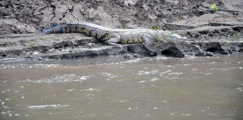
Für eine kleine Verwaltungsgebühr wurde unser Boot für 10 Jahre in das Land eingeführt. Dazu ging es mit dem Auto an die Grenze von Guatemala. Dank Luis Hilfe ging alles flott über die Bühne ... Also Mayatempel fast vor der Haustür, Kaffeeplantagen, Kakaoverarbeitung und Krokodile alles ganz in der Nähe. Dazu noch fixe Handwerker, die schnell mal die Salonpolster und Bezüge für wenig Geld neu machten. Ein Highlight hätte ich fast vergessen: das ausgezeichnete Baos Restaurant in der Marina, nur 100 m vom Boot entfernt.
Silvester feierten wir dann in Acapulco mit einem großen Feuerwerk. Die Fahrt führte uns vorbei an der (Freunde der seichten Musik aufgepasst:) Sierra Madre de Sur. Wir genossen das Sailfest von Zihuatanejo und die Lagune von Barra de Navidad und erreichten schließlich Puerto Vallarta. Auch die Zugfahrt ins Hochgebirge nach Creel und natürlich die schöne Stadt La Paz mit Baja Californien waren unvergesslich. All das ist auch "Panama Posse".
Noch ein Wort zum Segelwetter: das ganze Gebiet ist der Entstehungsraum des Nordost Passat. Durch die Küstengebirge kommt es aber letztendlich zu schwach umlaufenden Winden und der Dieseltank sollte gut gefüllt sein. Eine aktuelle Strömungskarte war auch hilfreich. Als sehr praktisch stellten sich auch die Räder fürs Dinghi heraus, die wir uns noch in Panama besorgt hatten. Durch den Tidenhub muss man das Dinghi oft mehrere Meter den Strand rauf und runterziehen. Der Wetterbericht ist zuverlässig. Internet Empfang in G4 war auch auf freier See preiswert und schnell. Was für ein Luxus.
Matthias und Regina SY "Jasina"
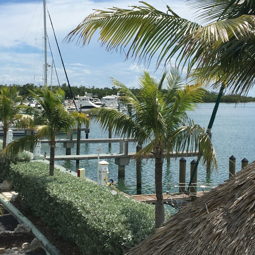
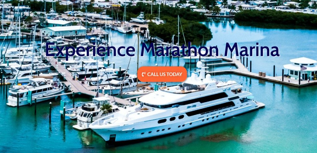
🇺🇸 MARATHON MARINA
MARATHON MARINA welcomes the panama posse
CONTACT INFO
1021 11th Street Ocean
Marathon, FL 33050
VHF 16/10
Tel: +1305-743-6575
Email: reservationagent@marathonmarinaandresort.com
SAFE APPROACH and FUEL DOCK
AMENITIES
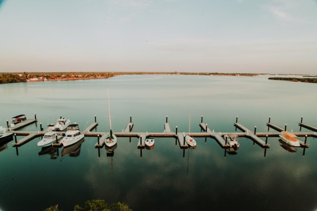
- 123 slips, floating & fixed concrete docks
- Designated transit slips
- Vessels from 20 feet to 130 feet, controlling depth up to 9 feet
- 30 – 50 – 100 AMP, 125/250 vac single phase electrical service
- Securely gated, access code protected facility with 24 hour video surveillance
- Clean and well-appointed restrooms, showers and laundry
- High speed WiFi throughout the marina for your streaming convenience
- Ocean Front park & Vacation Rentals
- Pet Friendly
LOCATION
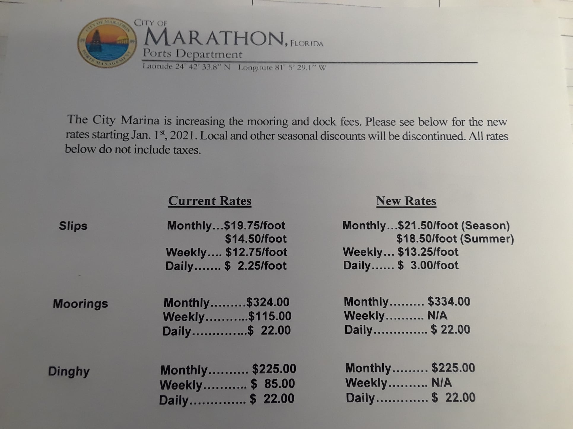
RATES
OFFICIAL WEBSITE
https://www.marathonmarinaresort.com/marina/

