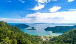
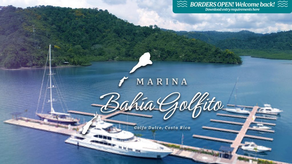
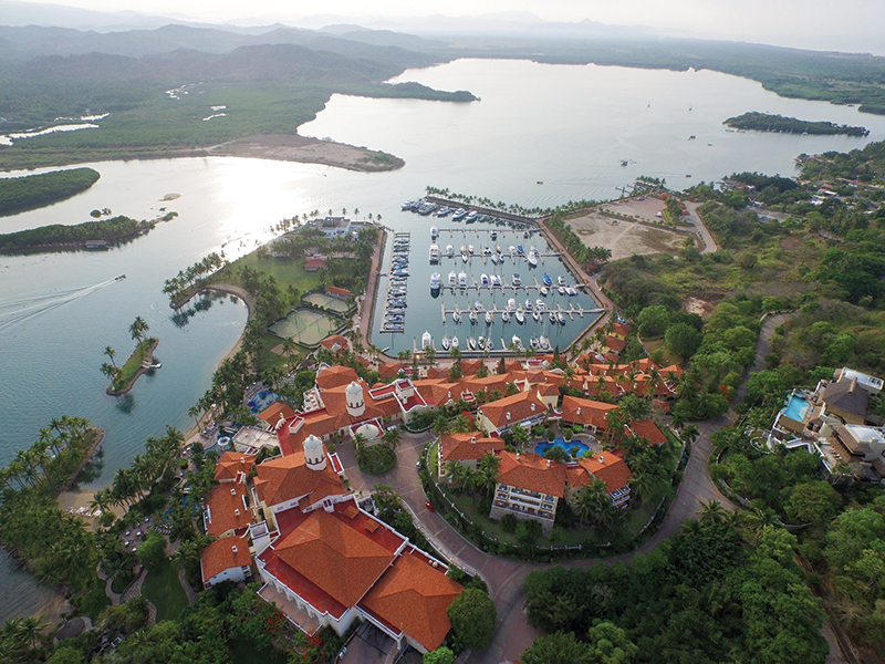
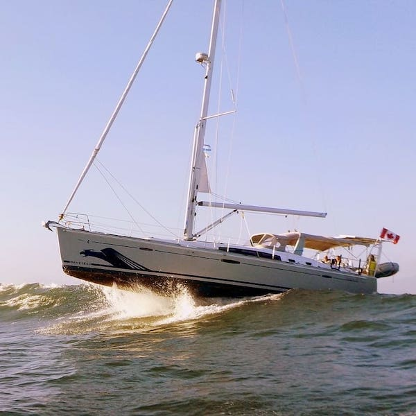
Marina Bahia Golfito
Marina Bahia Golfito
CONTACT
Maikol Barrantes
Dock Master
Marina Bahia Golfito
info@marinabahiagolfito.com • Ofc: +506 4080-6090 • Golfo Dulce, Costa Rica.
RATES
$2.75 x foot x night
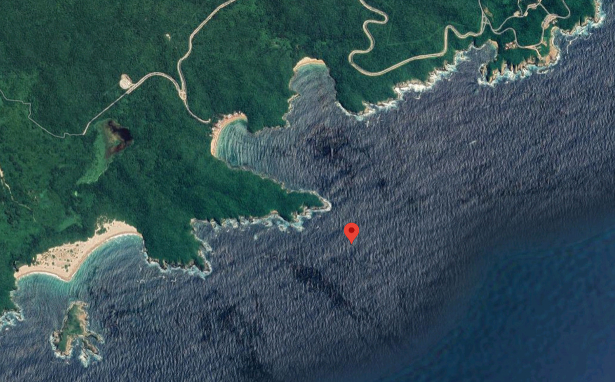
SAFE APPROACH
LOCATION
OFFICIAL WEBSITE
https://www.marinabahiagolfito.com/
SERVICE PROVIDERS
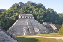
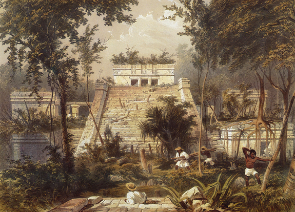
🇲🇽 Palenque
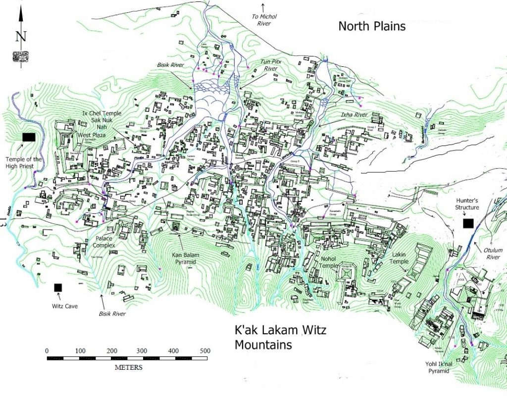
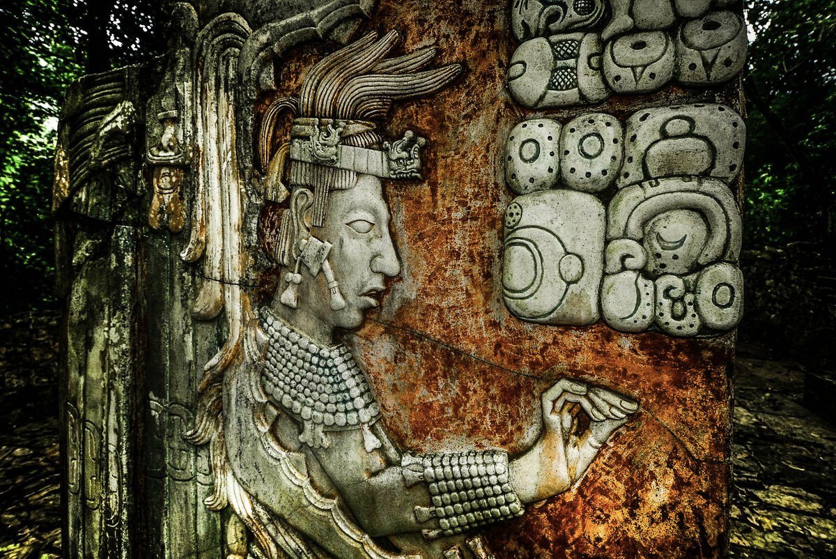
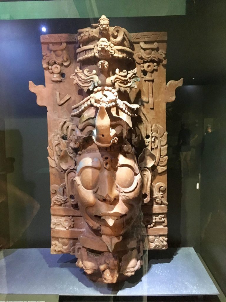
Palenque also anciently known as Lakamha "Big Water" , was a Maya city state in southern Mexico that flourished in the 7th century. The Palenque ruins date from ca. 226 BC to ca. 799 AD. After its decline, it was overgrown by the jungle of cedar, mahogany, and sapodilla trees, but has since been excavated and restored with an onsite museum. It is located near the Usumacinta River in the Mexican state of Chiapas resides at 150 meters (490 ft) above sea level.

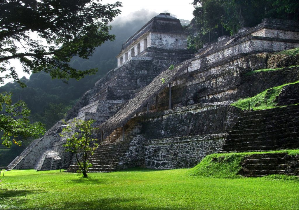
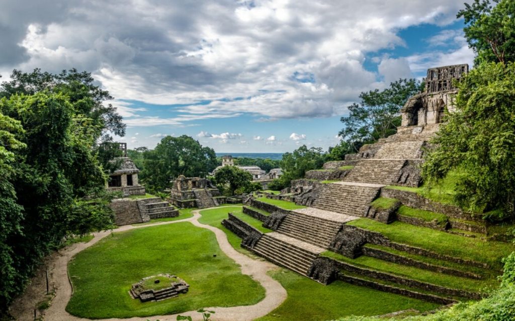
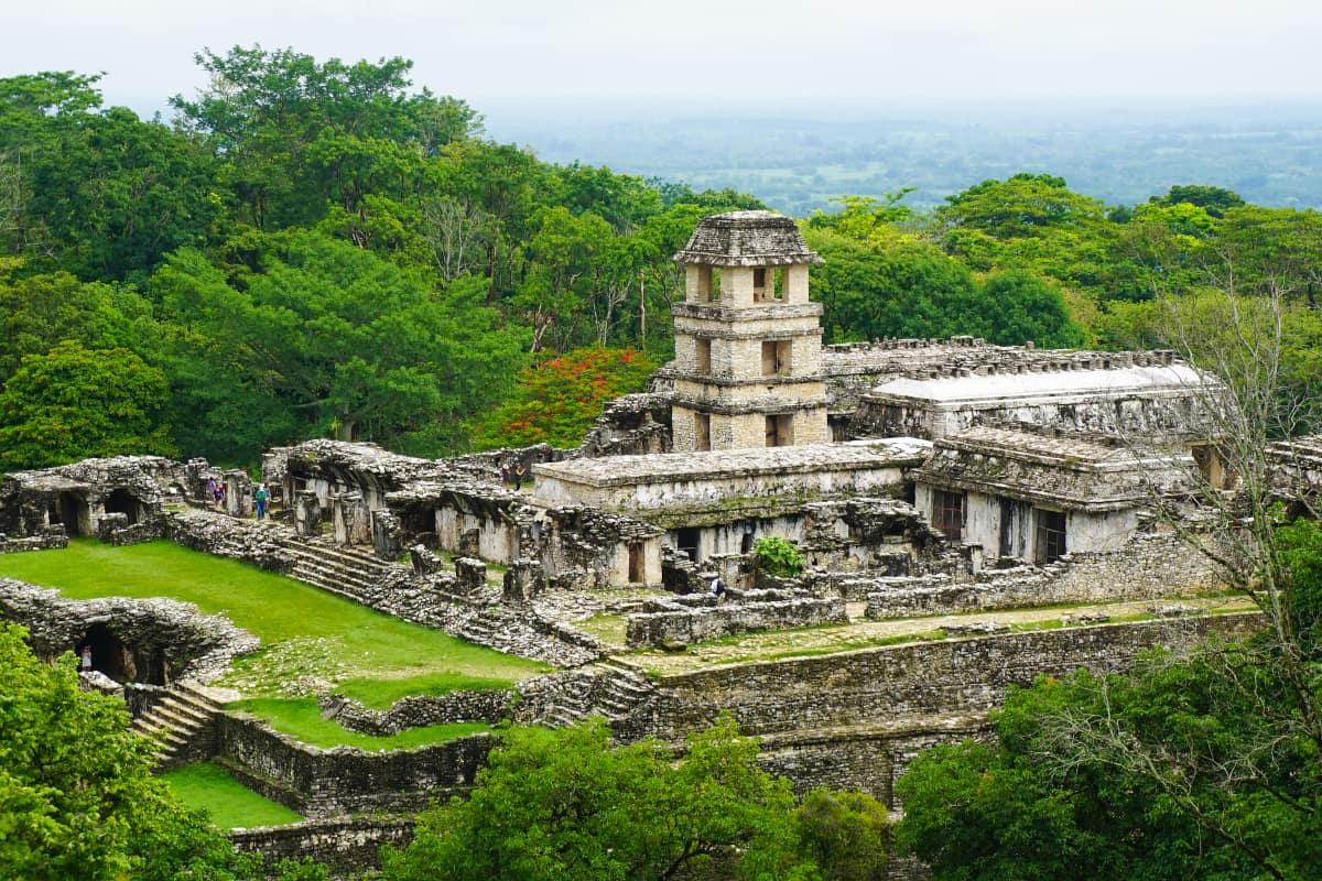
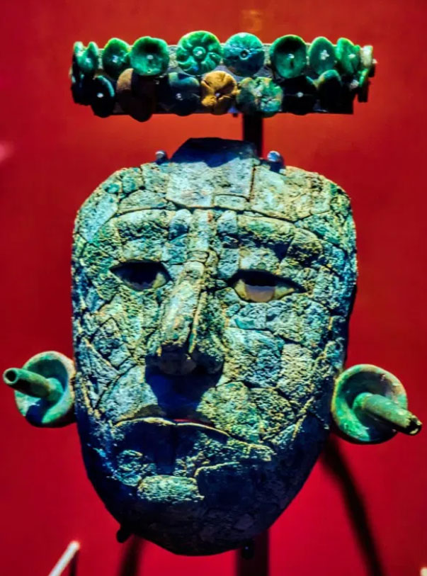
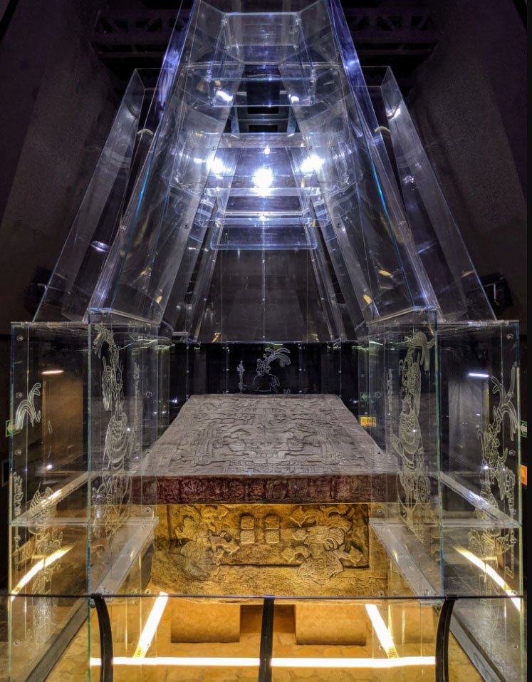
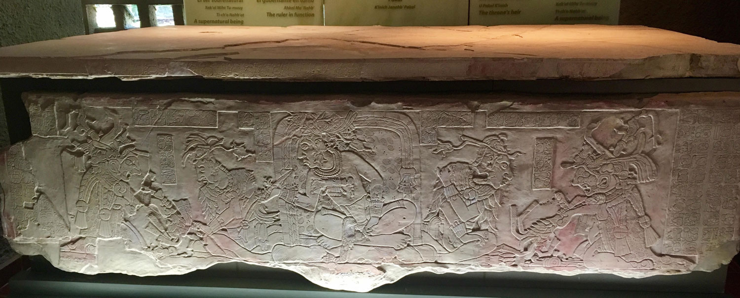
Palenque is a medium-sized site, smaller than Tikal but it contains some of the finest architecture, sculpture, roof comb and relief carvings that the Mayas produced. Much of the history of Palenque has been reconstructed from reading the hieroglyphic inscriptions on the many monuments; historians now have a long sequence of the ruling dynasty of Palenque in the 5th century and extensive knowledge of the city-state's rivalry with other states such as Calakmul and Toniná. The most famous ruler of Palenque was K'inich Janaab Pakal, or Pacal the Great, whose tomb has been found and excavated in the Temple of the Inscriptions. On the lid, as in his tomb, Pakal is positioned in an intermediary space, between the heavens—symbolized by the world tree and bird above him—and Xibalba, the Maya underworld. In addition to the remains of Pakal, precious materials such as jade, shells, pearls, and obsidians were discovered inside the sarcophagus.
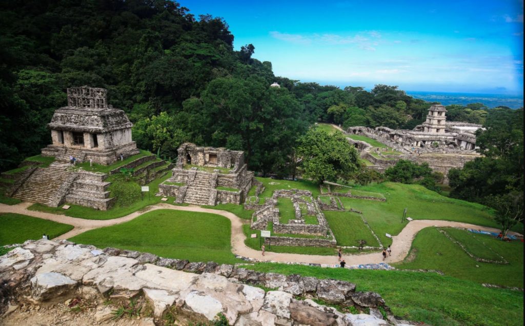
It is estimated that less than 10% of the total area of the city is explored, leaving more than a thousand structures still covered by jungle.
The first published account of this lost city was in 1567, from a Friar of the Dominican Order Pedro Lorenzo de la Nada. Lorenzo came upon its stone temples, terraces, plazas and architecture, originally decorated with blue- and red-painted stucco but by then long abandoned by the Maya who built it. Lorenzo gave the grand structure the name Palenque, a Spanish word meaning "fortification." As drought and warfare tore apart the social and political fabric of the Maya the Spanish conquistadors began claiming Maya land for plantations and subjugating Maya people to work on them, many residents of storied stone cities such as Yaxchilan and Palenque fled to the countryside in search of a better life. Ultimately they founded a host of new Maya cultures. Some people, known as the Lacandon Maya, established themselves in the forests around Lake Mensabak in the southern Mexican state of Chiapas. Their descendants still live in this region today. They are the Hach Winik, “the true people” in Yucatec Mayan.
The rulers of Palenque were called the "Holy Lord of Toktahn" or "Holy Lord of Baakal", and among the king list are several legendary leaders, including Snake Spine and Ch'a Ruler I. The very first named ruler of Palenque is GI, the First Father, said to have been born 3122 BCE, and the Ancestral Goddess said to have been born 3121 BCE.
The dynastic rulers of Palenque begin with Bahlum-Kuk or K'uk Balahm, the Quetzal Jaguar, who took the throne of Palenque in 431 AD.
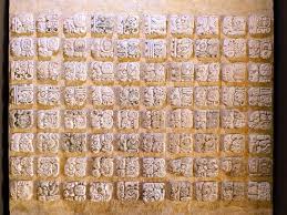
Lengthy Mayan texts, which researchers have used to translate Maya script.
![]()
16th century
The quest to decipher Maya hieroglyphs began with the very Spanish invaders whose rule did so much to wipe out the ancient Maya script. Among them was the conquistador Hernando Cortes, who led massacres in Mexico but who also, some scholars believe, had the famous Dresden Codex—one of just four Maya illustrated books surviving today—shipped back to Spain. Another was Diego de Landa, a friar bent on replacing indigenous with Christian beliefs. In what amounts to a crime against the cultural heritage of humanity, Landa orchestrated the burning in 1562 of hundreds if not thousands of Maya bark-paper books, which he deemed heretical. Yet four years later, Landa wrote a manuscript about the Maya world called "Relation of the Things of Yucatan" (left). Together, this manuscript and the Dresden Codex proved essential in the later decoding of the Maya's calendar system and their advanced understanding of astronomy and mathematics
1832
Counting
Actual decipherment began with an eccentric European genius named Constantine Rafinesque, who boasted of having dabbled in more than a dozen professions, from archeology to zoology. His insatiable thirst for knowledge had led Rafinesque to a reproduction of just five pages of the Dresden Codex, from which he was able to crack the Maya's system of counting. In 1832, Rafinesque declared in his newsletter, the Atlantic Journal and Friend of Knowledge, that the dots and bars seen in Maya glyphs (like these at left, from the Dresden Codex) represented simple numbers—a dot equaled one and a bar five. Later findings proved him right and also revealed that the Maya even had a symbol for zero, which appeared on Mesoamerican carvings as early as 36 B.C. (Zero didn't appear in Western Europe until the 12th century.)
1881
Photo documentation
Britain's Alfred Maudslay was a respected diplomat, but he would be best remembered for his work as an amateur Mayanist. Fascinated by scholars' writings on the Maya and by new advancements in photography, Maudslay set out to create as complete a record as possible of the civilization's architecture and art. Using a large-format, glass-plate camera, he captured highly detailed images of Maya sites, including clear close-ups of the glyphs (left). He also prepared papier-mâché casts of several carvings from which accurate drawings were later made. Maudslay had effectively given Maya studies its first systematic corpus, or body, of inscriptions. This helped make further decipherments possible, in part by bringing glyphs to scholars who had limited access to the few surviving Maya texts.
1952
The sounds of the glyphs
While glyph studies languished in the West, a Russian linguist in Moscow was making his own groundbreaking discoveries. In 1952, Yuri Knorosov (left) postulated that the individual symbols in Maya glyphs stood for phonetic sounds, much like English letters do. Knorosov knew that Maya had too many glyphs to be a true alphabet but too few for each glyph to symbolize an entire word. (Maya's 800-plus glyphs compare to the several thousand characters of Chinese, for example.) He determined that written Maya, like Egyptian hieroglyphics, contained a combination of these elements. Because "west," in spoken Maya, is "chik'in," and "k'in" is the word for sun, the hand represents the syllable "chi," as Knorosov concluded. Fortunately, American scholars Michael and Sophie Coe began publishing Knorosov's papers in the U.S. in the late 1950s. Otherwise, his important (though incomplete) findings might have been inaccessible to Western scholars until the end of the Cold War.
Tombraiders
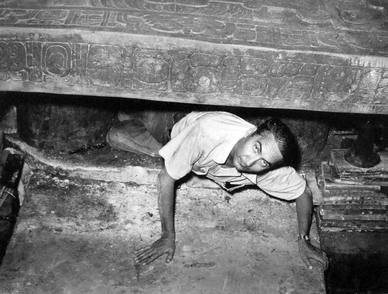
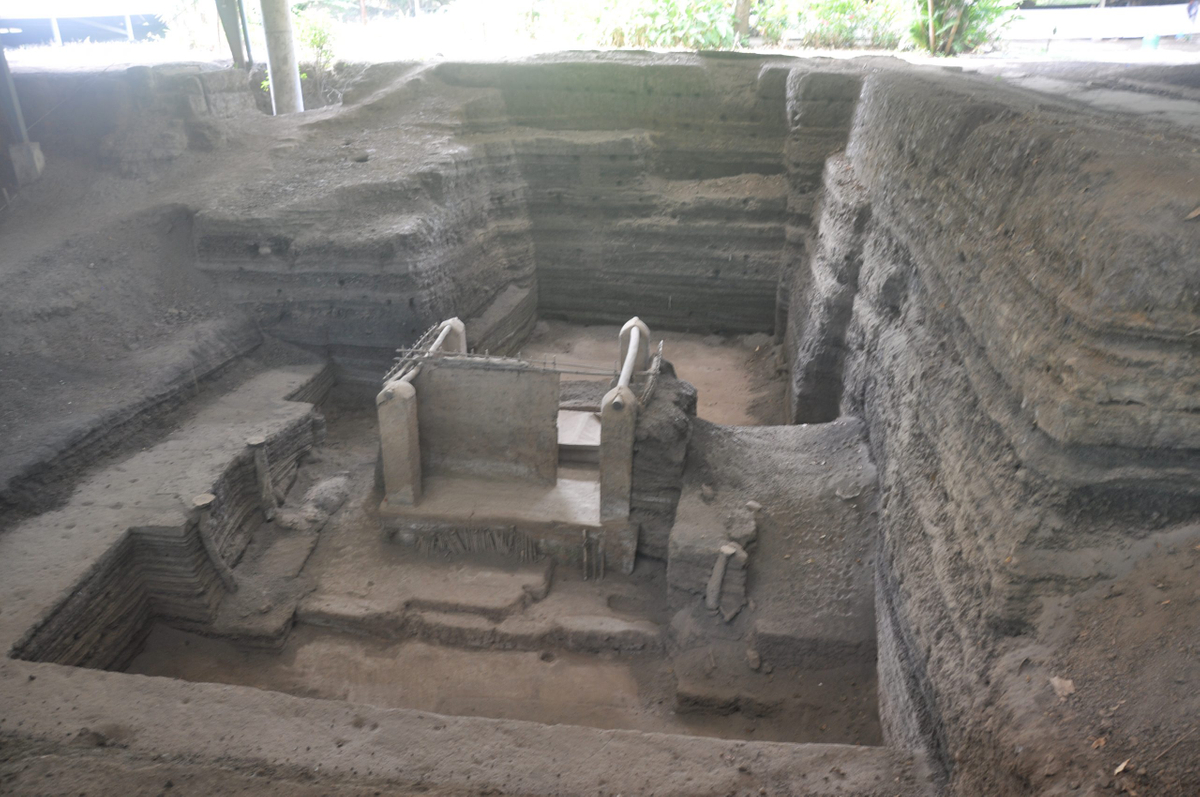
Scientific debt is owned to the famed Mexican archaeologist Alberto Lhuillier, who in 1952 removed a stone inside the Temple of Inscriptions and found the burial tomb of Pakal the Great. This has since become one of the most extensively studied archaeological sites in the Americas.
500 years later this site is one of the most visited archaeological sites in Mexico with close to 1M visitors x year. Archeological researchers have uncovered some of the most detailed information about Maya culture
How to get there
Leave your vessel at Marina Chiapas on the Pacific coast ( entry and exit in Puerto Madero South Western Mexico) and drive to this site with a shared guided tour - or if you are adventurous drive yourself though Zapatista territory. Although the EZLN is still active and maintains a few strongholds in Chiapas, things are relatively peaceful and there is no threat to tourists. Travelers are advised to respect any roadblocks they may come across in rural areas which may require payment of an unofficial road tax. Get to the site early int he day before most day tourist show up and head to the Museum at mid day to avoid the crowds and chachki vendors inside the park which amass around 11 AM.
![]()
https://panamaposse.com/marina-chiapas
TO JOIN THE PANAMA POSSE WHICH FOCUSES ON FINDING INSPIRING DESTINATIONS FOR YOU AND YOUR VESSEL AS YOU
SIGN UP FOR THE PANAMA POSSE
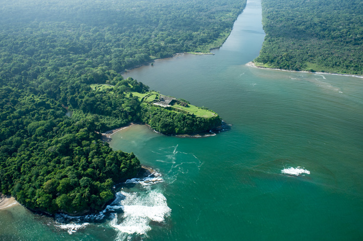
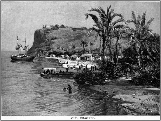
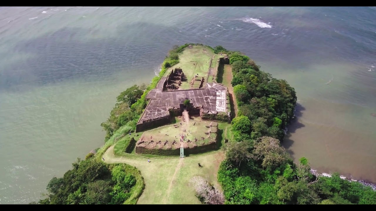
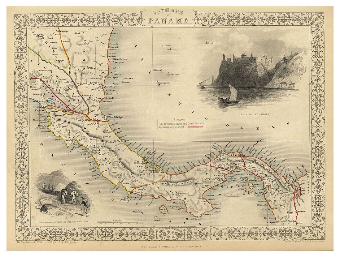
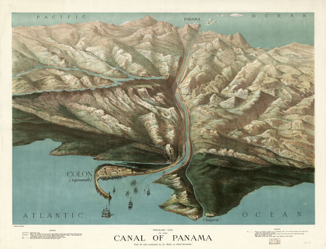
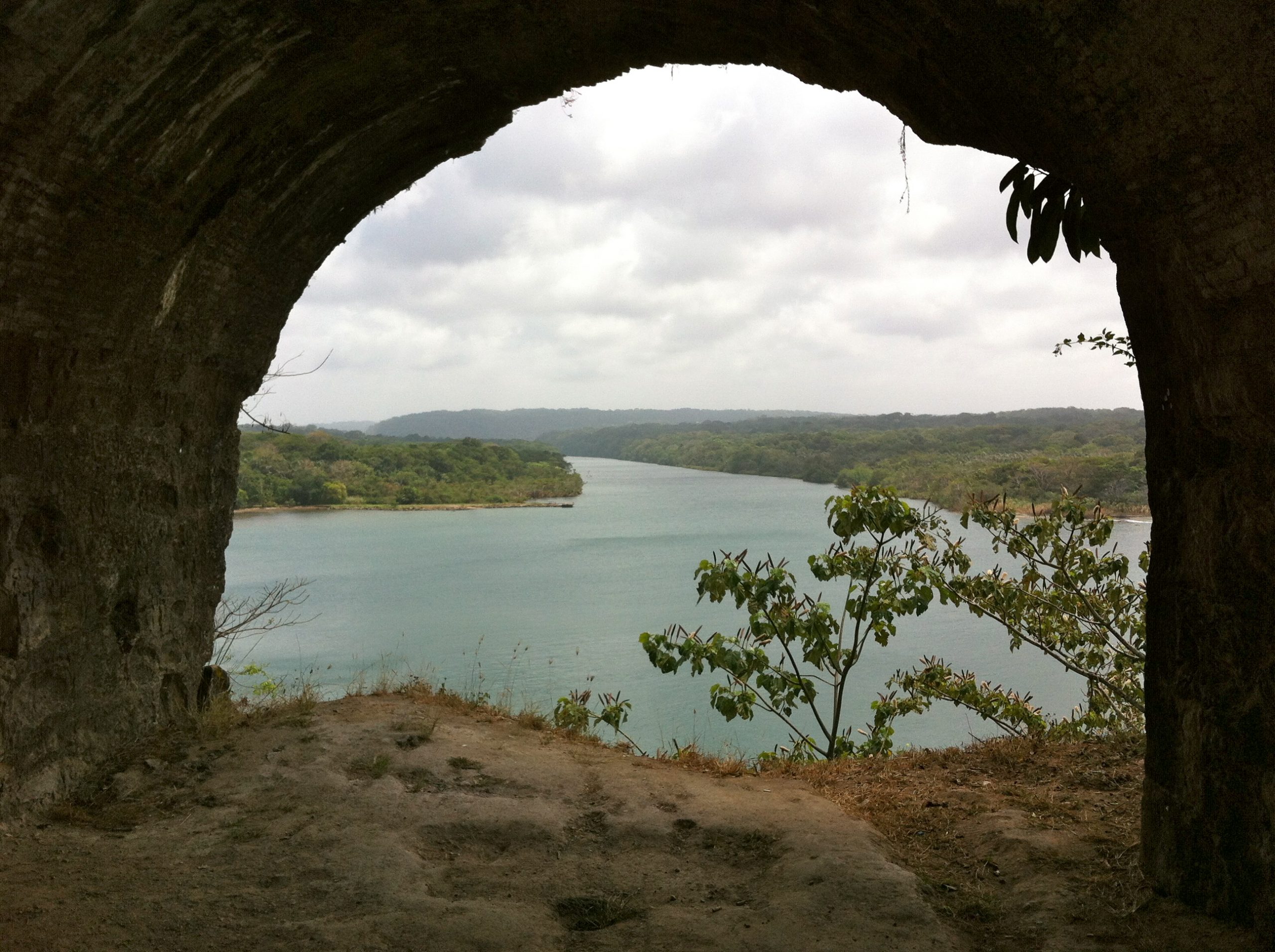
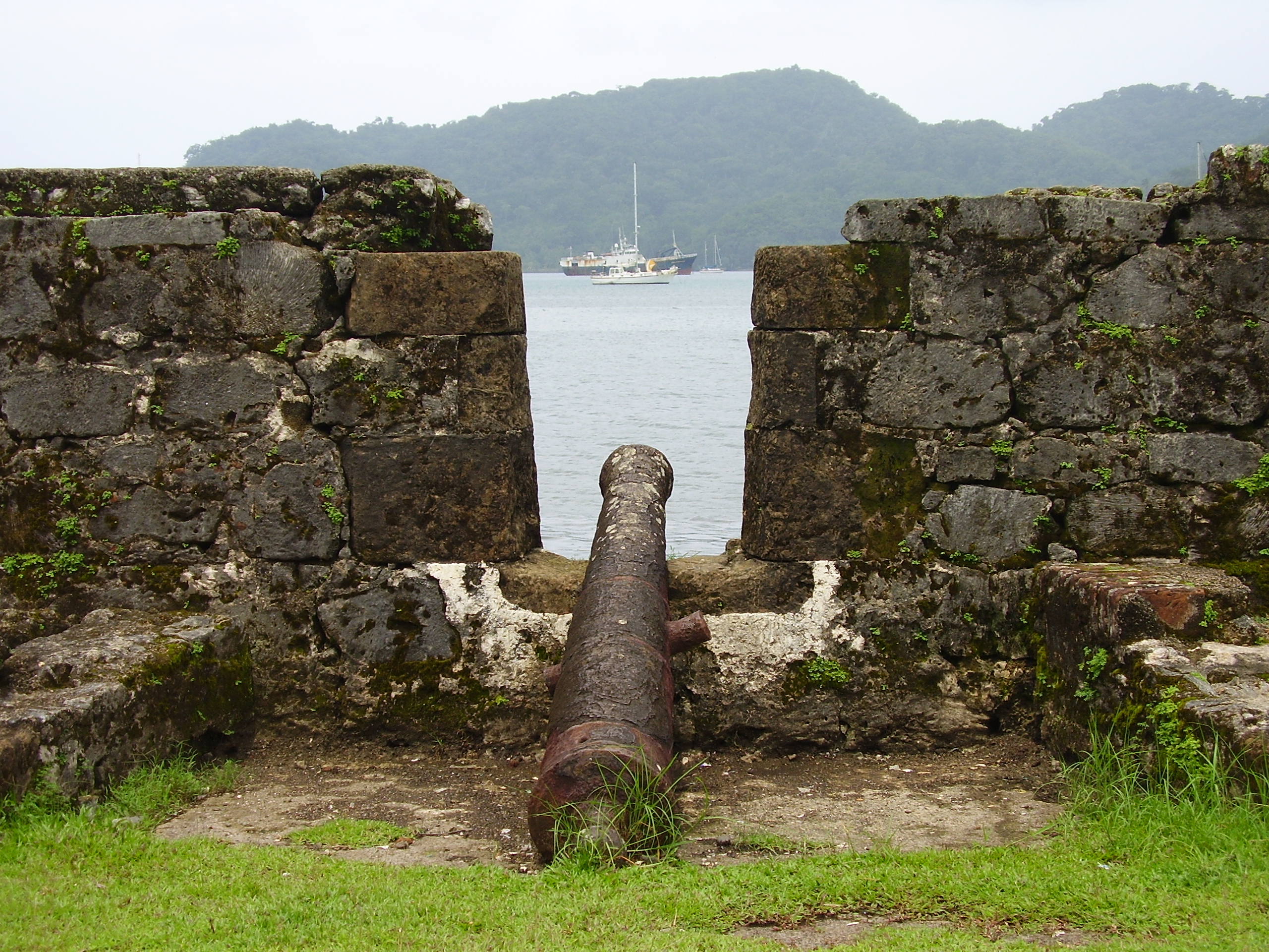
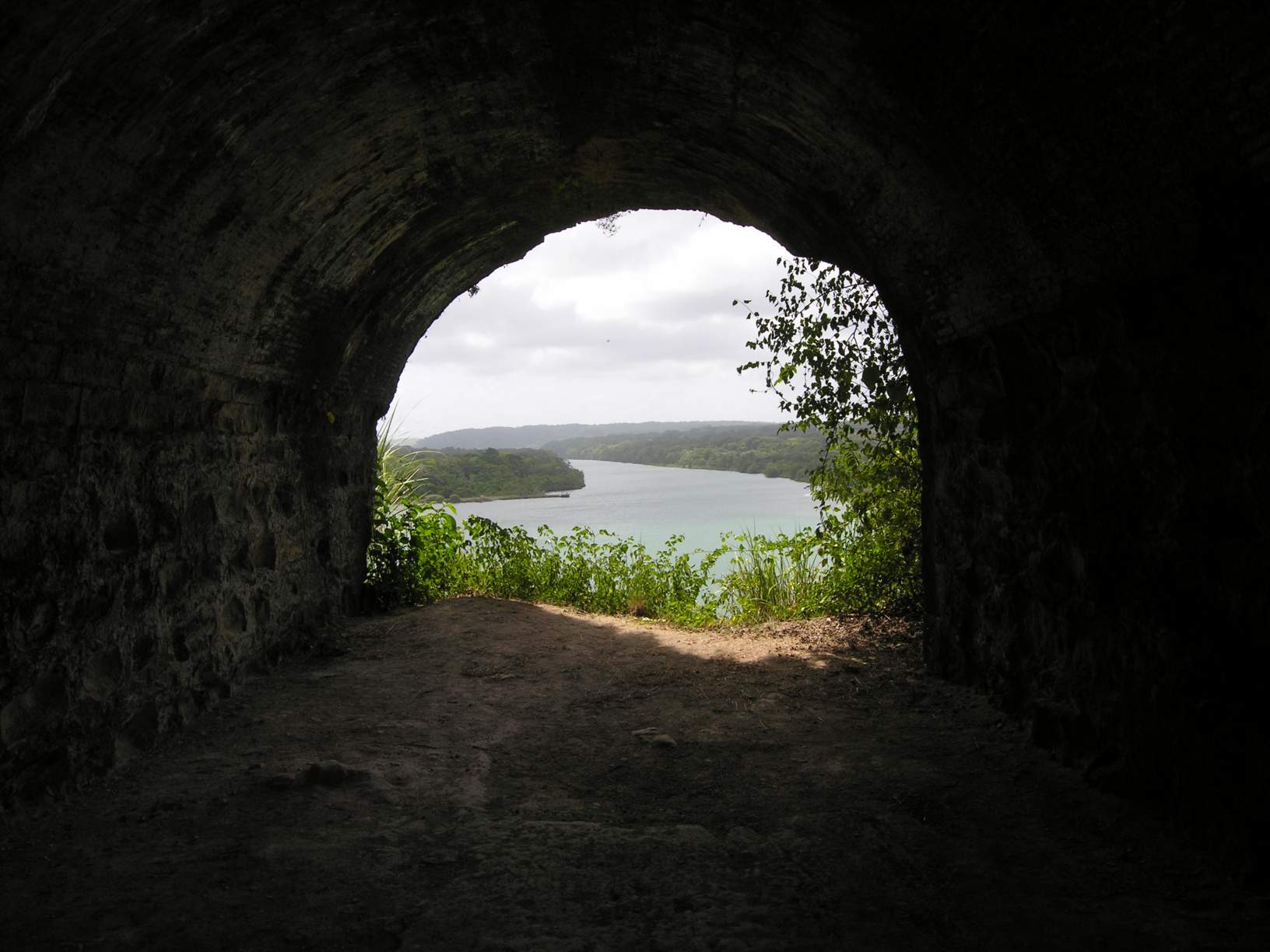
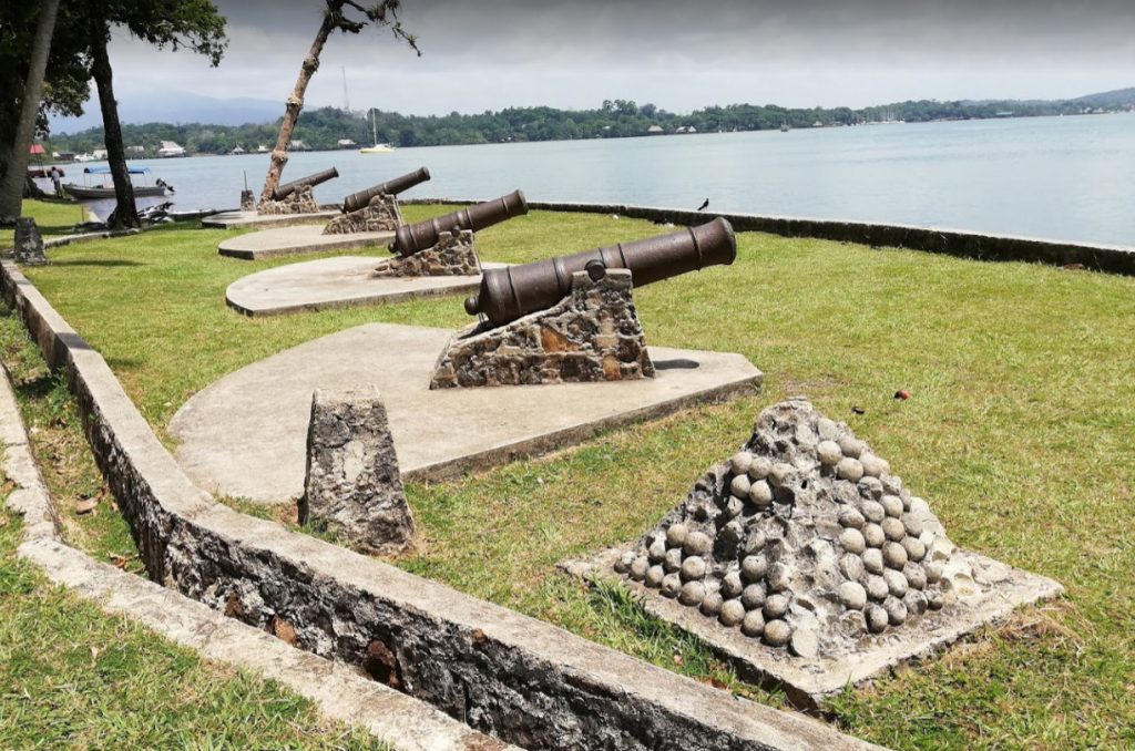
🇵🇦 Castle of San Lorenzo at Port Chagres
🇵🇦 Castle of San Lorenzo at Port Chagres, Panama
overlooks a bay leading into the river Chagres some 100 feet down a cliff. The river leads inland about 2/3 of the way across Panama to Panama City. A dam was built as part of the canal construction around 100 years ago. This created a big inland lake (Lake Gatun). The Panama Canal locks are used to lift boats up into this lake, sail across to the other side and then through a 7 mile long trench in the rock to the locks on the Pacific side where the boats go back down.
By 1534, the Monarchy of Spain had, following its conquest of Peru, established a rainy-season gold route over the isthmus of Panama —Camino Real de Cruces— using mule trains and the Chagres River.
The trail connected the Pacific port of Panama City to the mouth of the Chagres, from whence Peru's plunder would sail to Spain's storehouses in the leading Atlantic ports of the isthmus: Nombre de Dios, at first; and, later, Portobelo. The dry-season, overland route—the Camino Real—connected Panama City with those ports directly. Attracted to the treasure, pirates began attacking Panama's coast around 1560.
Captain Morgan the pirate came along about 300 years ago and captured the fort from the Spanish. He then took his boats and men inland as far as he could. He then found 500 mules and transported guns and canons and supplies another 7 miles to Panama City where he plundered all the gold for himself and men that the Spanish had plundered from local Indians. It is hard to tell who was the bad guy here.

Needles to say that most Spanish fortifications where built and maintained by indigenous, indentured or slave labor.
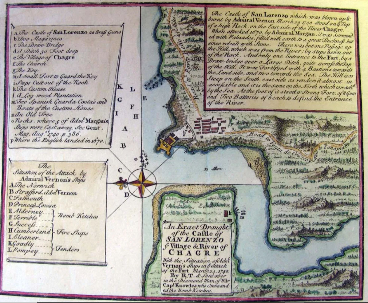
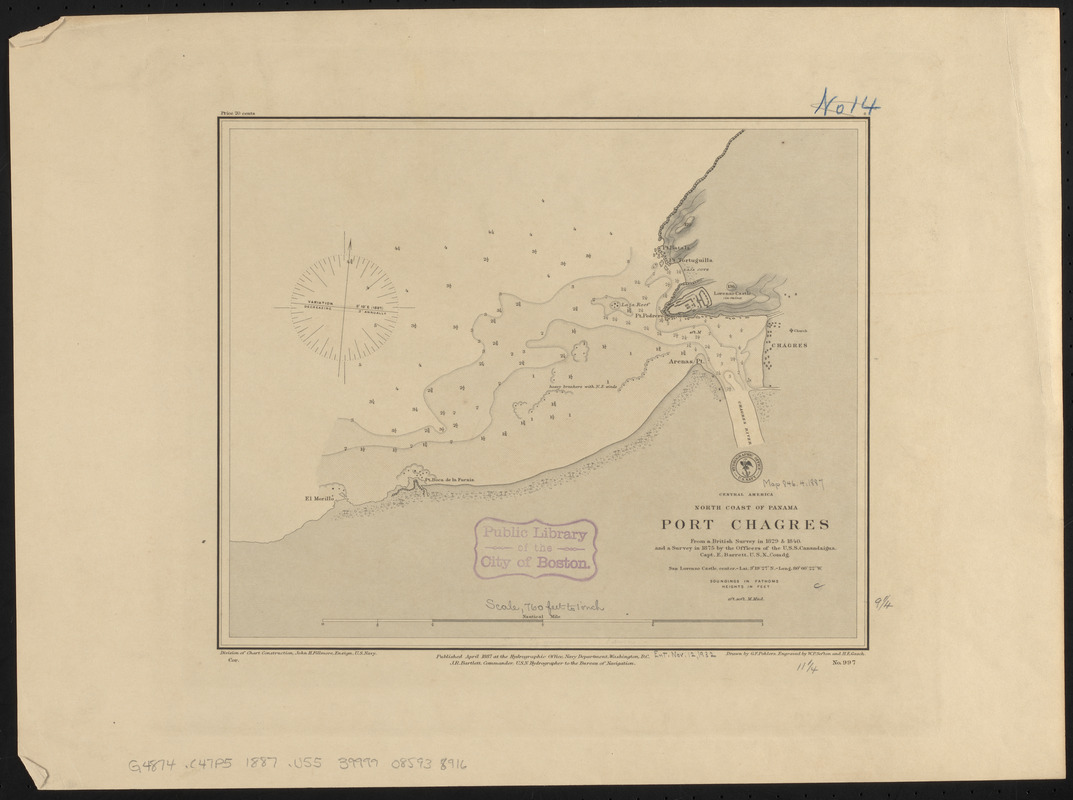
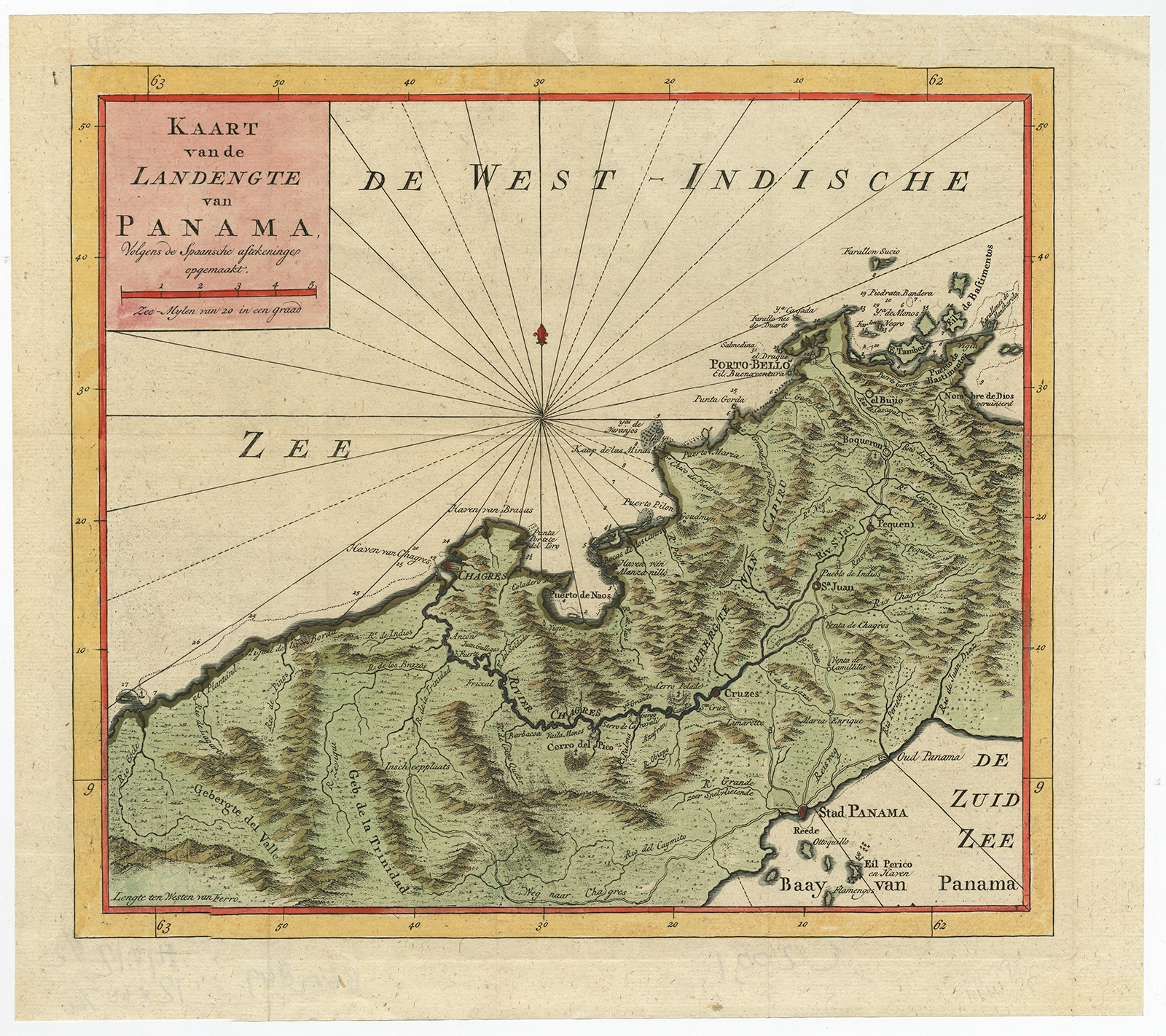
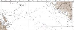
The Port of Chagres Chart
A design which did NOT work
Fortifications overlooking the Chagres River
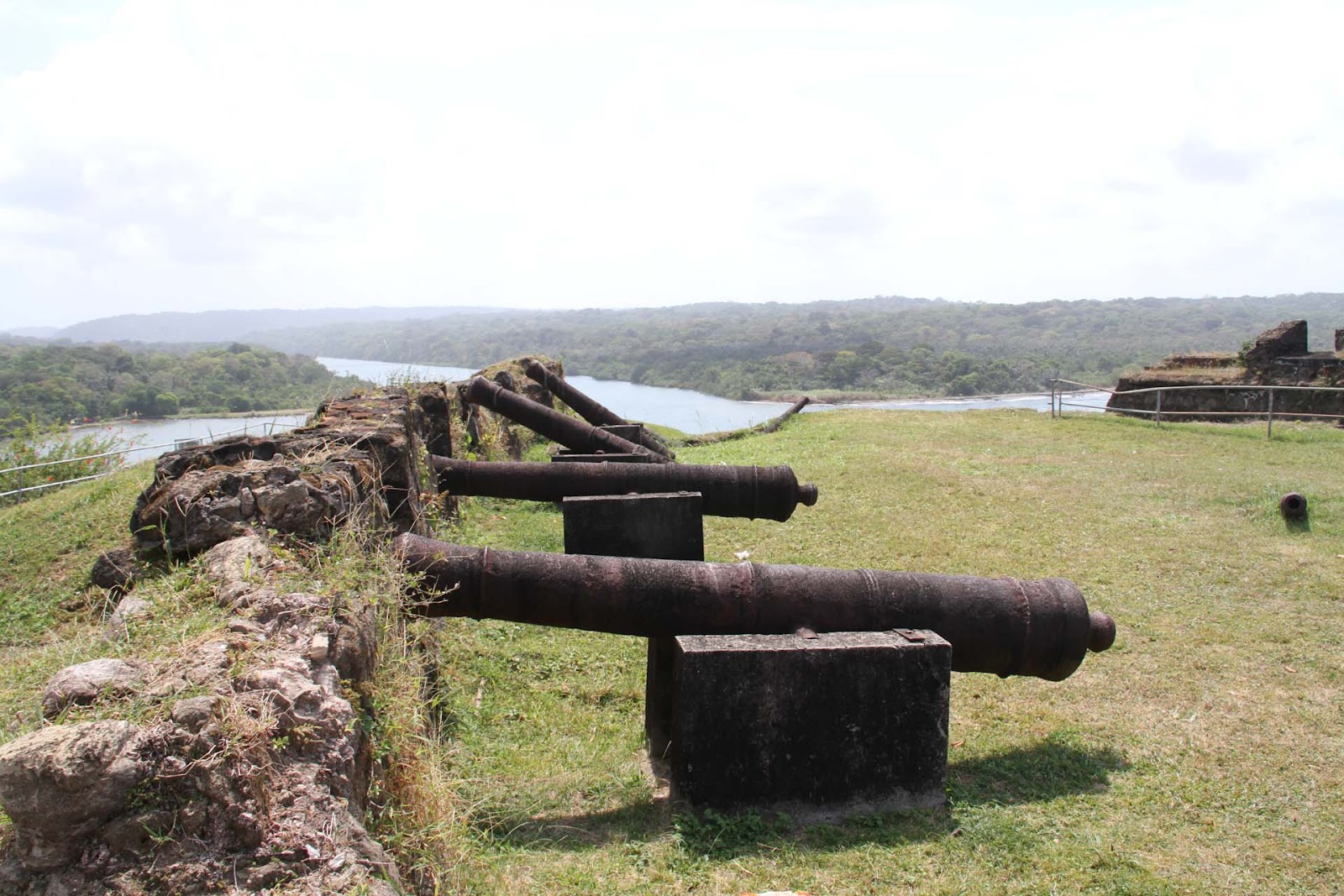
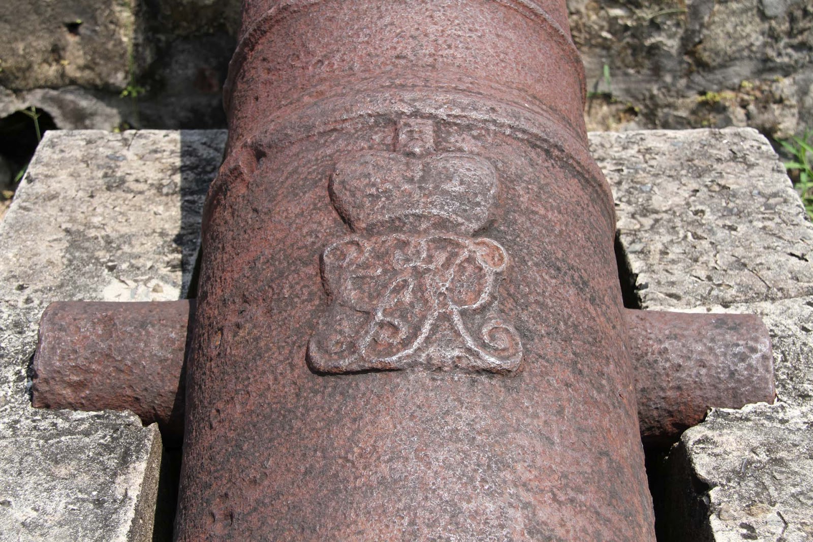
The Spanish Canons.
From a Sailing and engineering perspective there is an interesting connecting thread - We are focusing on the activities of Juan Bautista Antonelli and his brother.
Battista Antonelli (or Bautista) (1547–1616) was a military engineer from a prestigious Italian family of military engineers in the service of the Habsburg monarchs of Austria and Spain (Philip II) worked with his older brother on projects in Oran, Algeria and Spain.
His works sometime with the help of his brother can easily be divided into two well-defined and different periods: in the first, from 1560 -1580 onward dedicated to fortifications and defenses on the Levantine coasts and ports of North Africa with his first fortification is in Cartagena de Levante dated 1562 and signed by him followed by Castillo de Santa Bárbara in Alicante, Peñiscola and the African ports of Oran and Mazalquivir.
In 1580 Felipe II occupied Portugal and incorporated it into his kingdom. It was a relatively quick military operation and without confrontations on the battlefields because the action was more of a peaceful occupation than a fought conquest. Felipe II commissioned Juan Bautista Antonelli to find solutions for the easy movement of the troops, prepare the roads and smooth the rough spots of the terrain to speed up the transfer of supplies, supplies and armaments. The topography, however, was rugged and rugged; bad roads and with various rough edges difficult to overcome. Hence the idea of river navigation and the conveniences it represented for the transfer of heavy equipment arose.
The second period of work in the Americas
In 1581 Antonelli was commissioned by the king to build a fortress along the Straits of Magellan ( utter failure), to protect this vital sea lane from attacks by English privateers. From 1582-1584 he designed and built the Castle at Fortaleza in Brazilian and in 1586 he was commissioned to build fortifications for the city of Cartagena in Colombia.
Using the latest military technology of the time, he designed the city's renowned defenses, the San Felipe de Barajas Castle, the San Sebastián de Pastelillo Fort and the San Fernando Fort. He then set sail for Havana. In Havana he designed the fortifications which culminate at the fortress of El Morro (Los Tres Reyes).
An finally he returned to Spain and even worked on the fortresses in Gibraltar.
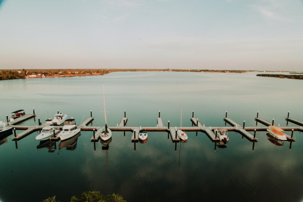
🇲🇽 Marina y Club de Yates Isla Cortés
 Marina y Club de Yates Isla Cortés
Nice to greet you, and thank you for contacting us.
We will gladly assist the Panama Posse at the Marina & Club de Yates Isla Cortés.
Responding to your email we can give you a 10% discount on our rate,

CONTACT
AMENITIES
- 40 spaces to house boats up to 150 feet
- Draft of 2.3 meters
- Electricity of 50 and 30 amps
- Water
- Restaurant
- Bar
- Bathrooms
- Showers
- Wi fi.
Marina y Club de Yates Isla Cortés SAFE APPROACH
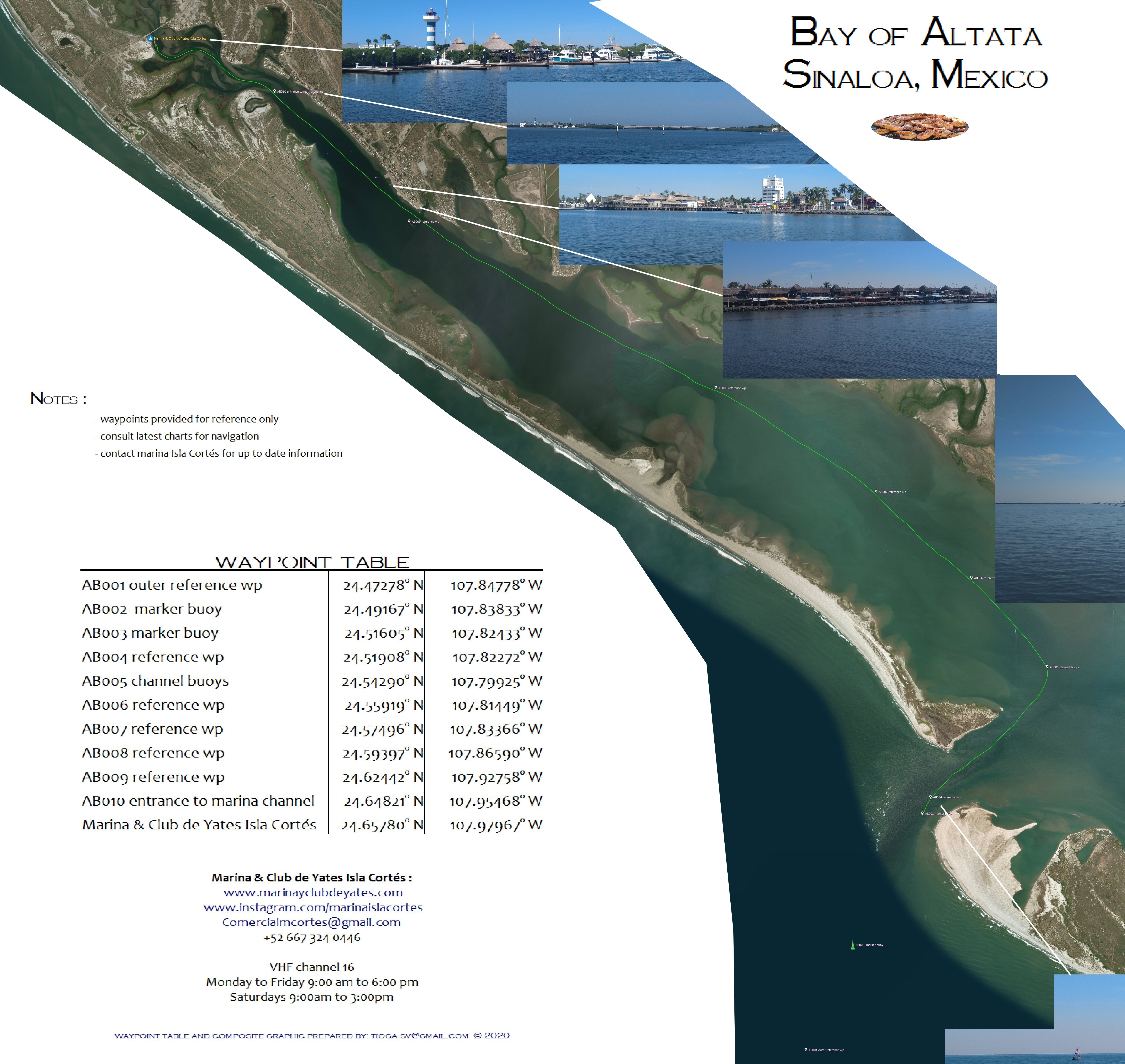
RATES
We will be charging you in Mexican pesos not USD
| 31-35 Feet MXD | 36-40 Feet MXD | 41-50 feet MXD | ||
| Daily | 500 | |||
| Weekly | 2,550 | |||
| Bi-Weekly | 4,800 | |||
| Monthly | 6,250 | 7,500 | 9,000 |
LOCATION
24°39.466' N 107°58.736 O
S&H CRUISING GUIDE UPDATE AND LINK
- https://www.bluelatitudepress.com/Blue%20Latitude%20Press_SOC_Altata_update_2014.pdf
OFFICIAL WEBSITE
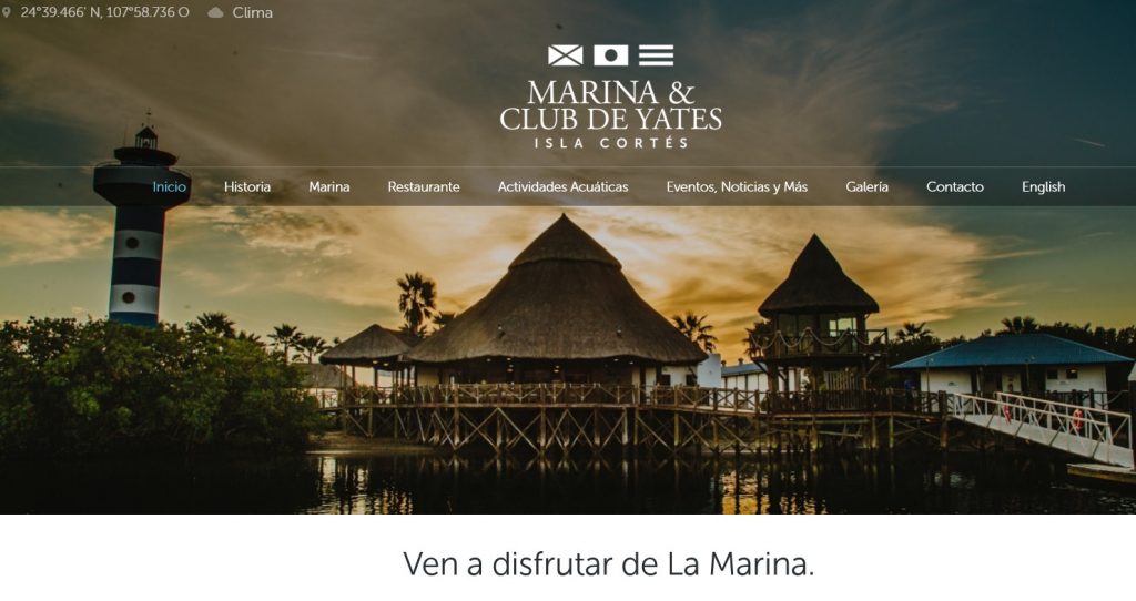
https://marinayclubdeyates.com/es/?lang=en
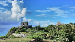
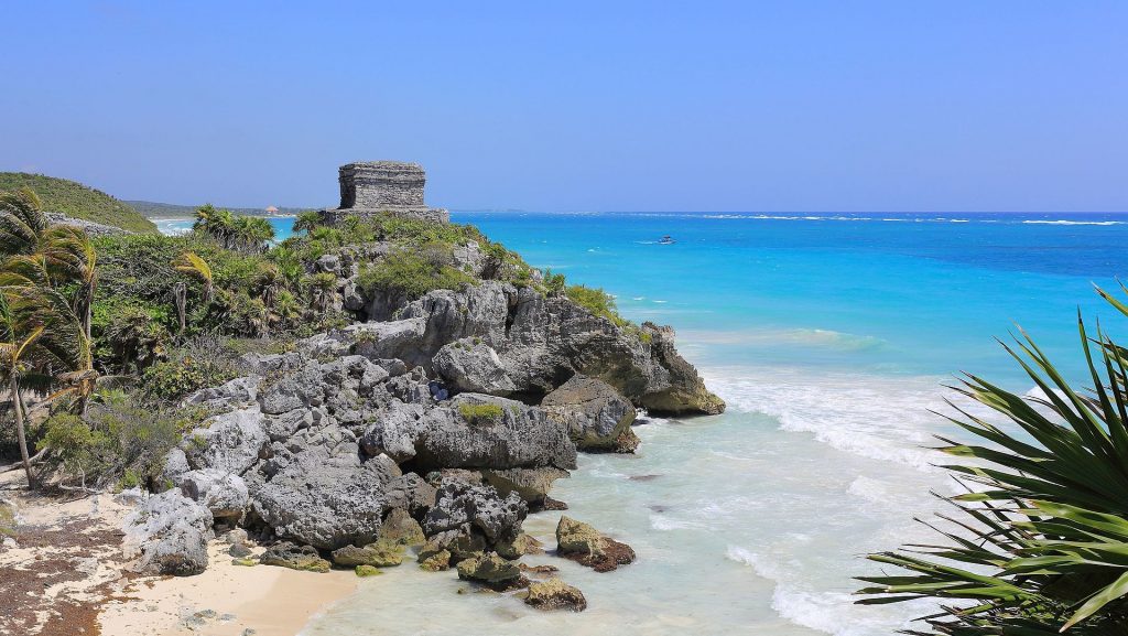
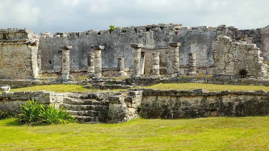
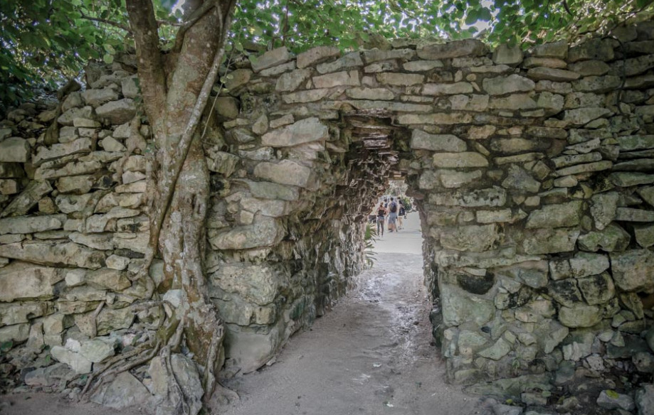
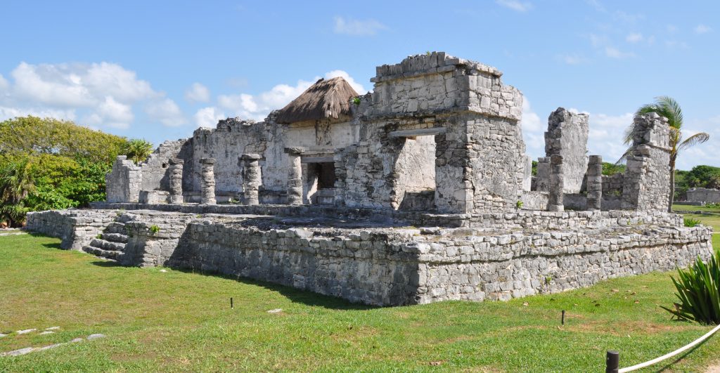
🇲🇽 TULUM
🇲🇽 Tulum
Tulum is the site of a Mayan walled city which served as a major port for Coba, in the Mexican state of Quintana Roo. These magificent ruins are situated on 40foot tall cliffs along the east coast of the Yucatán Peninsula. The site might have been called Zama, meaning City of Dawn, because it faces the sunrise.
Tulum was one of the last cities built and inhabited by the Maya at its height between the 13th and 15th centuries and managed to survive about 70 years after the Spanish began occupying what is now Mexico .
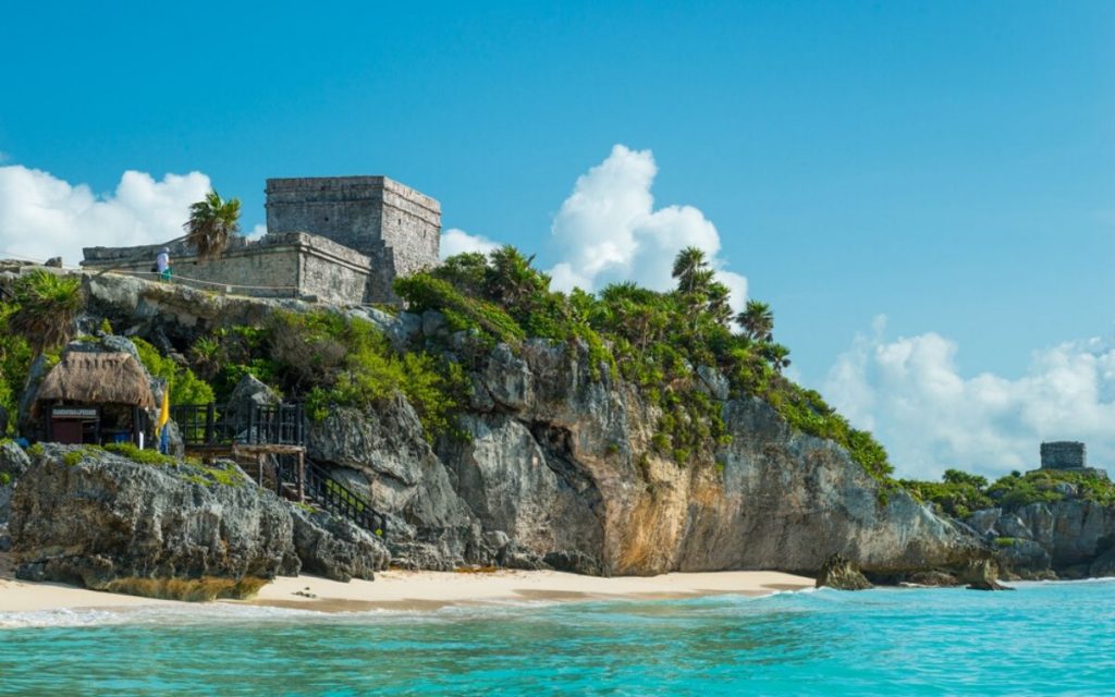
It is one of the best-preserved coastal Maya sites, Tulum and you can see it from your own vessel and anchor just south or to the north of it if you are brave enough to enter the path though the reef with good light ( noon non cloudy not too windy )
and draw less than 6 foot on a calm day - give yourself the flexibility to visit during the off-peak hours of the early morning or late afternoon and save your track. The Sand is compacted so only recommended as a day anchorage.
Tulum's massive wall was thick and 1,300 ft long parallel to the sea and would have taken an enormous amount of energy and time, which shows how important defense was. On the southwest and northwest corners there are watch towers demonstrating a well defended city.
Tulum is considered by archeological experts one of the most well-known fortified sites of the Mayan Civilization
Three major structures of interest
El Castillo
Temple of the Frescoes
Temple of the Descending God
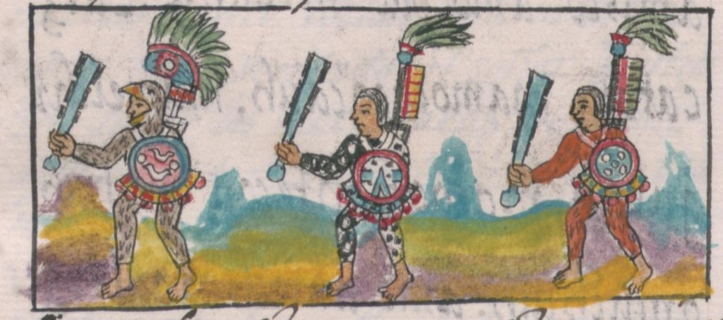
Since tulum had access to both land and sea trade routes it was an important trade hub, especially for volcanic glass called ovisidian used for tools, decorative objects and made into a type of sword with obsidian blades mounted in a wooden body. Called a macuahuitl .This weapon could inflict terrible injuries, combining the sharp cutting edge of an obsidian blade with the ragged cut of a serrated weapon.

From numerous depictions in murals and other works around the site, Tulum appears to have been an important site for the worship of the Diving or Descending god
Tulum was first mentioned by Jua Diaz a member of Grijalva's Spanish expedition in 1518, the first Europeans to spot Tulum.
In 2020, an underwater archaeological expedition led by Jerónimo Avilés again excavated the cave and revealed the skeleton of a female about 30 years of age that lived at least 9,900 years ago.
The Site is close to 2 marinas https://panamaposse.com/marina-vv-cancun and https://panamaposse.com/marina-el-cid
VIDEO OF THE AREA
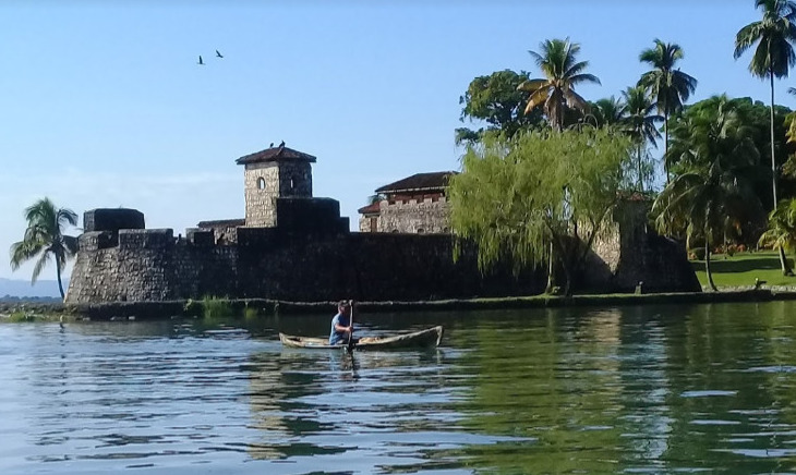
🇬🇹 Castillo de San Felipe
🇬🇹 The Castle of San Felipe de Lara
(Castillo de San Felipe de Lara)
is a Spanish colonial fort at the entrance to Lake Izabal in eastern Guatemala.
Lake Izabal is connected with the Caribbean Sea via the Dulce River and El Golfete lake. The fort was strategically situated at the narrowest point on the river. The Castillo de San Felipe was used by the Spanish for several centuries, during which time it was destroyed and looted several times by pirates
The fort is listed on the UNESCO World Heritage Tentative List and is a popular regional tourist destination.
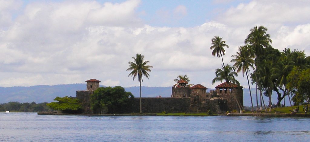
The Castillo de San Felipe was built to protect the port of San Antonio de las Bodegas on the south shore of Lake Izabal from frequent pirate attacks, mostly by English pirates.
After nightfall, passage along the river into the lake was blocked by a large chain that crossed from the fort to the far bank. San Antonio was the main port for receiving Spanish shipping carrying goods for the Captaincy General of Guatemala and was responsible for supplying and garrisoning the fort. Guatemalan records contain details of captains being appointed to the fort well into the 18th century.
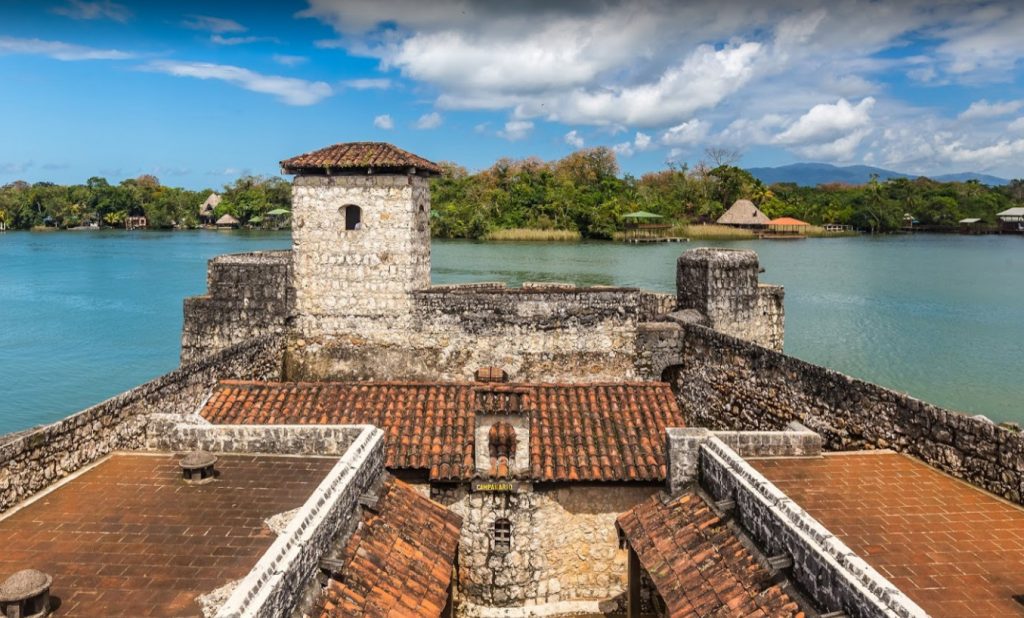
The position was a joint post, also including the position of mayor of San Pedro de Amatique and San Antonio de las Bodegas. The latter post was in name only, since the towns were soon abandoned due to constant slave raids by the Mosquito Zambo that left the Motagua delta and shores of Lake Izabal largely deserted, with those inhabitants that did not flee being sold into slavery in the British colony of Jamaica.
A tower already existed on the site by 1604, when it is recorded as having been destroyed. The fort was built in 1644 under the orders of Diego de Avendaño, then governor of the Kingdom of Guatemala. At the time it was known as Fuerte Bustamente ("Bustamente Fort") and the Torreón de Defensa ("Defence Tower").
The fort was redesigned in 1687 by Diego Gómez de Ocampo in the style of the French military architect Sébastien Le Prestre de Vauban. The modified design was implemented in 1689. Three bastions were functioning by 1697.
LOCATION YACHTING MAP
OLD MAP

SIGN UPFIND OUT MORE SUBSCRIBE
Near Marina Nanajuana >>
FLEET UPDATE 2020-10-25
|

|
|
|


|

|


FLEET UPDATE 2020-10-17
|


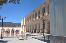
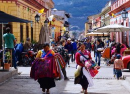
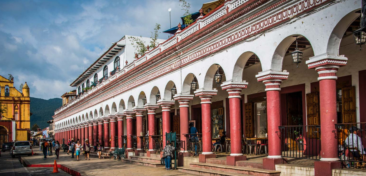
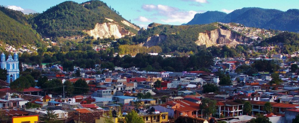
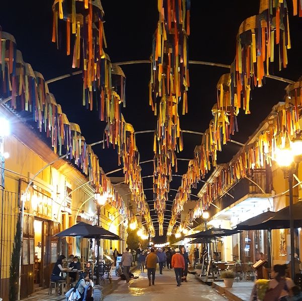
🇲🇽 San Cristóbal de las Casas
🇲🇽 San Cristóbal de las Casas is a city and municipality located in the Central Highlands region of Chiapas.

The historic center, has maintained its Spanish colonial layout, with narrow cobblestone streets, roofs covered in red clay tile and wrought iron balconies with flowers. The facades of the buildings vary from Baroque to Neoclassical and Moorish, painted in various colors.
Diego de Mazariegos founded San Cristóbal in 1528 as the Spanish regional base.
Its Spanish citizens made fortunes from wheat, while the indigenous people lost their lands and suffered diseases, taxes and forced labor.
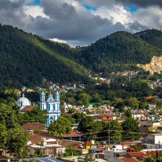
San Cristóbal is considered to be the “cultural capital” of the state and a designated in 2003 a "Pueblo Mágico" (Magical Village) in 2003, Mexcian President Felipe Calderón recognized it as “The most magical of the Pueblos Mágicos” and is located in a small valley surrounded by hills in the mountains with a 2,200-meter elevation 7,218 feet gives the city a crisp and cool climate.
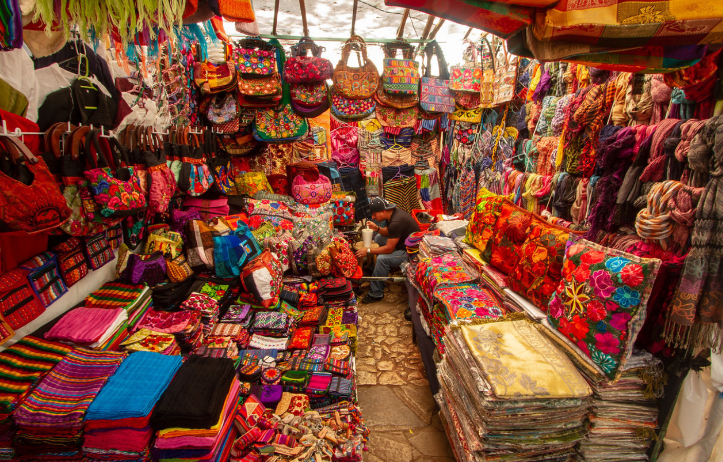
Much of it's large indigenous population made up of Tzotzils and Tzeltals continue to provide and continue to foster traditional culture.

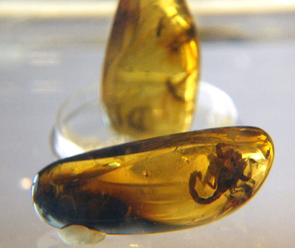
The making of textiles, especially weaving, with amber another important product. Ceramics, wrought iron and filigree jewelry can be found as well. The area is for crafts is the tianguis at Santo Domingo. The city hosts an annual Amber Expo at the Centro de Convenciones Casa de Mazariegos.
A more traditional Mexican market is located just north of the Santo Tomas Church. It is open each day except Sunday, when its vendors go to the surrounding communities in the municipality to sell at their markets which serve traditional dishes such as saffron tamales, sopa de pan, asado coleto, atole de granillo, a drink called posh made from sugar cane and the delightful Chiapanecan Coffee.

The city’s attraction for tourists has also led to a number making San Cristobal their permanent home. Foreign influence is the city’s noted cured meat tradition, which can be traced back to both the Spanish and the Germans These are featured in a number of dishes including chalupas. The pedestrian-friendly cobble-stoned streets and pastel dwellings are hugging the hillsides and add to San Cristobal’s charm.

It’s a convenient hub for travelers to base themselves for further explorations and things to do all throughout the state of Chiapas.It's nightlife music scene offers reggae, salsa, techno and more.
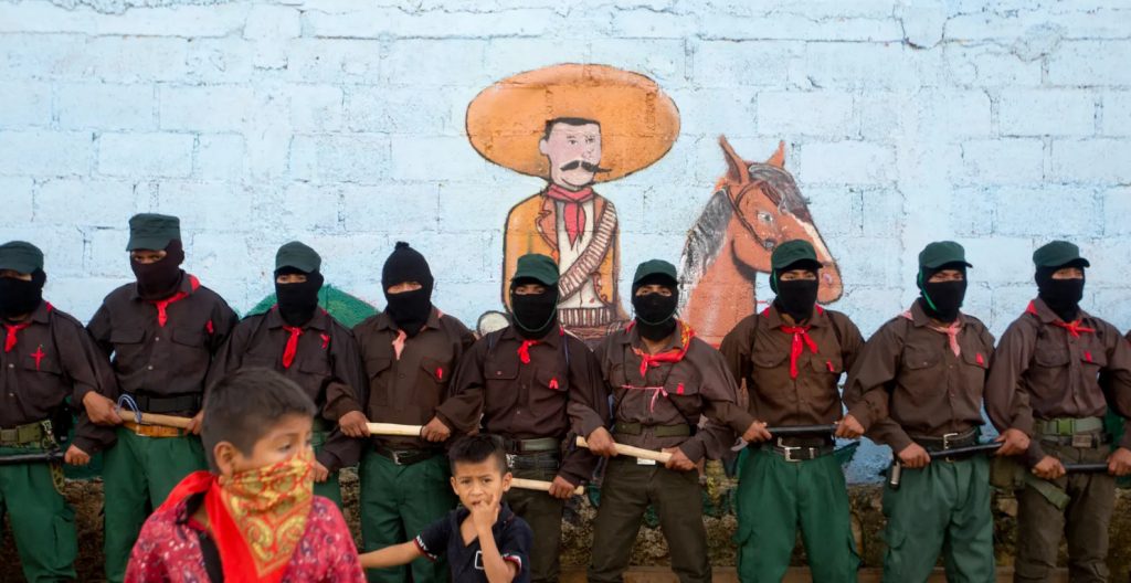
In the early 90's a guerrilla group, known as the Zapatista National Liberation Army named after Emiliano Zapata, a popular hero of the 1910-1917 Mexican Revolution who defended poor peasants’ rights to free land seized from wealthy landowners, has caused skirmishes with the Federal Mexican Government in the area and back in 1994 even occupied the main plaza - all of which adds to the bohemian flair, sporting mannequins in balaclavas, playing revolutionary music and selling T-shirts. Images of Che Guevara mix with those of Subcomandante Marcos, the poetic, pipe-smoking political philosopher who declared that the “fourth world war against neoliberalism and oblivion”. ...
JOIN THE PANAMA POSSE >>>
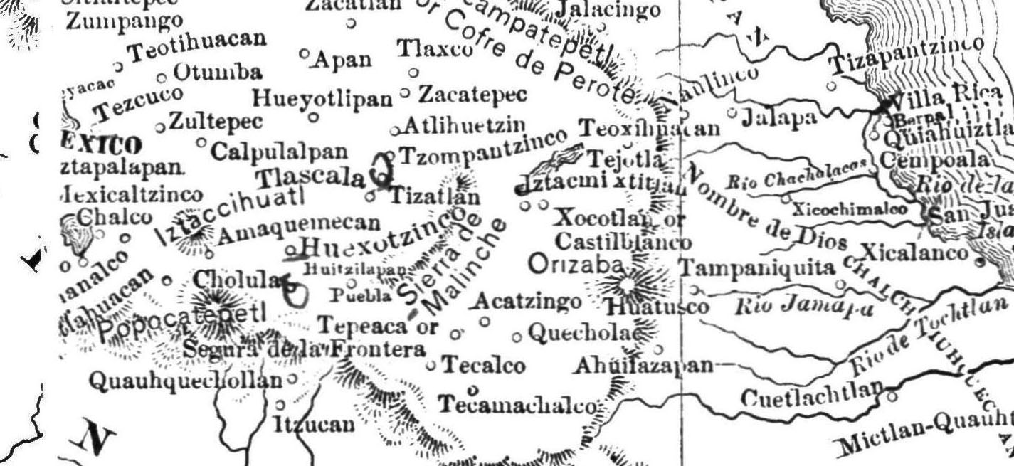
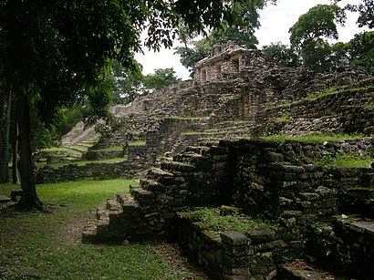
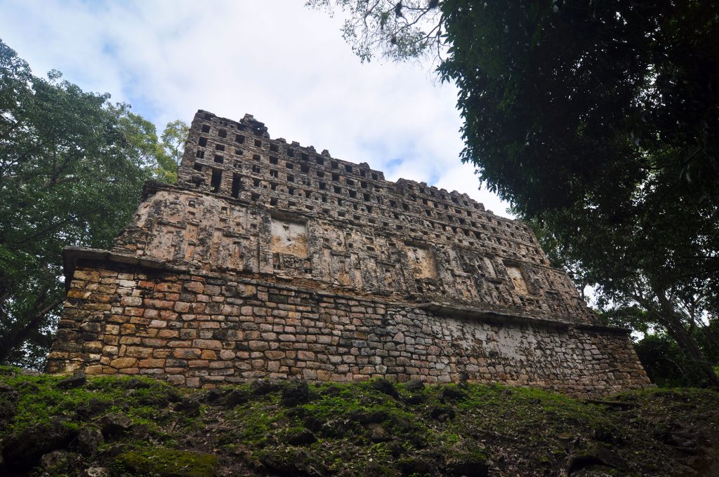
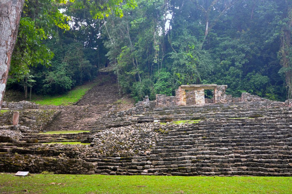
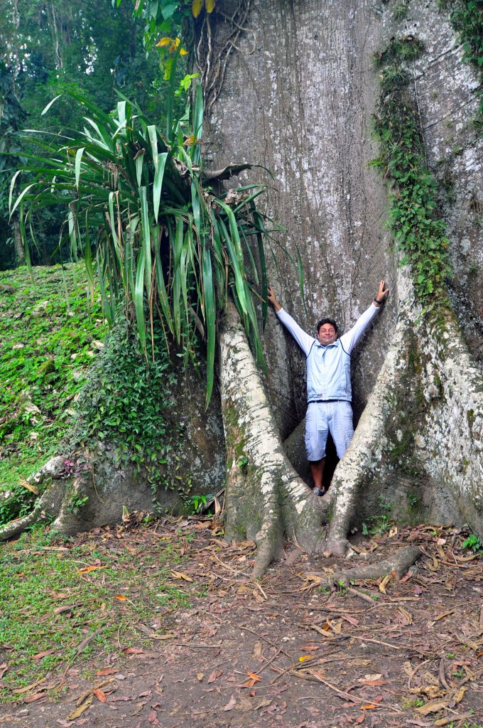
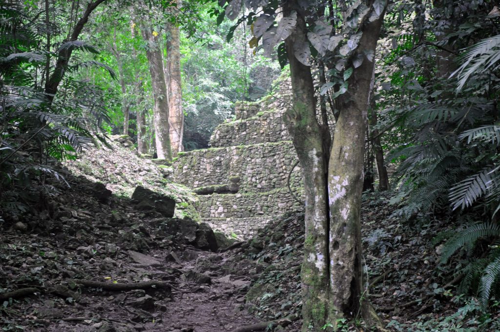
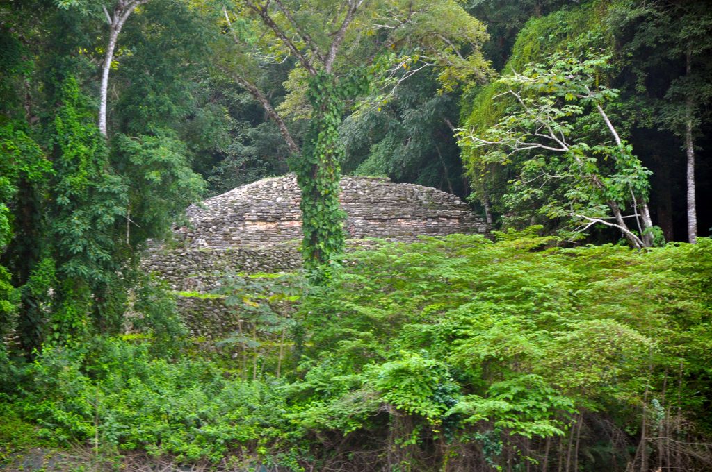
🇲🇽 YAXCHILAN
Yaxchilan is an ancient Maya city located on the bank of the Usumacinta River in the state of Chiapas, Mexico. During the height of its power the kings of Yaxchilan built gleaming temples, pyramids, and luxurious palaces clustered along the grand plaza and was one of the most powerful Maya states along the course of the Usumacinta River, with Piedras Negras as its major rival. Architectural styles demonstrate clear differences that mark a clear boundary between the two kingdoms.
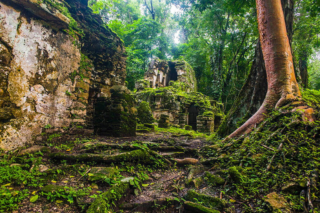
In 1882 archeologist Desire Charnay named it City Lorilla but Yaxchilan was a large center, important throughout the Classic era, and the dominant power over such smaller sites as Bonampak and was a rival of Palenque, with which Yaxchilan warred in 654.
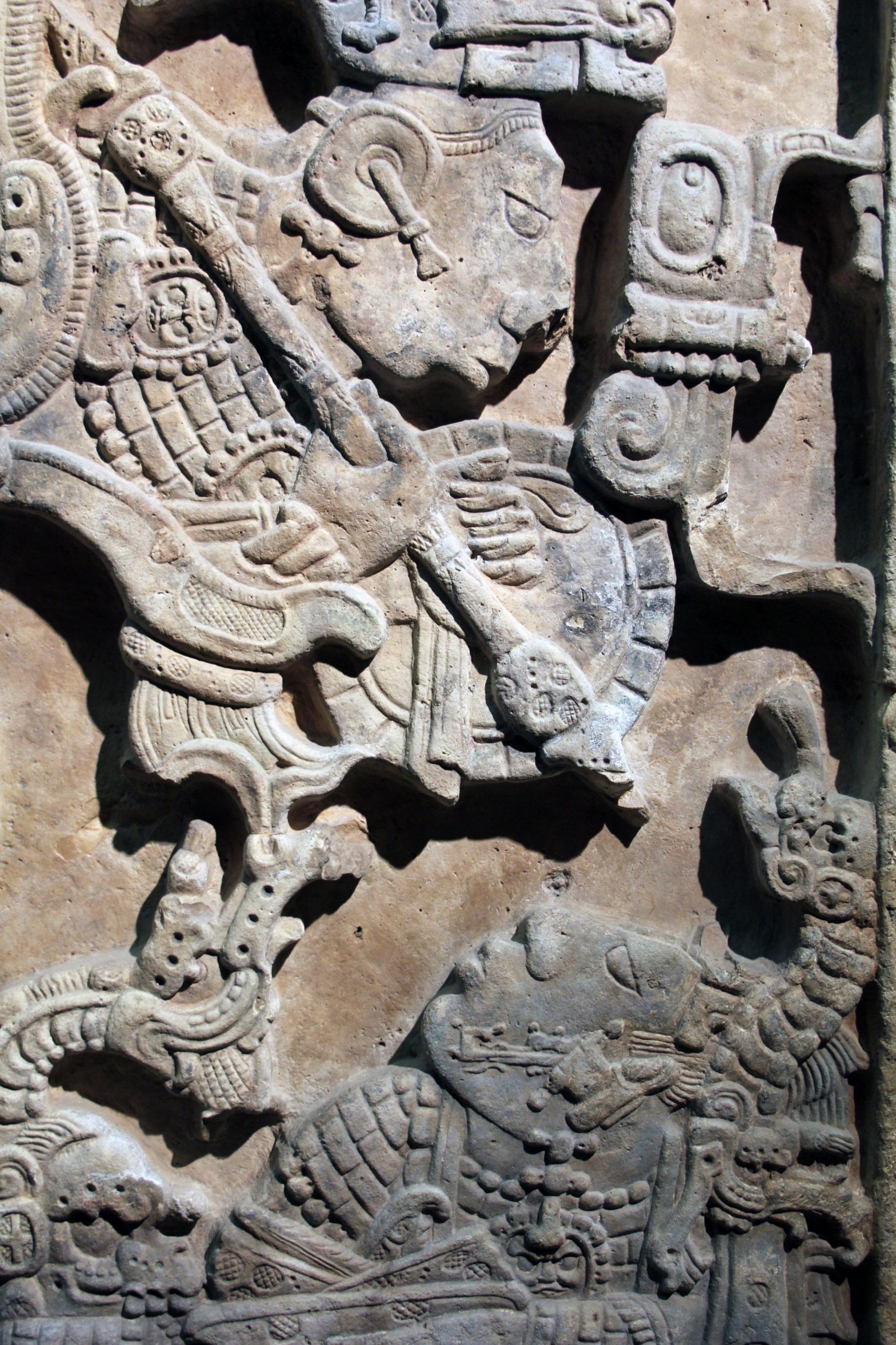
The site is particularly known for its well-preserved sculptured stone lintels set above the doorways of the main structures which contain hieroglyphic texts describing the dynastic history of the city.
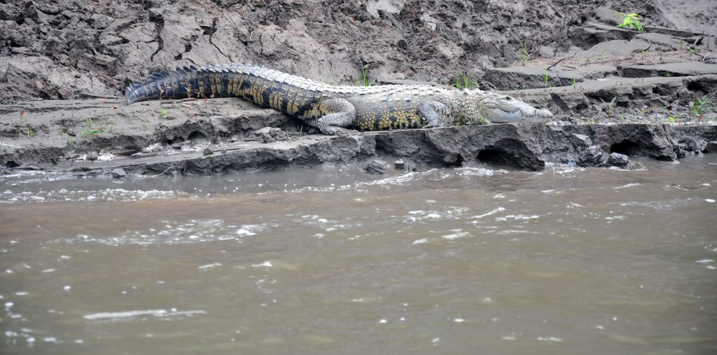
Yaxchilan is located on the south bank of the Usumacinta River at the apex of a horseshoe-shaped river bend.
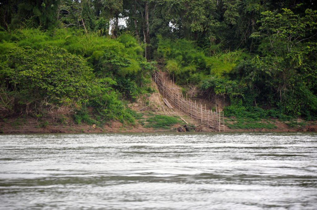
This loop defends the site on all sides except for a narrow land approach from the south. This natural barrier protected the city from invasion from outside forces. However, the river was in a high flood stage during the six month rainy season, during this time Yaxchilan became an island due to the swiftly flowing waters of the engorged river which encompassed the city. An all-weather passage across the treacherous river was a necessity in order to gain access to the farmlands to the north of the city.
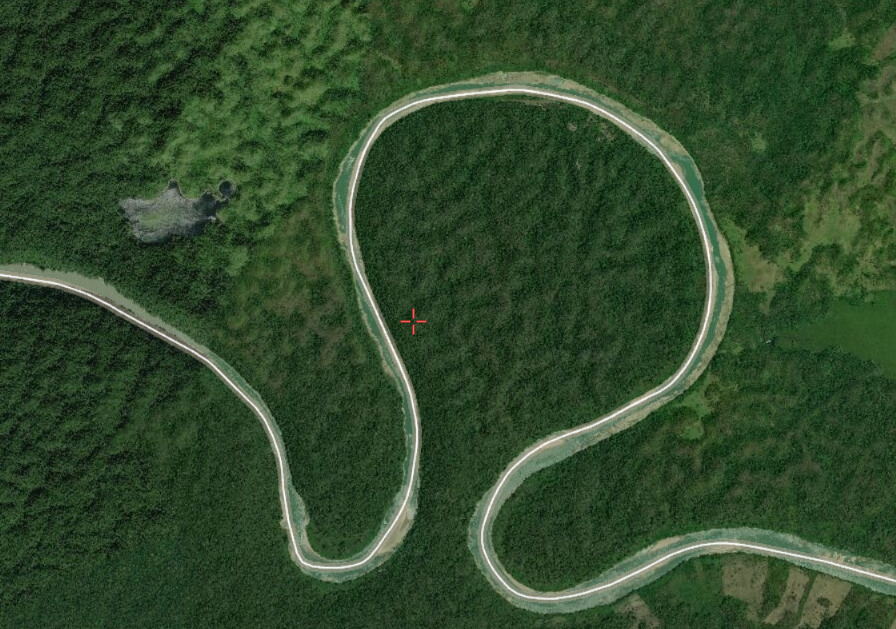
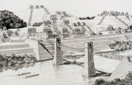
Yaxchilan had long been known to include an unusual raised terrace beside the river and pier in the river; these structures were long theorized to be the remains of a bridge thought to have been a suspension bridge built by the Maya across the River. If so, it would have been the longest bridge discovered in the ancient world. Yaxchilan required a dependable passageway to provide an uninterrupted flow of traffic across the river on a year-round basis.
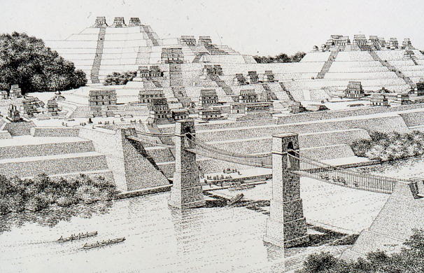
The prevailing theory is by constructing a 100-meter long suspension bridge featuring three spans extended from a platform on the grand plaza of Yaxchilan crossing the river to the northern shore. This span would be the longest in the world until the construction of the Italian Trezzo sull'Adda Bridge in 1377 and this unique feat of engineering has been virtually reconstructed by computer by archaeoengineering techniques by Engineer James A O'Kon PE. Results of this hypothesis were presented to the archaeological and engineering world in the pages of National Geographic magazine in 1995.
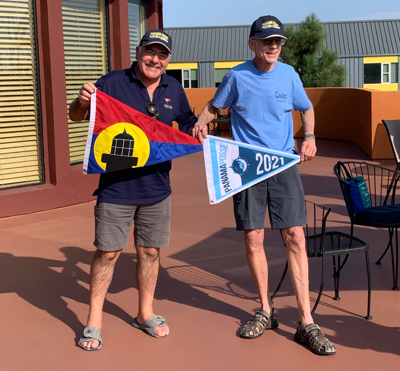
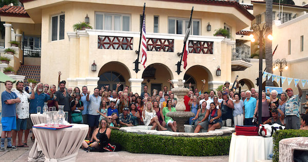
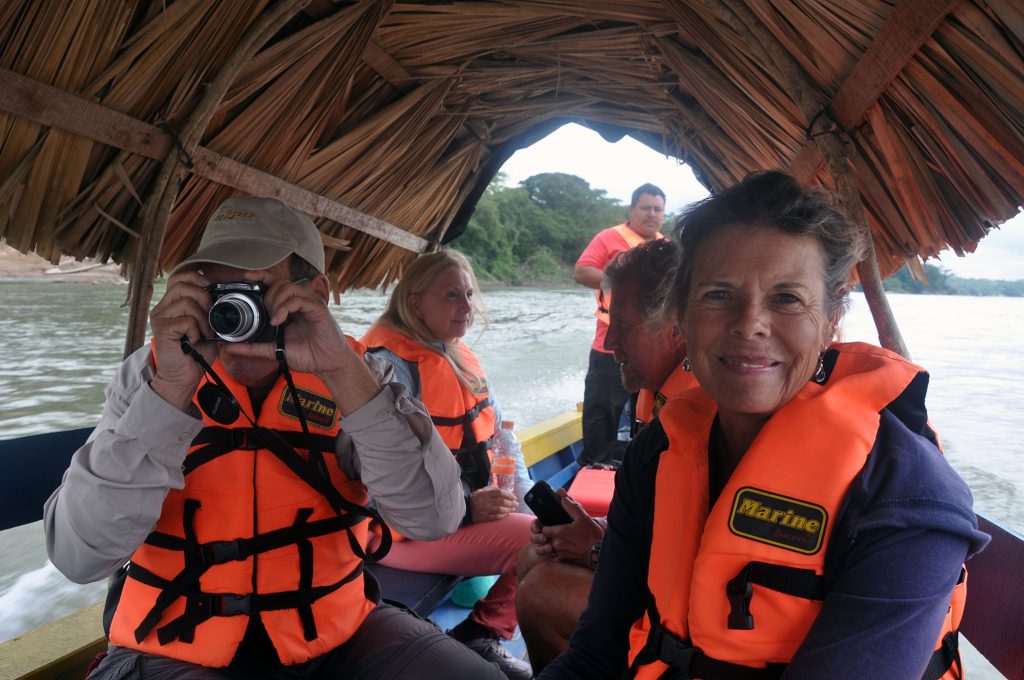
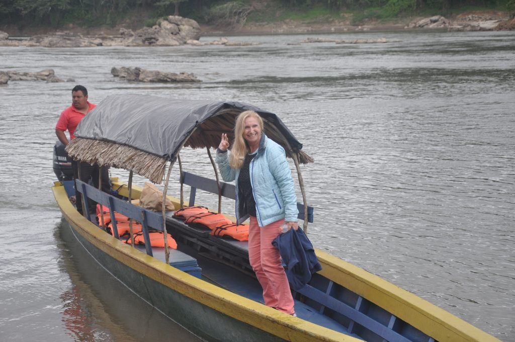
The First Panama Posse gang to visit Yaxchilan was SV RESPITE / MY CROSSROADS AND SV CARINTHIA utilizing local knowledge by LUIS a Chiapas based bilingual tour-guide which still operates in the area. The Area and adjacent world heritage sites are bets accessed via a multi-day excursion from Marina Chiapas a sponsor of the Panama Posse.
MY CROSSROADS
![]()