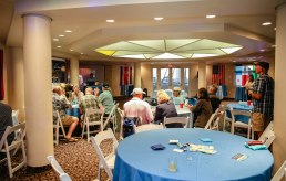
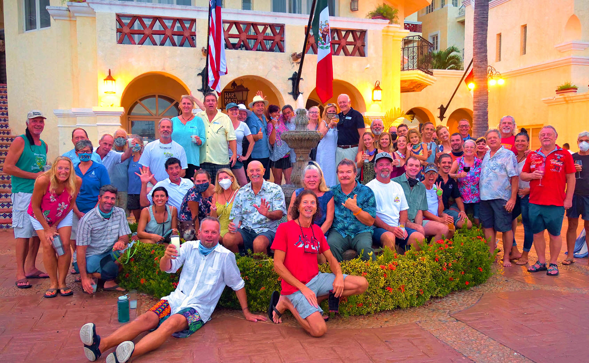
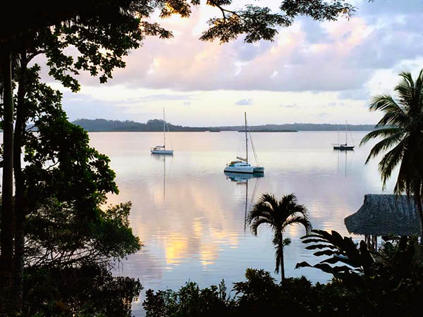
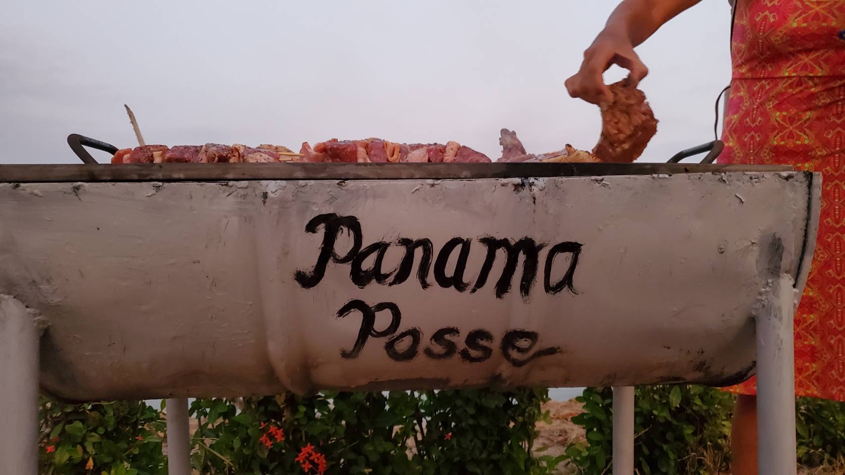
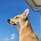
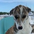
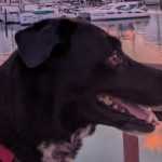
SATURDAY OCT 28 2024 @ 13:00 @ SAFE HARBOR SOUTH BAY EVENT CENTER ° SAN DIEGO
SAFE HARBOR SOUTH BAY
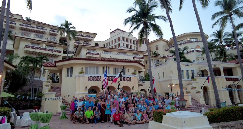
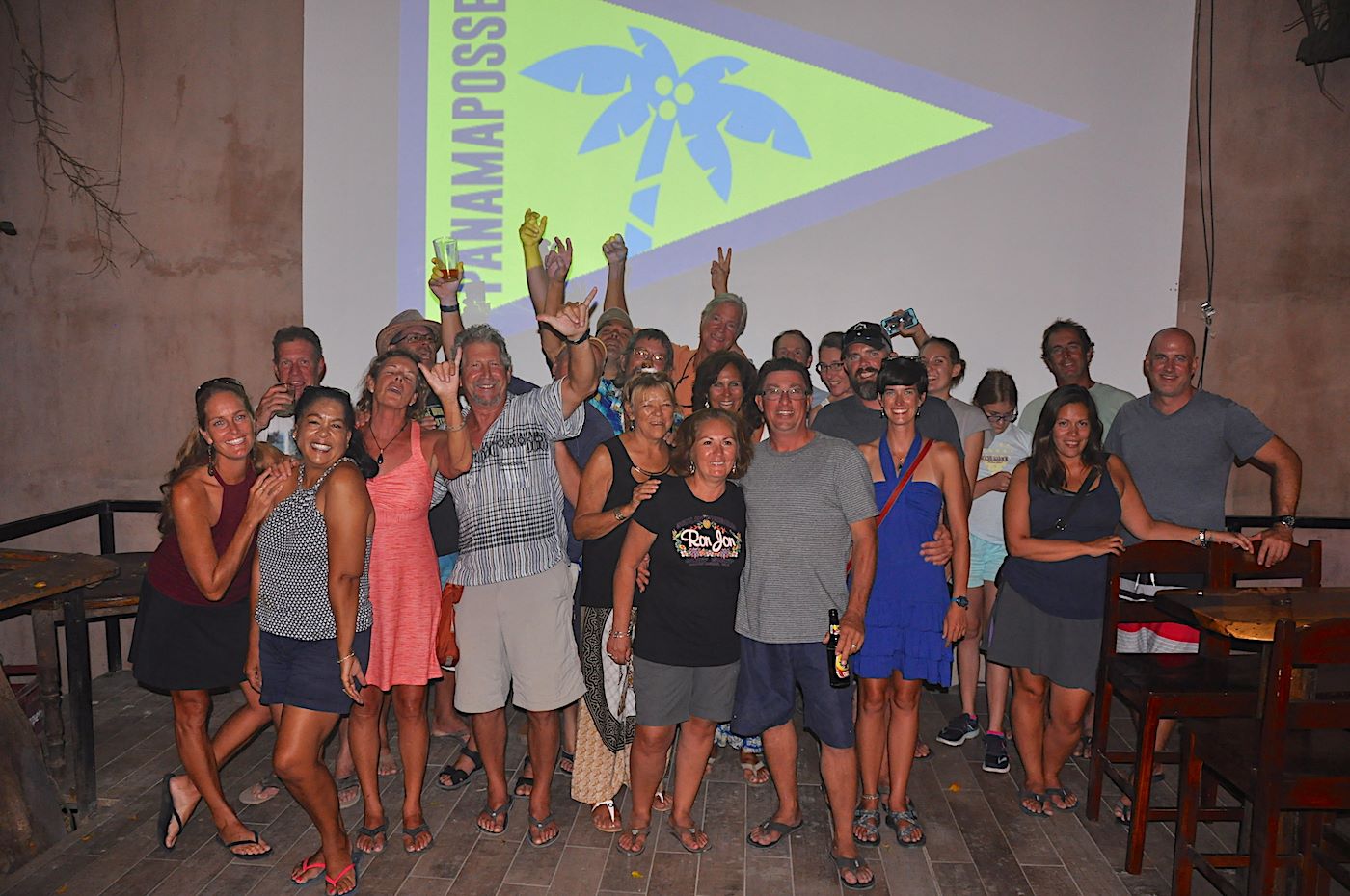
PANAMA POSSE KICK OFF PARTY ° SAN DIEGO ° CHULA VISTA °
THIS EVENT WAS SATURDAY OCTOBER 28th, 2023
'23 SEASON PICKS


SPONSORED BY:
| SAFE HARBOR SOUTH BAY |
'22 SEASON PICKS


event planning details >>
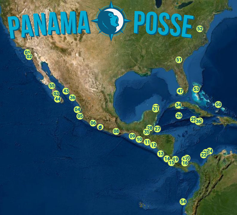
2022-2023-vessels
🇺🇸🇨🇦🇳🇿🇬🇧🇦🇺🇮🇹🇩🇪🇨🇰🇻🇬🇬🇬🇳🇱🇻🇮🇪🇸🇿🇦🇧🇪🇯🇪🇬🇮🇧🇲🇸🇮🇨🇭🇻🇬🇲🇭🇫🇷🇵🇦🇸🇪🇩🇰🇹🇷🇦🇹🇳🇴
📍 VESSEL TRACKING | 🔒 VESSEL CONTACT SHEET |✔️ VESSEL REQUIREMENTS | 🕫 VESSEL UPDATES |🔍 Search THIS PAGE
| 01 ® ☸️ | DELOS |    |
Seattle, WA | 🇺🇸 | Amel 53' | |
| 02 ® 🦜 LV | MAISON DE SANTÉ |    |
San Diego, CA |  |
Cal 46' | |
| 03 ® ☸️ | CALICO SKIES |   |
New York, NY | 🇺🇸 | Sabre 36' | |
| 04 ® 🦜 | STRAY CAT |   |
Seattle, WA | 🇺🇸 | PDQ 34' | |
| 05 ® 🌿 ☸️ | DELTA SWIZZLER |   |
San Francisco, CA | 🇺🇸 | Vantare 58' | |
| 06 ® 🦜 | NAVIGATOR |  |
Kona, HI | 🇺🇸 | Nordhavn 46′ | |
| 07 🌿 | ELEUTHERA |   |
Auckland, NZ | 🇳🇿 | Fountaine Pajot 59' | |
| 08 ® 🍹 🦜 | TOKETEE |    |
Gresham, OR | 🇺🇸 | Skookum 53' | |
09 ® 🦜  |
CARINTHIA |
   |
Las Vegas, NV | 🇺🇸 | Lagoon 44' | |
| 10 ® ☸️ 🦜 | KNOT RIGHT |   |
Annandale, VA | 🇺🇸 | Beneteau 47' | |
| 11 ® 🌿 | PISCES |  |
China Spring, TX | 🇺🇸 | Antares 44' | |
| 12 ® ☸️ 🌿 | RUM TRUFFLE |   |
London, UK | 🇬🇧 | Moody 49' | |
| 13 ® 🥥 🦜 |
RED ROVER |   |
Seattle, WA | 🇺🇸 | Nordhavn 55' | |
| 14 ® 💰 | SEA ANGEL |
 |
Destin, FL | 🇺🇸 | Sparkman Stevens 88' | |
| 15 💰 | TERRAPIN |   |
Morehead City, NC | 🇺🇸 | Nordhavn 58' | |
| 16 🌵 | FICKLE |
   |
Marina del Rey, CA | |
Hunter 42' | |
| 17 🥥 🦜 |
CERCA TROVA |   |
Portland, OR | |
Manta Mk IV 42'′ | |
| 18 🥥 | EPSILON | 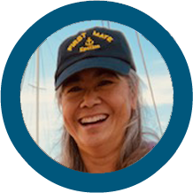 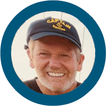 |
Morgan Hill, CA | 🇺🇸 | Island Packet 41' | |
| 19 💰 | ISIDORE |   |
Whitehorse, Canada | 🇨🇦 | Tashing Tashiba 36' | |
| 20 🌿 | THINK GOOD THOUGHTS |   |
Point Loma, CA | 🇺🇸 | Outremer 49' | |
| 21 🥥 ® | KATMANDU |  |
Boulder, CO | 🇺🇸 | Lagoon 42' | |
| 22 💰 | DESTINY | Palmetto, FL | 🇺🇸 | Hatteras 56' | ||
| 23 ® 🦜 | TULUM5 |  |
29 Palms, CA | 🇺🇸 | Chung Hua 51' | |
| 24 ® 🌿 | ACQUA | Messina, ITALY | 🇮🇹 | Alliage 50' | ||
| 25 💰 | HONU KAI |  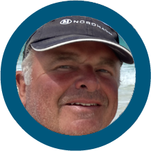  |
Toronto, CANADA | 🇨🇦 | Nordhavn 47' | |
| 26 🦜 | PTF-26 |   |
Port of Paducah, KY | 🇺🇸 | Sewart Seacraft (Swiftships) 95' | |
| 27 ® 🦜 | SEA TRIAL |
   |
Laguna Beach, CA | 🇺🇸 | Nordhavn 55' | |
| 28 🦜 | SUDDEN INSPIRATION |
  |
Seattle, WA | 🇺🇸 | Navigator 58' | |
| 29 ® 🦀 | SOLMATE |   |
Green Cove Springs, FL | 🇺🇸 | Fountaine Pajot 45′ | |
| 30 ® ☠️ | AVANT |   |
Vancouver, BC | 🇨🇦 | Beneteau 43.5' | |
| 31 ☸️ ® | EMMY KATE |   |
Sanibel, FL | 🇺🇸 | Lagoon 40' | |
| 32 💰 | EASY ONE |   |
Würzburg, GERMANY | 🇩🇪 | Bavaria 46' | |
| 33 ® 🦜 | GREEN FLASH |   |
Long Beach, CA | 🇺🇸 | Beneteau 35' | |
| 34 ® 🦜 🌵 | SAPHIRA |   |
Georgetown, CAYMAN ISLANDS |
 |
Goetz Composites 70' | |
| 35 ® 🦜 🍹 | JUNGLE |   |
Tacoma, WA | 🇺🇸 | Sea Horse Mandarian 52' | |
| 36 ® 🦜 | MAGIC CARPET |  |
San Diego, CA | 🇺🇸 | Custom Dutch Built 60' | |
| 37 🦜 | PELERIN |   |
Victoria, BC | 🇨🇦 | Alubat 43' | |
| 38 ® 🦜 | L EXCURSION I |   |
Victoria, BC | 🇨🇦 | Fountain Pajot 37' | |
| 39 ® 🦜 | PATHFINDER |
  |
North Oaks, MN | 🇺🇸 | Lagoon 39' | |
| 40 ® 🦜 | RAMBLE ON ROSE |   |
San Francisco, CA | 🇺🇸 | Caliber 40' | |
| 41 🌵🍹 | SEEKER |   |
Omaha, NE | 🇺🇸 | Selene 62' | |
| 42 ☸️ | DANCING ON THE EDGE |
  |
Oriental, NC | 🇺🇸 | Island Packet 53' | |
| 43 ® 🦜 | KYRIE |      |
Juneau, AK | |
Prout 37' | |
| 44 ® 🥥 🦜 | AKIA |   |
Anacortes, WA | |
Jensen Marine 46′ | |
| 45 🌵 🦜 ® | MAPACHE 2.0 |
  |
Portland, OR | 🇺🇸 | Hans Christian 462' | |
| 46 🌿 ® | WHITE WINGS |   |
Annapolis, MD | 🇺🇸 | Leopard 48' | |
| 47 ® | LORIEN |    |
Portland, OR | 🇺🇸 | Garcia 48' | |
| 48 🥥 🦜 | SANS CLÉS |  |
Boca Raton, FL | 🇺🇸 | Passport 43' | |
| 49 ® ☠️ | SHEARWATER |   |
Santa Cruz, CA | |
Formosa 50' | |
| 50 ® 🌿 ☠️ | SEA FOREVER |   |
Palmetto, Fl | 🇺🇸 | Catlina 42' | |
| 51 💰 | ROSAMARIA |   |
Seattle, WA | 🇺🇸 | Downeaster 38' | |
| 52 ® 🌵 🦜 | MARY ARLENE |  |
San Diego, CA | 🇺🇸 | Formosa 41' | |
| 53 ® 🦜 | MANGO |  |
Pensacola, FL | 🇺🇸 | Bristol 27' | |
| 54 ® 🦜 | SAIL FISH |   |
Truckee, CA | 🇺🇸 | Beneteau 39' | |
| 55 🌿 🏝️ | TUDO BEM |     |
Cook Islands | 🇨🇰 | Hallberg Rassy 43' | |
| 56 ® 🦜 | BRIGHTNEST |   |
Seattle, WA | 🇺🇸 | Island Packet 38.6' | |
| 57 ☸️ | BLUE BAMBOO |  |
Grand Junction, CO | 🇺🇸 | Maine Cat 38′ | |
| 58 ® 🦜 | MAKE ME LAUGH AGAIN |   |
Cedar Rapids, IA | 🇺🇸 | Island Packet 45' | |
| 59 ® 🌵 🦜 | RHUMBLINE |  |
Tarpon Springs , Fl | 🇺🇸 | Cheoy Lee 44' | |
| 60 ® 🥥 🦜 | AEGIS |   |
Victoria, BC | 🇨🇦 | Nordhavn 40' | |
| 61 ® 🦜 | PILIALOHA |   |
Kaneohe, HI | 🇺🇸 | Beneteau '37 | |
| 62 🥥 🦜 | DA MMAD CAT |    |
Mashpee Neck, MA | 🇺🇸 | Lagoon '42 | |
| 63 ® 🦜 | XENIA |   |
Honokohau, HI | 🇺🇸 | Gemini 32' | |
| 64 💰 ☸️ | LEMA | West Barnatable, MA | 🇺🇸 | Amel 54 ' | ||
| 65 🦜 | TRIUMPH |   |
San Diego, CA | 🇺🇸 | Cabot 36' | |
| 66 🦜 🥥 🌵 | VIA | Seattle, WA | 🇺🇸 | Caliber 40' | ||
| 67 🥥 🌵 🦜 | VIAGGIO |   |
San Diego, CA | 🇺🇸 | Gulfstar 43' | |
| 68 ® 🦜 | SECOND WIND |  |
Portland, OR | 🇺🇸 | Tayana 37' | |
| 69 🦜 🥥 | VANCHANG |    |
Denver, CO | 🇺🇸 | Lagoon 38' | |
| 70 🦜 🥥 | QUESO GRANDE II |   |
Semiahmoo, WA | 🇺🇸 | Seawind 41' | |
| 71 ☸️ ® | ENJOY |   |
Annapolis, MD | 🇺🇸 | ||
| 72 🥥 ® | SONHO |   |
Oceanside, CA | 🇺🇸 | Baba 35' | |
| 73 🥥 🦜🍹 | FREEDOM |   |
Dana Point, CA | 🇺🇸 | Beneteau 55' | |
| 74 🦜 🏝️ | ALMA FEROZ |   |
Pagosa Springs, CO | 🇺🇸 | Dufour 42' | |
| 75 🌿☠️ | LADY BLUE |  |
Hamburg, DE | 🇩🇪 | Feltz 46' | |
| 76 🌿 ☸️ | CAT TALES |  |
Miami, FL | 🇺🇸 | Privilege 37' | |
| 77 🦜 | HYPNAUTIC II | Victoria, BC | 🇨🇦 | Navigator yachts 63.5' | ||
| 78 ® 🦜 | YO-D-YO |   |
RENO, NV | |
Hunter 45' | |
| 79 🦜 | PAPAHOBO |   |
Plymouth, UK | 🇬🇧 | Mason 40' | |
| 80 ® 🥥 🦜 🍹 | RAINBOWS END |   |
George Town, Cayman Islands | 🇰🇾 | Nordhavn 60' | |
| 81 🦜 🏝️ | BRIZO X |  |
Vancouver, BC | 🇨🇦 | Trintella 42' | |
| 82 ® 🥥 🦜 | BOHEMIA |   |
San Francisco, CA | 🇺🇸 | Beneteau 36' | |
| 83 ® 🦜 | STAND DOWN |   |
Polson, MT | 🇺🇸 | Fleming 53' | |
| 84 ® 🦀 💰 | JUPITER 2 |  |
Brisbane, AUSTRALIA | 🇦🇺 | Mumby 48' | |
| 85 ® 🥥🦜 | BOUNDLESS |   |
San Francisco, CA | |
Passport 42' | |
| 86 ☸️ ® | CARPE DIEM |   |
San Diego, CA | 🇺🇸 | Franchini 47' | |
| 87 🥥 🦜 🍹 | LONG WINDID |   |
San Diego, CA | 🇺🇸 | Jeanneau 42' | |
| 88 🦜 🍹 ® | CODA |    |
Seattle, WA | 🇺🇸 | American tug 45' | |
| 89 ® 🦀 💰 | ROSIE 2 |  |
Italy, TX | 🇺🇸 | Antigua Sloop 49' | |
| 90 ® 🦜 | KARUNA |   |
San Diego, CA | 🇺🇸 | Ta Shing Panda 40' | |
| 91 🦜 | DOS ROJOS |   |
Portland, OR | 🇺🇸 | Kadey-Krogen 53' | |
| 92 ☸️ ® | BISOU |   |
Port Stephens, AUSTRALIA | 🇦🇺 | Fountaine Pajot 44' | |
| 93 ® 🦜 | LAST ARROW |  |
Vancouver, BC | 🇨🇦 | Nordhavn 65' | |
| 94 ® 🦜 🥥 | MAR Y SOL |   |
Long Beach, CA | 🇺🇸 | Downeaster 38' | |
| 95 ® 🦜 | GITANA II |  |
Vancouver, BC | 🇨🇦 | Nordhavn ' | |
| 96 ® 🦜 🍹 | LOLA |   |
Washington, WA | 🇺🇸 | Catana 47 ' | |
| 97 ® 🦜 | AZURE |   |
Sultan, WA | 🇺🇸 | Cheoy Lee 61' | |
| 98 🌵 🦜 | HULA KAI |   |
Blaine, WA | 🇺🇸 | Tayana DS 48' | |
| 99 🌵 🦜 | JUBEL |  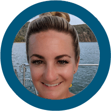 |
Victoria, BC | 🇺🇸 | Gulfstar 44' | |
| 100 ® 🌿 ☸️ | MIRA |   |
Atlanta, GA | 🇺🇸 | Antares 44' | |
| 101 ® 🌵 🥥 🦜 | TITS PIERRE |    |
San Perdro, CA | 🇺🇸 | Bayliner 45' | |
| 102 ® ☠️ | PACIFIC RAVEN |   |
Reno, NV | 🇺🇸 | Hunter 40.5' | |
| 103 ® 🏝️ | WONOMA |   |
Montreal, CANADA | 🇨🇦 | Dufour 37' | |
| 104 ® | NAO SANTA MARIA |  |
Huelva, SPAIN | 🇪🇸 | Fundacion Nao Victoria 92' | |
| 105 ® ☠️ | ONE LIFE |   |
Boise, ID | 🇺🇸 | Nordhavn 46' | |
| 106 ® 🌿 ☸️ 🌵 | STELLA BLUE |  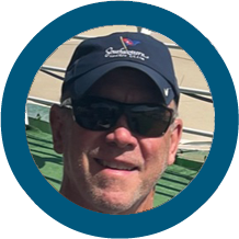 |
Green Cove Springs, FL | 🇺🇸 | Hunter 46' | |
| 107 🌿 | REMEDY |  |
Annapolis, MD | 🇺🇸 | Pacific Seacraft 37' | |
| 108 ® 🥥 🦜 | SOULMATE |
   |
Carefree, AZ | 🇺🇸 | Hatteras 63' | |
| 109 ® ☠️ 🍹 | HOPE |  |
Bristol, RI | 🇺🇸 | Hylas 49' | |
| 110 🌵 🦜 🍹 | GHILLIE II |   |
Victoria, BC, CANADA | 🇨🇦 | Custom 67' | |
| 111 ® 🌵 | TEMPTRESS |  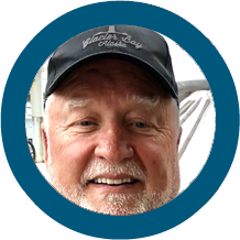 |
Newport Beach, CA | 🇺🇸 | Ocean Alexander 85' | |
| 112 🌵 🦜 | QUE VENDRA |   |
Seattle, WA | 🇺🇸 | Outbound 46' | |
| 113 ☠️ 🍹 | WANDERFUL |  |
Houston, TX | 🇺🇸 | Beneteau 49' | |
| 114 🥥🦜 | TIDEWALKER |  |
Vancouver Island, CANADA | 🇨🇦 | Nordhavn 57' | |
| 115 🦀 💰 ☸️ 🌊 | LADY SLIPPER |   |
Racine, WI | 🇺🇸 | Dufour 41' | |
| 116 ☸️ | ROXXY |
  |
Friday Harbor, WA | 🇺🇸 | Beneteau 52' | |
| 117 | INDUSTRY | Bellingham, WA | 🇺🇸 | Nichols 40' | ||
| 118 ® 🥥 | TESORO |   |
Bikini , Marshall Islands | 🇲🇭 | Nordhavn 55' | |
| 119 ® 🦜 | BELLA SIRENA |  |
San Francisco, CA | 🇺🇸 | Pacific Seacraft 45′ | |
| 120 💰 | BLUEBIRD |   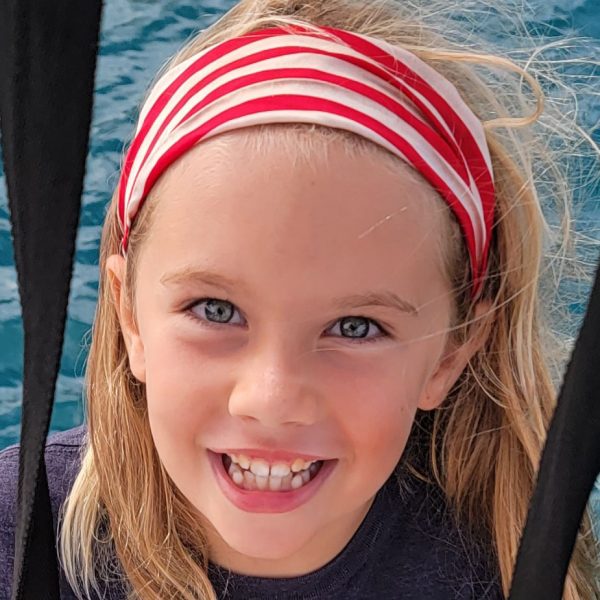  |
Lake Tahoe, NV | 🇺🇸 | Privilege 50′ | |
| 121 🦜 | BELA JUJU |  |
Marina Del Rey, CA | 🇺🇸 | Jeanneau 64′ | |
| 122 ☸️ | LA PAZ |   |
San Diego, CA | 🇺🇸 | Lagoon 45′ | |
| 123 🦜 | SEAS THE DAY 11 |   |
Heritage Pointe, BVI | 🇻🇬 | Prestige 72' | |
| 124 🦜 🌵 | AIR BENDER |   |
Honolulu, HI | 🇺🇸 | Lagoon 42′ | |
| 125 ☸️ | LAZYDAY | Alliance, NE | 🇺🇸 | Kirie Feeling 44′ | ||
| 126 ☸️ | GALATEA |   |
Milwaukee, WI | 🇺🇸 | Morgan 46′ | |
| 127 ® 🌵 | CAYENNE | Green Cove Springs, FL | 🇺🇸 | Kingdragon Passport 40 ′ | ||
| 128 🦜 | AUDREY MAE II |   |
Edmonton, CANADA | 🇨🇦 | Nordhavn 57′ | |
| 129 🌿 ® | JETWAVE AVALON |   |
Fremantle, WA | 🇺🇸 | Peter Wormwood Designs 55' | |
| 130 ® 🦜 🌵 | STRAY CAT 2 |   |
Vancouver, BC, CANADA | 🇨🇦 | Lagoon 38' | |
| 131 ® 🌿 | WIZARD |  |
GUERNSEY, UK | 🇬🇬 | Elan Marine 40' | |
| 132 ® | MOOMBA |   |
Seattle, WA | 🇺🇸 | Seamaster 46' | |
| 133 🦀 💰 | ORENDA |   |
Richland, WA | 🇺🇸 | Nordhavn 55' | |
| 134 💰☸️ | SALPARE |   |
Kapolei, HI | 🇺🇸 | Fountaine Pajot Orana 44' | |
| 135 ® 🦜 🌵 | HUAKA'I |  |
Seattle, WA
|
🇺🇸 | Beneteau 42’ | |
| 136 ® 🦜 | KIANA |   |
Ketchikan, AK | 🇺🇸 | WAUQUIEZ 41' | |
| 137 🌿 | ZEPHYR |   |
Snowmass, CO | 🇺🇸 | Lagoon 45' | |
| 138 ☠️ 🍹 | MESHUGGA | Road Harbour, BVI | 🇻🇬 | Lagoon 62' | ||
| 139 🥥 🦜 | TRANQUILO |   |
Channel Islands Harbor, CA | 🇺🇸 | Catalina 44' | |
| 140 ® | LOPAKA |   |
Kona, HI | 🇺🇸 | Catana 47' | |
| 141 🌿 ☠️ | PACIFIC BLUE | Groningen, NETHERLANDS | 🇳🇱 | Breehorn 44' | ||
| 142 💰® | WILDHOOD |     |
Kingston, Ontario | 🇨🇦 | Perry Catamarans 43' | |
| 143 ☸️ | ALU'EVA |  |
Holstein, GERMANY | 🇩🇪 | Dufour Nautitech 48' | |
| 144 🦜 | C-YA |  |
Sedro Wolley, WA | 🇺🇸 | Island Packet 38.8' | |
| 145 🦜 ® | CURANDERA |   |
Minneapolis, MN | |
Nordhavn 43' | |
| 146 🦜 | IT'S ABOUT TIME |    |
San Diego,CA | 🇺🇸 | Hunter 42' | |
| 147 🦜 | WE NO KEA | Costa Mesa,CA | 🇺🇸 | Irwin 38' | ||
| 148 ☸️ ® | NEW HORIZONS | San Diego,CA | 🇺🇸 | Tayana 55' | ||
| 149 🦜 | DEJA' VU | Chelan,WA | 🇺🇸 | Hunter 49' | ||
| 150 ☠️ ® | COOLRUNNINGS |  |
Panama, PANAMA | 🇵🇦 | Catalac '30 | |
| 151 🌿 | EMANUEL IV |   |
St. Thomas, USVI | 🇻🇮 | Manta '40 | |
| 152 🥥 ® | ILIOHALE |     |
Larkspur, CA | 🇺🇸 | Lagoon 450s ' | |
| 153 ☸️ ® | SPILL THE WINE |   |
ZAP, ND | 🇺🇸 | Jeanneau 42′ | |
| 154 ® 🍹 ☠️ ® | AZIMUTH |   |
Oakland, CA | 🇺🇸 | Pearson 36.5 ′ | |
| 155 ☸️ | DO THE THING |   |
Montreal, CANADA | 🇨🇦 | Dufour 43' | |
| 156 🥥 🦜 | SERENITY_ |   |
Boise, ID | 🇺🇸 | Antares 44' | |
| 157 🥥 🦜 | DAZE DREAM | Brewster, WA | 🇺🇸 | Islander 41' | ||
| 158 🌵 🦜 | PASARGADA |   |
Seattle, WA | 🇺🇸 | Hallberg-Rassy 36' | |
| 159 ☸️ 🌿 | AMAROK | Lake Tahoe, CA | 🇺🇸 | Nordhavn 40' | ||
| 160 🌿 | FULMO |   |
Rostock, GERMANY | 🇩🇪 | Hallberg Rassy 42' | |
| 161 🌿 | HIRONDELLE |  |
Dartmouth, UK | 🇬🇧 | Dufour 37' | |
| 162 ® ☸️ | GADABOUT |   |
Anacortes, WA | 🇺🇸 | Tayana 48' | |
| 163 🌿 | ADEL | Horn Bad Meinberg, GERMANY | 🇩🇪 | Lagoon 39' | ||
| 164 🌿 | MORGANE OF SARK |   |
Amsterdam, NETHERLANDS | 🇳🇱 | Hallberg Rassy 46' | |
| 165 🌿 | FLIP FLOP | Karlsruhe, GERMANY | 🇩🇪 | R & C Leopard 37' | ||
| 166 🦜 | AVOGATO |    |
Albany, CO | 🇺🇸 | Amel 53' | |
| 167 🥥 🦜 | ORCA |   |
Nederland, CO | 🇺🇸 | Tayana 42' | |
| 168 ® | YAHTZEE |     |
Seward, AK | 🇺🇸 | Grand Soleil 39' | |
| 169 🌿 | ALAMEA | Wismar, GERMANY | 🇩🇪 | African Cats 43' | ||
| 170 🌿 | MARIA NOA |   |
Hamburg, GERMANY | 🇩🇪 | Lagoon 39' | |
| 171 🌿 🧭 | DIVERGENT |  |
Sequim, WA | 🇺🇸 | Lagoon 420F' | |
| 172 🌿 | COPEPOD | Inverness, SCOTTLAND | 🇬🇧 | Hallberg Rassy 43' | ||
| 173 ®🦜 | BEATA |  |
San Diego, CA | 🇺🇸 | Beneteau 45′ | |
| 174 ® 🦜 | IMPULSE |  |
Portland, OR | |
Selene 53' | |
| 175 ® 🥥 🦜 | JO |  |
San Diego, CA | |
Island Packet 40' | |
| 176 🥥 🦜 | MARTINI | Liberty Hill, TX | 🇺🇸 | Nordhavn 64′ | ||
| 177 🌿💰 | DRAGONFLY |    |
Captiva, FL | 🇺🇸 | Leopard 46′ | |
| 178 ® 🌿 🏝️ | PAREM |  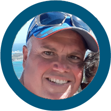 |
Ocean Springs, MS | 🇺🇸 | Lagoon 44' | |
| 179 🥥 🦜 | ROCHAMBEAU |   |
Los Angeles, CA | 🇺🇸 | Lagoon 39′ | |
| 180 ® 🌿 ☸️ | BELUGA |   |
Durban, SOUTH AFRICA | 🇿🇦 | Charter Cats 38' | |
| 181 🥥 🦜 🏝️ | HOPTOAD |   |
Seattle, WA | 🇺🇸 | Moody 46' | |
| 182 ☸️ | MONARA | 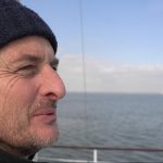 |
Antwerp, BELGIUM | 🇧🇪 | Delft 65' | |
| 183 ®
|
EXHIBITIONISM |    |
Houston, TX | 🇺🇸 | Tayana 70′ | |
| 184 ® 🦜 | GLADIATOR |   |
Portland, OR | 🇺🇸 | Beneteau 45' | |
| 185 🌿 | PANGAEA | Hamburg, GERMANY | 🇩🇪 | Amel 53' | ||
| 186 ® 🦜 🍹 | CODDIWOMPLE |   |
Astoria, OR | 🇺🇸 | Ta Shing 40' | |
| 187 ® 🦜 | VAGABUNDO DOS |   |
Fairbanks, AK | |
Island Packet 38' | |
| 188 ® 🦜 | NAKAMAL |   |
Tucson, AZ | 🇺🇸 | ||
| 189 🌵 🦜 | LA VIDA GYPSEA |    |
Kemah, TX | 🇺🇸 | Catana 47' | |
| 190 ® 🌵 🦜 | WILD |   |
San Antonio, TX | 🇺🇸 | Beneteau 42' | |
| 191 ® 🌿 ☠️ | MEDEA | 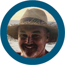 |
Brisbane, AUSTRALIA | 🇦🇺 | Bavaria 46' | |
| 192 ® 🌿 | NEW BEGINNINGS |   |
Cape Town, SA | 🇿🇦 | Robertson & Caine 48' | |
| 193 ☠️ | MILVINA | Montreal, CANADA | 🇨🇦 | Garcia Aluminium 47' | ||
| 194 ® ☸️ | SCOUT |   |
Austin, TX | 🇺🇸 | Robertson & Caine 48' | |
| 195 ® ☸️ | MACH3 |
 |
Scheveningen, NETHERLANDS | 🇳🇱 | Hallberg Rassy 49' | |
| 196 💰 ☸️ | INTREPID | Reno, NV | 🇺🇸 | Islander 36' | ||
| 197 🌿 ☸️ | ICAROS |
  |
Townsville, AUSTRALIA | 🇦🇺 | Catana 43.1' | |
| 198 ®🍹 ☠️ | FOOTLOOSE |   |
Roy, NM | 🇺🇸 | Catana 47' | |
| 199 🦀 💰 🏝️ | SOLACE | JERSEY | 🇯🇪 | Lagoon 42' | ||
| 200 🦀 💰 | EDELWEISS | Gloucester Point, VA | 🇺🇸 | Hunter 45' | ||
| 201 🥥 🦜 | SJ | Seattle, WA | 🇺🇸 | Tartan 48' | ||
| 202 ® 🦜 | KATHLEEN |   |
Seattle, WA | 🇺🇸 | Cal 39' | |
| 203 🌿 | KATINKA |   |
Stuttgart, GERMANY | 🇩🇪 | Sparr 41' | |
| 204 🌿 🏝️ | MANATEE |   |
Bonn, GERMANY | 🇩🇪 | Carter 33' | |
| 205 ⛯ ® | SEPHINA |   |
Boca Raton, FL | 🇺🇸 | Custom build 52' | |
| 206 🦜 ® | FIREFLY |   |
San Francisco, CA | 🇺🇸 | Catalina 47′ | |
| 207 🦀💰🏝️ | CLOUDY BAY |   |
GIBRALTAR | 🇬🇮 | Hallberg Rassy 54′ | |
| 208 🌿 🏝️ | TRANQUILLITY | Amsterdam, NETHERLANDS | 🇳🇱 | Scanmar 33′ | ||
| 209 🌿 🏝️ | ALLONZEE | Chichester, UK | 🇬🇧 | Amel 46' | ||
| 210 🍹🦀 | ZEN AGAIN |   |
Fremantle, AUSTRALIA | 🇦🇺 | Yamazaki Yachts 34' | |
| 211 ☠️ 🍹 ® | CHIMERA |   |
Santa Barbara, CA | |
Beneteau 47' | |
| 212 💰 ® | AEESHAH |  |
Hamilton, BERMUDA | 🇧🇲 | Gulfstar Hirsh 45' | |
| 213 🦜 ® | BONZER |   |
Ventura, CA | 🇺🇸 | Chris White 44′ | |
| 214 🦜 🥥 | SYNCHRONICITY |   |
Vancouver, CANADA | 🇨🇦 | Fraser 41' | |
| 215 ⛯ 🌿 | WORLDWIND | Milford, CT | 🇺🇸 | Maverick 44′ | ||
| 216 🦜 🥥 | HALCYON | Los Angeles, CA | 🇺🇸 | Hans Christian MKII 38′ | ||
| 217 ® 🥥 🦜 | WILD BLUE |    |
San Diego, CA | 🇺🇸 | Island Packet 45' | |
| 218 🥥 🦜 | PEREGRINE HEART |  |
Encinitas, CA | 🇺🇸 | Ericson 30' | |
| 219 ® 💰 🌿 | MAJESTIC |      |
Annapolis, MD | 🇺🇸 | St. Francis 44' | |
| 220 🦜 | SOUTHERN CROSS EH! |
  |
Vancouver, CANADA | 🇨🇦 | Ta Yang 42' | |
| 221 🌿 🏝️ | CALYPSO |
Amsterdam, NETHERLANDS | 🇳🇱 | Bavaria 30' | ||
| 222 ® | CAPRICORN CAT |  |
Brisbane, CA | 🇺🇸 | Shaw Boat Works and Blair Grinols 45′ | |
| 223 ® 🦜 | ARCANE |   |
Montreal, Québec, CANADA | 🇨🇦 | Aura 40' | |
| 224 🌿 🏝️ © | CHANTEY | Opua, NZ | 🇳🇿 | Pearson 42' | ||
| 225 ☠️ 🏝️ | MALA | NZ | 🇳🇿 | Fountain Pajot 43' | ||
| 226 🌿 🏝️ | SONG OF THE SEA |     |
Newport, RI | 🇺🇸 | Lagoon 49' | |
| 227 🥥 🦜 | OZ |   |
Seattle, WA | 🇺🇸 | Catana 40' | |
| 228 ☠️ | HARMONIUM CAYS |   |
Toronto, CANADA | 🇨🇦 | Island Packet 38' | |
| 229 🌿 💰 | FREEFALL | Molalla, OR | 🇺🇸 | St. Francis 50′ | ||
| 230 🥥 🦜 | VINGATHOR | Ptuj, SLOVENIA | 🇸🇮 | Tayana 42′ | ||
| 231 🦜 ® | NAMO |   |
Vancouver,BC | 🇨🇦 | Dix 43' | |
| 232 🥥 🦜 | TASI |   |
San Diego, CA | 🇺🇸 | Island Packet 38' | |
| 233 🌿 🏝️ | DUE |   |
Bayfield, WI | 🇺🇸 | Voyage 44' | |
| 234 🍹 | RECESS |       |
Wilmington, DE | 🇺🇸 | Outremer 51' | |
| 235 ® 🌵 | TENNIE ANN |   |
Austin, TX | 🇺🇸 | Grand Alaskan 64' | |
| 236 🥥 🦜 🏝️ |
COMMITMENT |   |
San Diego, CA | 🇺🇸 | Transpacific Marine 49' | |
| 237 🌵 🦜🍹 |
WILDFLOWER |    |
Salt Lake City, UT | 🇺🇸 | Beneteau 54' | |
| 238 ® 🌵 🌊 | AMANDLA |   |
London, UK | 🇬🇧 | Beneteau 48′ | |
| 239 ® 🦜 | KASTAWAY | Alameda, CA | 🇺🇸 | Hunter 44' | ||
| 240 🌿 🏝️ | DANCEME |   |
Antwerp, BELGIUM | 🇧🇪 | Breehorn 41' | |
| 241 🦀 💰 | HIGHWIND |   |
St. Augustine, FL | 🇺🇸 | Endeavour 52' | |
| 242 🌵 🦜 | FRENCH KISSING LIFE |   |
Glendora, CA | 🇺🇸 | Bavaria 45' | |
| 243 ® ☸️ | OCEAN DREAM III |   |
Nanaimo, BC | 🇨🇦 | Hallberg-Rassy 40' | |
| 244 ® ☸️ | LIBERTY VENTURER | London, UK | 🇬🇧 | Whisstocks 57' | ||
| 245 ® 🌵 🦜 🍹 | OCEANANIGANS |      |
Discovery Bay, CA | 🇺🇸 | Lagoon 56' | |
| 246 🏝️ 🌿 | VIRIDIAN |   |
Portsmouth, UK | 🇬🇧 | Northwind 50' | |
| 247 🌵 🦜 | CHAOS | Anchorage, AK | 🇺🇸 | Beneteau 47.7' | ||
248 ®  |
HO'OKIPA |   |
San Diego, CA | |
Selene 43' | |
| 249 🌵 🦜 | NIRVANA |       |
Ogden ,UT | 🇺🇸 | Voyage 50' | |
| 250 🦜 | STRANGE BIRD | Ventura,CA | 🇺🇸 | Tartan 37' | ||
| 251 ☸️ ® | KJALOHA |   |
Basel,Switzerland | 🇨🇭 | Amel 39' | |
| 252 ®🦜 🥥 | REVERENCE |   |
Kansas City, MO | 🇺🇸 | Tayana 58' | |
| 253 🌿 | FREEDOM | Gorda Sound, BVI | 🇻🇬 | Fountain Pajot 47' | ||
| 254 ® 🥥🦜🍹 | SALACIA |   |
San Francisco, CA | |
Santa Cruz 50' | |
| 255 ® 🌵 | NO MORE GAMES |   |
Bass Lake, CA | 🇺🇸 | Ocean Alexander ’62 | |
| 256 🦜 | DEEKN BLEWS | Bowen Island, BC, CANADA | 🇨🇦 | Morgan 46' | ||
| 257 🌿 | MEERLA | Basel,Switzerland | 🇨🇭 | Allures 45' | ||
| 258 🌿 🏝️ | YEBO | London, UK | 🇬🇧 | Leopard 48' | ||
| 259 🌿 🏝️ | LEVANTE | Bikini, Marshall Islands | 🇲🇭 | Xquisite 50' | ||
| 260 🌿 🏝️ | WADURA |  |
Sete, FRANCE | 🇫🇷 | Outremer 48' | |
| 261 ☠️ ® | KATA DEL MAR | Panama, PANAMA | 🇵🇦 | Lagoon 45′ | ||
| 262 ® ☸️ | SONG OF THE SEA |   |
Gothenburg, Sweden | 🇸🇪 | Najad 46' | |
| 263 🦜 | LYRA |    |
Bikini , Marshall Islands | 🇲🇭 | Nordhavn 60' | |
| 264 🦜 | BASIK |     |
🇺🇸 | 435 Catamaran' | ||
| 265 ® 🦜 | INVICTUS |   |
Charleston, SC | 🇺🇸 | Simpson 60' | |
| 266 🌿 | RAVEN | Seacliff, CA | 🇺🇸 | Leopard 45' | ||
| 267 💰 ☸️ | ET CETERA | San Diego, CA | 🇺🇸 | Catana 47' | ||
| 268 🦜 | EVER AFTER |    |
Lake Oswego, OR | 🇺🇸 | Jeanneau 44' | |
| 269 🌿 ® | LA MUNI |  |
Panama, PANAMA | 🇵🇦 | Beneteau 34' | |
| 270 ® 🌵 🦜 | AO |   |
Chagrin Falls, OH | 🇺🇸 | Seawind 41' | |
| 271 🌵 🏝️ | WANDERLUST | Fort Lauderdale, FL | 🇺🇸 | Seawind 52' | ||
| 272 🌵 🦜 ☠️ | MANXI | Edmonds, WA | 🇺🇸 | Marples 35′ | ||
| 273 🦜 | CONSTELLATION |    |
Anacortes, WA | 🇺🇸 | Freedom 45' | |
| 274 🌵 🦜 | FELICITÀ |   |
San Diego, CA | 🇺🇸 | Catalina 42' | |
| 275 🍹 | ARIES | Copenhagen, DENMARK | 🇩🇰 | Sparkman & Stephens 49' | ||
| 276 🌵 🦜 | GATO MAL |  |
Baltimore, MD | 🇺🇸 | Malcolm Tennant Power Catamaran 53' | |
| 277 ® 🦜🍹 | BUSY BEE |    |
New Castle, DE | 🇺🇸 | Lagoon 40' | |
| 278 ☸️ | SORCERESS | San Francisco, CA | 🇺🇸 | Cal 39' | ||
| 279 🦜 🍹 | AVEMARINA | Danville, CA | 🇺🇸 | Hatteras 72' | ||
| 280 🌿 🏝️ | JOSEPHINE |   |
Ft Worth, TX | 🇺🇸 | Ericson 38' | |
| 281 💰 🏝️ | YASIDA | Marmaris, TURKEY | 🇹🇷 | MARTI YAT TURKEY 40' | ||
| 282 ® 🌵 🦜 🍹 🥥 | SAUVAGE |     |
Seattle, WA | 🇺🇸 | Hanse 50' | |
| 283 💰 🌿 🏝️ | FREYA |   |
USA | 🇺🇸 | Pacific Seacraft 40' | |
| 284 🌿 | BEATA MARIA 🌿 |
Basel,Switzerland | 🇨🇭 | Hallberg Rassy 42' | ||
| 285 🍹 ® | KRISTINA MARIE |    |
Long Beach, CA | 🇺🇸 | Hudson Force 50' | |
| 286 🌿 🏝️ | VOODOO |   |
Loveland, CO | 🇺🇸 | Hylas 70' | |
| 287 🌿 | PRIMULA |   |
Victoria, BC, CANADA | 🇨🇦 | Fountaine Pajot 43' | |
| 288 🌵 🦜 | DELPHINA | Rapid City, SD | 🇺🇸 | Waterline 55' | ||
| 289 ☸️ 🌵 | BEACH HOUSE |    |
Roseburg, OR | 🇺🇸 | Horstman 60' | |
| 290🍹 | EARENDIL II | Jamestown, RI | 🇺🇸 | Lagoon 56' | ||
| 291 💰 | TEMIS | Cayman Islands | 🇰🇾 | Catana 46' | ||
| 292 🌵 🦜 | RESOLUTE | Jamestown, RI | 🇺🇸 | Beneteau 50' | ||
| 293 ® ☸️ | MIDNIGHT BREEZE |   |
Southampton, UK | 🇬🇧 | Sweden Yachts 43' | |
| 294 🪸 | JOURNEY | Jacksonville, FL | 🇺🇸 | Hatteras 48' | ||
| 295 🦜 🍹 | SIDONIA |
 |
San Francisco, CA | 🇺🇸 | Hans Christian 40' | |
| 296 ☸️ 🌊 | 1MAGIC | Camden, ME | 🇺🇸 | Lyman-Morse 44' | ||
| 297 🌿 🏝️ | KARMA |   |
Portland, OR | 🇺🇸 | Catana Bali 39' | |
| 298 🦜 | WINDHORSE |   |
Napa, CA | 🇺🇸 | Islander 45' | |
| 299 🌿 ☸️ 🌊 | ASTA |   |
Gothenburg, Sweden | 🇸🇪 | Bowman 45' | |
| 300 🌿 🏝️ | FRIENDSHIP | Falmouth, UK | 🇬🇧 | Broadblue 38' | ||
| 301 🪸 | ISLAND BOUND | Seattle, WA | 🇺🇸 | Kelly Peterson 44' | ||
| 302 🌿 | PIJAMA REPUBLIC | Panama, Panama | 🇵🇦 | Leopard 58' | ||
| 303 🦜 | SHIP FACED |   |
St Croix, USVI | 🇻🇮 | Nordhavn 60' | |
| 304 🦜 | SARAH SARAH | Anacortes, WA | 🇺🇸 | Circa 68' | ||
| 305 💰 | DOWNSTREAM I |    |
Ontario, CANADA | 🇨🇦 | Bruce Roberts 44' | |
| 306 ⛯ 🌿 | MOVING 2 |   |
Vienna, AUSTRIA | 🇦🇹 | Lagoon 450F' | |
| 307 🦜 | AMAZING GRACE III |
 |
Seattle, WA | 🇺🇸 | Island Packet 44′ | |
| 308 🌿 🏝️ | JACK IRON |   |
St Petersburg, FL | 🇺🇸 | Valiant 42′ | |
| 309 🌿 🏝️ | ALISSA | Oslo, NORWAY | 🇳🇴 | Beneteau 50′ | ||
| 310 🥥 🦜 | SPLINTERS |   |
San Diego, CA | 🇺🇸 | American Marine Grand Banks 42' |
|
| 311 🦜 | VIVA |   |
Portland, OR | 🇺🇸 | Amel 52' | |
| 312 ☠️ | BLOWN AWAY |   |
Key West, FL | 🇺🇸 | Robertson and Caine 44' | |
| 313 💰 | MITHRIL OF NEWHAVEN | Newhaven, UK | 🇬🇧 | Prout 46' | ||
| 314 🌵 🦜 | TASHI | Marina del Rey, CA | 🇺🇸 | Island Packet 44' | ||
| 315 🌵 🦜 | TYPHOON | Bloody Bay, CAYMAN ISLANDS | 🇰🇾 | Custom 60' | ||
| 316 🌿 ☸️ | MRS. CHIPPY |
Lake Tahoe, NV | 🇺🇸 | Beneteau 49.2' | ||
| 317 ☸️ 🏝️ | CARPATHIA | Montreal, CANADA | 🇨🇦 | Beneteau 47' | ||
| 318 🦜 | SANDRO | Sydney, AUSTRALIA | 🇦🇺 | Beneteau 41' | ||
| 319 🌿 | BALLERINA | St. Thomas, USVI | 🇻🇮 | Outbound 46' | ||
| 320 🦜 | CATSBY | Philadelphia, PA | 🇺🇸 | Fountain Pajot 42' | ||
| 321 🌿☸️ | LOVELIGHT | Ettersburg, PA | 🇺🇸 | Fountain Pajot 47' | ||
| 322 🦜 | MORGEN | Seattle, WA | 🇺🇸 | Tashing 38' | ||
| 323 🦜 | WHIRLWIND |     |
Seattle, WA | 🇺🇸 | Alajuela 48' | |
| 324 ☸️ | TUI |  |
Redwood City, CA | 🇺🇸 | Bavaria 46' | |
| 325 🦜 🏝️ | EYONI |     |
Ya Ta Hey, NM | 🇺🇸 | Alubat, Ovni36' | |
| 326 🦜 | SANCERRE | Victoria, BA CANADA | 🇨🇦 | Hylas 45' | ||
| 327 🦜 | OLE SARA | Discovery Bay, CA | 🇺🇸 | Beneteau 37' | ||
| 328 🌿☸️ | VOLARE | San Diego, CA | 🇺🇸 | Neel 51' | ||
| 329 🦀 💰 | VALENTIN |   |
Dortmund, NRW, GERMANY | 🇩🇪 | Robertson&Caine 40' | |
| 330 🌿 | WICKED |   |
New Smyrna Beach, FL | 🇺🇸 | Lagoon 50' | |
| 331 🥥 🦜 | LUCIA AETERNA | Houston, TX | 🇺🇸 | Cavalier 36' | ||
| 332 🌿 🏝️ | SAIL LA VIE | Stuart, FL | 🇺🇸 | Fountaine Pajot 46' | ||
| 333 🪸 💰 | AQUILA |   |
Key West, FL | 🇺🇸 | Pearson 36' | |
| 334 🦜 | SELAH | Newport Beach, CA | 🇺🇸 | Jeanneau 54' | ||
| 335 🪸 | PRIVATE ISLAND | Portland, OR | 🇺🇸 | Formosa 60' | ||
| 336 🌿☸️ | STINGRAY 7 | Portland, OR | 🇨🇦 | Leopard 42' |
💰 GOLD RUNNERS
Florida / Bahamas / Turks and Caicos / Windward Passage / Jamaica / Panama / South Bound
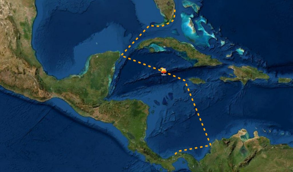
🍹 RUM RUNNERS
Colombia / Caribbean Panama Via Jamaica / Cayman Islands / Cuba / Yucatan / Florida Keys / North Bound
🌿 SPICE RUNNERS
Lesser Antilles via Colombia –-> Panama Canal Bound - East to West
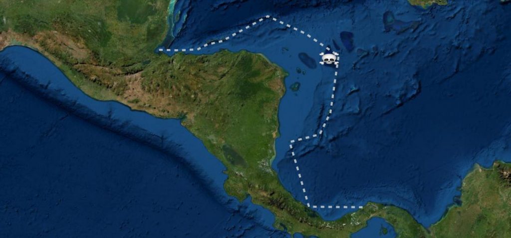
☠️ PIRATE RUNNERS
Bocas del Toro –-> Cayman Islands / Roatan / Rio Dulce / North Bound
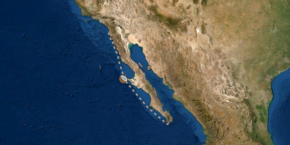
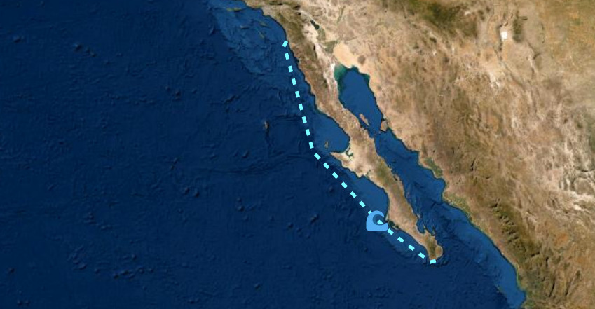
🥥 COCONUT RUN
San Diego / Ensenada / Cabo / La Paz / Mazatlan / PV -–> Barra de Navidad - South Bound
☸️ COUNTER POSSE
Pacific Panama / Costa Rica –-> North Bound
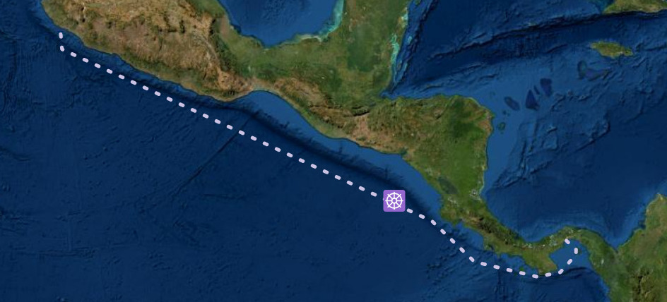
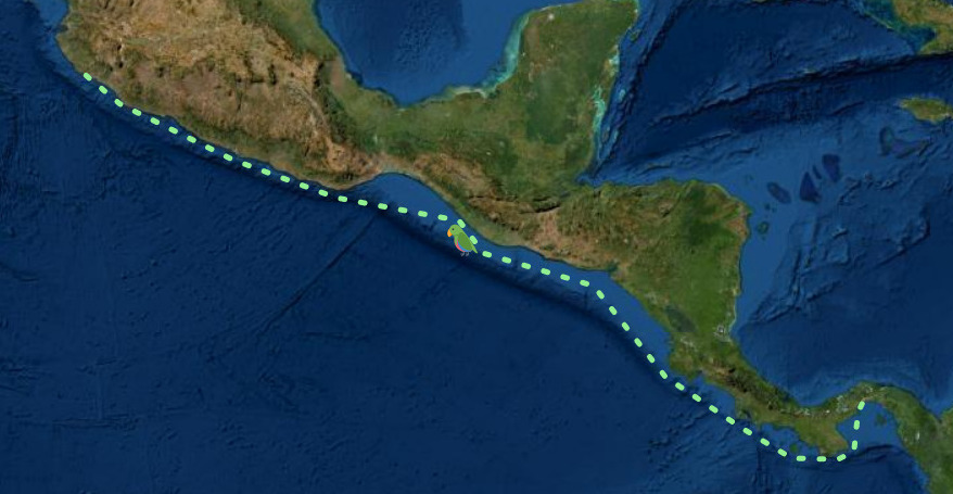
🦜 ORIGINAL POSSE
Barra de Navidad -–> Panama Canal South Bound
🌊 BASHERS
Barra / Cabo / La Paz / PV --> San Diego / LA / SFO - North Bound
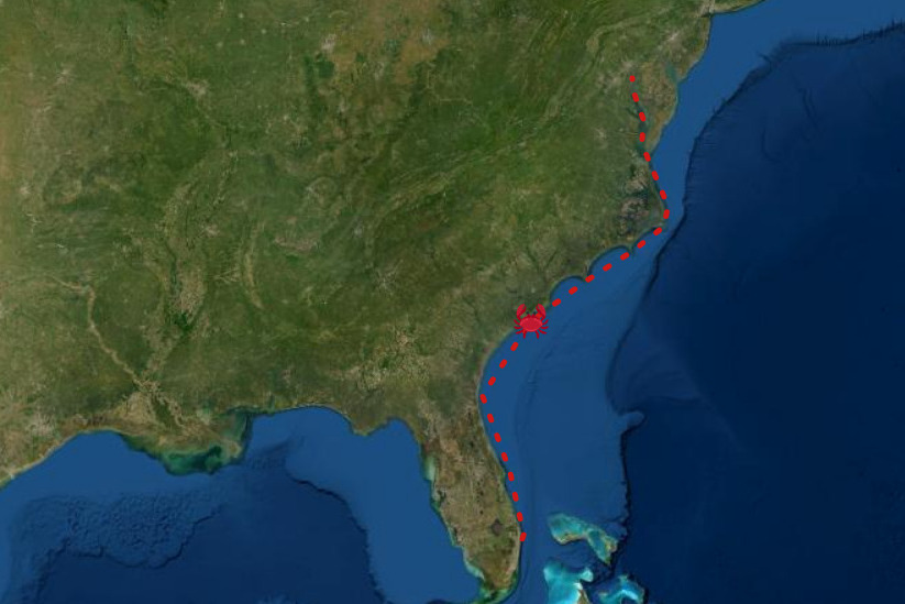
🦀 CRAB POD
Maryland, Virginia, North Carolina, South Carolina, Georgia & Florida Bahamas– north or south bound, coastal or via the ICW
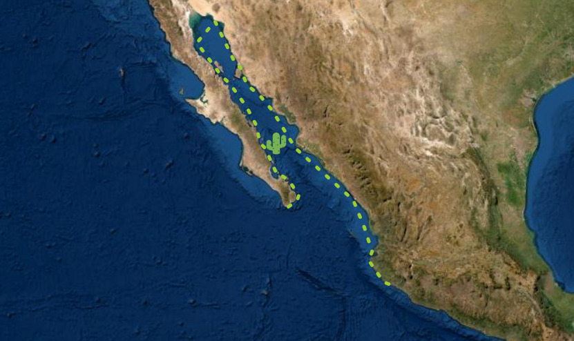
🌵 CACTUS POSSE
La Paz / Mazatlan / Sea of Cortez - North and South Bound
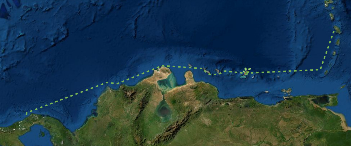
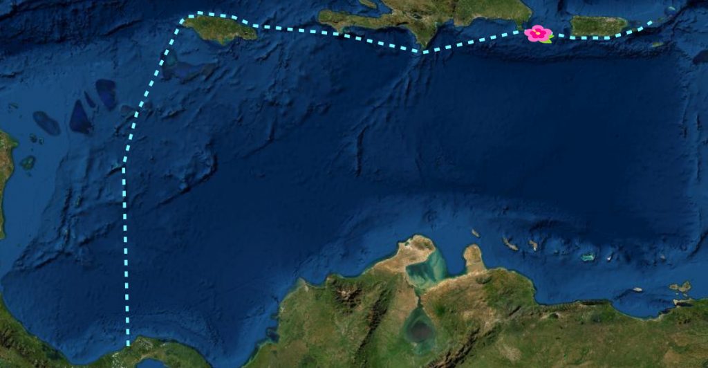
🌺 HIBISCUS POSSE
Panama - Jamaica - South Coast of Cuba - South Coast of Haiti - South Coast of Dominican Republic - South Coast of Puerto Rico - to the Virgin Islands - East Bound
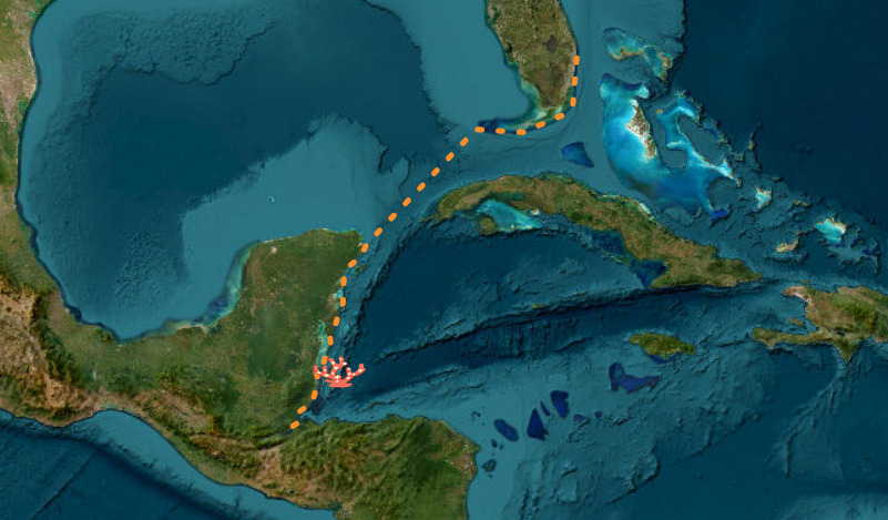
🪸 CORAL POD
GUATEMALA - BELIZE - YUACATAN PENINSULA - FLORIDA KEYS
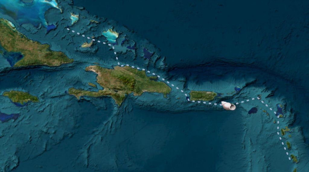
🐚 SHELL POD
BAHAMAS - GREATER ANTILLES - LESSER ANTILLES
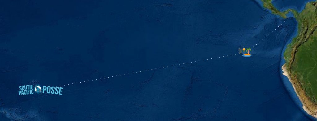
🏝️ MILK RUN - SOUTH PACIFIC POSSE >>
Pacific Coast --> Galapagos --> Marquesas / French Polynesia - South Pacific Bound
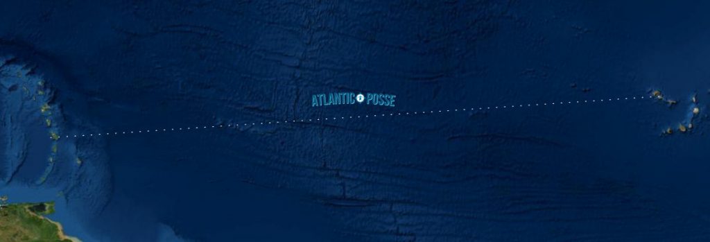
⛯ ATLANTIC POSSE - JOIN THE ATLANTIC POSSE
Spain - Greater Antilles
-
AIS SHIP TRACKING >> https://www.marinetraffic.com/en/ais/home/centerx:-86.7/centery:7.5/zoom:4
-
FCC LICENSE SEARCH >> https://wireless2.fcc.gov/UlsApp/UlsSearch/searchShip.jsp
-
USCG PSIX SEARCH >> https://cgmix.uscg.mil/psix/psixsearch.aspx
-
FLEET MON >> https://www.fleetmon.com/
-
IMO >> https://gisis.imo.org/Public/SHIPS/Default.aspx
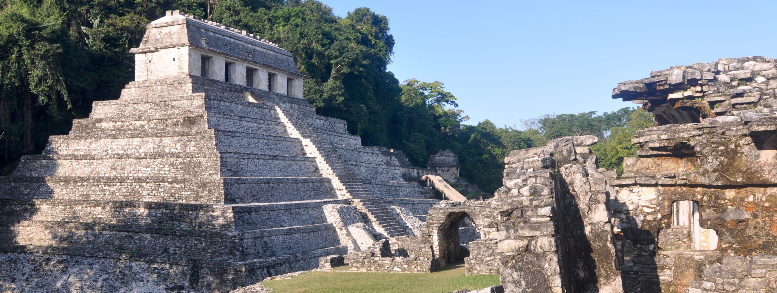
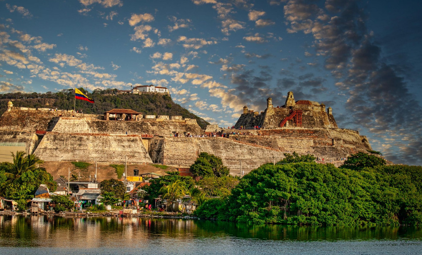
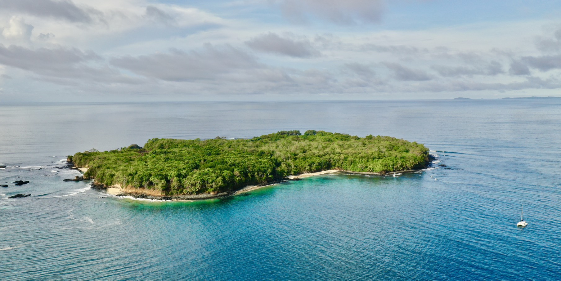
MUST SEE FROM YOUR YACHT - CENTRAL AMERICAN SIGHTS
Along the Panama Posse CENTRAL AMERICAN route are THESE UNESCO AND OTHER SIGNIFICANT SITES
Below is a list of some of the most cultural or historically significant sites along the Panama Posse route.
Many of these locations are accessible from nearby marinas and are listed as UNESCO WORLD HERITAGES SITES.
🇺🇸 USA California CRUISING TO MEXICO AND CENTRAL AMERICA WITH THE PANAMA POSSE YACHT RALLY
🇺🇸 CALIFORNIA
CLEARING INTO THE US
- US CUSTOMS: US ROAM application was updated July 2022. A new feature assists with port check ins required by US Customs if the foreign vessel has the ROAM application. A vessel first checks in at arrival, and obtains a cruising permit. The vessel captain then enters in the Cruising Permit/ number to US ROAM application. After successful permit information is entered in ROAM, vessels can then use the application to do online check-in at their next port of entry/stops. If a cruising permit has not been entered into ROAM, a boat must physically check in at each stop made at US Ports. Basically a vessel either uses the ROAM app for online check in–or if ROAM is not available, they must check in physically at each port of entry, as has been done previously. There is no change in the need for foreign vessels to check in, just the way its possible.
US ROAM APP >>

WEATHER CALIFORNIA
SOUTH BOUND AND NORTH BOUND ROUTES
SOUTHERN CALIFORNIA - SOUTH BOUND
🇺🇸 POINT CONCEPTION - CHANNEL ISLAND HARBOR
75 nm
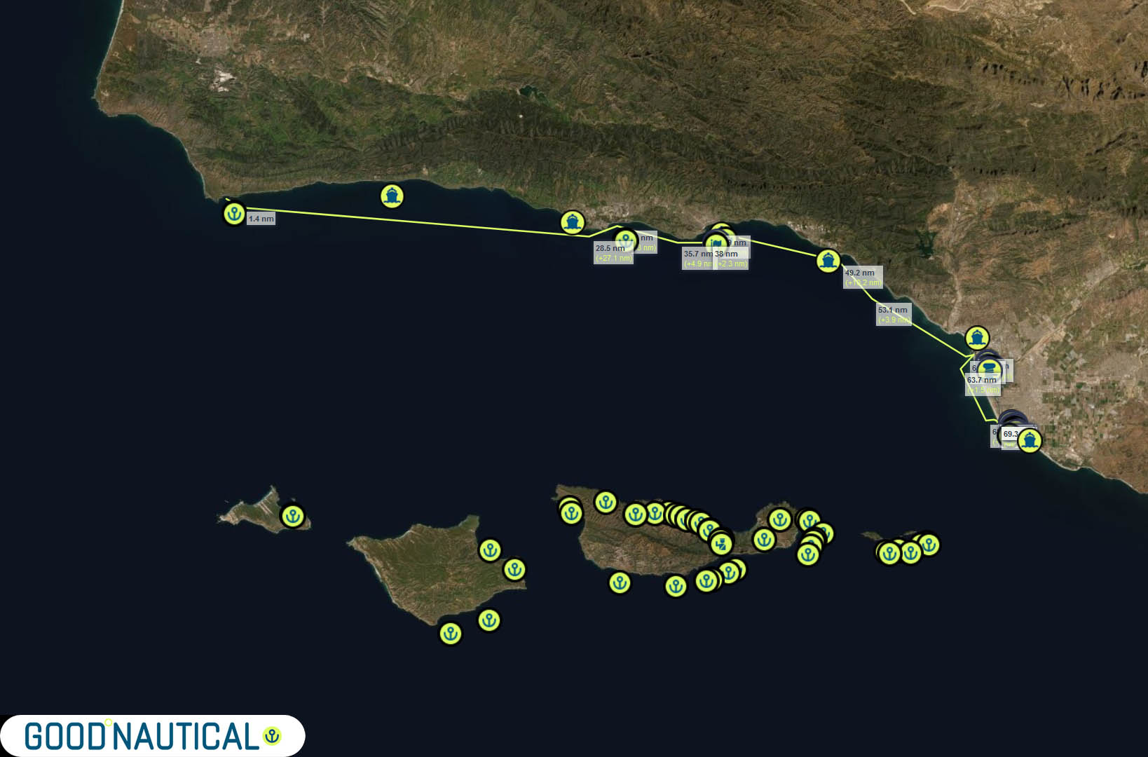
🇺🇸 CHANNEL ISLANDS HARBOR - CATALINA ISLAND
170 nm
🇺🇸 CATALINA ISLAND - SAN DIEGO
75 NM
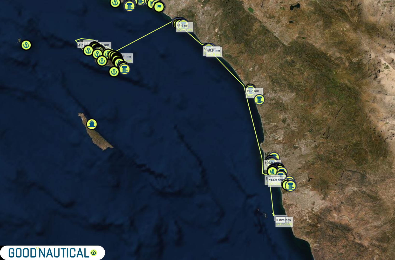
🇺🇸 SAN DIEGO - ENSENADA 🇲🇽
65 NM
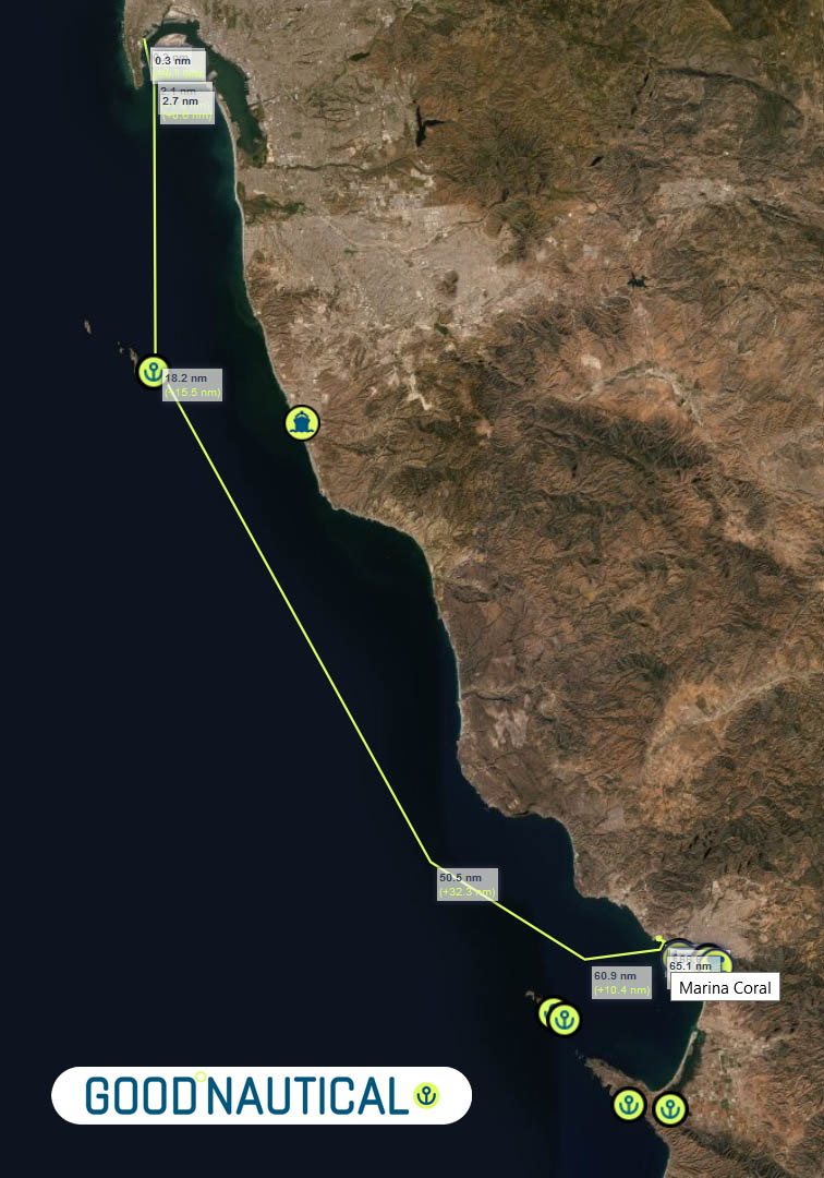
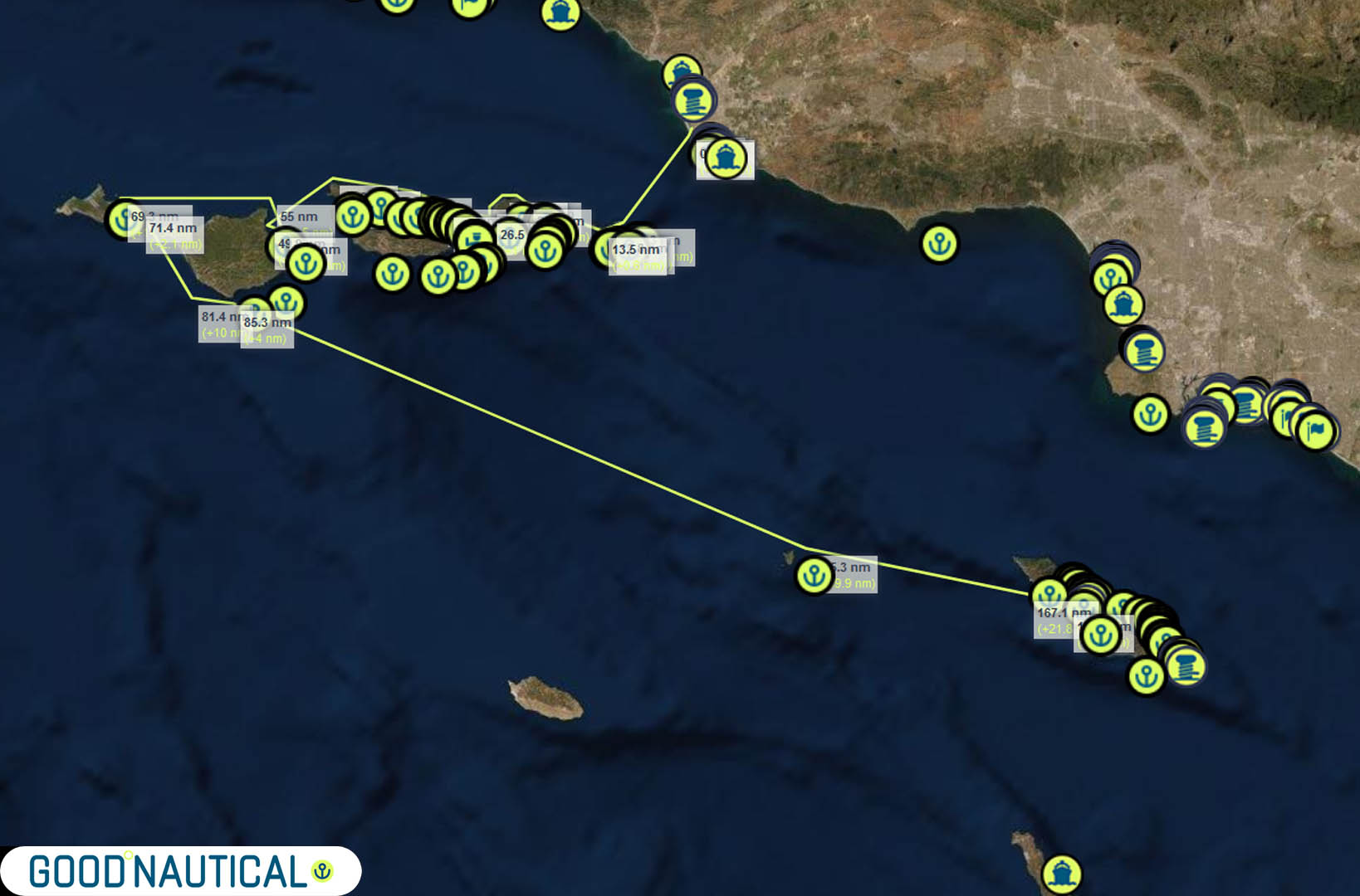
SOUTHERN CALIFORNIA - NORTH BOUND
🇲🇽 ENSENADA - SAN DIEGO 🇺🇸
65 NM
🇺🇸 SAN DIEGO - CATALINA ISLAND
75 NM
🇺🇸 CATALINA ISLAND - CHANNEL ISLANDS HARBOR
170 nm
🇺🇸 CHANNEL ISLAND HARBOR - POINT CONCEPTION
75 nm
TIDAL RANGE PACIFIC CALIFORNIA
🇰🇾 CAYMAN ISLANDS - CRUISING THE WESTERN CARIBBEAN WITH THE PANAMA POSSE YACHT RALLY
🇰🇾 CAYMAN ISLANDS
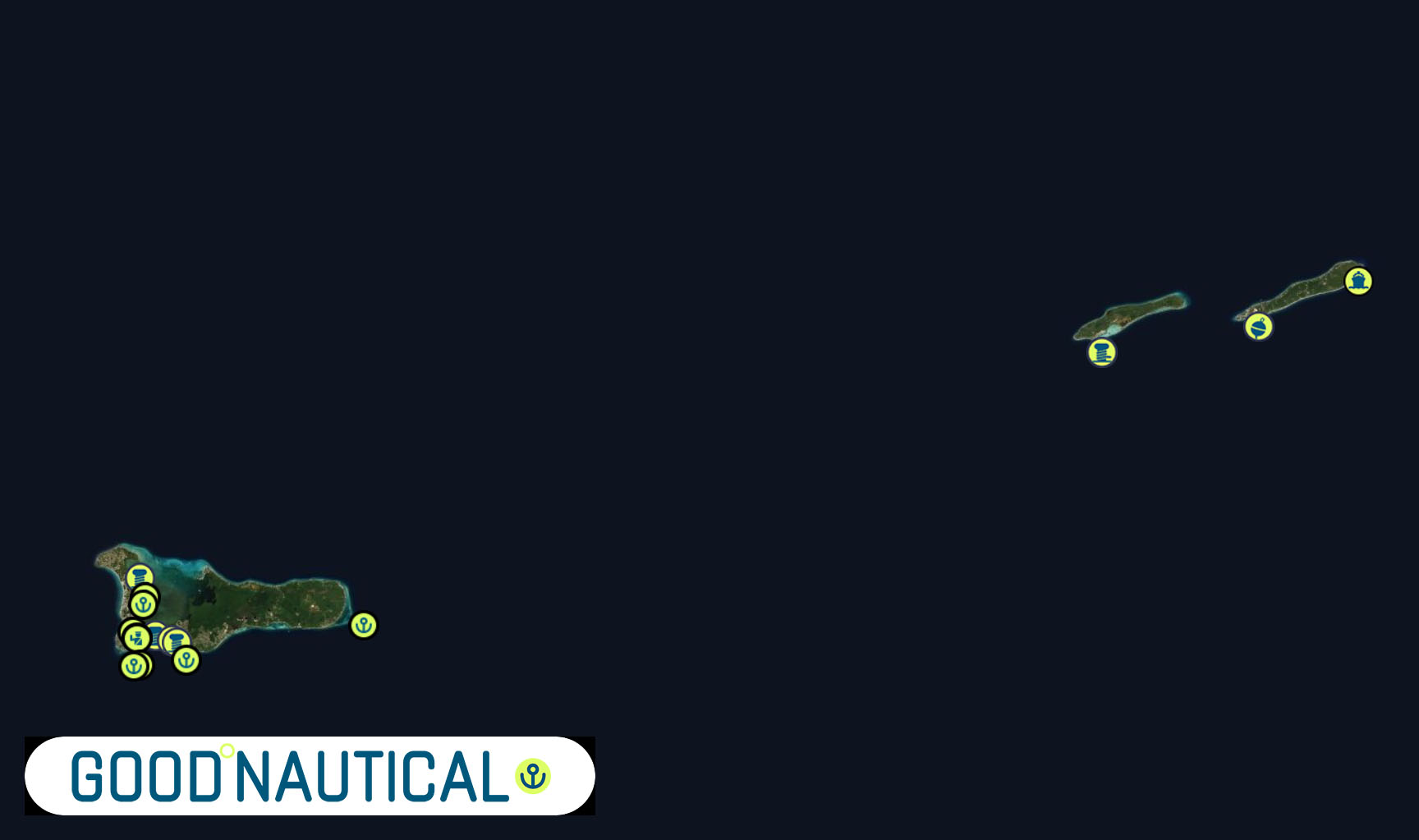
MARINAS SPONSORING THE PANAMA POSSE
| DOCUMENTATION | CAYMAN ISLANDS |
| Passport | Valid for at least 6 months; requires one blank page |
| Boat Documentation | Coast Guard Doc (Original) |
| Proof of Insurance | Liability |
| Crewlist | Required at checkin/out |
| Zarpe | Required at checkin/out |
| OFFICIAL PROCEDURES | HAIL UPON ARRIVAL |
| Official Country Visa | Visitors may be granted permission to land in the Islands for a period of up to six months. This period may be extended for further periods not exceeding six months upon application to the Chief Immigration Officer – extendable for another 6 months http://www.immigration.gov.ky/portal/page/portal/immhome/visitinghere/entryrequirements |
| Immigration Visa | Good for 180 days; |
| Required Permits | TIP (Temporary Import Permit) – good for 10 years; fishing license required for each person aboard |
| Upon Arrival Visit: | Immigration; Customs; Port Authority |
| Upon Departure Visit: | Immigration; Customs; Port Captain |
| Entry & Exit Fees: | Unknown |
| Notes: | Expect to be boarded by Coast Guard upon entering and/or leaving the country |
| OTHER | |
| Required Vaccinations | NA |
| Pets | Vaccination Certificate |
| Currency: Cayman Island Dollar |
 American Dollar to
  Cayman Islands Dollar
| Crime Index | Safety Index | Corruption Index | Corruption Score | GDP x cap | Pop (K) | Life Ex. | Cost of Living | Groc. | Rest. $ | Loc.Purch.P. | ||
| 29.61 |
|
NA = Unknown and that is a problem | The Caymans have become a popular tax haven among the American elite and large multinational corporations because there is no corporate or income tax on money earned outside of its territory. 1 This includes interest or dividends earned on investments, making the Caymans especially popular among hedge fund managers. | 43,800 | 65 | 82.19 years | Cayman Islands is the most expensive country in Latin America | Cayman Islands is the most expensive country in Latin America | Cayman Islands is the most expensive country in Latin America | Cayman Islands is the most expensive country in Latin America |
US EMBASSY
NA – closed – visit US EMBASSY in Jamaica for consular services,
WEATHER
The Cayman Islands have a tropical marine climate, with a wet season of warm, rainy summers (mid-May through October) and a dry season of relatively mild winters (November to April). Located in the northwest Caribbean at Northwest Caribbean, west of Jamaica the three Cayman Islands are in a unique position to be far enough north to be affected by cold front during the winter and still within the belt that is influenced by tropical waves and hurricanes during the summer. A typical day would have you wake up to warm sunny mornings becoming hot by afternoon with a few afternoon thundershowers especially over western Grand Cayman.
Occasional surges of cooler air from continental North America, the leading edge of which is called a cold front is the main winter system affecting the Cayman Islands from late October through early April. These systems are the major producers of rainfall during the winter months although precipitation is not quite as long lasting or of the same amounts as with summertime systems. The stronger cold fronts tend to bring strong North to northwest winds and rough seas, especially along the Western and Northern Coasts of the Islands: Such fronts are locally called “Northwesters”.
Perturbations in the easterlies or tropical waves are the main summer systems affecting the Cayman Islands from late May through November. During these months the systems move through the Cayman area roughly every four to five days but can all but disappear for a few weeks. The stronger of these systems tend to bring a day or two of cloudiness, heavy showers and thundershowers during their passage and strong southeast winds after their passage. During the summer months the main impetus for the development of these systems are the tropical waves.
TIDES
Download the Tide tables here
http://www.weather.gov.ky/portal/page/portal/nwshome/forecasthome/suntides30
Tidal range is about 0.7 meters
PILOT CHARTS
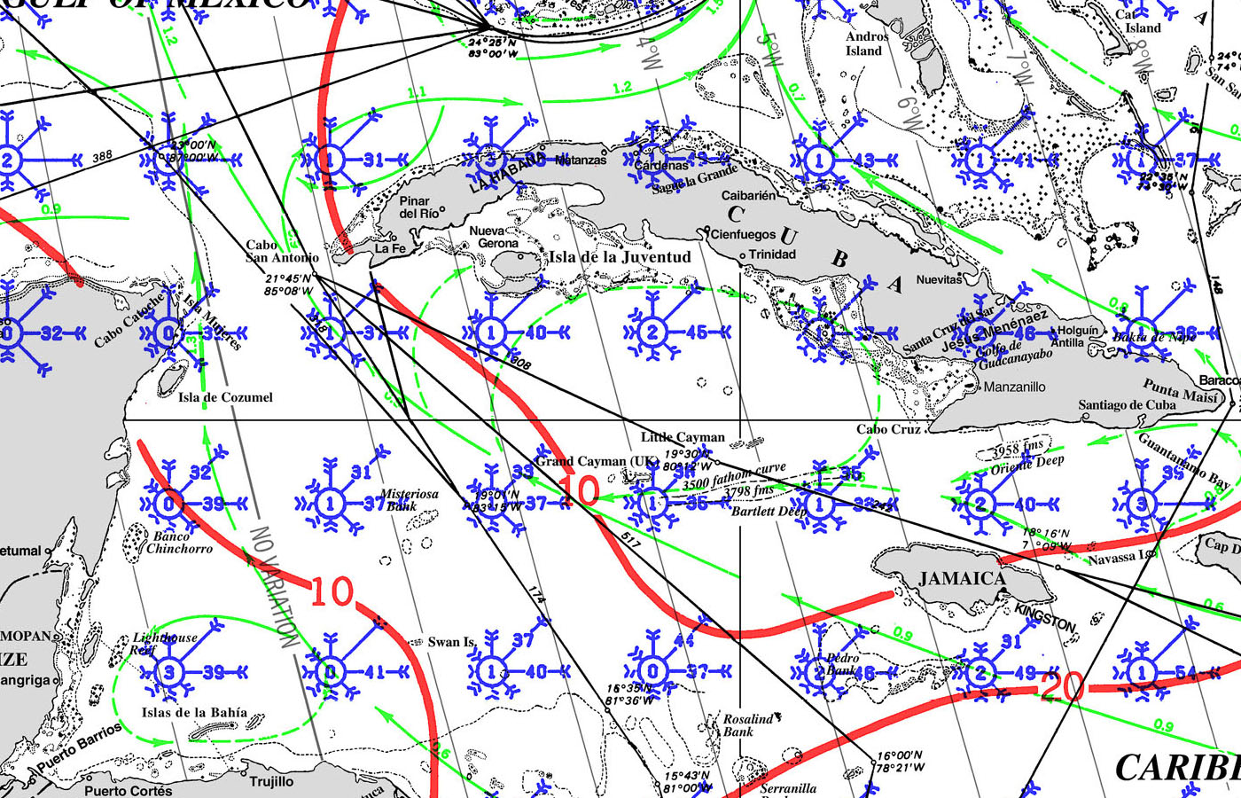
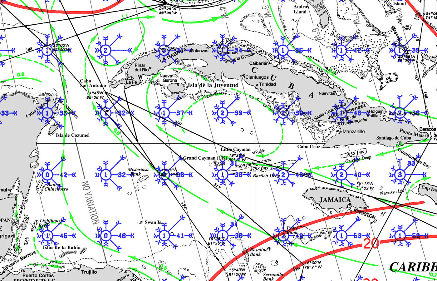
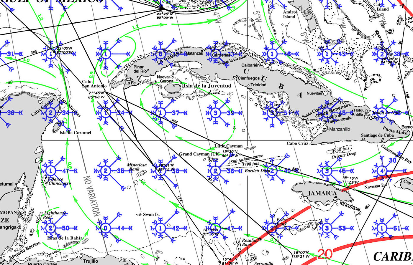

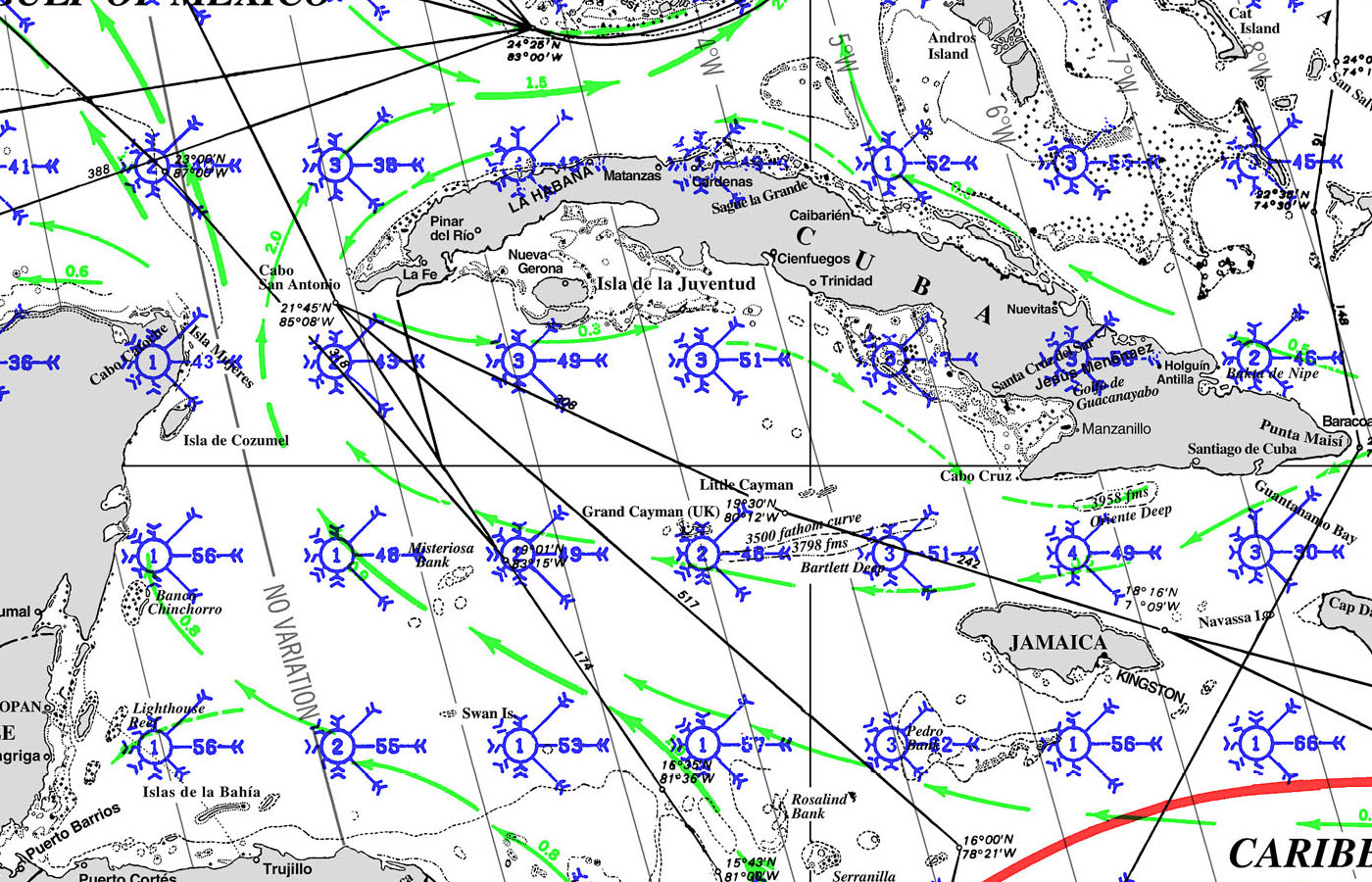

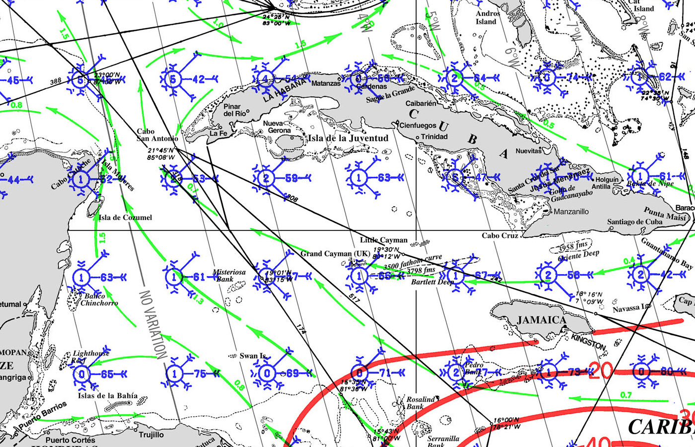
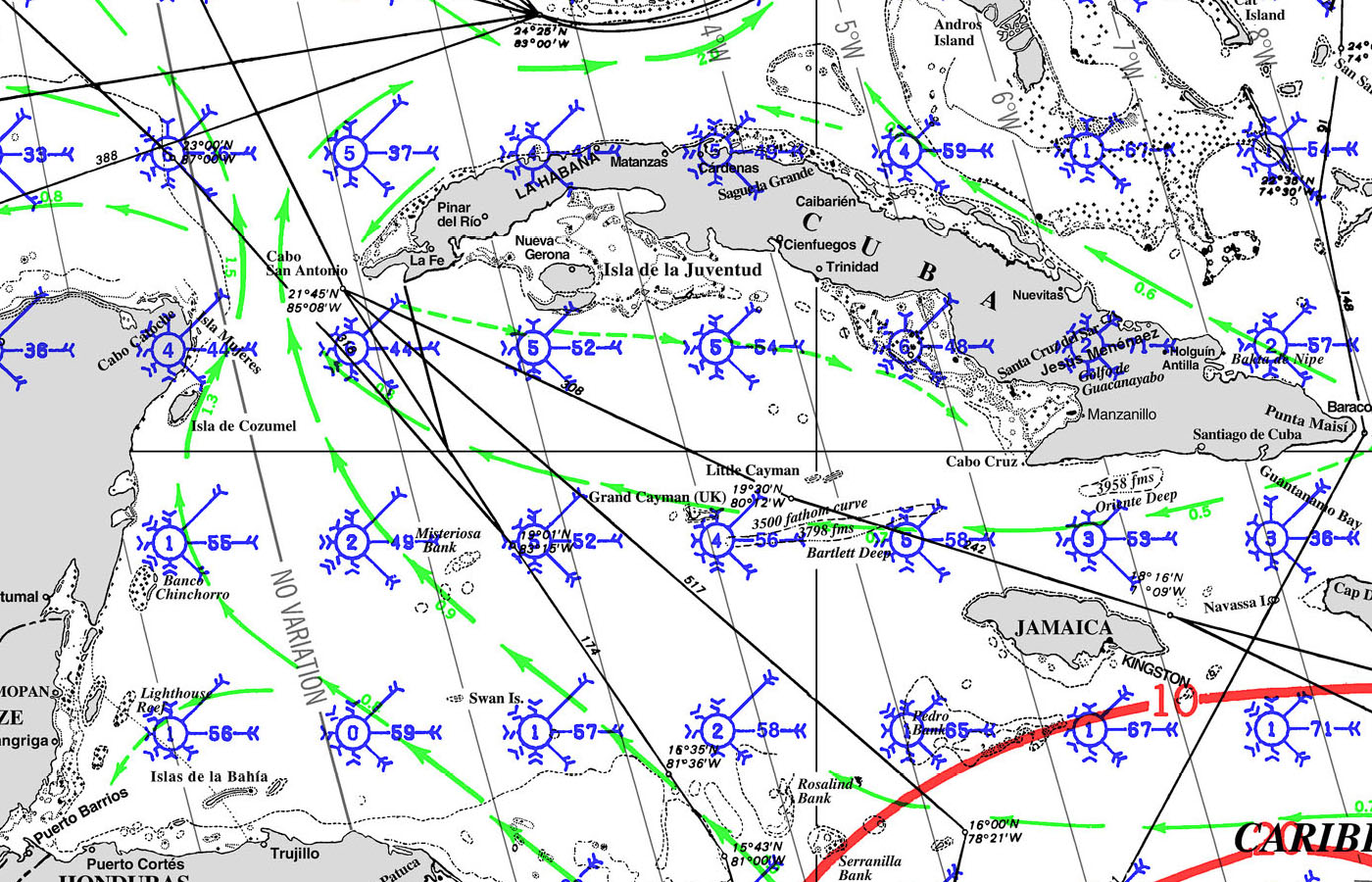
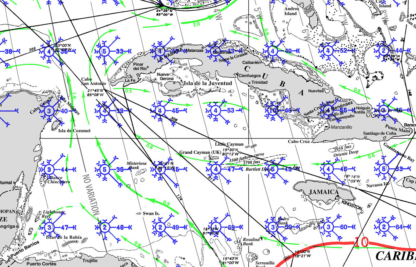

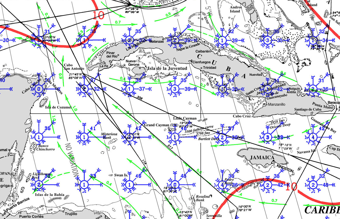
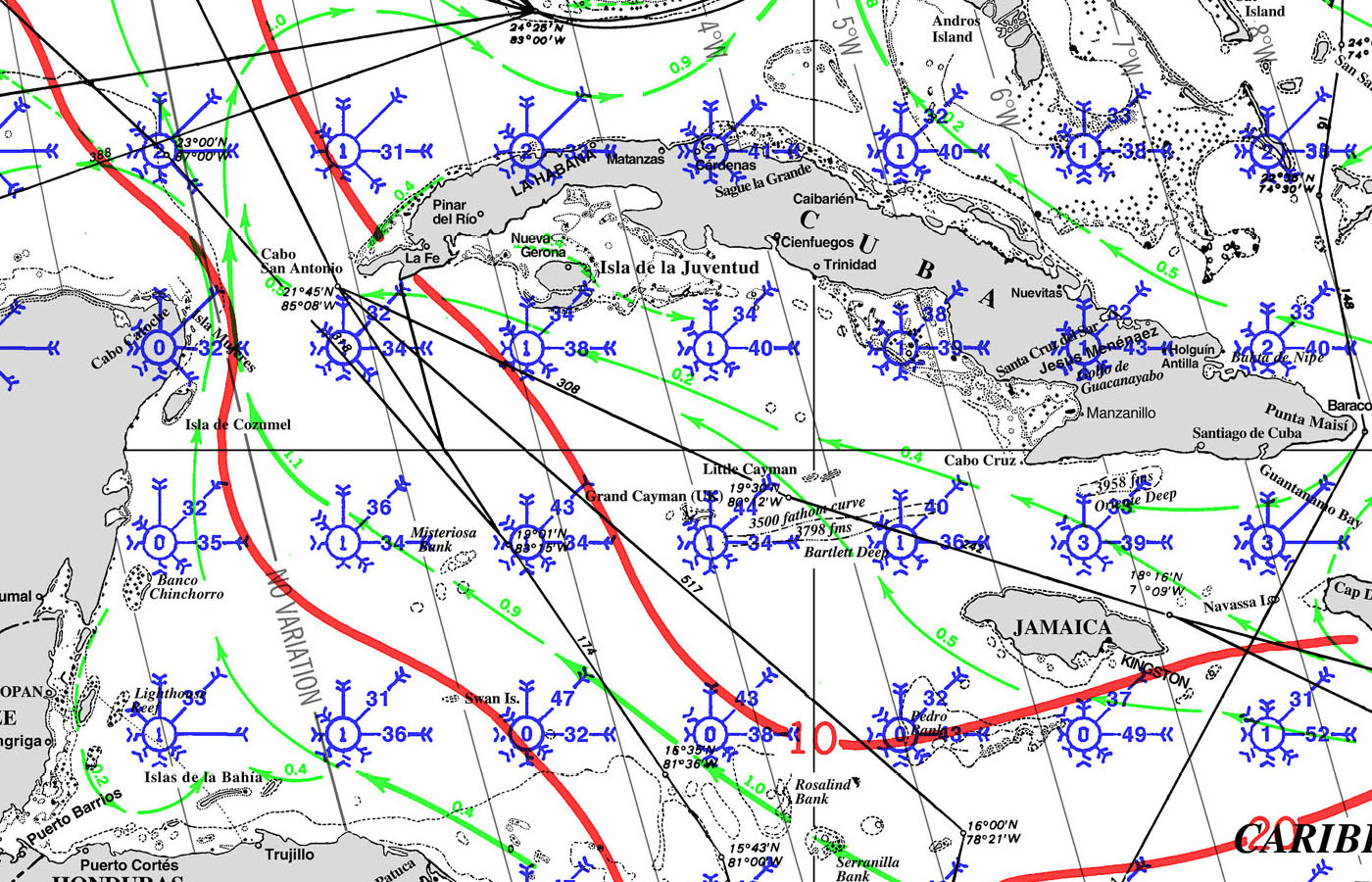
CAYMAN ISLAND Pilot Charts depict averages in prevailing winds and currents, air and sea temperatures, wave heights, visibility, barometric pressure, and weather conditions at different times of the year. The information used to compile these averages was obtained from oceanographic and meteorologic observations over many decades during the late 18th and 19th centuries.The charts are intended to aid the navigator in selecting the fastest and safest routes with regards to the expected weather and ocean conditions.
An explanation of historic Cayman Islands Climatology and Wind-roses is here.
AIDS TO NAVIGATION
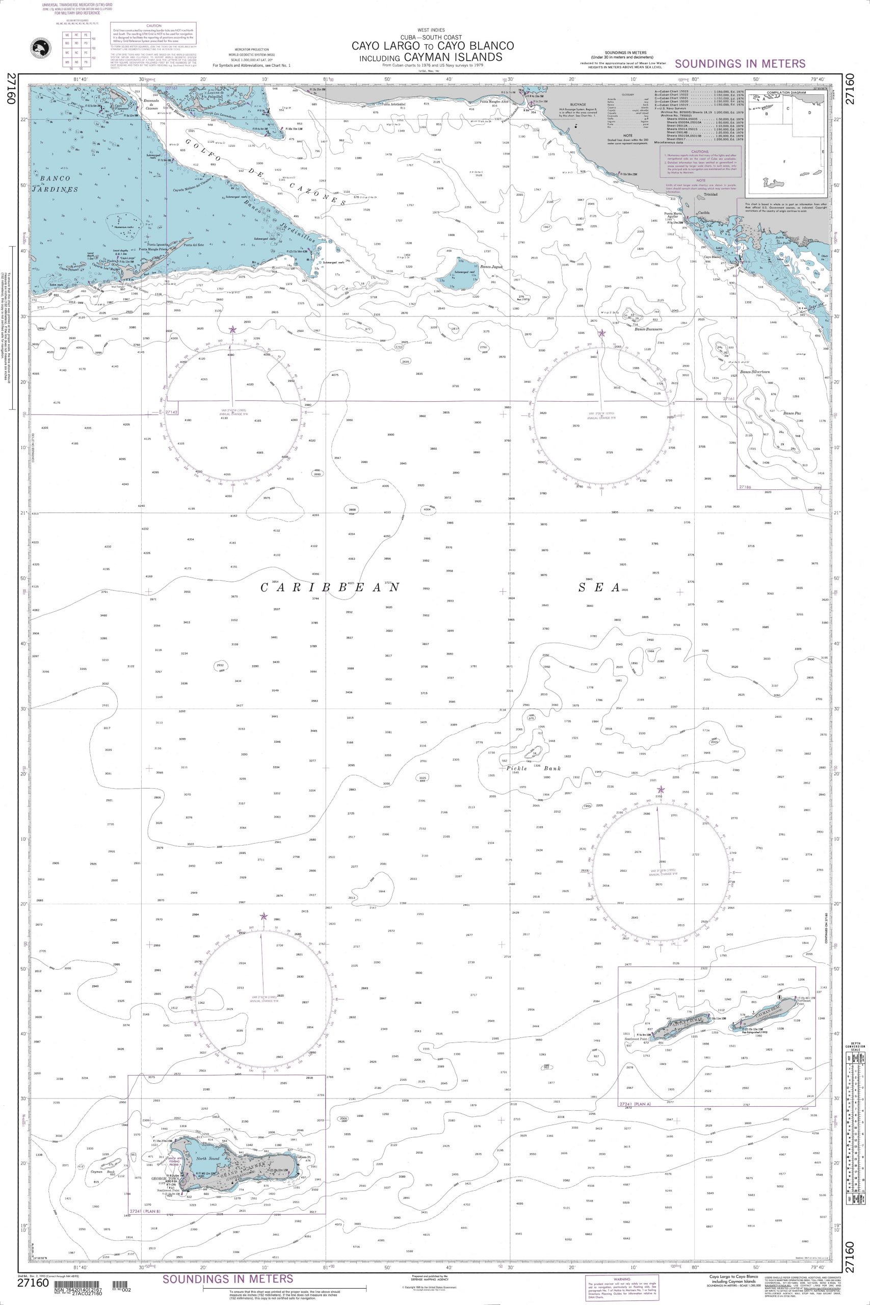
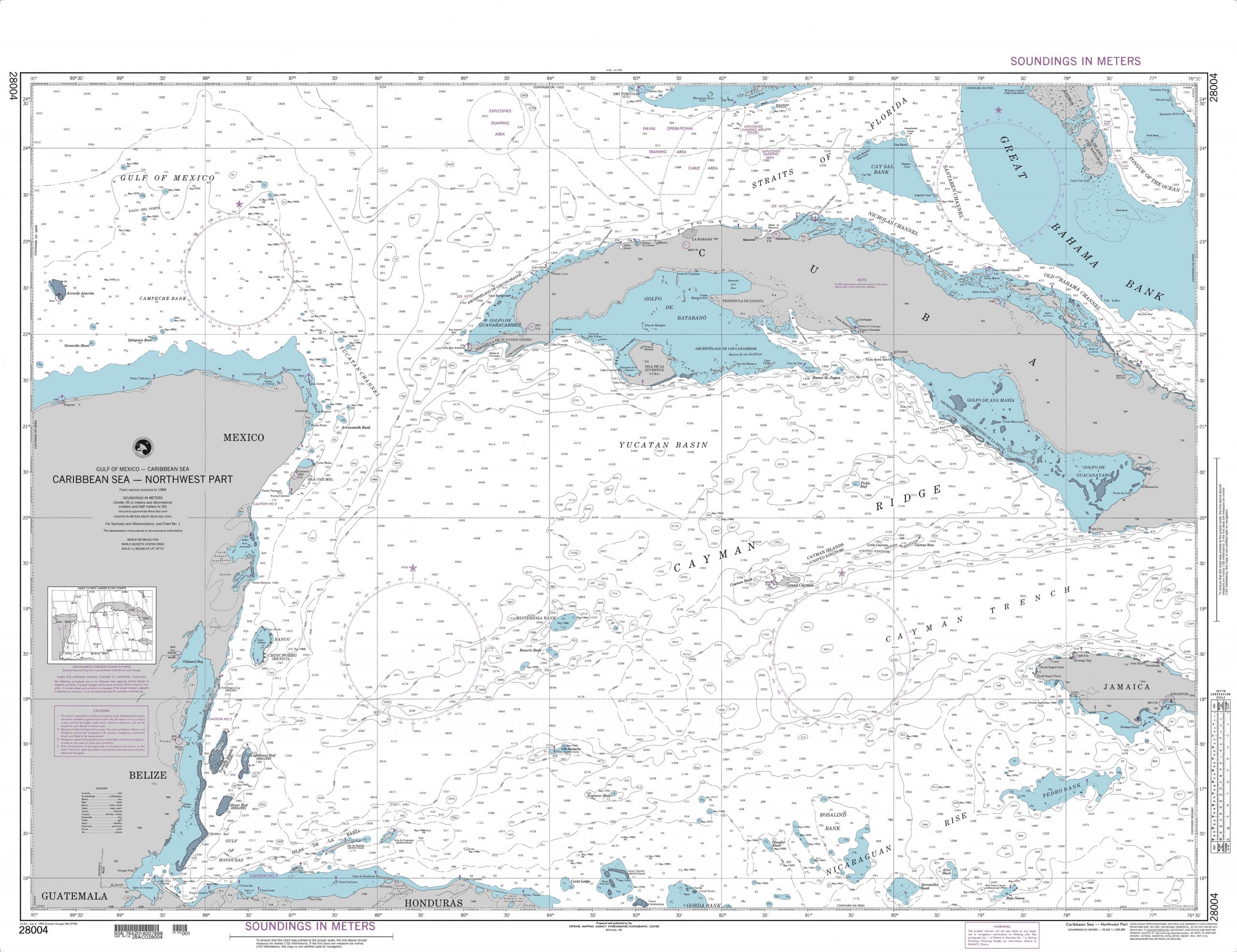
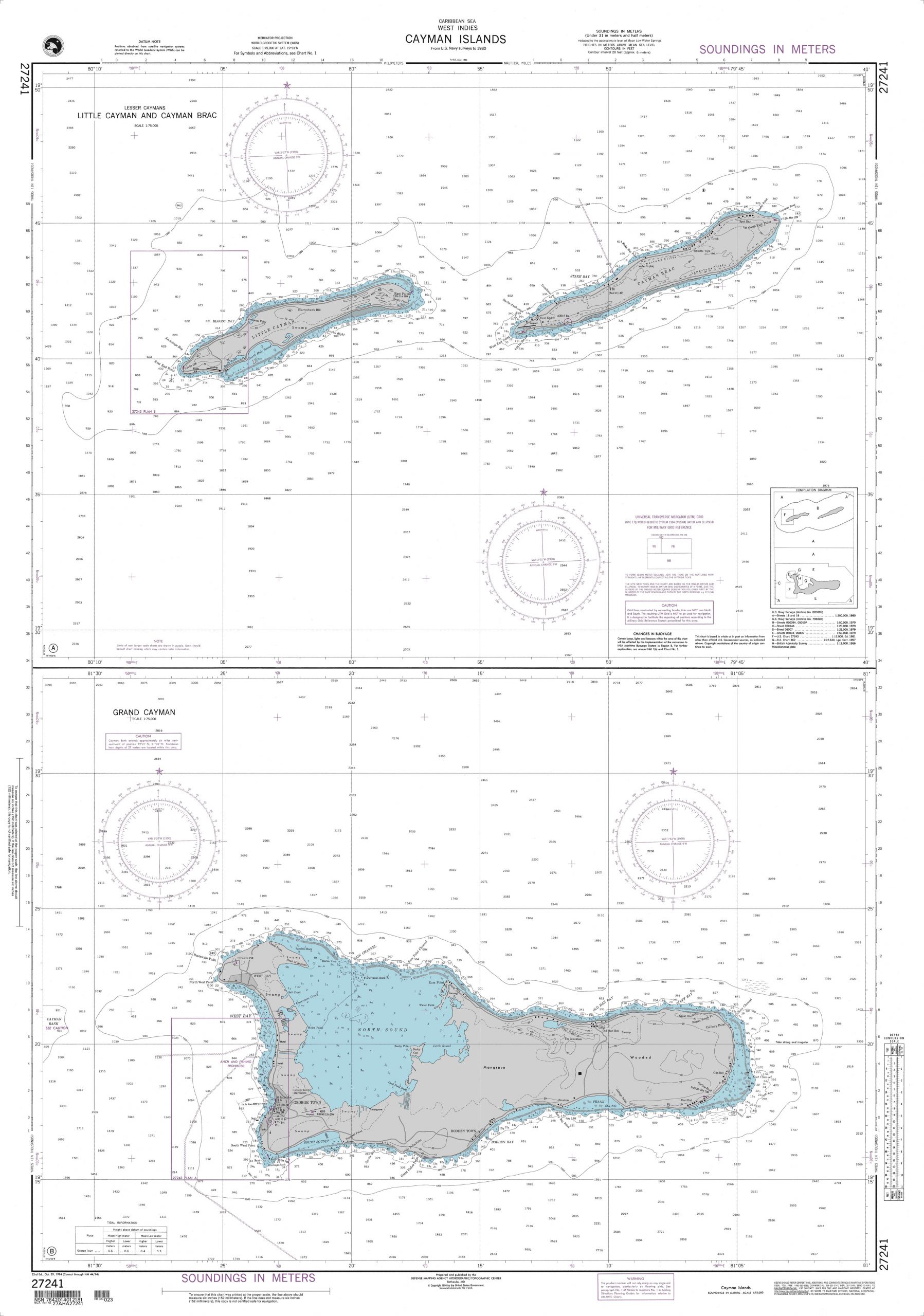
DOWNLOADABLE REFERENCE CHARTS FOR THE CAYMAN ISLANDS
- Cayo Largo to Cayo Blanco including Cayman Islands – CAYMAN ISLANDS 27160
- Cayman Islands (West Indies) Plans: A. Little Cayman and Cayman Brac – CAYMAN ISLANDS 27241
- Caribbean Sea-Northwest Part – CAYMAN ISLANDS 28004
- Gulf of Mexico – CAYMAN ISLANDS 401
Please sign up with Good Nautical for Anchorages, Marinas, and Ports of Entry Information.
ALERTS


CAYMAN ISLANDS SEARCH AND RESCUE SAR
MRCC Cayman Islands Coast Guard
Type: MRCC, Country: Cayman Islands, SRR: SRR CAYMAN ISLANDS
Latitude, Longitude:
(19.3025837,-81.3050003)
Telephone:
+1 (345) 649-6722 (Primary) +1 (345) 936-6722 (Secondary)
In event that primary number is unavailable then use secondary number. Secondary number is a cellular phone and can also be reached using Whatsapp
Email:
Fax:
Website:
INMARSAT:
Telex:
Notes:
The Cayman Islands Coast Guard is responsible for the co-ordination of all Maritime Search and Rescue operations within the Cayman Islands SRR.
Secondary Email: dwight.hunter@cicg.gov.ky
PredictWind sponsors the Panama Posse
PREDICT WIND - predictwind.com
We support the Panama Posse with free trackign and a 20 % Discount off our pro packages - to claim your discount please login and
Read more
Benefits
BENEFITS OF of joining the Panama Posse - Central American Rally
SAVE TIME - SAVE MONEY - and get the best and most up to date INFORMATION !
Here are the benefits (pre-season aka during hurricane season) vs in season ) explained
| BENEFITS FOR YOU, YOUR YACHT & YOUR CREW | $ 299 (early discount ) |
$349 |
| PRE SEASON JUN - OCT |
IN SEASON NOV- JUN | |
| ✔️ Up to date and verified information by fellow yachts | ✔️ | ✔️ |
| 📊 Communications focused on facts, not opinions or unsolicited advice | ✔️ | |
| 💰 Save real money at 70+ Marinas with discounts * | ✔️ ( June ) | ✔️ |
| 🛰️ Free vessel and fleet tracking courtesy of Predict Wind | ✔️ | |
| 🚩 Free Burgee | ✔️ | |
| 💰 Save with service providers and chandleries | ✔️ ( June ish ) | ✔️ |
| 🕵️ dedicated, experienced and discounted Canal and clearing in agents | ✔️ | ✔️ |
| 🗺️ Free aid to navigation 150 Gb OpenCPN satellite charts (mac/pc/android) | ✔️ immediately | ✔️ |
| 💰 Save Money on parts with a Westmarine Pro Discount | ✔️ | |
| 💰 Save Money with a Predict Wind Pro Discount | ✔️ | |
| 🗺️ Free Printable Reference Charts emergency backup to your electronics | ✔️ immediately | ✔️ |
| 📹 Free Video Seminars on destinations from those who are there | ✔️ immediately | ✔️ |
| 🌩️ Top weather routing avail by Marine Weather Center Chris Parker | ✔️ | |
| ⛵ Community of voyagers all are welcome, kids, single-handers, pets | ✔️ | ✔️ |
| ⚓ Peer support in emergencies with escalation procedures | ✔️ | |
| 🛈 Fleet Updates via email – free | ✔️ Prior Fleet immediately | ✔️ |
| 🏆 Fun Award Categories | ✔️ | |
| 📍 Free access to GOOD NAUTICAL Anchorage reports | ✔immediately | ✔️ |
| ☎️ Free Weekly live calls on Mondays via dedicated LINE.me group | ✔️ | |
| 💬 Free 24/7 LINE group channel | ✔️end of June | ✔️ |
| 🌊 Benefit from the latest information and prior experience participants | ✔️ | |
| 🔭 Be part of a fleet of sensor for those who come behind you or meet | ✔️ | |
| 🚷 Always priority traffic – for participants by participants | ✔️ |
- (* as long as you do not have prior contracts or reservations in place and of course subject to a marina’s availability the longer you stay the more discount the marina may give you )
If this is agreeable you can sign up now
https://panamaposse.com/sign-up/
to sign up now go to
* WE ALSO SAIL WHERE
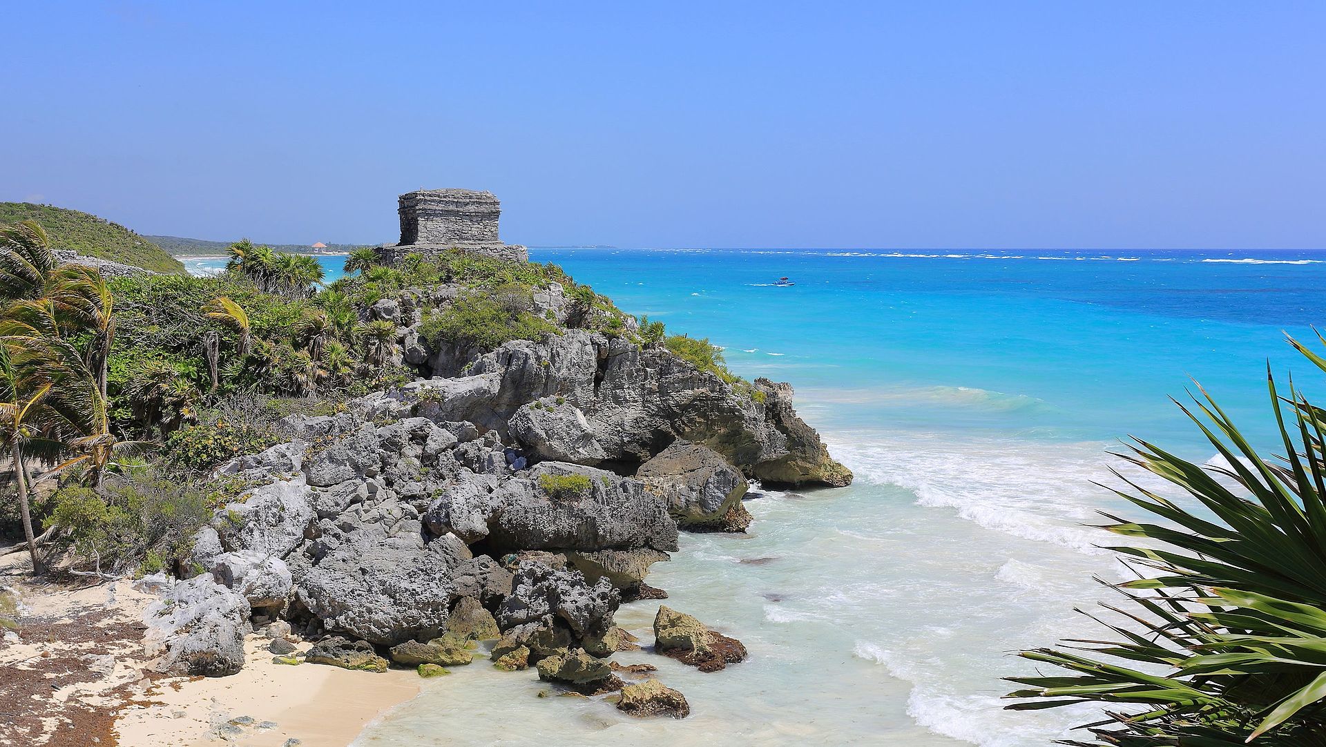
ancient ruins of the Aztecs and Mayan civilizations lie
where the oceans connect
many national parks are plentyful
the Sandinistas and Contras clashed
LIST OF REQUIREMENTS
YOUR VESSEL - YOUR CREW - YOUR RESPONSIBILITY
At a very high level we do not have any requirements for you to participate
THIS IS YOUR ADVENTURE - ENJOY !
FROM OUR EXPERIENCE here is what you WILL need !
Seaworthy vessel well equipped, tested and ready to go capable of voyaging up to 500 nm without assistance between stops
Experienced skipper and competent crew
Money and Credit Cards ( budget between 1,900 and 7,500 x month x vessel / average 4,500 x month )
Time
Vessel Documentation
Passports
Drivers License
Proof of Covid Vaccination
Third Party Liability Insurance
Windows or Mac Laptop wih keyboard and mouse
WITH REGARDS TO SEAMANSHIP = THEORY + APPLICATION + TIME + EXPERIENCE
Download the THEORY by following these links
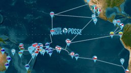
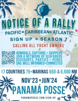
PANAMA POSSE 23·24 SAIL BETWEEN THE PACIFIC, ATLANTIC, CARIBBEAN AND THE PANAMA CANAL - THE NETWORK OF SEAFARERS
CALLING ALL, SKIPPERS, ADMIRALS, CAPTAINS, ADVENTURERS + YACHTS
ENJOY REMOTE ISLANDS
DISCOVER AMAZING ARCHITECTURE
REST UP IN 75+ DISCOUNTED MARINAS
ANCHOR WAY OUT
SAFETY IN NUMBERS
MAKE NEW FRIENDS
ENJOY THE REMOTENESS
REPEAT FOR THE NEXT 8 MONTHS
GOOD FLAVORS
FELLOW LINE HANDLERS
+ DEDICATED CANAL AGENTS
CALLING ALL YACHT OWNERS, ADMIRALS, CAPTAINS AND SKIPPERS
“Sail on your own schedule” anywhere between Southern California and Annapolis via the Panama Canal. Discover Central American, Pacific and Western Caribbean waters alongside like-minded cruisers, adventurers and explorers while creating life-long friendships at your own pace. As part of the fleet you’ll receive immediate and up to date information and in turn will report your findings to the next yacht. Better communications, discounts at marinas and vetted service providers keep you exploring and enjoying your journey. Have fun, win awards and share stories with fellow seafarers.
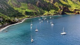
SOUTH PACIFIC POSSE ’23
UNDERWAY NOW
SOUTH PACIFIC POSSE
-//-
8,500 NM
1,500 ⚓<
13 MARINAS
19 MARITIME AREAS
9 MONTHS
PANAMA POSSE 23·24
REGISTRATION IS NOW OPEN
PANAMA POSSE
-//-
5,500 NM
550 ⚓
75+ MARINAS
17 MARITIME AREAS
8 MONTHS
ATLANTIC POSSE 23·24
FORMING NOW
ATLANTIC POSSE
-//-
5,400 NM
550⚓
13+ MARINAS
15 MARITIME AREAS
8 MONTHS
ENJOY REMOTE ISLANDS
DISCOVER AMAZING ARCHITECTURE
REST UP IN 75+ DISCOUNTED MARINAS
ANCHOR WAY OUT
SAFETY IN NUMBERS
MAKE NEW FRIENDS
ENJOY THE REMOTENESS
REPEAT FOR THE NEXT 8 MONTHS
GOOD FLAVORS
FELLOW LINE HANDLERS
+ DEDICATED CANAL AGENTS
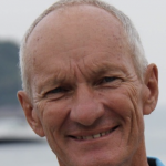
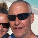
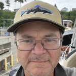
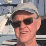
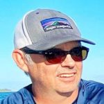
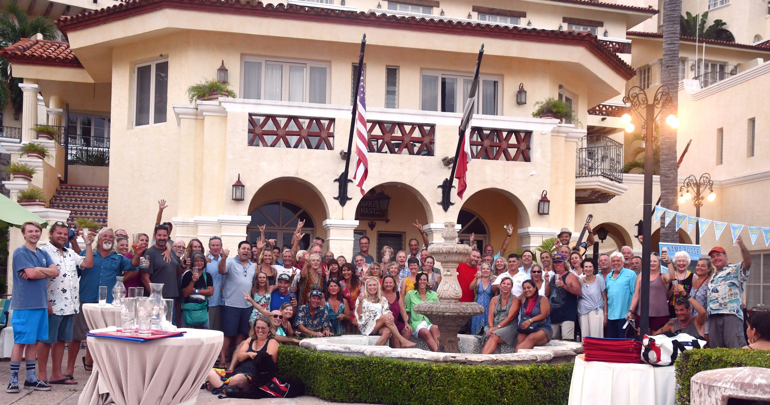
THE HAPPY FACES OF THE 23·24 PANAMA POSSE
                                                                                                                                                                                                                                                                                                                                                                                                                 |
BENEFITS FOR YOU, YOUR YACHT & YOUR CREW
✔️ Up to date and verified information by fellow yachts
📊 Focused on facts, not opinions or unsolicited advice
💰 Save real money at 75+ Marinas with discounts
🛰️ Free vessel and fleet tracking courtesy of Predict Wind
🚩 Free Burgee
💰 Save with service providers and chandleries
🕵️ dedicated, experienced and discounted agents
🗺️ Free aid to navigation 150 Gb OpenCPN satellite charts (mac/pc/android)
💰 Save Money on parts with a Westmarine Pro Discount
💰 Save Money with a Predict Wind Pro Discount
🗺️ Free Printable Reference Charts emergency backup to your electronics
📹 Free Video Seminars on destinations from those who are there
🌩️ Top weather routing avail by Marine Weather Center Chris Parker
⛵ Community of voyagers all are welcome, kids, single-handers, pets
⚓ Peer support in emergencies with escalation procedures
🛈 Fleet Updates via email – free
🏆 Fun Award Categories
📍 Free access to GOOD NAUTICAL 550 Anchorages
☎️ Free Weekly live calls on Mondays via dedicated LINE.me group
💬 Free 24/7 LINE group channel from now – June ’24
🌊 Benefit from the latest information and prior experience participants
🔭 Be part of a fleet of sensor for those who come behind you or meet
🚷 Always priority traffic – for participants by participants
🇺🇸 🇨🇦 🇰🇾 🇦🇺 🇩🇪 🇲🇶 🇨🇭 🇻🇬 🇸🇮 🇲🇽 🇲🇭 🇧🇲 🇵🇱 🇻🇮 🇳🇱 🇸🇪 🇫🇷 🇯🇪 🇬🇧 🇩🇰 🇵🇦 🇦🇹 🇫🇮
As a participant you will receive, disseminate and collect up to date information to brief “the fleet”.
Put your anchor down in any of the 550+ verified anchorages and enjoy discounts in 75 marinas along the way.
No more surprises – just the facts so you can focus on your journey and explore the shores.

Enjoy the sense of security that safety in numbers afford and most of all having FUN while saving money. With hundreds of engaged yachts from multiple flag states and fellow mariners you’ll make stories that will last a lifetime.
🇺🇸 🇨🇦 🇰🇾 🇦🇺 🇩🇪 🇲🇶 🇨🇭 🇻🇬 🇸🇮 🇲🇽 🇲🇭 🇧🇲 🇵🇱 🇻🇮 🇳🇱 🇸🇪 🇫🇷 🇯🇪 🇬🇧 🇩🇰 🇵🇦 🇦🇹 🇫🇮
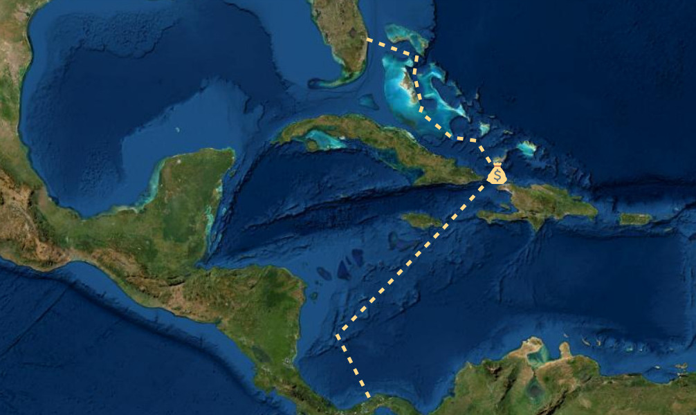
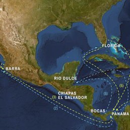
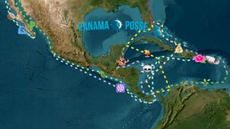
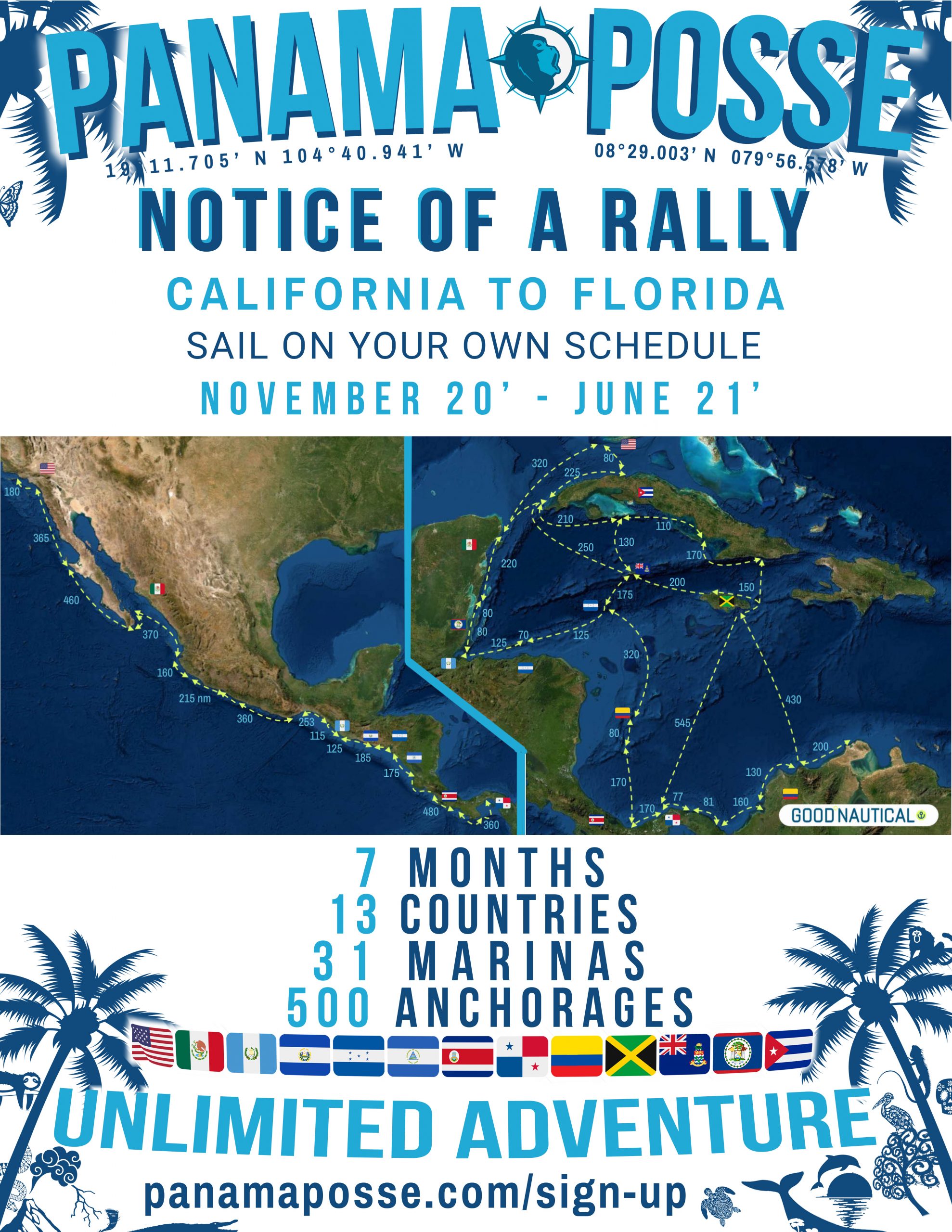
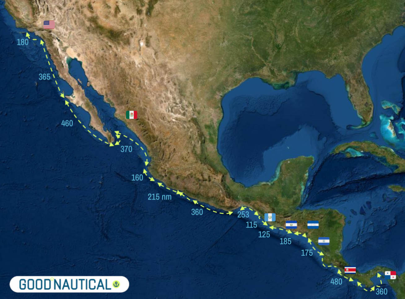
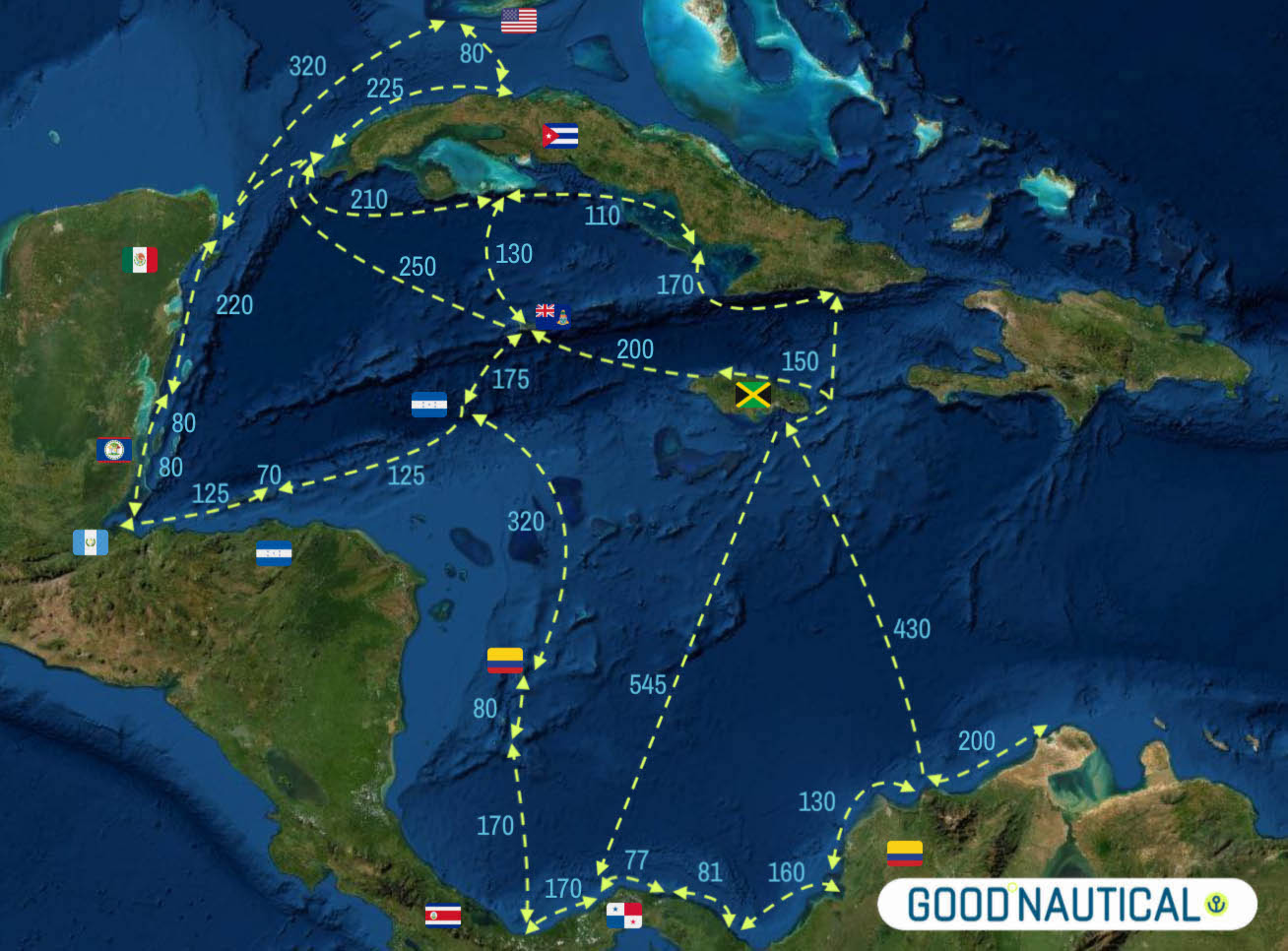
This is one of the largest rallies in the world and hundreds of vessels participate every season in this 5,500 nm journey via Mexico, Guatemala, El Salvador, Honduras, Nicaragua, Costa Rica, Panama, Colombia, Jamaica, Roatan Bay of Islands, Rio Dulce, Belize, Yucatan peninsula, Cuba and Key West.
Visit of 40+ world heritage sites along the way and discover the transformation of the Americas over hundreds of years

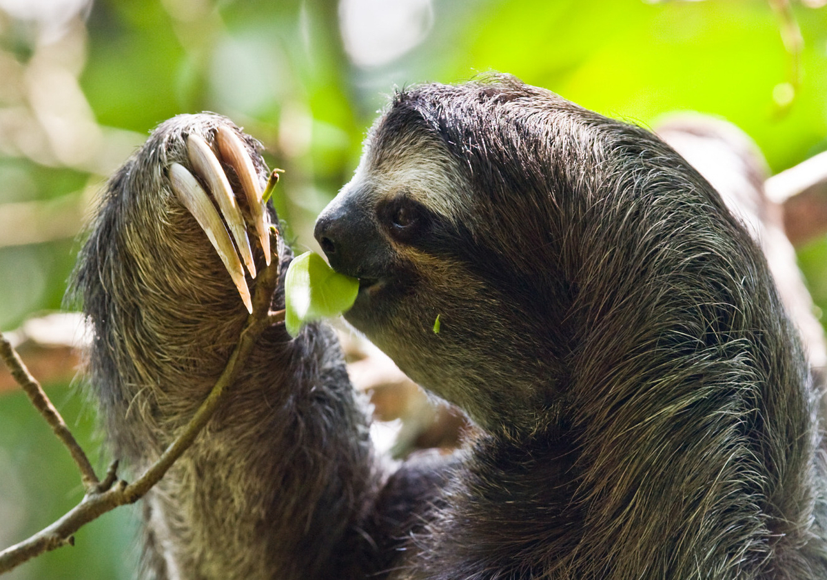
We sail where the Sloths, … well sloth around .
JOIN AND SIGN UP FOR THE 7th SEASON
282 VESSELS signed on for the 23·24 SEASON >>
The 5,500 nm journey will guide you through Mexico, Guatemala, El Salvador, Honduras, Nicaragua, Costa Rica, Panama and the Panama Canal, Colombia,
Jamaica, Roatan, Rio Dulce, Belize, Yucatan peninsula via Cuba to Key West. Set sail in November.
TAKE PART IN THE PANAMA POSSE SEASON 7 AND SAIL AT YOUR OWN PACE
You can sign up anywhere – in Mexico, Guatemala, El Salvador, Honduras, Nicaragua, Costa Rica, Panama or if you are in the Caribbean join in Colombia, Jamaica, Belize, Cuba, Dominican Republic or even Florida. “Onboarding” takes places in a day and your electronic registration validates your participation with fellow participants, marinas and sponsors. Weekly fleet updates keep you informed and a live 24/7 comm tool runs on your smartphone for immediate connectivity and access to group knowledge.
75+ DISCOUNTED MARINAS · 550+ ANCHORAGES · 24/7 GROUP COMMUNICATIONS
000 days 00 hours 00 minutes 00 seconds
Kick of Date December 7, 2023 Barra de Navidad, MX
Cruising used to be gathering information from old blogs books and single vessel point of view cruising guides – with the Panama Posse you have access to live feedback and over 350 vessels who have shared and vetted data compiled within Good Nautical in the prior seasons. There is no area where participants have not been before – but if you find it we will add it ! Panama Posse participants have met all the port captains, harbor masters, service providers and tour guides along the way and reported on their operations. We know these areas to avoid and challenges of all the aspects affecting your journey. It’s an adventure with fewer unknowns than ever before making this voyage fun and forward thinking.
VISIT 40+ UNESCO 🌎 HERITAGE SITES ALONG THIS ROUTE